NOAA’s spring outlook shows how dying El Nino could bring the heat to large swath of US
While El Niño conditions continue for the time being, ocean water temperatures beneath the surface are no longer warmer than average. That, climatologists say, shows that there’s an imminent end to El Niño.
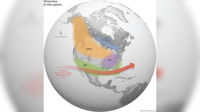
The meaning of El Nino and La Nina
The status of whether the world is being impacted by an El Nino or a La Nina is determined by water temperatures in the central and eastern Pacific. (NOAA)
NOAA’s Climate Prediction Center (CPC) released its spring temperature and precipitation outlooks on Thursday morning, and climatologists say that even though the ongoing El Niño will quickly fade away, it’s still expected to impact weather patterns through spring before a transition to La Niña conditions as summer gets underway.
While El Niño conditions continue for the time being, ocean water temperatures beneath the surface are no longer warmer than average. That, climatologists say, shows that there’s an imminent end to El Niño.
WHAT ARE EL NINO AND LA NINA CLIMATE PATTERNS?
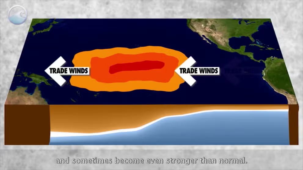
Classic El Niño setup.
(NOAA)
That transition won’t happen fast, though. Atmospheric conditions around the world are consistent with El Niño, and that’s expected to be the main driver of weather patterns for the spring season.
The transition to El Niño Southern Oscillation (ENSO)-neutral conditions is expected by the end of spring or early summer, with La Niña conditions expected to develop later in the summer or early fall.
According to climatologists, that transition, in addition to the record-warm water temperatures in the Atlantic Ocean, could mean we could be facing an active 2024 Atlantic hurricane season.
HOW THE FADING EL NIÑO PATTERN WILL IMPACT HURRICANE SEASON ACTIVITY IN 2024
Hurricane season in the Atlantic Ocean begins on June 1 and runs through Nov. 30.
Spring outlook shows above-average temperatures for millions

This image shows NOAA's three-month temperature outlook for meteorological spring (March, April and May 2024).
(FOX Weather)
If you live in the northern tier of the U.S. and aren’t a fan of cold temperatures, NOAA’s three-month temperature outlook for meteorological spring, which spans March, April and May, could be music to your ears.
The CPC says the spring temperature outlook is favoring above-average warmth across the northern tier of the U.S. from the West Coast to the East Coast.
However, it’s the Pacific Northwest, like Seattle and Portland in Oregon, and the Northeast and New England, like New York City and Boston, that have the highest chances of seeing above-average temperatures over the next three months.
Across the southern U.S., there are equal chances of seeing either above-average or below-average temperatures due to continued rounds of rain-cooled air brought on by the continuing El Niño conditions.
HERE'S WHAT AN EL NINO CLIMATE PATTERN IS
Spring precipitation outlook shows wetter conditions in East, drier in West
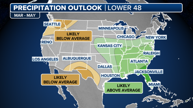
This image shows NOAA's three-month precipitation outlook for meteorological spring (March, April and May 2024).
(FOX Weather)
NOAA’s spring precipitation outlook favors below-average rain and snow for parts of the Northwest and northern Rockies, as well as in the Rio Grande Valley in the Southwest.
However, the opposite is expected in the East.
Above-average rain and snow amounts are expected from the central Plains through the middle and lower Mississippi Valley to the mid-Atlantic and Southeast.
This, climatologists say, is also due to the lingering impacts of El Niño.