Little-known weather pattern when El Nino and La Nina are no longer in control
During neutral events, cooler water temperatures are typically experienced around South America. Severe weather across the U.S. is typically around or below normal, but hurricane activity can be fairly busy.
The meaning of El Nino and La Nina
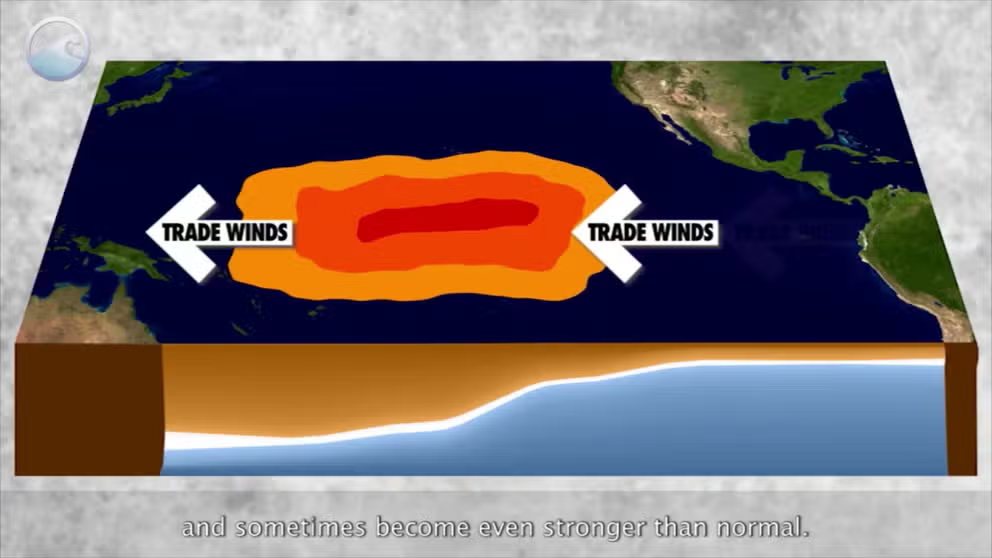
The status of whether the world is being impacted by an El Nino or a La Nina is determined by water temperatures in the central and eastern Pacific. (NOAA)
When the Pacific Ocean can’t decide whether it wants to be warmer or cooler than average, or it’s transiting into or out of an extreme, the water is considered to be in a neutral state.
The neutral state of the El Niño-Southern Oscillation (ENSO) occurs when water temperature anomalies in the eastern and central Pacific are between 0.5 °C and -0.5 °C.
The status means neither La Niña or El Niño are in control and is sometimes referred to as La Nada.
Similar to when El Niño and La Niña are in control, neutral conditions impact weather across the country and around the globe.
Typically, there are fewer kinks in the jet stream, meaning more regional patterns dominate local weather.
The world experienced extended neutral cycles in: 1990-1991; 1993-1994; 2003-2004; 2012-2013; 2012-2014; and 2019-2020.
WHAT ARE EL NIÑO AND LA NIÑA CLIMATE PATTERNS?
Historical ENSO statuses
(FOX Weather)
Impacts on spring severe weather season
ENSO-neutral conditions are not known to produce busy spring severe weather seasons.
Meteorological spring, which consists of the months of March, April and May, is typically the busiest period for severe weather as the jet stream allows plenty of warm moisture to stream northward and aid in the instability needed for thunderstorms.
Forecasters believe atmospheric ingredients typically aren’t as conducive during a neutral event than during a La Niña period, but are more active than under an El Niño regime.
Research completed by various private, government and educational entities has found that neutral-ENSO conditions tend to produce tornado and hail events that are more in line with average or slightly below-average historical tallies.
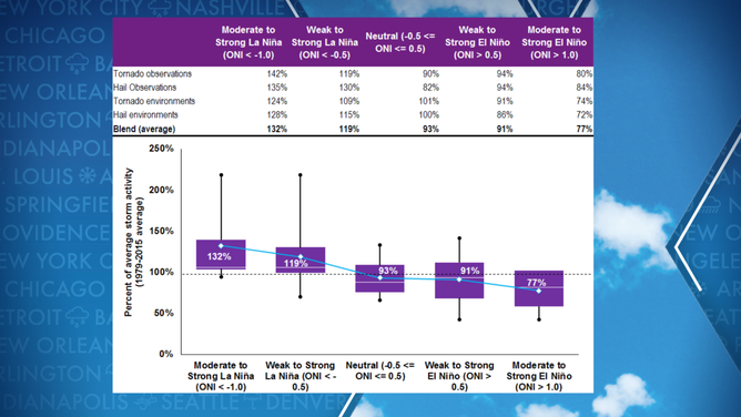
Hail and tornado activity versus state of atmosphere
(Willis Re/Columbia University / FOX Weather)
The U.S. averages around 1,300 tornadoes each year, with many that either rank as an EF-0 or EF-1 on the Enhanced Fujita Scale.
HERE’S WHAT AN EL NINO CLIMATE PATTERN IS
Hurricane season impacts
The impacts of the ENSO status on hurricanes are well documented but do occasionally throw curveballs at forecasters.
Generally speaking, La Niña years are known to produce more activity in the Atlantic than El Niño seasons, with neutral conditions being a wildcard.
Neutral years have run the gamut from just a handful of storms to being one of the most active on record.
Forecasters consider 2005 to have been a year dominated by neutral conditions – 28 named storms formed, of which 15 turned into hurricanes and seven reached major status with winds of at least 115 mph.
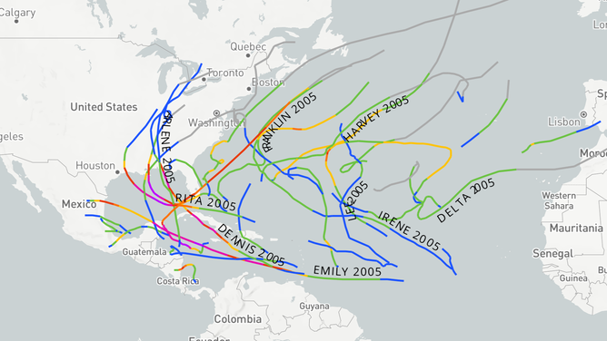
2005 hurricane season tropical activity
According to research conducted by experts at Florida State University, impacts from hurricanes during neutral years are heightened for the Florida Peninsula and Gulf of Mexico and are similar to what’s produced by La Niña sequences.
The East Coast tends to experience reduced tropical cyclone activity, while the Caribbean sees impacts that are considered to be around average.
DO EL NINO EVENTS INCREASE CHANCES OF A HAWAIIAN HURRICANE?
Summer heat
All occurrences of neutral summers over the last two decades have produced seasons that had temperatures above average.
Meteorological summer runs from June 1 through Aug. 31, and when compared to 125 years of records, neutral seasons ranked in the top half of warmest years.
While the dog days of summer are prevalent during neutral years, so are chances of rain and thunderstorms.
According to data compiled by NOAA, most regions of the country see average or above-average precipitation, which can be beneficial during the peak of summer.
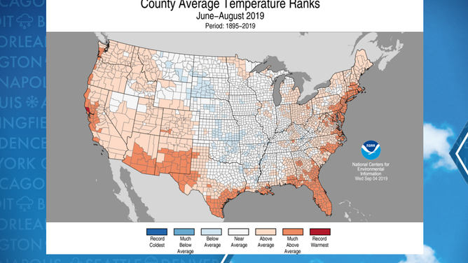
Neutral-ENSO summer in 2019