

Tropical Storm Moke unleashes a rare back-to-back threat, driving up the flood danger for the Big Island
Tropical Storm Moke is expected to track south of the Big Island but still deliver 5 to 10 inches of rain, with localized pockets of up to 15 inches, the National Hurricane Center said.
Tropical Storm Moke to approach Hawaii’s Big Island with growing flood threats
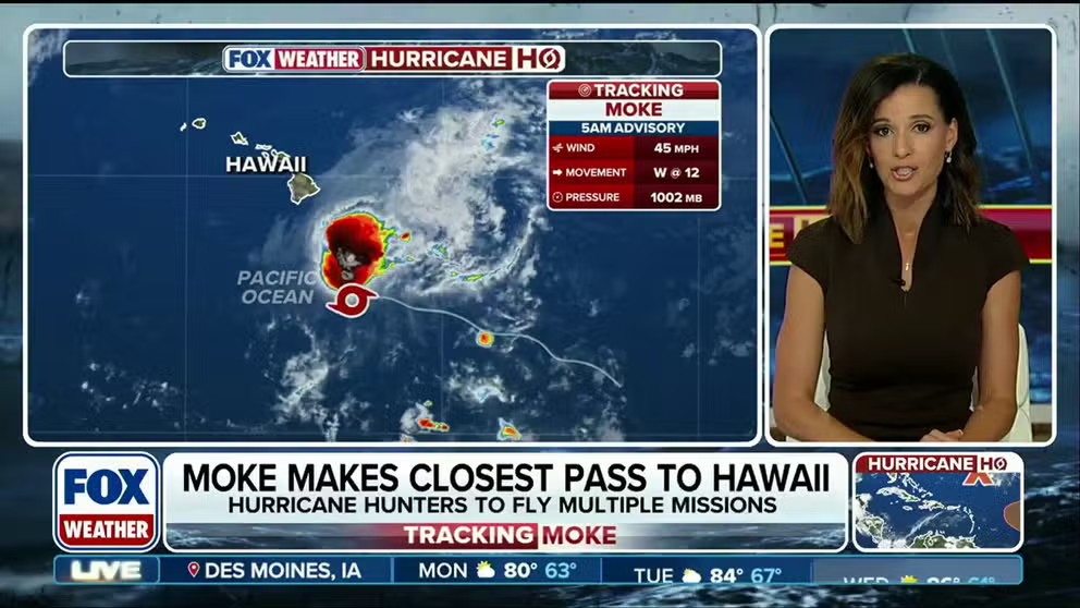
Tropical Storm Moke targets the Big Island of Hawaii on Sunday with mounting flood risks in a rare back-to-back threat for the state. As it makes its closest approach to the island, over a foot of rain is possible in some areas, accompanied by strong gusts. FOX Weather Meteorologist Melanie Black breaks down Moke’s tracking and impacts:
THE TAKEAWAY
- Hawaii faces a rare tropical threat for the second time in two weeks.
- Tropical Depression Two-C strengthened into Tropical Storm Moke on Friday.
- Hawaii's Big Island is once again in the bull's-eye for heavy rain after Hurriane Lala dumped nearly 3 feet of rain last week.
HONOLULU — Hawaii, which rarely sees tropical activity, is facing its second tropical system in two weeks as Tropical Storm Moke tracks toward the Islands, on the heels of the torrential rain Hurricane Lala brought last week.
The system is expected to dump another round of heavy rain on the Big Island, in particular, as well as other islands across the state on Sunday.
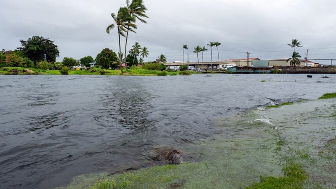
A young green sea turtle fills up on grass as ocean waters started to raise due to the approach of Tropical Storm Lala at Reed's Bay in Hilo, Hawaii on August 14, 2026.
(Jill K. Briggs / AFP / Getty Images)
This comes as Hurricane Lala continues spinning through the Central Pacific after hitting Hawaii as a Category 1, before rapidly strengthening to a Category 4 storm on Wednesday.
LATEST FROM FOX WEATHER HURRICANE SPECIALIST BRYAN NORCROSS
It has since been downgraded back to a tropical storm, and gradual weakening is forecast over the next several days.
Farther east, Invest 91E is expected to develop and could become a named storm this week.
Tropical Storm Moke puts Big Island on alert for more flooding
In the 5 a.m. ET advisory, the National Hurricane Center (NHC) announced that Moke has sustained winds of 45 mph, moving west through the Pacific Ocean at 12 mph.
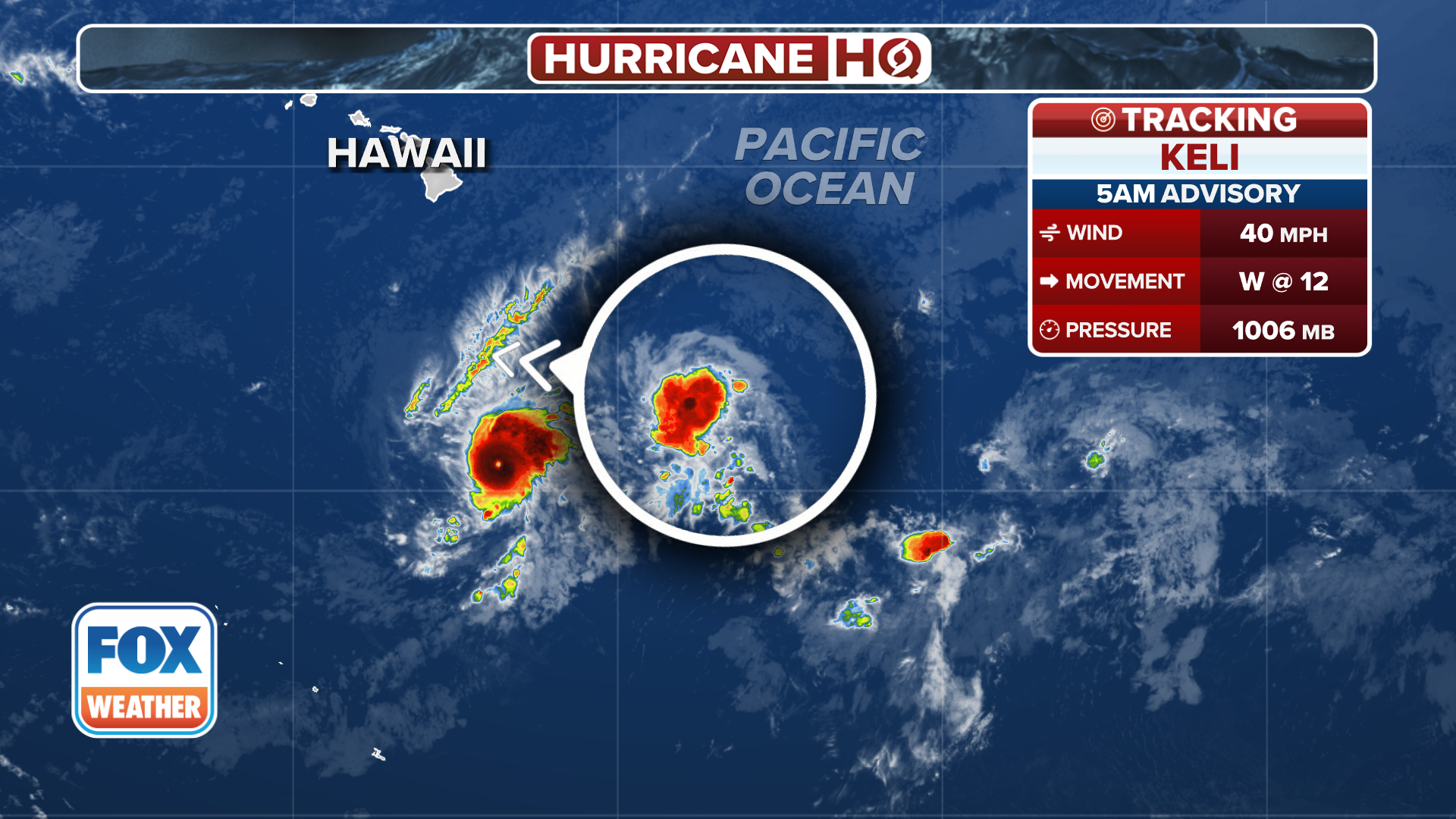
(FOX Weather)
RAIN, WIND AND… SNOW? TROPICAL STORM LALA BRINGS A WINTRY SURPRISE TO HAWAII
Moke is expected to track south of the Big Island but still deliver 5 to 10 inches of rain, with localized pockets of up to 15 inches, the NHC said.
The FOX Forecast Center said the heaviest rain is expected to arrive on the Big Island on Sunday.
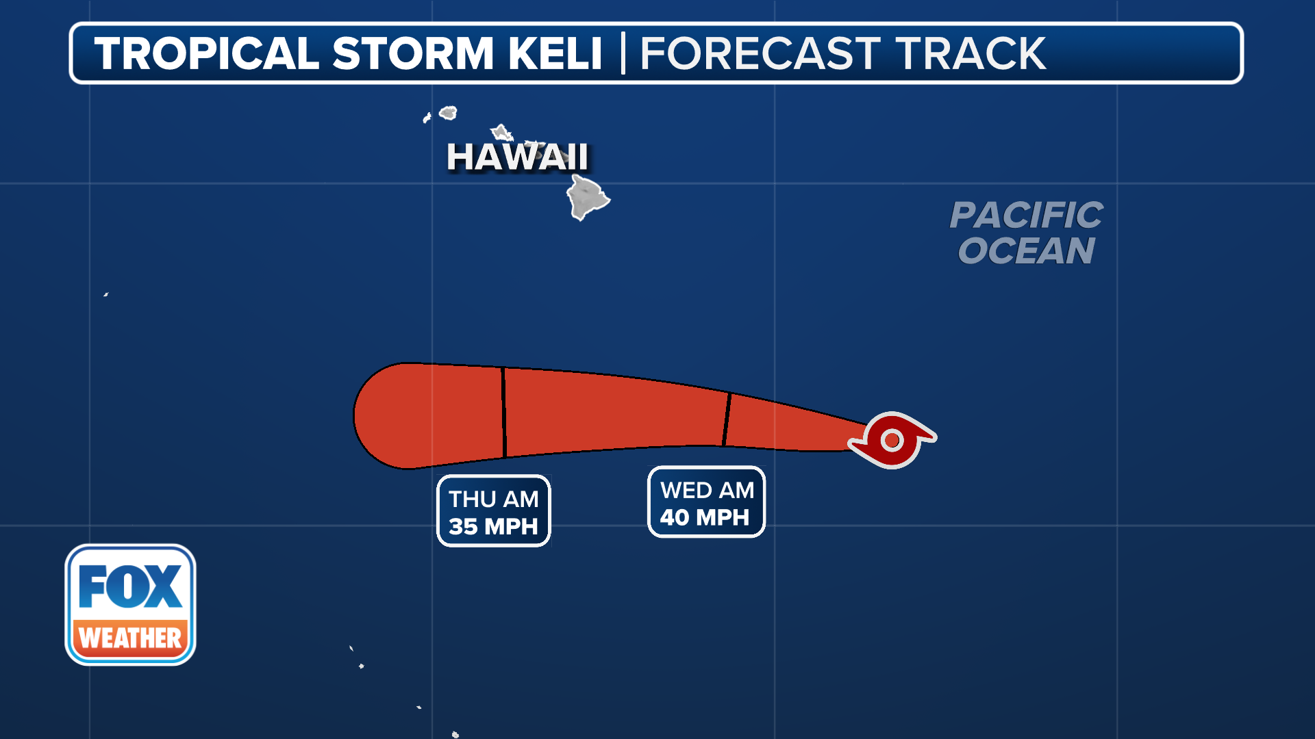
(FOX Weather)
According to the FOX Forecast Center, tropical downpours will create a flash flood threat, which could trigger mudslides in some steep areas of the islands.
Additionally, wind gusts will likely peak in the 40 to 50 mph range on the southern tip of the Big Island and in the usual downslope-prone areas. High and rough surf are also expected.
WHAT IS A CATEGORY 3 HURRICANE?
Rain totals of 1 to 2 inches are expected across Maui as Moke passes south of the rest of the island chain Monday.
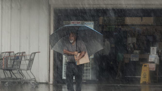
![]() Image 1 of 5
Image 1 of 5A resident carries supplies during Hurricane Lala in Hawaiian Ocean View, Hawaii, Saturday, Aug. 15, 2026. The storm strengthened into a hurricane as it approached Hawaii, with up to 25 inches of rain possible on the island of Hawaii, commonly known as the Big Island. (Photo by Stephen Lam/San Francisco Chronicle via Getty Images) ( )
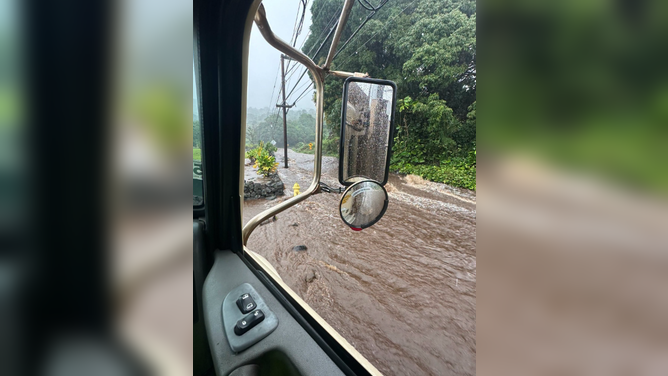
![]() Image 2 of 5
Image 2 of 5Major flooding in Waiohinu, Hawaii, from Hurricane Lala on Saturday, Aug. 15. (Hawaii Department of Transportation )
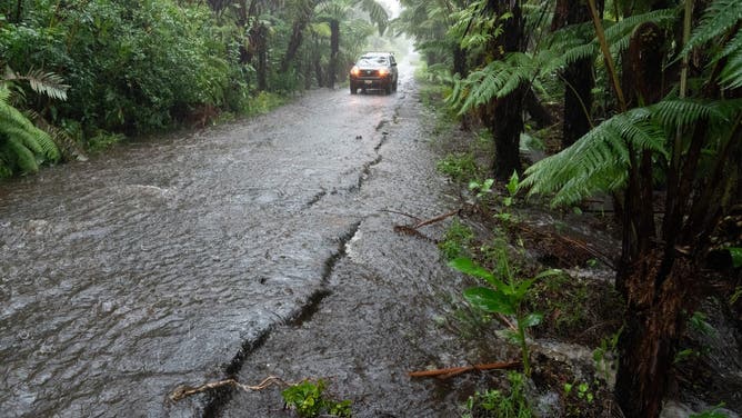
![]() Image 3 of 5
Image 3 of 5A rural road floods in Volcano Village on Hawaii Island, on August 15, 2026. Hurricane Lala on Saturday lashed Hawaii's Big Island with heavy rain and strong winds, as forecasters warned of potentially dangerous flooding across the US Pacific island state. Lala strengthened into a Category 1 hurricane at around 9:00 am local time (1900 GMT), generating winds of up to 75 miles per hour (120 kilometers per hour). (Photo by Jill K. Briggs / AFP via Getty Images) ( )
![A young green sea turtle fills up on grass as ocean waters started to raise due to the approach of Tropical Storm Lala at Reed's Bay in Hilo, Hawaii on August 14, 2026.]() Image 4 of 5
Image 4 of 5A young green sea turtle fills up on grass as ocean waters started to raise due to the approach of Tropical Storm Lala at Reed's Bay in Hilo, Hawaii on August 14, 2026. (Jill K. Briggs / AFP )
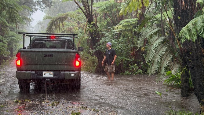
![]() Image 5 of 5
Image 5 of 5A resident stops on a rural road as it floods in Volcano Village on Hawaii Island, on August 15, 2026. Hurricane Lala on Saturday lashed Hawaii's Big Island with heavy rain and strong winds, as forecasters warned of potentially dangerous flooding across the US Pacific island state. Lala strengthened into a Category 1 hurricane at around 9:00 am local time (1900 GMT), generating winds of up to 75 miles per hour (120 kilometers per hour). (Photo by Jill K. Briggs / AFP via Getty Images) ( )
Tropical Strom Lala continues to weaken
The latest forecast models keep this storm farther south than Hurricane Lala's track, the FOX Forecast Center said.
Over 6,000 customers are still without electricity on the Big Island as of early Sunday after Lala dumped over 3 feet of rain near Nāʻālehu on the southeastern tip of the Big Island last week.
FLASH FLOOD THREAT BUILDING FOR HALF A DOZEN STATES IN THE EAST TO END THE WEEK
Widespread flooding washed out roads and left Nāʻālehu cut off.
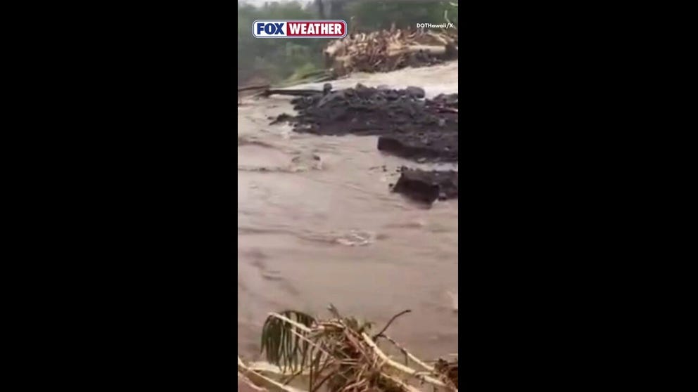
Watch: Hurricane Lala Washes Away Part Of Māmalahoa Highway On Hawaii's Big Island
🌊WASHED AWAY: Parts of Māmalahoa Highway on Hawaii's Big Island were washed away by torrential rainfall and flooding from Hurricane Lala over the weekend. More than 3 feet of rain fell around the community of Nā`ālehu, which was still cut off early Monday.
The system is expected to undergo a gradual weakening trend over the next few days. Moke is forecast to remain a tropical storm into early next week before dissipating.
WHAT HAPPENS WHEN A HURRICANE COLLIDES WITH HAWAII’S MASSIVE VOLCANOES?
More Eastern Pacific disturbances
Another significant, potential system is taking shape closer to the American Continent, where conditions are prime for robust development, the FOX Forecast Center said.
The area to watch being marked by the NHC now has a high chance of development and was tagged as Invest 92E on Thursday evening.
Fueled by warm El Niño waters, the system is expected to strengthen into a hurricane over the next several days.
BREWING SUPER EL NIÑO EXPECTED TO BE STRONGEST ANYONE ALIVE ON THE PLANET HAS EVER EXPERIENCED
However, it poses no threat to land and is expected to dissipate in the open Pacific late next week. Moisture from the system could drift toward the West Coast later, though that forecast remains uncertain.
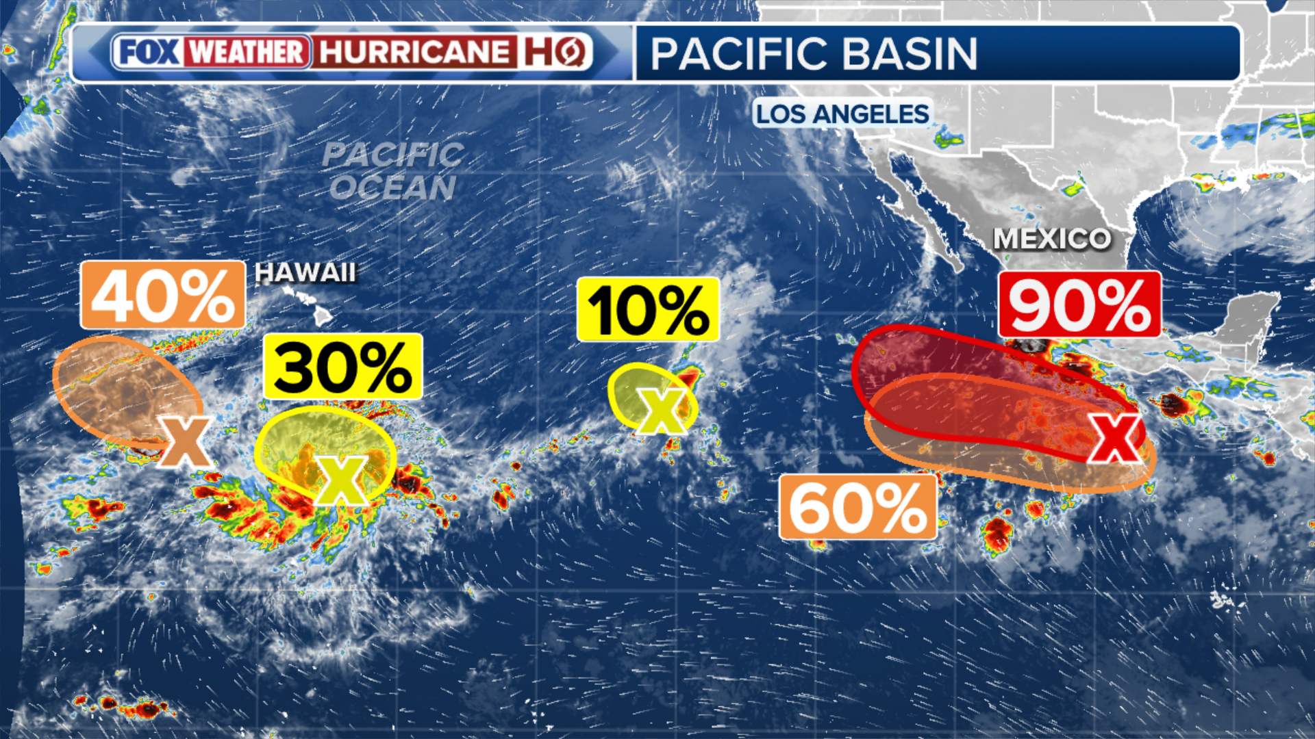
(FOX Weather)
Another invest was designated early Saturday morning. Invest 91E is being monitored alongside another Area to Watch, and the FOX Forecast Center will continue to track developments.
The term "invest" is used every hurricane season in the Atlantic and the Eastern and Central Pacific basins, accompanied by a number from 90 to 99 and either the suffix "L," "E" or "C," respectively.
TOURIST DIES IN DEATH VALLEY NATIONAL PARK AFTER BECOMING STRANDED IN TRIPLE-DIGIT HEAT
Check back for updates on this developing story.