

Deadly severe storms slam millions along the East Coast with dangerous flooding, damaging winds
Level 3 of 4 Flash Flood risk issued for NYC as storms set to erupt Thursday evening, with 17 million people at highest risk of flash flooding
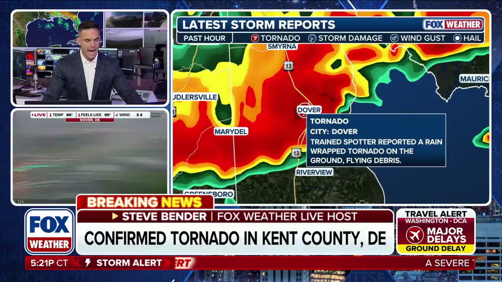
Confirmed tornado spins through Dover, Delaware
A confirmed tornado was reported in Dover, Delaware, as FOX Weather Meteorologist Steve Bender analyzes the radar, with millions across the Mid-Atlantic and Northeast under the threat of severe weather through Thursday night.
THE TAKEAWAY
- Severe storms to bring wind and flood threat for the Thursday evening commute along I-95.
- Urban flooding possible in New York City and Philadelphia Thursday.
- Stalled cold front will bring days of rain to the East Coast.
Severe storms rumbled the East Coast during the Thursday evening rush, placing more than 32 million people along the Interstate 95 corridor under a flash flood threat from southern Connecticut to Virginia, including the New York City, Philadelphia and Baltimore metro areas.
As the threat shifted east, a level 3/4 flash flood risk was issued for central and northern New Jersey and New York City for Thursday afternoon as drenching downpours impacted the region around the evening commute.
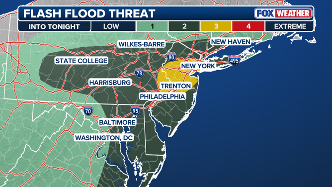
A level 3/4 flash flood risk has been issued for central and northern New Jersey and New York City for Thursday afternoon as drenching downpours are expected around the evening commute.
(FOX Weather)
On top of a flash flood threat, a Tornado Watch was in place for over 15 million people across parts of Delaware, District of Columbia, Maryland, New Jersey, Pennsylvania and Virginia.
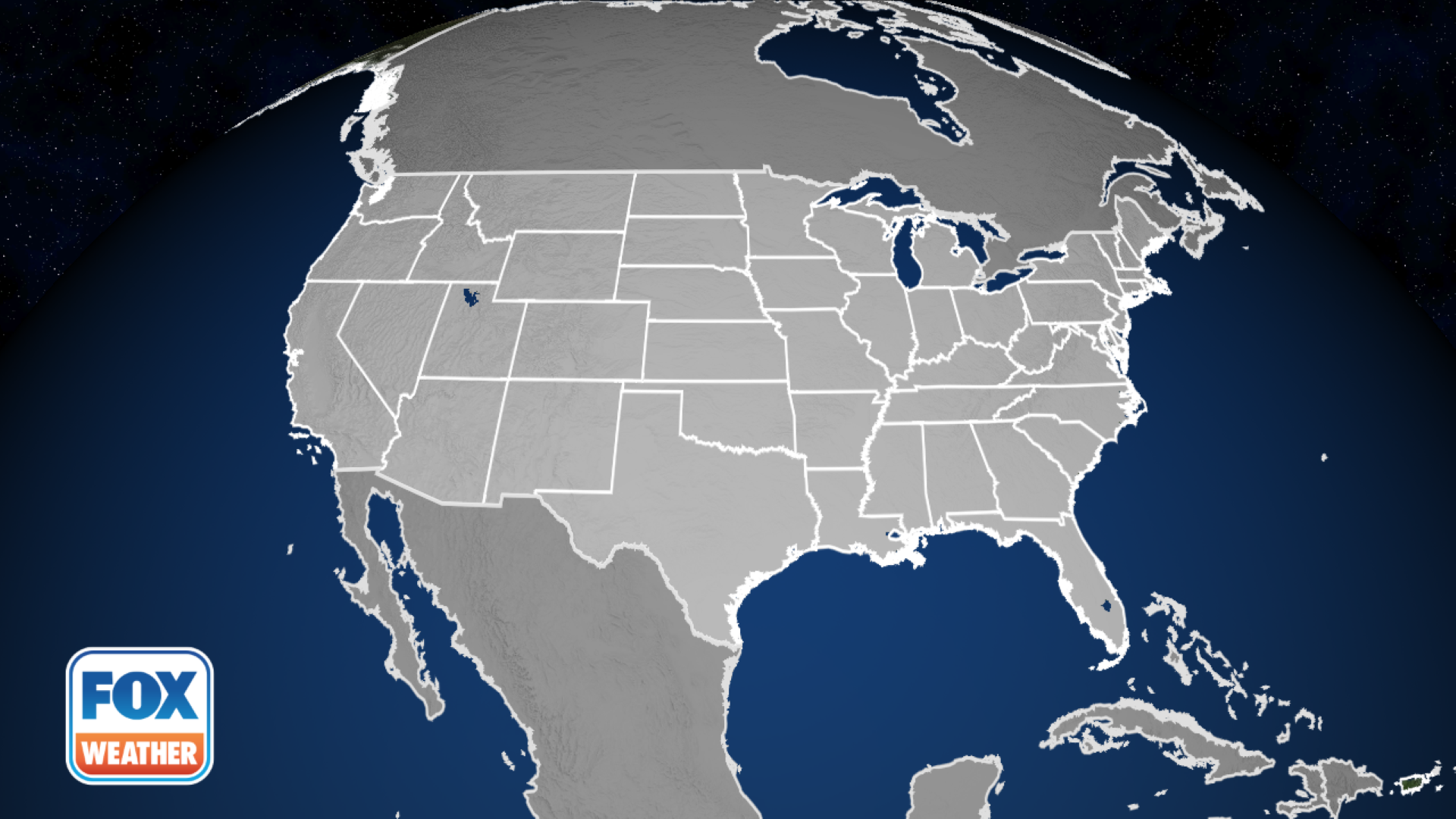 Active Tornado Watch Map.
(FOX Weather)
A confirmed tornado, prompting a Particularly Dangerous Situation (PDS) warning, ripped through Dover, Delaware, just after 6 p.m. Thursday.
The Dover Police Department reported "significant damage" across parts of the city, including numerous downed trees, flooding and other storm-related damage. Officials declared a State of Emergency for Dover as emergency crews responded to impacted areas.
As well, Columbia Borough Mayor Leo Lutz declared a state of emergency Thursday evening after severe storms and a possible tornado caused significant damage to the area.

Blinding rain slams Union, New Jersey
Blinding rain is slamming Union, New Jersey, leaving cars stranded as flash flooding continues across the area. A Level 3 of 4 flash flood risk is in effect for central and northern New Jersey.
Storms advanced eastward after blasting parts of northeastern Arkansas and Kentucky late Wednesday, as well as Indiana, which is still reeling from last week's deadly flooding.
Severe storms placed parts of southwestern Indiana under a Tornado Warning Wednesday afternoon.
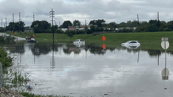
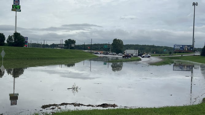
![Residual flooding near Interstate 70 in Franklin County, Ohio, on Thursday, Aug. 20, 2026.]() Image 1 of 4
Image 1 of 4Residual flooding near Interstate 70 in Franklin County, Ohio, on Thursday, Aug. 20, 2026. (@CHIEFGILBERT1/X)
![Residual flooding near Interstate 70 in Franklin County, Ohio, on Thursday, Aug. 20, 2026.]() Image 2 of 4
Image 2 of 4Residual flooding near Interstate 70 in Franklin County, Ohio, on Thursday, Aug. 20, 2026. (@CHIEFGILBERT1/X)
![Residual flooding near Interstate 70 in Franklin County, Ohio, on Thursday, Aug. 20, 2026.]() Image 3 of 4
Image 3 of 4Residual flooding near Interstate 70 in Franklin County, Ohio, on Thursday, Aug. 20, 2026. (@CHIEFGILBERT1/X)
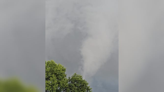
![Tornado-warned storms loom over Yorktown, Indiana, on Wednesday, Aug. 20, 2026.]() Image 4 of 4
Image 4 of 4Tornado-warned storms loom over Yorktown, Indiana, on Wednesday, Aug. 20, 2026. (Jim Chenoweth)

More than 24,000 customers were still without power in southwestern Kentucky early Thursday. NOAA's Storm Prediction Center (SPC) also received a report of a possible tornado in Graves County overnight Thursday.
The cold front responsible for the severe weather moved east from the Ohio Valley with an area of low pressure trailing behind it.

New York City rocked by heavy downpours
Torrential rain is slamming the Big Apple, flooding roadways and disrupting the evening commute. A Level 3 of 4 flash flood risk is in effect across New York City as heavy rain continues to bombard the region.
According to the FOX Forecast Center, the front stalled Thursday evening over the Northeast coast down south into the Mid-Atlantic and Carolinas.
Thunderstorms produced rainfall rates of up to 2 inches per hour.
WHAT TO DO IF YOU ENCOUNTER A FLOODED ROAD
(FOX Weather)
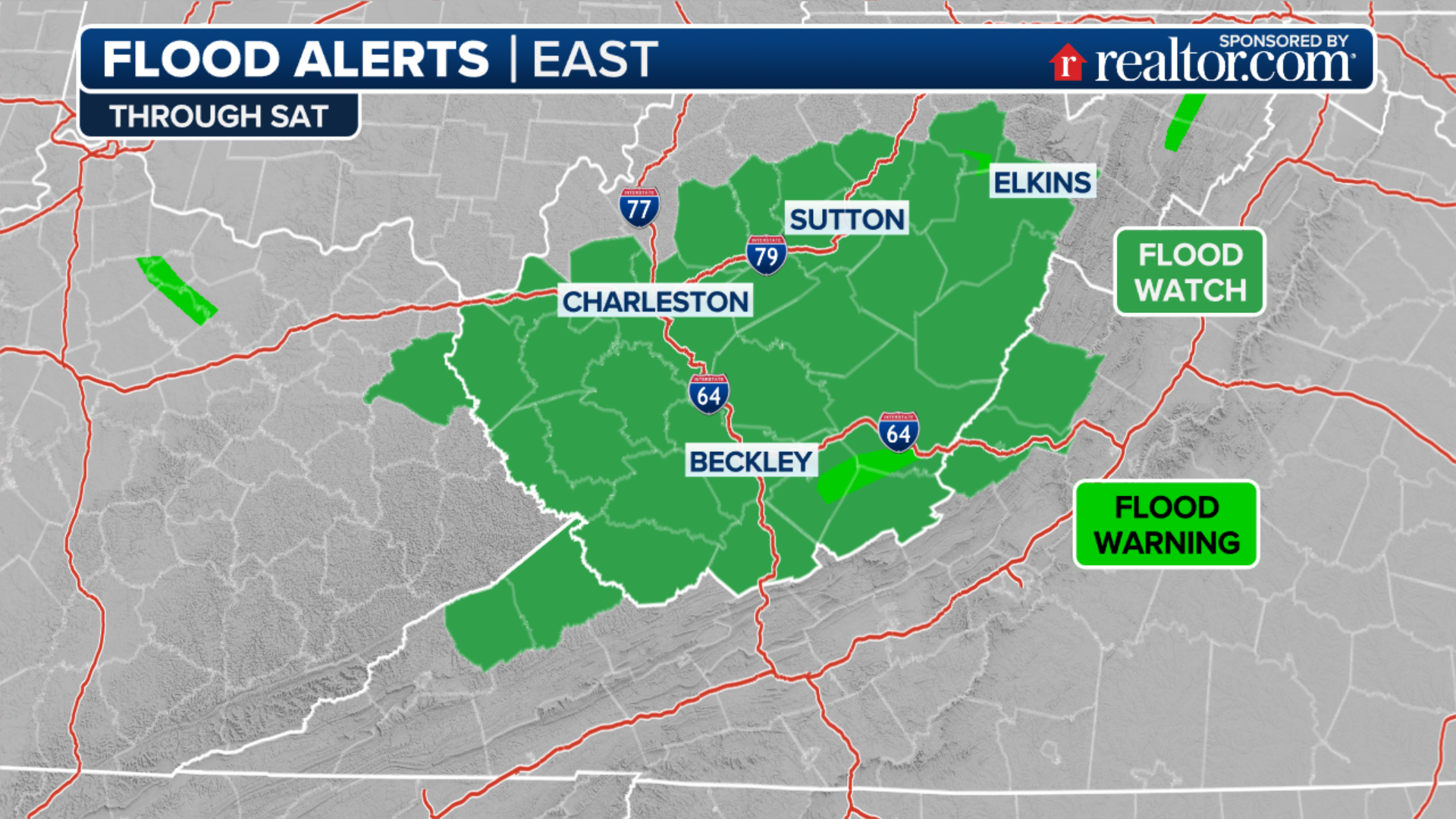
NOAA's Weather Prediction Center (WPC) issued widespread Level 2 out of 4 risk of flash flooding along the I-95 corridor from Connecticut to Virginia, while 17 million people across parts of New Jersey and New York City faced a higher Level 3 out of 4 risk.
Additionally, Central New Jersey through parts of northern North Carolina saw severe storms that produced damaging wind gusts. This included Washington, D.C. and the entire Delmarva.
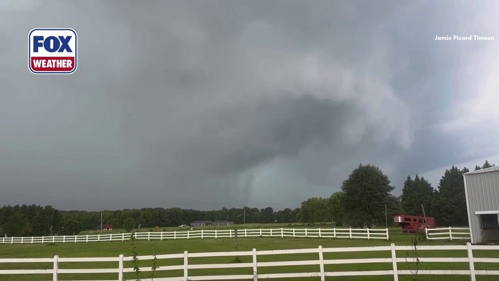
Severe storm shows rotation as it approaches Dover
A severe storm begins showing signs of rotation just after 6 p.m. southwest of Dover in Kent County, Delaware. At 6:18 p.m., the National Weather Service issued a confirmed tornado warning for Dover, as reports of significant damage began coming in from the Delaware capital, with a timelapse of the video highlighting the storm’s rotation.
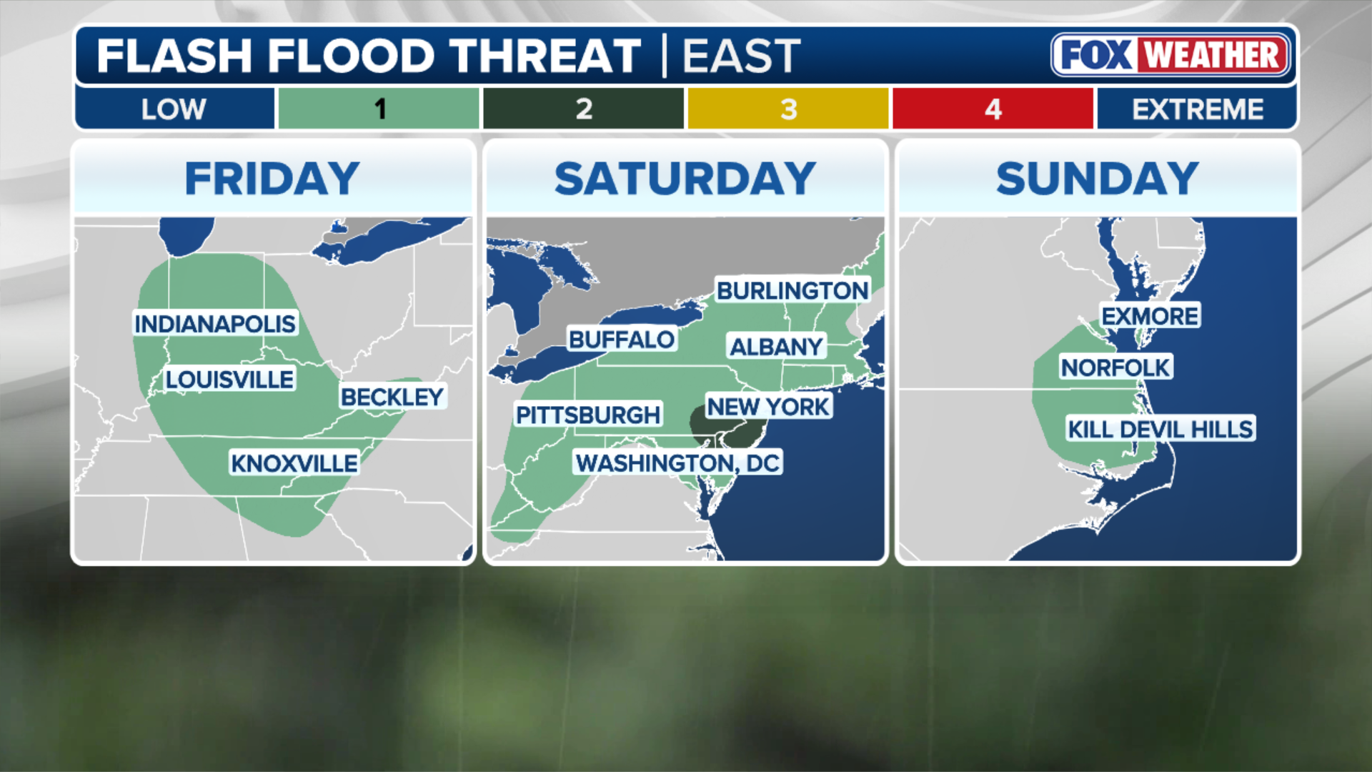
By Friday, the stalled cold front is expected to allow more storms to develop over the same areas in Virginia, North Carolina and into coastal Maryland, where rainfall rates of 2 inches per hour could be possible.
The Level 2 flood threat will shift south Friday, covering an area from southern Delmarva to parts of central South Carolina.
(FOX Weather)
As we move into the weekend, the area of low pressure could develop, potentially pushing rainfall north into the Interstate 95 corridor, but nothing is guaranteed just yet, the FOX Forecast Center said.
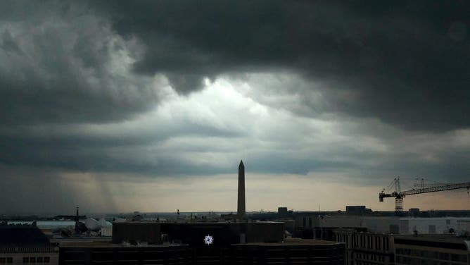
WASHINGTON, DC - AUGUST 7: A severe thunderstorm moves into Washington, D.C., Monday, August 7, 2023.
(Robert Miller/The Washington Post / Getty Images)
Rainfall is still expected to fall through Saturday evening in the Mid-Atlantic and Carolinas.

(FOX Weather)
Widespread rainfall totals of 2 to 3 inches are possible from North Carolina heading north up into coastal New Jersey, with localized amounts of 3 to 5 inches possible.
If this forecast holds, the flash flood risk could be upgraded in the coming days, the FOX Forecast Center said.
(FOX Weather)
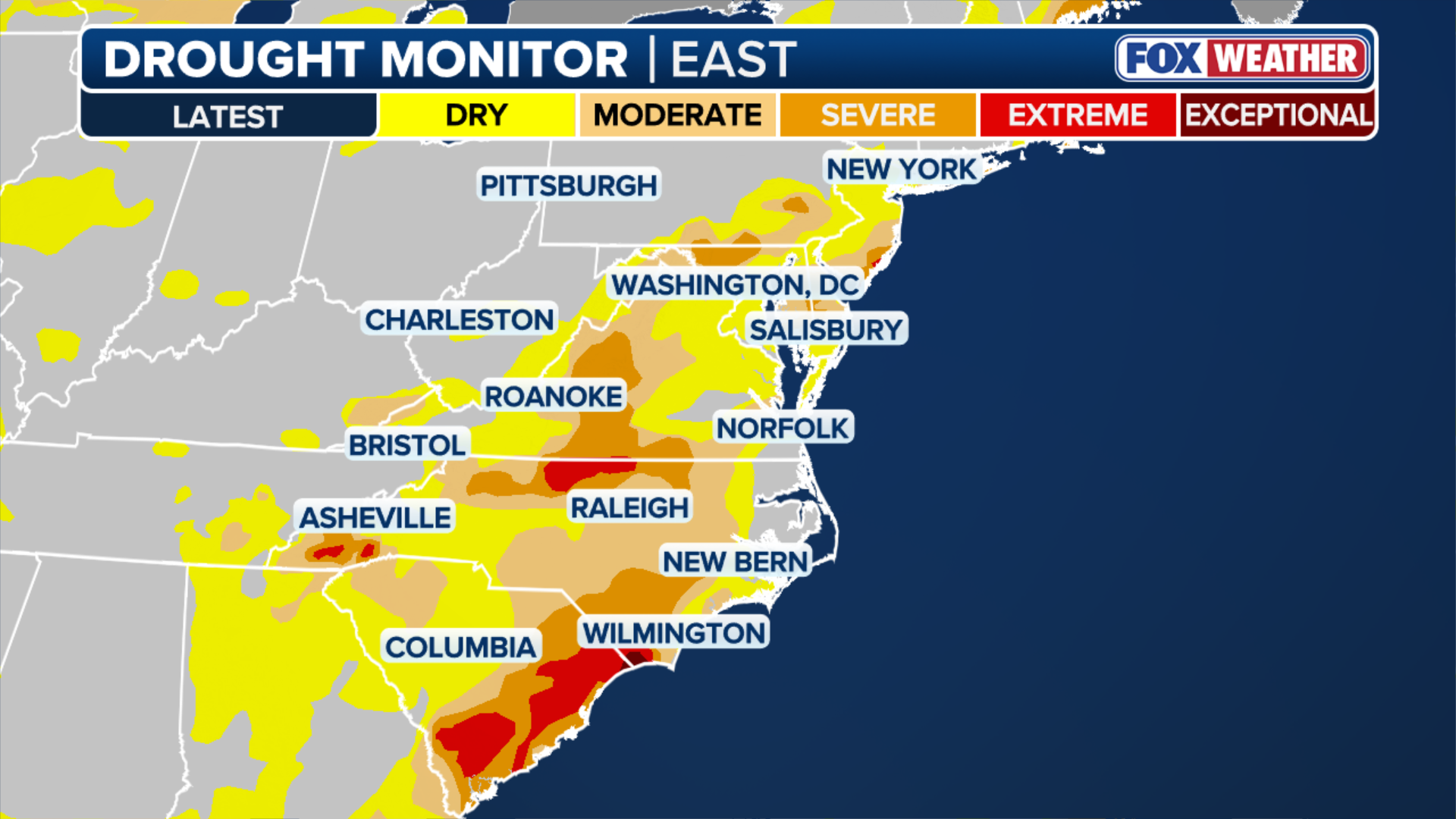
The bullseye for the heaviest rain is also an area dealing with widespread severe to extreme drought across the Carolinas and Virginia.
EL NIÑO INTENSIFIES PUERTO RICO'S RECORD DROUGHT AND WATER CRISIS AS WATER RATIONING BEGINS
Stick with FOX Weather for the latest forecasts as the storms near.