More snow blasts Northeast, Great Lakes as millions feel bone-chilling temperatures
The Great Lakes and interior Northeast will see snow and wind beginning Friday afternoon, before reaching the Interstate 95 corridor early Saturday. Brief periods of whiteout driving conditions will be possible beginning Friday evening.

Snow blasts Northeast, Great Lakes into this weekend, creating dangerous travel amid historic cold
A fast-moving clipper system is expected to bring powerful wind gusts and a shot of snow to the Great Lakes and Northeast — regions that are already well above their average winter snow accumulations. Snow squalls are the main concern in the interior Northeast, bringing powerful wind gusts that can create blowing snow that greatly reduces road visibility. Over 42 million people across the region are under Wind Alerts, with wind gusts up to 60 mph possible through Saturday. Snow is expected to reach the Interstate 95 corridor early Saturday through midday. New York City could see an additional 1 to 3 inches of snow.
A fast-moving clipper system is expected to bring powerful wind gusts and a shot of snow to the Great Lakes and Northeast — regions that are already well above their average winter snow accumulations.
Much of the snow from January's historic winter storm that dropped double-digit accumulations remains on the ground. Municipalities are rushing to remove snowpiles ahead of this latest system and historic cold that will be ushered in with arctic wind gusts associated with this clipper this weekend.
(FOX Weather)
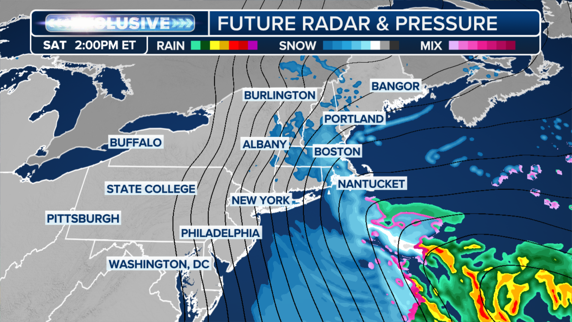
The Great Lakes and interior Northeast will see snow and wind beginning Friday afternoon, with lingering activity expected into Saturday before the storm moves off the New England coast on Sunday.
WHAT ARE SNOW SQUALLS AND WHY ARE THEY SO DANGEROUS?
Brief periods of hazardous driving conditions will be possible Friday evening through Saturday for parts of upstate New York, western Pennsylvania, and interior New England.
Snow squalls are the main concern, bringing powerful wind gusts that can create blowing snow that greatly reduces road visibility.
Over 42 million people across the region are under Wind Alerts, with wind gusts up to 60 mph possible through Saturday.
(FOX Weather)
Snow is expected to reach the Interstate 95 corridor early Saturday through midday.
New York City could see an additional 1 to 3 inches of snow, while cities like Philadelphia, Pennsylvania, and Albany, New York, will only see up to an inch.
WHAT FACTORS GO INTO A SNOW DAY FOR SCHOOL DISTRICTS?
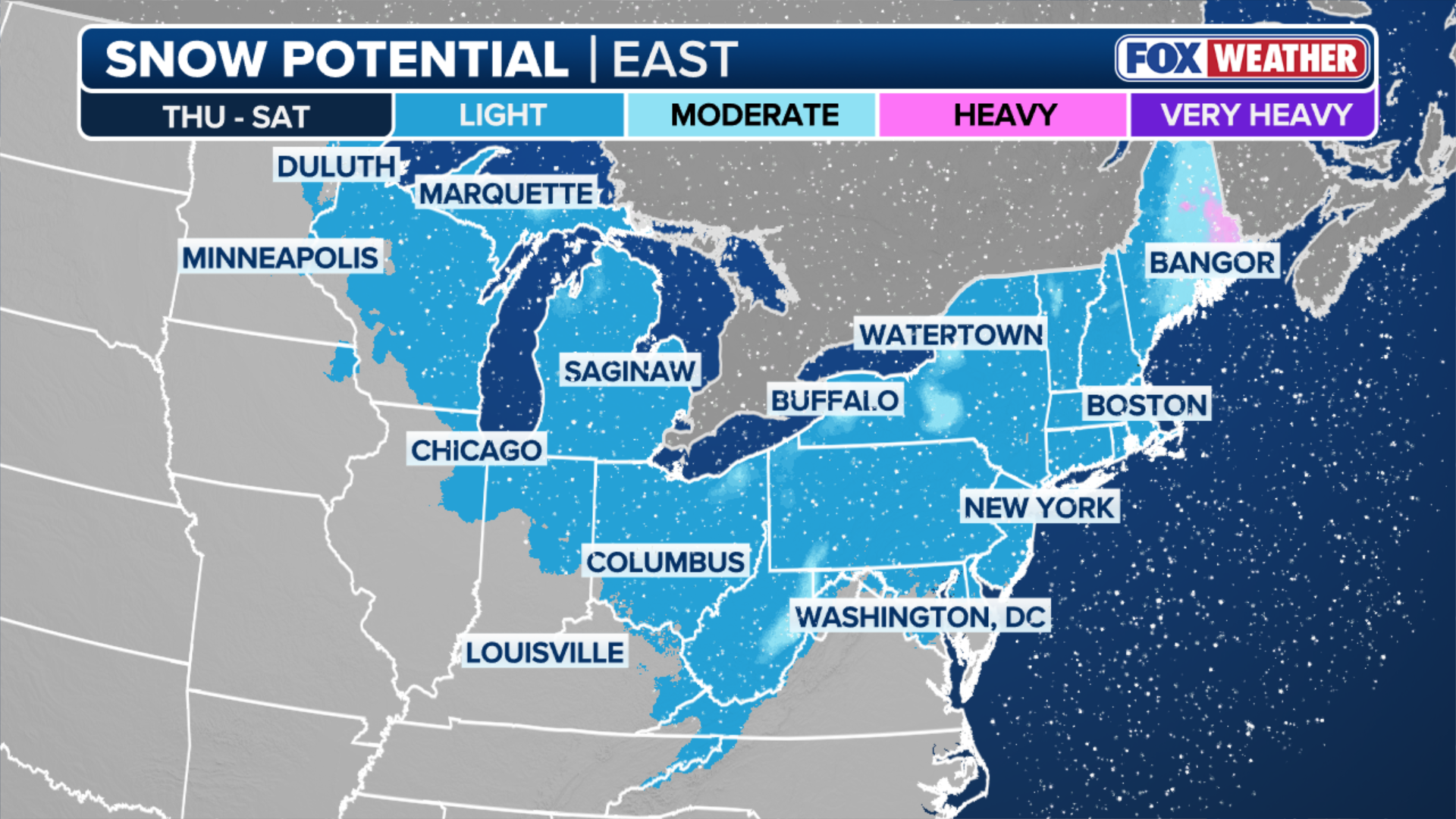
Higher snow totals are expected in the elevated terrain of West Virginia. Winter Storm Watches have been issued for these mountainous areas, where 5 to 8 inches of snow is possible.
Boston and coastal Massachusetts may see some ocean enhancement, potentially picking up 3 to 5 inches of snow through Saturday afternoon.

(FOX Weather)
This snowfall will impact regions already experiencing a significant winter surplus. Areas downwind of the Great Lakes and much of the Northeast are currently at 110 to 200% of their seasonal average, according to the FOX Forecast Center.
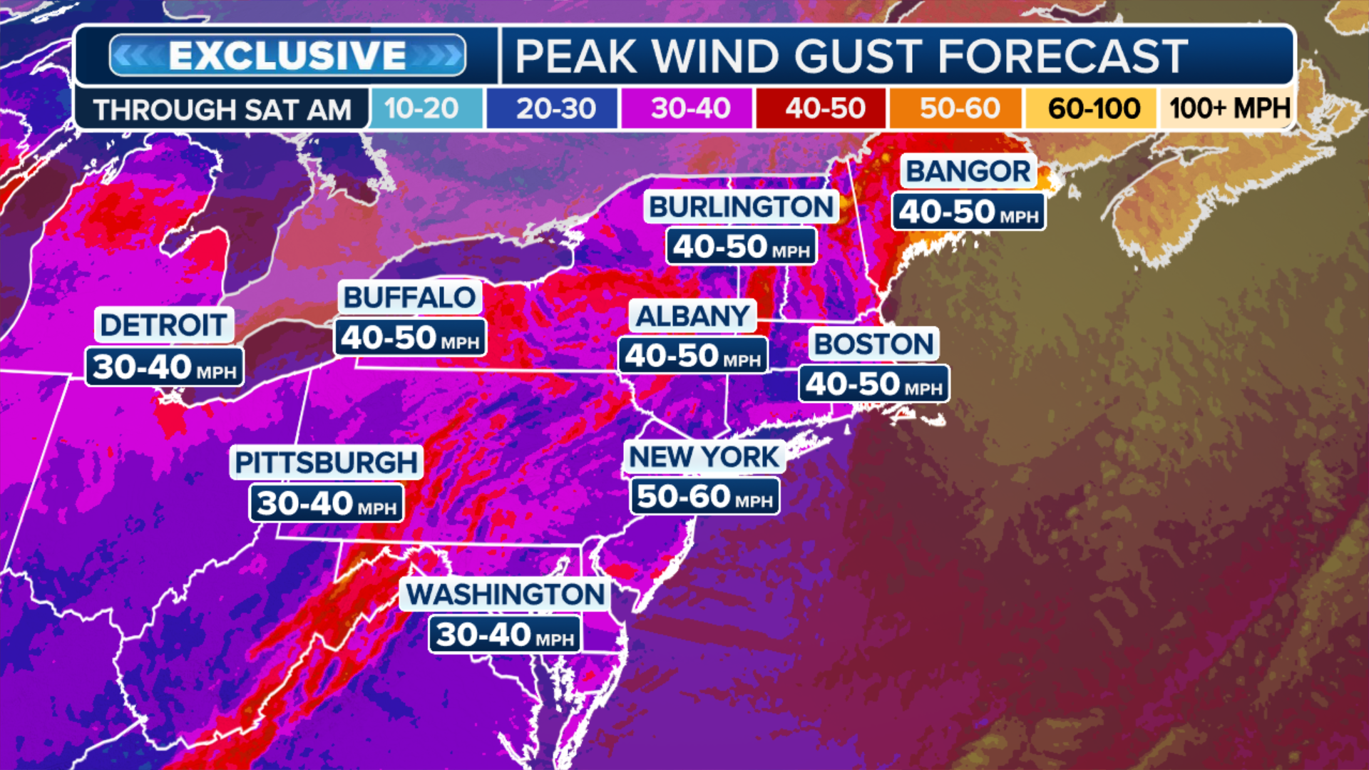
As the system reaches the Atlantic by Sunday, it will briefly strengthen into a more organized coastal system while exiting offshore. Combined with strong high pressure to the west, an increased pressure gradient will generate gusty winds through Saturday.
(FOX Weather)
Amid a winter of relentless arctic conditions, the most powerful polar punch of the season is expected across the Northeast this weekend, with dangerous wind chills approaching 25 degrees below zero in some places.
NORTHEAST BRACES FOR DANGEROUS, COLDEST WEEKEND OF THE WINTER AHEAD OF HIGHLY ANTICIPATED WARM UP
The powerful northwest winds trailing behind the clipper will bring in air associated with the polar vortex across the northeast corridor of Boston, New York and Philadelphia.
The National Weather Service (NWS) has issued rare Extreme Cold Warnings for more than 43 million people.

(FOX Weather)
Frostbite can set in on open skin within just a few minutes and prolonged exposure to these temperatures could be life-threatening, according to the NWS.
Check back for updates on this developing story.