Winter Weather Alerts issued for parts of Rockies, Northern Plains as late-week snow, sharp cooldown grip area
Winter Storm Watches have been issued for parts of southern Montana and northwestern Wyoming, including Yellowstone National Park.

More spring snow looms for Rockies, Northern Plains as temperatures plunge Friday
Another round of spring snow targets the Rockies and Northern Plains later this week as temperatures are set to plunge. Winter storm watches are already in place for parts of the region. FOX Weather Meteorologists Stephen Morgan and Marissa Torres breakdown what’s happening:
Another burst of winter weather is set to sweep across the Rockies and Northern Plains later this week.
While millions from Texas to the Midwest find themselves under a renewed risk of severe storms Friday, the cooler side of this sprawling low pressure system will fuel a spring snowfall farther north.

(FOX Weather)
Winter Storm Watches and Winter Weather Advisories have been issued for parts of Montana, Idaho and Wyoming through Friday morning. This includes cities like Jackson, Casper, Denver and even Yellowstone National Park.
![]() Image 1 of 6
Image 1 of 6Snow blankets Boulder, Colorado Friday morning, April 18, 2025. (Brandy Campbell/ FOX Weather)
![]() Image 2 of 6
Image 2 of 6FILE: FARGO, ND - MARCH 30: Snow falls in downtown March 30, 2009 in Fargo, North Dakota. (Photo by Scott Olson/Getty Images)
![]() Image 3 of 6
Image 3 of 6Snow blankets Boulder, Colorado Friday morning, April 18, 2025. (Brandy Campbell/ FOX Weather)
![]() Image 4 of 6
Image 4 of 6Snow blankets Boulder, Colorado Friday morning, April 18, 2025. (Brandy Campbell/ FOX Weather)
![]() Image 5 of 6
Image 5 of 6(UDOT Cottonwood Canyons)
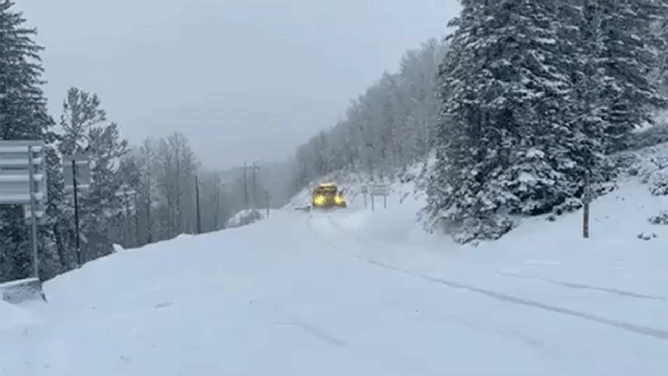
![Utah Department of Transportation snowplows work to clear fresh snow on Memorial Day in the upper canyons. (Image: UDOT)]() Image 6 of 6
Image 6 of 6Utah Department of Transportation snowplows work to clear fresh snow on Memorial Day in the upper canyons. (Utah DOT)


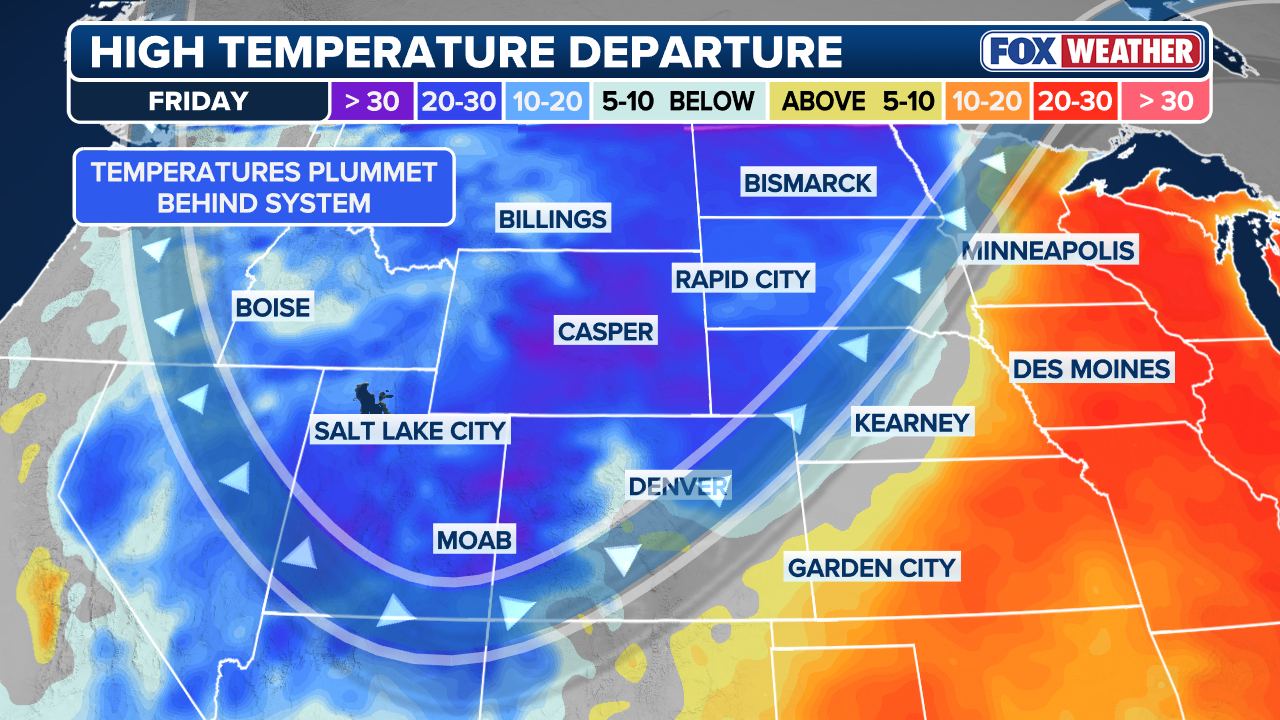
By Friday afternoon, temperatures will start to fall across much of the central and northern Rockies.
HOW HIGH PRESSURE AND LOW PRESSURE DRIVE THE WEATHER
While severe weather will be likely on the warm side of this system across the central U.S. — bringing more risks of hail, strong winds and tornadoes — cooler air will be pulled southward from Canada, helping to set the stage for snow into Friday and Saturday on the colder side of the system.

(FOX Weather)
Temperatures will begin to plummet Friday afternoon across much of the central and northern Rockies.
Some areas will see drops within a 25-degree difference, such as the city of Denver.
According to the FOX Forecast Center, the city will see a sharp temperature drop on Friday, with highs only in the 40s after Thursday’s mid-70s.
Meanwhile, even colder air will settle by the evening, especially over higher terrain, as lows in the city fall into the upper 20s.
(FOX Weather)
Even Minneapolis will see a high temperature on Friday in the upper 70s, then drop into the mid-30s overnight into Saturday morning, with highs through the weekend remaining in the 40s, about 10 degrees below average.
This will support snow development as a band of precipitation forms Friday evening and shifts northeast along with the surface low.
FLOOD THREAT INCREASES ACROSS GREAT LAKES AMID HEAVY RAINFALL, RAPID SNOWMELT
The FOX Forecast Center notes that while some forecast uncertainty remains, a swath of snow is expected across the Dakotas and into Minnesota by Saturday.
(FOX Weather)
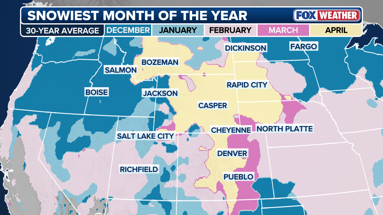
Although snow in the Rockies is not unusual in April—and in some areas it is actually the snowiest month on average—it will do little to offset the significant seasonal snowfall deficit.
Inches of snow will be possible across the higher terrain, with lighter totals into the Upper Midwest.