More flooding possible along I-95 corridor as powerful storm continues to spin off the East Coast
The coastal storm developed from the remnants of what was once Hurricane Ian.
High tide during coastal storm will keep the threat for coastal flooding
Breezy conditions will continue along the coast, which will keep the threat for coastal flooding during high tide.
A powerful storm that developed from the remnants of what was once Hurricane Ian will continue to spin off the East Coast on Tuesday, resulting in another day of flooding concerns as strong onshore winds push water inland.
The FOX Forecast Center has been monitoring the storm system since it developed over the weekend, which has been bringing heavy rain and gusty winds from the Northeast to the Delmarva Peninsula and North Carolina's Outer Banks.
HOW TO WATCH FOX WEATHER ON TV
Hurricane Ian first made landfall along the southwestern coast of Florida last Wednesday as a powerful Category 4 hurricane with winds of 150 mph.
Ian spun across Florida, knocking out power to millions of utility customers and bringing a catastrophic and deadly storm surge to coastal areas.
After exiting the northeastern coast of Florida, Ian headed north and made its final landfall in South Carolina on Friday afternoon as a Category 1 hurricane with winds of 85 mph.
Ian quickly lost strength and tropical characteristics but continued to bring high winds, heavy rain and flooding to parts of the mid-Atlantic and Northeast.
A coastal storm spawned by Ian's remnants developed and is now responsible for causing this persistent stretch of heavy rain, gusty winds and coastal flooding.
HURRICANE IAN LEFT SCARS VISIBLE FROM SPACE ALONG ITS TRAIL OF DESTRUCTION
Tuesday forecast

(FOX Weather)
As the storm system continues to spin off the coast, it will funnel in moderate to heavy rain across the Delmarva Peninsula northward to New Jersey and Long Island.
Rain is possible along hundreds of miles of the Interstate 95 corridor from Boston to the Outer Banks of North Carolina, but the highest rain totals will be centered along coastal areas of Delaware, Maryland and New Jersey.
Farther inland, the Washington area could also pick up an additional 2 to 3 inches of rain over the next 24 to 48 hours.
(FOX Weather)
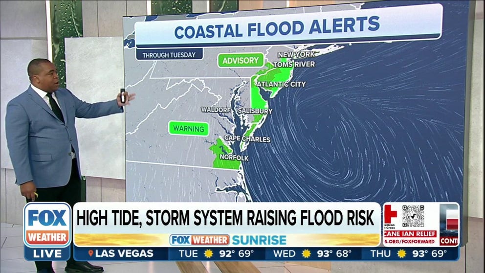
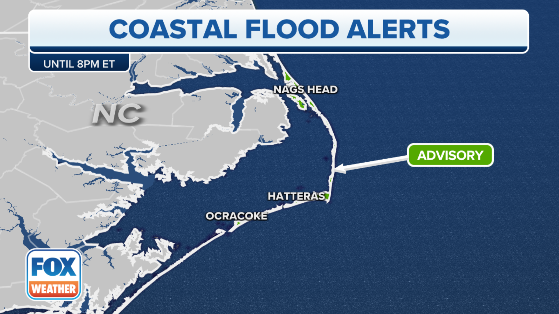
The FOX Forecast Center expects strong winds from the storm will lead to coastal flooding, and as a result, there are Coastal Flood Warnings and Advisories in effect through at least Wednesday.
FOX Weather meteorologist Jason Frazer explained that the winds are so strong with the storm system spinning off the coast because it's teaming up with an area of high pressure to the north.
"Whenever you have a difference of pressure like this, right in between there is where you start to get those really strong winds," he said. "As a result, with that onshore flow, we are going to get those very strong onshore winds, and that's going to lead to major flooding."
The Coastal Flood Warnings extend from the Toms River, New Jersey, area south along the Jersey Shore, the Delmarva Peninsula and the Virginia Tidewater, including Norfolk and Virginia Beach.
The Coastal Flood Advisories are in effect for areas farther inland. That includes southern New Jersey, northern Delaware and parts of eastern North Carolina.
History of Ian

Hurricane Ian hits Pinar Del Rio, Cuba causing roofs to blow off some buildings
Video shows Hurricane Ian hitting Pinar Del Rio, Cuba, on Tuesday causing roofs to blow off some buildings.
In its first landfall, Ian hit the town of La Coloma in the Pinar del Rio Province of Cuba at 4:30 a.m. Eastern time on Tuesday. The maximum sustained winds of the Category 3 hurricane at landfall were estimated to be 125 mph.
After leaving a trail of destruction and causing an island-wide blackout, Hurricane Ian made its way into the warm Gulf of Mexico waters, where it continued strengthening.
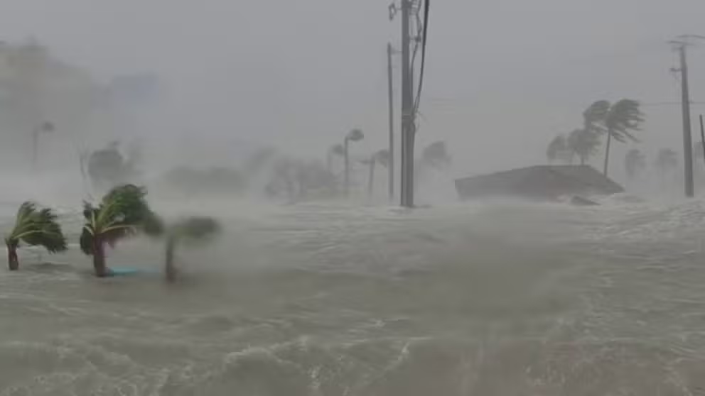
Major storm surge from Ian sweeps away homes in Fort Myers
More than 12 feet of storm surge caused by Hurricane Ian is captured moving homes away from their foundations in Fort Myers, Florida. (Video: Max Olson / LSM)
On Wednesday, Hurricane Ian pummeled Southwest Florida after making two catastrophic landfalls.
Ian was a monstrous Category 4 hurricane storm with 150-mph winds when it first came ashore on Cayo Costa, Florida, about 3 p.m. Wednesday.
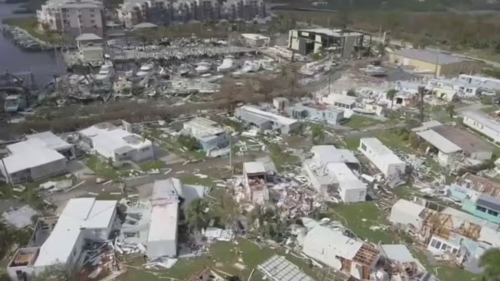
Drone footage shows destruction to mobile homes in Placida, FL
Drone video captures the destruction to mobile homes in Placida, Florida from Hurricane Ian.
About 90 minutes later, the hurricane made a second Florida landfall, just south of Punta Gorda, with 145-mph winds.
The storm continued to trek through the Florida Peninsula, bringing flooding rains to Orlando and other parts of the Sunshine State. The storm left more than 2.5 million customers without power.
WHEN WILL POWER BE TURNED BACK ON? RESTORATION FROM HURRICANE IAN COULD TAKE MONTHS

Kayaking in streets of Orlando amid Hurricane Ian
Hurricane Ian delivered so much rain to east Orlando that residents were able to go kayaking.
After downgrading to a tropical storm in Northeast Florida, Ian spun its way into the Atlantic with its eyes set on the Carolina coast.
On Thursday, Ian regained hurricane strength and brought life-threatening storm surge to South Carolina.
With its last U.S. landfall, Ian arrived in South Carolina as a Category 1 hurricane with 85-mph winds and a central pressure of 977 millibars.
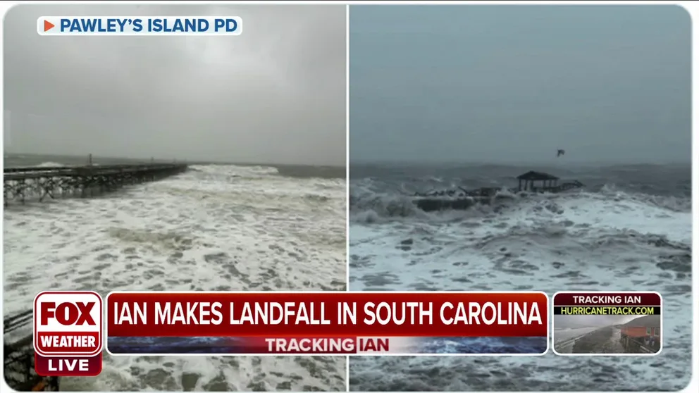
South Carolina pier collapses during Ian
A pier floated away in Pawleys Island during storm surge from Ian on Friday. FOX News multimedia reporter Stephen Goin says thousands are without power and trees are down across South Carolina.