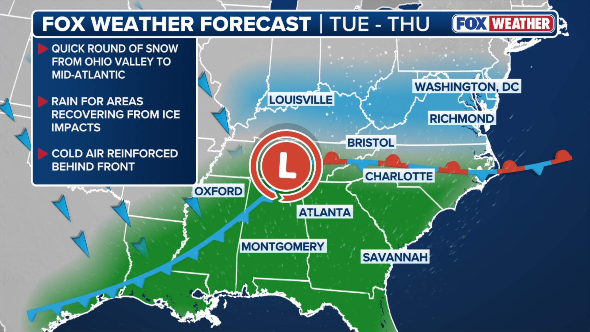
Next round of snow begins across winter-weary East, late-week storm could cause travel trouble
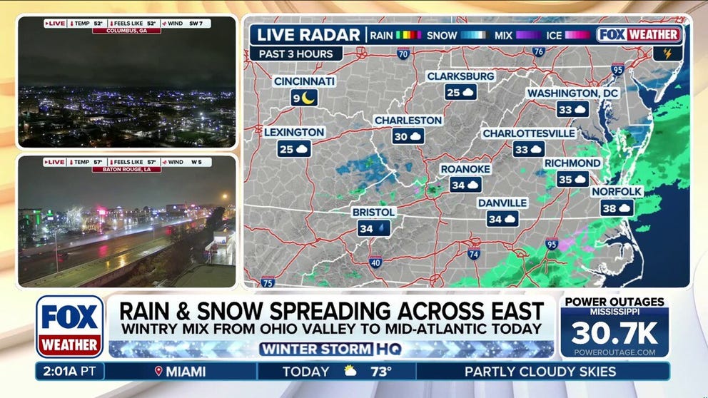
Meanwhile, rain is expected across the South on Tuesday, as far north as Tennessee and North Carolina. This rain could help melt lingering ice from last week's devastating and deadly ice storm — power outages remain across pockets of Mississippi and Tennessee.
Snow continues across Eastern U.S. with second round expected later this week
The first round of snow has begun across the East, bringing quick bursts of rain and fresh powder to portions of the Ohio River Valley and Mid-Atlantic. Meanwhile, a second system is expected later this week, with strong wind gusts increasing the potential for snow squalls and travel disruptions. Latest:
PHILADELPHIA – The first of two more rounds of snow began Tuesday across the winter-weary eastern U.S., including parts of the Ohio Valley, Mid-Atlantic and Northeast. While neither storm is expected to pack accumulations approaching last week's historic winter storm, the second of the upcoming two systems will be accompanied by wind gusts that could cause travel delays, alongside the unshakable arctic chill that has many cities across the East on track for their coldest winter in recent years.
(FOX Weather)
Midweek snow to clip Ohio Valley, Mid-Atlantic; rain to help melt remaining ice across the South
Timing: Continuing through Wednesday
A weak clipper system out of Canada tapped into moisture that was streaming north from the Gulf. This is bringing a coating of snow to parts of Indiana east through southern Ohio and into West Virginia. Snow began around the Tuesday morning rush hour and will continue into Wednesday, after arriving a little earlier than initially forecast.
NOR'EASTER 'BOMBS' OUT AFTER SLAMMING CAROLINAS, VIRGINIA WITH RECORD SNOW, BLIZZARD CONDITIONS
According to the FOX Forecast Center, snow totals are expected to stay between 1–2 inches, with slightly higher amounts possible in the higher elevations of the Appalachians.
Lighter snow is possible into Wednesday across portions of the Carolinas as this weaker system pushes out into the Atlantic.
While in many locations snow may be too light to justify Winter Weather Advisories, the National Weather Service has issued advisories for a narrow corridor from southern Indiana through West Virginia through Wednesday morning, highlighting slippery road conditions as the main threat.
Parts of North Carolina and Virginia have advisories issued through Thursday morning.

(FOX Weather)
This is already one of the snowiest winter seasons in recent years for areas across the Ohio Valley, including Cincinnati, Ohio, which has received 24.4 inches of snow, more than 11 inches above average.
Meanwhile, rain is expected across the South, as far north as Tennessee and North Carolina. This rain could help melt lingering ice from last week's devastating and deadly ice storm — power outages remain across pockets of Mississippi and Tennessee.
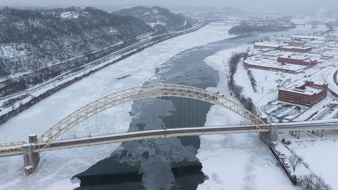
![The ice-covered Ohio River in Pittsburgh, Pennsylvania, US, on Monday, Jan. 26, 2026.]() Image 1 of 7
Image 1 of 7FILE - The ice-covered Ohio River in Pittsburgh, Pennsylvania, US, on Monday, Jan. 26, 2026. (Photographer: Justin Merriman/Bloomberg via Getty Images)
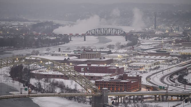
![The ice-covered Ohio River in Pittsburgh, Pennsylvania, US, on Monday, Jan. 26, 2026.]() Image 2 of 7
Image 2 of 7The ice-covered Ohio River in Pittsburgh, Pennsylvania, US, on Monday, Jan. 26, 2026. (Photographer: Justin Merriman/Bloomberg via Getty Images)
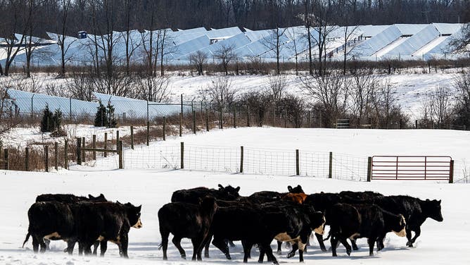
![FILE - A solar farm behind cows in a pasture during a winter storm in Cynthiana, Kentucky, US, on Monday, Jan. 26, 2026.]() Image 3 of 7
Image 3 of 7FILE - A solar farm behind cows in a pasture during a winter storm in Cynthiana, Kentucky, US, on Monday, Jan. 26, 2026. (Photographer: Michael Swensen/Bloomberg via Getty Images)
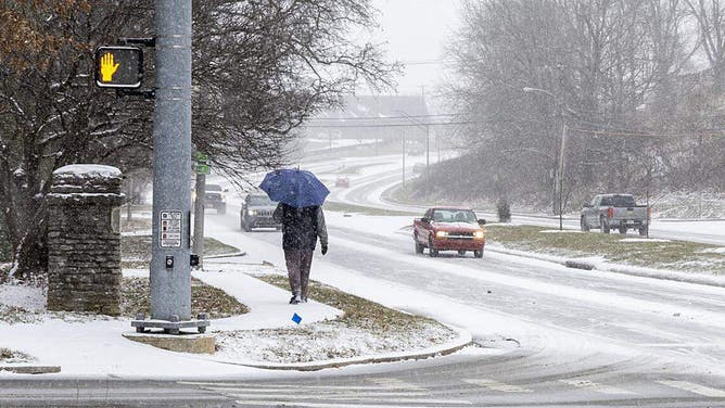
![FILE - A pedestrian walks along Lexington's Tates Creek Road Jan. 24, 2026, as winter storm starts to bring heavy snowfall and sleet across Lexington and Central Kentucky.]() Image 4 of 7
Image 4 of 7FILE - A pedestrian walks along Lexington's Tates Creek Road Jan. 24, 2026, as winter storm starts to bring heavy snowfall and sleet across Lexington and Central Kentucky. ((Brian Simms/Lexington Herald-Leader/Tribune News Service via Getty Images))
![FILE - PHILADELPHIA, PA - JANUARY 27: A general view of the exterior of Citizens Bank Park with snow during stadium shoot at Citizens Bank Park on Tuesday, January 27, 2026 in Philadelphia, Pennsylvania.]() Image 5 of 7
Image 5 of 7FILE - PHILADELPHIA, PA - JANUARY 27: A general view of the exterior of Citizens Bank Park with snow during stadium shoot at Citizens Bank Park on Tuesday, January 27, 2026 in Philadelphia, Pennsylvania. ((Photo by Denis Kennedy/MLB Photos via Getty Images))
![NEW YORK, UNITED STATES - JANUARY 29: A person takes the dog for a walk near the river that froze parts of it due to the extreme cold following a snowstorm as cold weather continues in New York, United States, on January 29, 2026.]() Image 6 of 7
Image 6 of 7NEW YORK, UNITED STATES - JANUARY 29: A person takes the dog for a walk near the river that froze parts of it due to the extreme cold following a snowstorm as cold weather continues in New York, United States, on January 29, 2026. (Selcuk Acar/Anadolu)
![NEW YORK, NEW YORK - JANUARY 29: People watch as ice floats cover part of the Hudson River along the Manhattan shoreline as New York City experiences frigid temperatures following a winter storm over the weekend on January 29, 2026, in New York City. New York received up to a foot of snow in a winter storm that swept through large parts of the country, resulting in numerous deaths, power outages, and accidents.]() Image 7 of 7
Image 7 of 7NEW YORK, NEW YORK - JANUARY 29: People watch as ice floats cover part of the Hudson River along the Manhattan shoreline as New York City experiences frigid temperatures following a winter storm over the weekend on January 29, 2026, in New York City. New York received up to a foot of snow in a winter storm that swept through large parts of the country, resulting in numerous deaths, power outages, and accidents. (Spencer Platt)


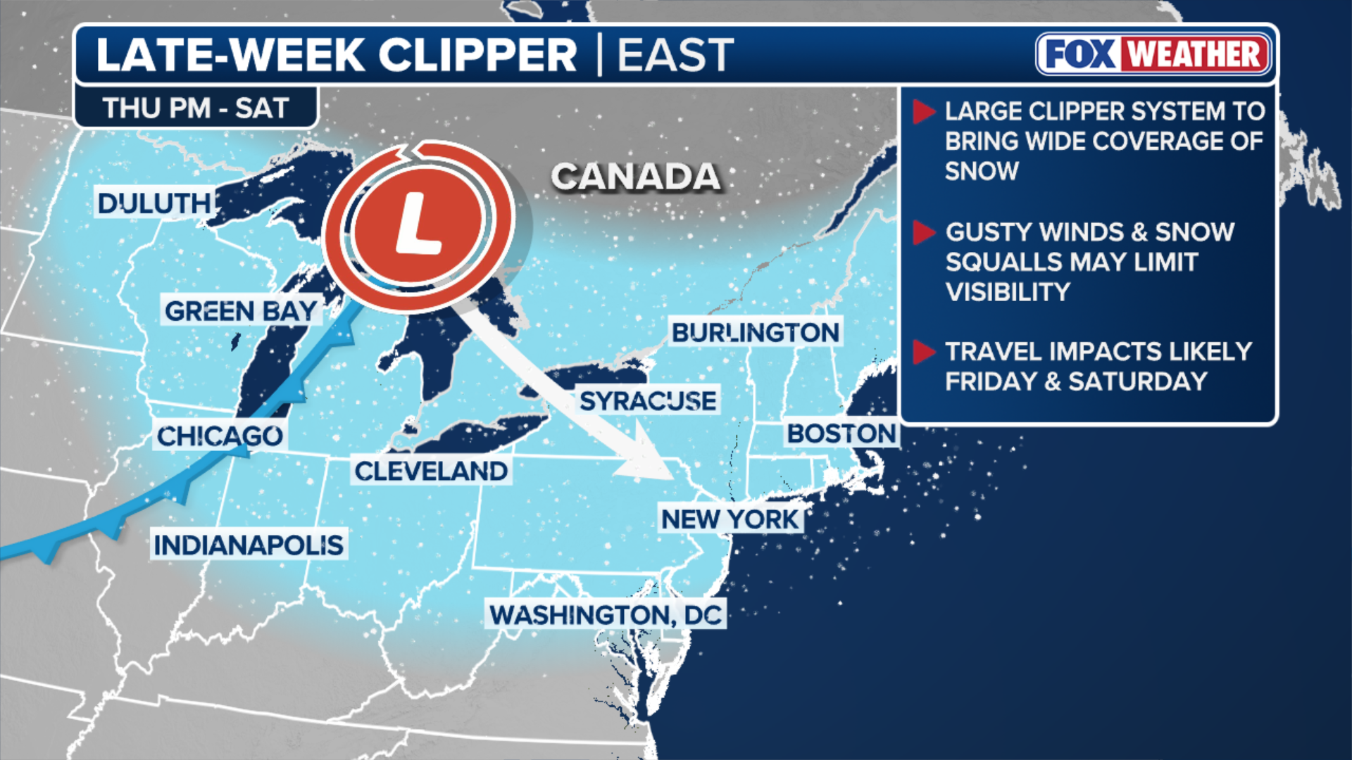
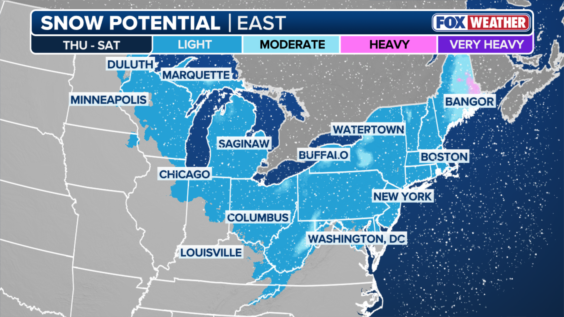
Late-week clipper could impact travel across Northeast, Great Lakes
Timing: Late Thursday through Saturday
A stronger clipper is expected to move across the Great Lakes and Northeast late Thursday, with parts of the Interstate 95 corridor likely seeing snow beginning sometime Friday afternoon into early Saturday.
SEE IT: COAST GUARD CUTTER FREES NYPD VESSEL FROM ICEBOUND HUDSON RIVER
1–3 inches of snow are expected across the Great Lakes and Northeast, with higher amounts favored in elevated terrain, according to the FOX Forecast Center.
"Forecast details will continue to be refined as the event draws closer," the Forecast Center said Monday.
(FOX Weather)
FOX Weather meteorologists also highlighted that wind gusts between 30–40 mph are expected to accompany this system.
DRIVING ON ICE AND DRIVING IN THE SNOW
Those gusts are strong enough to produce snow squalls and sudden visibility reductions for drivers on Friday afternoon and evening.
(FOX Weather)
The system is expected to move off the northeastern coast by Sunday, but whether it briefly strengthens and develops into a coastal storm or quickly exits remains something of an open question.
Check back for updates on this developing story.