Eastern Pacific hurricane season starting on a quiet note. What can that tell us about the Atlantic season?
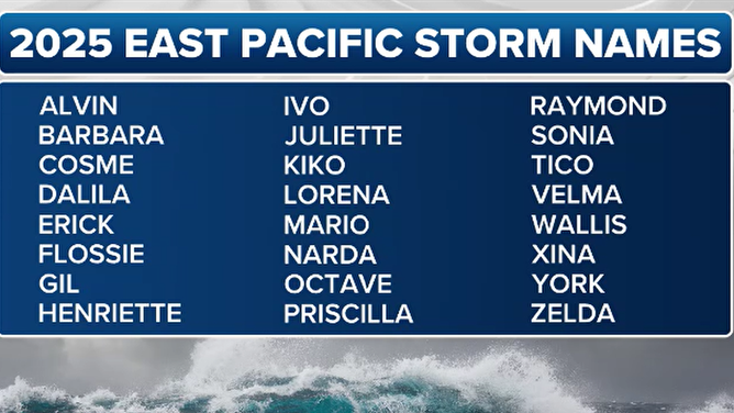
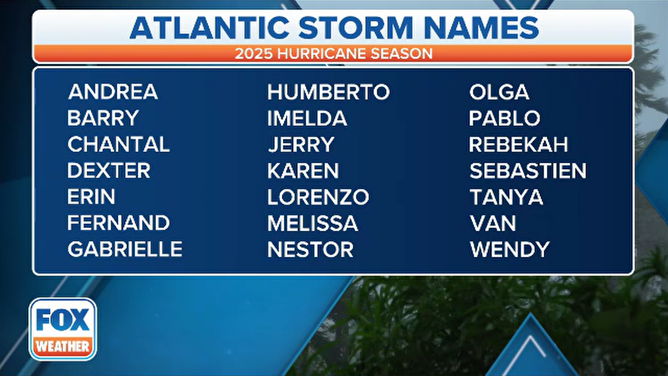
The 2025 hurricane season in the Eastern Pacific begins on May 15 and runs through Nov. 30. The first named storm of the Eastern Pacific season will be Alvin, followed by Barbara, Cosme and Dalila. The Atlantic season begins June 1.
Eastern Pacific hurricane season has arrived
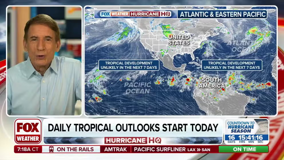
Thursday kicks off the Eastern Pacific hurricane season. FOX Weather Hurricane Specialist Bryan Norcross has a closer look at the current state of the tropics.
The Eastern Pacific hurricane season officially started Thursday, but forecast models show no sign of tropical cyclone formation in the near future.
While this may appear unusual, it's not yet behind schedule. On average, the first named storm in the Eastern Pacific forms about June 10, and the first hurricane develops by June 26, according to statistics from the National Hurricane Center.
Forecasters do expect the Eastern Pacific to produce greater-than-average activity and be much more active than the 2024 season, which saw just 13 named storms, four hurricanes and three that reached major status with sustained winds of at least 111 mph.
An average season usually produces 18 named storms, 10 hurricanes and four major hurricanes, with several threats to the Mexican coastline.
The status of what is known as the El Niño Southern Oscillation, or ENSO for short, plays a role in the amount of activity.
Currently, the world is in a neutral stage of the ENSO, meaning neither a La Niña nor an El Niño are in control.
A neutral status results in minimal extremes in water temperatures in the Central and Eastern Pacific.
Despite there being nothing to track in mid-May, the Pacific can offer clues about what’s to come, particularly in the Atlantic basin.
HERE’S A FIRST LOOK AT HOW BUSY HURRICANE ACTIVITY COULD BE IN THE EASTERN PACIFIC
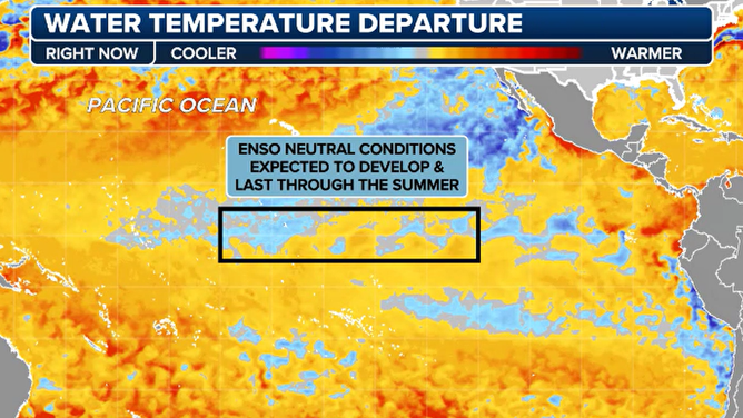
Water temperatures in the Pacific as of May 14, 2025.
(FOX Weather)
State of the atmosphere
Historically, seasons dominated by a La Niña tend to spark earlier activity in the Eastern Pacific, while El Niño years often see a delayed start.
That’s because El Niño years require time for waters to warm and favorable atmospheric conditions to fully align. Once the alignment happens, activity tends to ramp up rapidly and stay fairly constant throughout the season.
Neutral ENSO years - like the one currently in place - can vary widely and run the gamut. Some years start strong, while others remain sluggish well into the heart of the season.
Just because the atmosphere is in one of the three states doesn’t mean that the weather follows an absolute guideline. Some years, tropical activity follows an El Niño pattern despite being in a La Niña and vice versa.
2025 ATLANTIC HURRICANE SEASON GUIDE
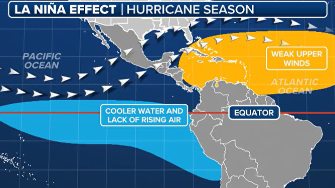
La Niña hurricane season impacts.
(FOX Weather)
Understanding how the current atmospheric patterns are evolving is crucial, as there is often an inverse relationship between cyclone activity in the Eastern Pacific and the Atlantic basin. When one basin is active, the other tends to be quieter due to a range of atmospheric and oceanic factors.
Major cyclones or a series of hurricanes in the Pacific can lead to an altered subtropical jet stream and enhanced vertical wind shear in parts of the Atlantic basin.
This shear can suppress cyclone development in the Caribbean and Gulf, leading to fewer organized systems outside the Pacific.
Oscillations give a heads-up
While most tropical cyclones travel from east to west, forecasters closely monitor global oscillations that move in the opposite direction - from west to east - as they can influence storm development across basins.
Two of the more important oscillations for tropical activity are the Madden–Julian Oscillation (MJO) and Kelvin waves.
The MJO is an area of upward motion that travels around the globe every 30 to 60 days. When the active phase aligns over the Eastern Pacific or Atlantic basin, it enhances rising motion and thunderstorm activity. Conversely, a suppressed phase of the MJO can keep cyclone activity minimal.
HURRICANE SEASON 2025: HERE ARE THE NAMES FOR STORMS YOU’LL SEE THIS SEASON
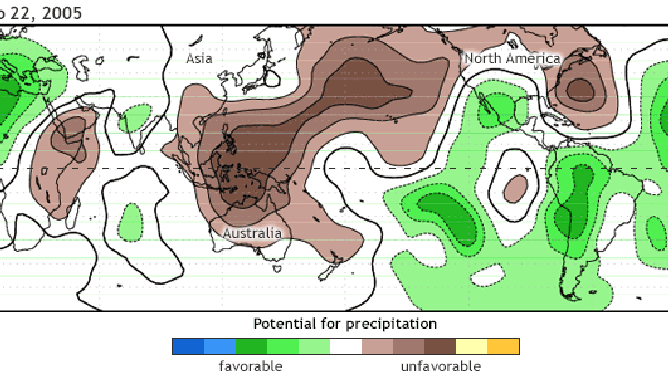
MJO animation of favorable and unfavorable waves for precipitation.
(NOAA)
Kelvin waves are similar pulses that travel from west to east and can influence rainfall and directional wind patterns.
Climate change effects
It’s worth noting that tropical cyclone activity is quiet not only in the Eastern Pacific, but also in the Western Pacific, which has yet to see a named storm in 2025.
The trend of inactivity comes after 2024 saw appreciable time periods of no tropical formation, which may reflect a larger pattern around the globe.
A 2022 study led by hurricane expert Phil Klotzbach, Ph.D., of Colorado State University, found global hurricane activity and Accumulated Cyclone Energy (ACE) have shown a decreasing trend since 1990, particularly in the Western Pacific.
The study also warned that the storms that do form may be more intense and costly, with a higher likelihood of rapid intensification.
If the Pacific were to make it into July or even August without tropical development, it would be another sign that there is something amiss with the climate, and would likely signal a down year for cyclones around the hemisphere, including the Atlantic.
Storms can form year round in all basins around the world. However, there are times of the year that are more conducive to hurricane development. In the Eastern Pacific, the hurricane season begins May 15. In the Atlantic, the season begins June 1. The seasons in both basins run through Nov. 30.
![Eastern Pacific Storm Names for 2025 Season]() Image 1 of 3
Image 1 of 3Eastern Pacific storm names for the 2025 season. (FOX Weather)
![2025 Hurricane Season Names]() Image 2 of 3
Image 2 of 3The 2025 Atlantic hurricane season names. (FOX Weather)
![Pacific satellite image from 5/14/2025]() Image 3 of 3
Image 3 of 3A satellite image of the Pacific Ocean taken May 14, 2025. (NOAA)