Watching tropical development hot spots ahead of hurricane season's official start in Eastern Pacific
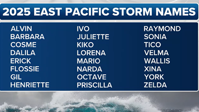
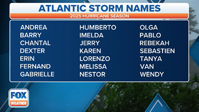
When the first named storm does eventually form in the eastern Pacific, it will be named Alvin. In the Atlantic, the first system to earn a name will be Andrea. Historically, the first named storm in the eastern Pacific forms around June 10, while the Atlantic’s first named system tends to develop closer to June 20. Missing those average dates does not necessarily signal a slow season overall, but it does reduce the window of opportunity for storms to develop.
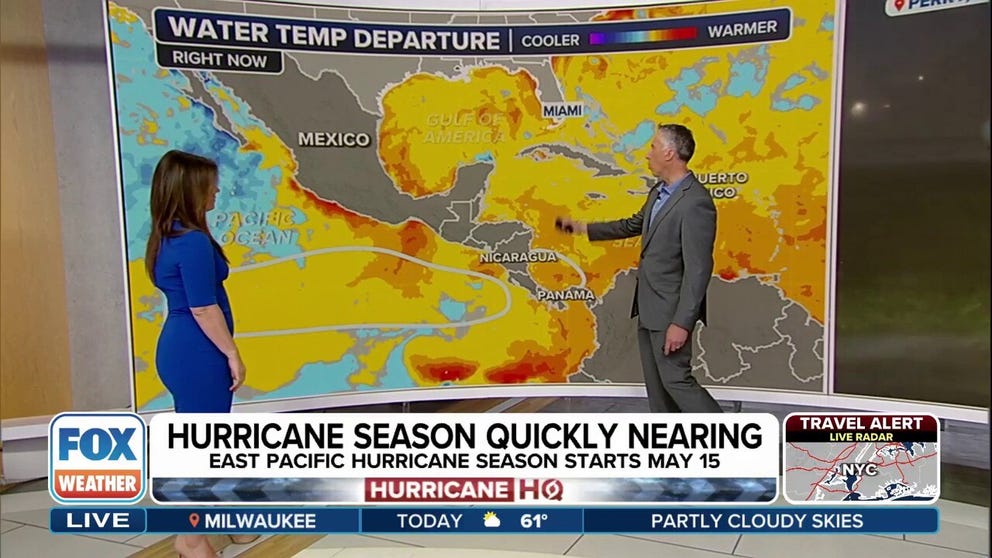
Hurricane season quickly nearing in Pacific, Atlantic
Despite nearing the start of the hurricane season, there does not appear to be any activity to track in the basins across the Northern Hemisphere.
As the official start of the hurricane season approaches in both the eastern Pacific and Atlantic basins, meteorologists are closely monitoring typical tropical hot spots, but, so far, there are few signs of any early-season storm development to worry about.
According to the latest forecasts from the National Hurricane Center and NOAA’s Climate Prediction Center, there is currently no indication of any tropical cyclone formation in the basins through the next week - and possibly through the entire month of May.
There have, however, been a few blips in some forecast models indicating some potentially favorable conditions for storm development in the eastern Pacific Ocean, but chances of anything greater than a tropical depression are considered to be extremely low over the next week.
NOAA's Climate Prediction Center has noted some of the models hinting at these long-range developments but "there is not enough confidence to warrant any (tropical cyclone) areas at this time."
May and June typically mark the beginning of tropical cyclone development along the Central American and North American coastlines, where water temperatures are warmer and there is more available moisture.
This early-season activity usually originates along frontal boundaries or a weather feature known as the Central American Gyre, which can create low-pressure systems under favorable atmospheric conditions.
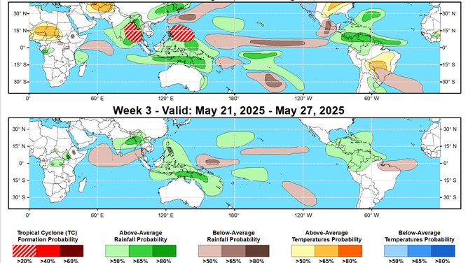
NOAA Global Tropics Hazards Outlook through May 27, 2025
(NOAA)
The absence of preseason activity is not unusual and follows last year's exceptionally slow start for tropical cyclone development across all basins in the Northern Hemisphere.
Despite the delayed onset in 2024, most basins still generated enough tropical cyclone activity to be considered above-average seasons.
2025 ATLANTIC HURRICANE SEASON GUIDE: HERE’S WHAT TO KNOW ABOUT THE TROPICS THIS YEAR
Nearly all major computer models show inactivity lasting for several weeks, but there is one notable outlier - the Global Forecast System, otherwise known as the American GFS.
For around a week, the GFS has generated erroneous forecasts suggesting that a significant hurricane would develop and impact Jamaica, Haiti and other Caribbean Islands.
"Unsurprisingly, the signal the U.S. GFS model was giving off (Wednesday) that an organized tropical system might lift north out of a broad low-pressure area in the extreme southern Caribbean is not present in (Thursday)'s model run. No other models, including the most modern AI forecasts, indicate that type of development. The broad Central American low-pressure system will bring persistent rain to that region, but high pressure across the northern Caribbean should block any movement north. No computer forecast models are skillful at predicting the genesis of new tropical systems in the long range. Before we pay attention, we look for multi-model consensus and a persistent forecast over time," FOX Weather Hurricane Specialist Bryan Norcross said Thursday in regards to the lack of tropical cyclone development.
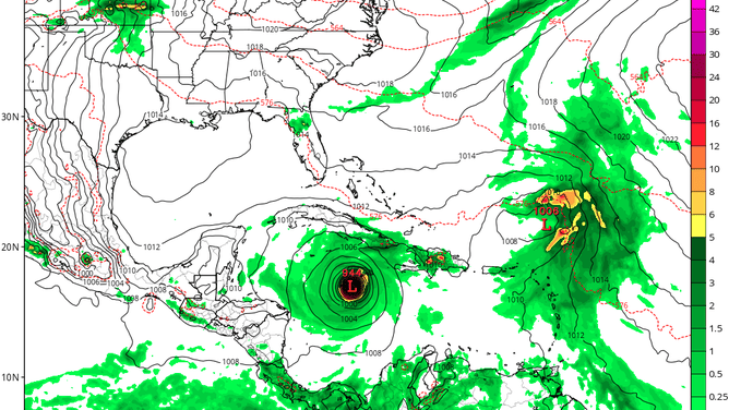
Erroneous GFS model forecast showing a hurricane impacting Jamaica on May 20, 2025.
(Tropicaltidbits.com / FOX Weather)
According to the FOX Forecast Center, early-season runs of the GFS are often unreliable and are marred by errors stemming from atmospheric dynamics.
Unfortunately, these erroneous runs are often seized upon by social media users to suggest that a massive hurricane threat is on the horizon, when one doesn’t actually exist.
Meteorologists typically seek consensus among multiple model solutions - such as the ECMWF, Canadian and other reputable forecasting models - before seriously considering the threat of tropical development.
Early-season tropical disturbances usually need more than just favorable conditions for development — and those factors simply don’t exist right now or in the near future.

Tropical satellite image from 5/9/2025
(NOAA)
HERE’S A FIRST LOOK AT HOW BUSY HURRICANE ACTIVITY COULD BE IN THE EASTERN PACIFIC
When the first named storm does eventually form in the eastern Pacific, it will be named Alvin, and in the Atlantic, the first system to earn a name will be Andrea.
Historically, the first named storm in the eastern Pacific forms around June 10, while the Atlantic’s first named system tends to develop closer to June 20.
Missing those dates does not necessarily signal a slow season overall, but it does reduce the window of opportunity for storms to develop.
![Eastern Pacific Storm Names for 2025 Season]() Image 1 of 2
Image 1 of 2Eastern Pacific Storm Names for 2025 Season ( )
![2025 Hurricane Season Names]() Image 2 of 2
Image 2 of 22025 Hurricane Season Names ( )
One important benchmark meteorologists will be watching this year is whether either basin comes close to its latest-ever date for its first cyclone.
In the eastern Pacific, the record latest date for formation is Aug. 23, while in the Atlantic, it is Sept. 15.
If activity doesn’t percolate until those dates or later, it has always been an indicator of a notably quiet season.
While the tropics around the world may be quiet for the time being, conditions can change rapidly, especially with water temperatures warming in key formation zones.