

Spring shocker: Major cold snap slamming East after record-setting heat
By Monday, more than 212 million Americans will see temperatures 20 to 30 degrees below average.
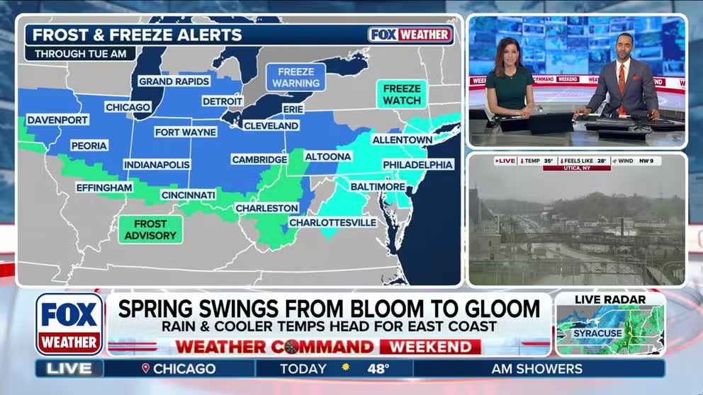
Wintry mix, cold temperatures return to East Coast, prompting frost and freeze alerts in parts of the Northeast, Midwest
Snow showers and colder air are returning to the East Coast, reinforcing winter’s lingering grip. While a wintry mix is already falling in parts of the Northeast, the bigger hit will be a sharp temperature drop, with frost and freeze alerts in effect through Tuesday morning for portions of the region and Midwest.
A spring chill is returning and is not expected to leave anytime soon, with some areas likely to remain cooler through the end of April.
It comes as several record high temperatures fell last week across the East, with many cities seeing their earliest 90 degree days in over a decade.
RECORD-SETTING SPRING HEAT WAVE DRIVES TEMPERATURES INTO THE 90S ACROSS EASTERN US
A strong cold front is progressing toward the East Coast. As it moves through, it will bring a round of rain and, as temperatures drop, some snow will fall across higher terrain in the Adirondacks and far northern New England.
Frost and freeze alerts have been posted through Tuesday morning for parts of the Northeast, as well as the Midwest, where temperatures are expected to be close to freezing.
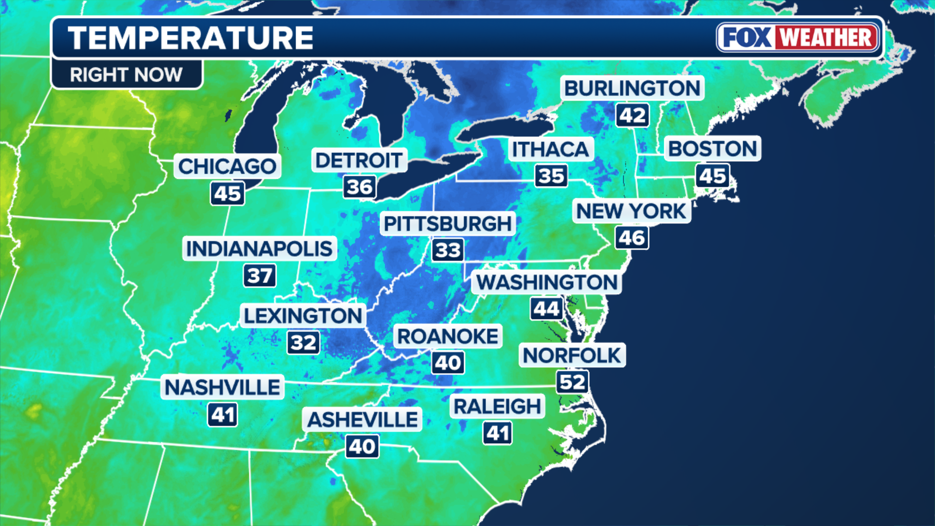
(FOX Weather)
While a few flakes have fallen across portions of the Northeast, the more widespread impact will be the sharp drop in temperatures this week.
By Monday, more than 212 million Americans will see temperatures 20 to 30 degrees below average.
This past week, many cities — including Washington, DC, Philadelphia and Atlantic City, New Jersey — recorded their earliest 90-degree day in over a decade.
That said, the 80s and low 90s are long gone as this cold front is moving through the East.
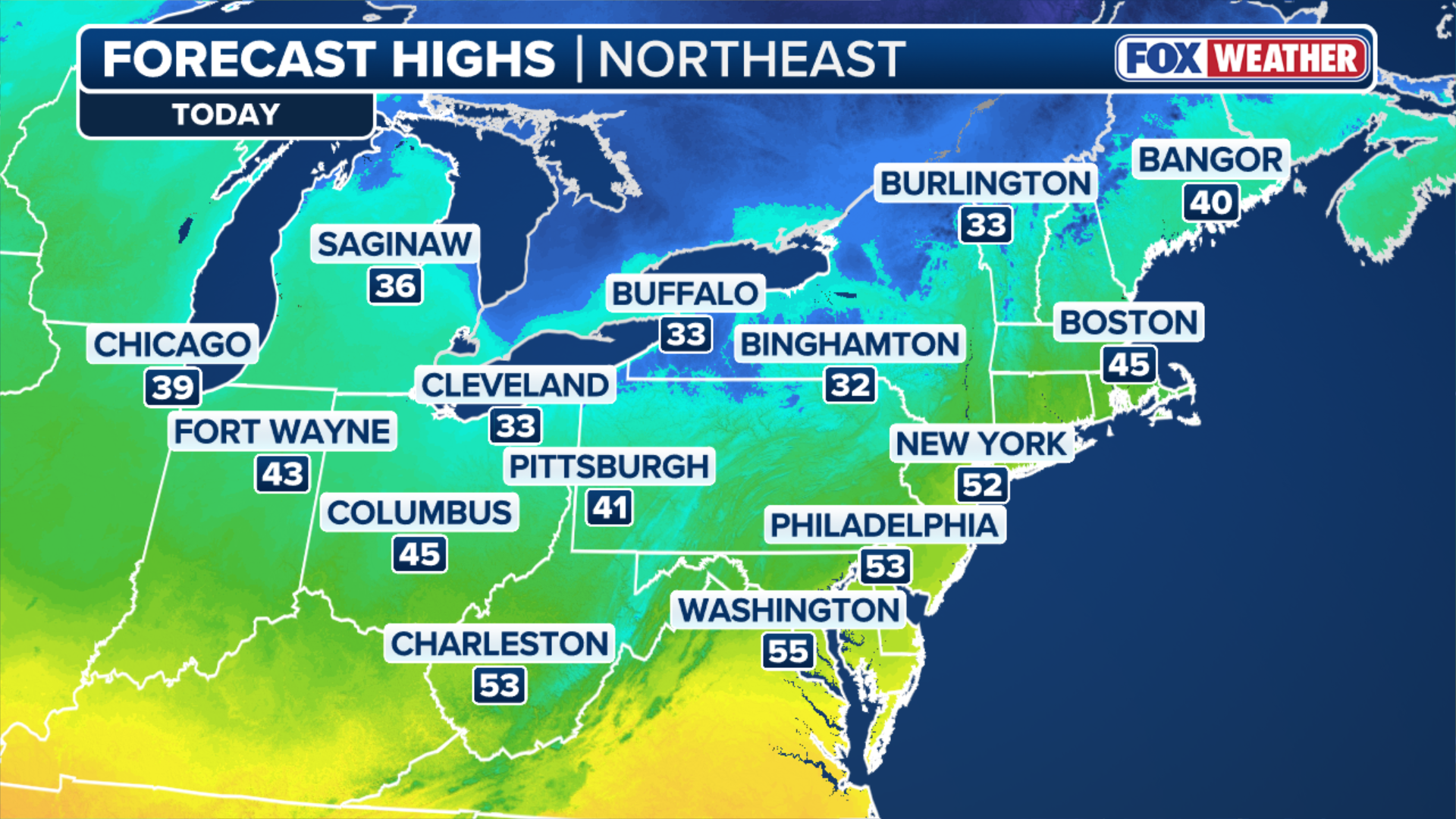
(FOX Weather)
Some notable temperature drops include Pittsburg, Pennsylvania, where a high reached near 80 on Saturday, and is expected to fall to a Monday morning low of 32 degrees, according to the FOX Forecast Center. That's a near-50 degree drop.
WHAT IS CAUSING ALL THE RECENT FLOODING IN THE GREAT LAKES?
Washington, DC reached the mid-80s on Saturday before falling into the mid-40s to start the week.
Locations across interior New England and the Northeast could see below-freezing temperatures, which, while not entirely uncommon in mid-April, will still come as a shock after the recent record warmth.
By Monday afternoon, temps will peak only in the 40s and low 50s in most areas, which is more typical of early March than mid-April.
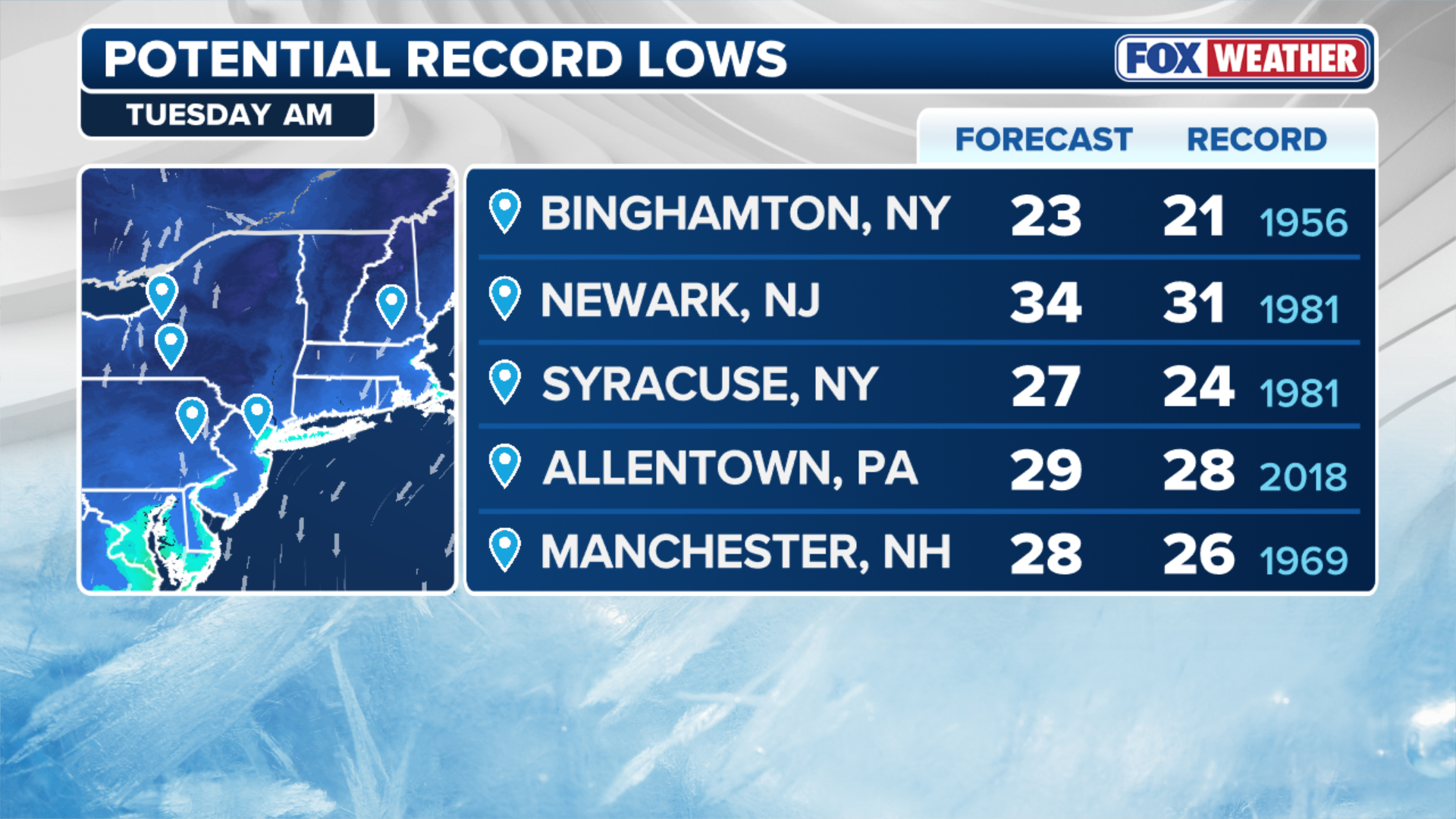
(FOX Weather)
Record low temperatures are possible across some locations in the Northeast on Tuesday morning, making it feel like winter has returned for some.
But will the cold last? The answer is yes for some, but the longer-range temperature outlook from the Climate Prediction Center suggests the Northeast will stay slightly cooler than average through the end of April.