Winter Storm knocks out power in Oregon, drops Seattle into deep freeze
Snow totals are expected to reach 6-8 inches around the Portland area, with some isolated areas getting up to about a foot of snow.
Winter storm slams into West Coast bring snow, ice to Pacific Northwest
Oregon is on alert as a winter storm threatens to bring snow and ice to Portland. FOX Weather Meteorologist Michael Estime outlines the forecast.
PORTLAND, Ore. – The season's first blast of arctic air has combined with a Pacific storm to bring a wintry mix of heavy snow, freezing rain, ferocious wind and dangerously cold wind chills to parts of the Pacific Northwest through the weekend, knocking out power to hundreds of thousands.
The bulk of the storm moved into northern and central Oregon on Saturday morning but slowed down, bringing prolonged snow to the Portland and Vancouver metro areas through the day combining with damaging winds of 40-55 mph blasting in from the Columbia River Gorge.
Portland's IMAX light rail system was suspended Saturday and through Sunday morning "due to impacts from the extreme weather," TriMet officials posted on X. "Power outages, trees down and dangerous conditions have impacted our ability to safely provide MAX service at this time."
![Downed trees on Barbur Boulevard in Naito, Oregon.]() Image 1 of 4
Image 1 of 4Downed trees on Barbur Boulevard in Naito, Oregon. (Image: ODOT) (Oregon Department of Transportation)
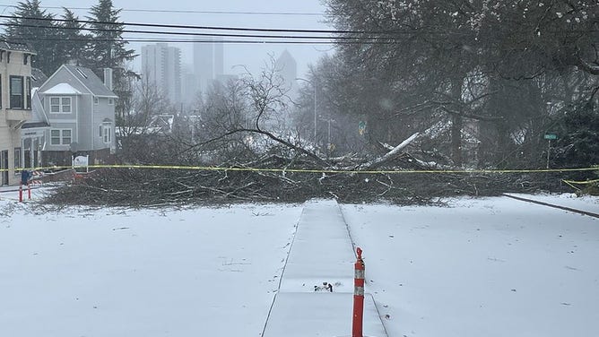
![Tree down in northern Oregon]() Image 2 of 4
Image 2 of 4A massive tree falls in Multnomah County, Oregon during a winter storm on Jan. 13, 2024. (Multnomah County Road Services)
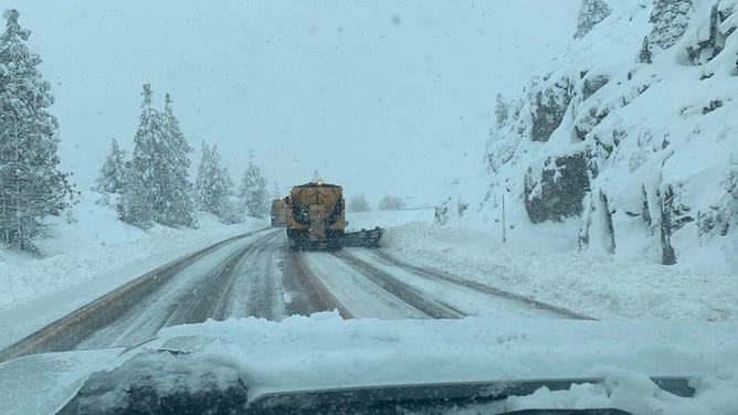
![ODOT plows on Interstate-5 near the California border.]() Image 3 of 4
Image 3 of 4ODOT plows on Interstate-5 near the California border. (image: ODOT) (Oregon Department of Transportation)
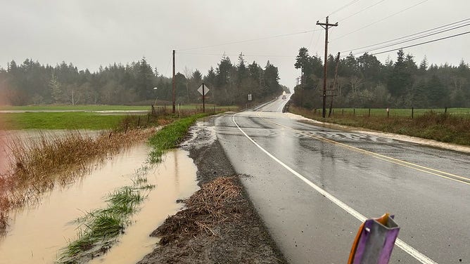
![]() Image 4 of 4
Image 4 of 4High water on U.S. 101 near Langloris, Oregon. (Oregon Department of Transportation)

Spotters reported a falling tree causing damage to a home and car in Lloyd Center iin Downtown Portland, while another tree fell into a car in eastern Portland area of Rockwood.
Snow totals are expected to reach 6-8 inches around the Portland area, with some isolated areas getting up to about a foot of snow.

(FOX Weather)
Just to the south, on the warmer side of the storm system, a layer of above-freezing air has brought a widespread freezing rain and ice storm to the northern Oregon coast, spreading inland to the southern Willamette Valley between roughly Eugene and Salem.
HOW MUCH ICE IS NEEDED TO KNOCK OUT POWER, DAMAGE TREES?
Freezing rain could lead to ice accretions of up between a quarter-inch to even 0.75 inches along the Oregon coast and southern Willamette Valley as winds gust to 30-35 mph.
"Today is NOT the day to be traveling," NWS Portland said Saturday afternoon as a myriad of snow, sleet and freezing rain fell across the region. "As a result of the ongoing winds, ice and snow we have had MANY reports of large downed trees across much of Northwest Oregon and southwest (Washington.)"

(FOX Weather)
A myriad of Winter Storm Warnings and Ice Storm Warnings cover all of northwestern Oregon, with a Blizzard Warning in effect for the Columbia Gorge as ferocious winds of 50-70 mph combine with 7-12 inches of snow.
Both the heavy snow and freezing rain will lead to treacherous travel and power outages as trees and power lines succumb to the weight of snow and ice. Nearly 250,000 customers have lost power in Oregon and southwestern Washington as of Saturday afternoon, according to PowerOutage.us.
By Sunday, outages dropped to 157,000 customers, with the majority of in Washington, Multnomah and Clackamas counties.
The National Weather Service in Portland, Oregon reported peak wind gusts up to 83 mph at Crown Point and 56 mph in southeast Portland.
Areas above mountain passes could see up to 4 feet of new snow while below the passes will max out at 2 feet, according to the NWS Portland.
Seattle area in the deep freeze
The Seattle metro area missed out on the snow but instead has seen some of its coldest temperatures in years.
"The big headline for us here in the Seattle Metro locations is going to be the Bitter cold," said FOX 13 Seattle Meteorologist Ilona McCauley. "We're going to be talking about wind chill advisories there with below zero feels like temperatures east of the Cascades as you get over to Spokane," she continued. "Even worse, we're talking about -25 degrees for wind chill value."
Temperatures dropped well into the teens on Saturday morning or lower, with lows of 7 degrees reported in Bellingham and Arlington in Washington. Seattle dropped to 15 degrees, which was its coldest low since 2010. With chilly arctic winds still funneling in from British Columbia and Eastern Washington, the wind chill dropped to 0 degrees overnight in Seattle.
WATCH: ‘BOMB CYCLONE' SENDS MASSIVE WAVES INSIDE WASHINGTON FERRY AMID TURBULENT SEAS
Wind Chill advisories are in place for eastern Washington through noon on Sunday.
By Sunday afternoon, wind chill temperatures are forecast to reach the low 20s for Seattle and hit 17 degrees in Blaine.
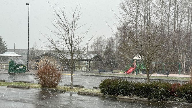
![Snow flies at a park in Everett, Washington, on Jan. 11, 2024.]() Image 1 of 5
Image 1 of 5Snow flies at a park in Everett, Washington, on Jan. 11, 2024. (Scott Sistek)
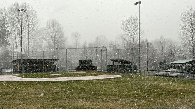
![Snow flies at a park in Everett, Washington, on Jan. 11, 2024.]() Image 2 of 5
Image 2 of 5Snow flies at a park in Everett, Washington, on Jan. 11, 2024. (Scott Sistek)
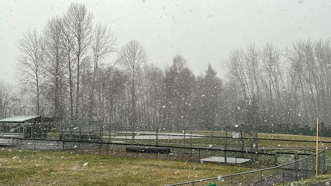
![Snow flies at a park in Everett, Washington, on Jan. 11, 2024.]() Image 3 of 5
Image 3 of 5Snow flies at a park in Everett, Washington, on Jan. 11, 2024. (Scott Sistek)
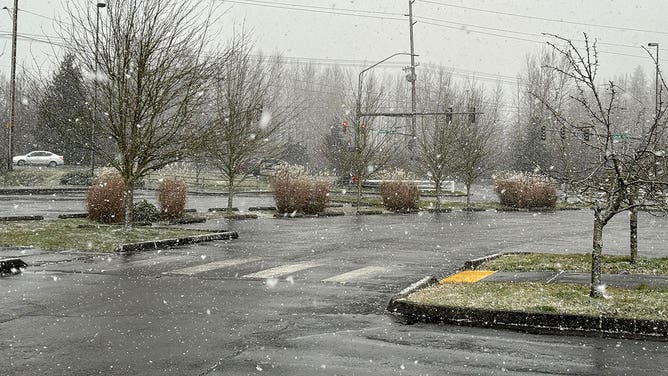
![Snow flies at a park in Everett, Washington, on Jan. 11, 2024.]() Image 4 of 5
Image 4 of 5Snow flies at a park in Everett, Washington, on Jan. 11, 2024. (Scott Sistek)
![Snow flies at a park in Everett, Washington, on Jan. 11, 2024.]() Image 5 of 5
Image 5 of 5Snow flies at a park in Everett, Washington, on Jan. 11, 2024. (Scott Sistek)

Strong winds are expected near and along gaps of the Cascades, where arctic high pressure will be pushing icy gusts toward the Interstate 5 corridor.
High Wind Warnings are in effect for the western spine of the Washington Cascades for easterly winds up to 65 mph Saturday. Along the Columbia Gorge, easterly winds could reach 70 mph with higher gusts, creating potential blizzard conditions during snowy periods.
In northwestern Washington, while it'll be dry, strong northeasterly winds roaring out of the Fraser River Valley will drop wind chills to -15 degrees around Bellingham.

(FOX Weather)
WHAT DOES THE WIND CHILL MEAN?
Wind chills drop to dangerous levels in Spokane and east of the Cascades
Meanwhile, east of the Cascades, temperatures will drop even further as the arctic air mass settles in.
Wind Chill Warnings cover parts of eastern Washington and Idaho, including the Spokane, Washington, area, as strong winds drop wind chills as low as -25 to -35 degrees through the weekend with snow totals of 2-5 inches.
Winter Storm Warnings cover eastern Oregon as well for periods of heavy snow and gusty winds up to 45-50 mph.