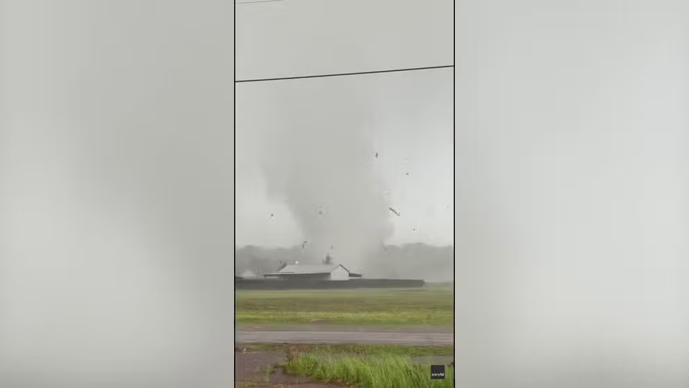
Tornado strikes near St. Augustine, Florida, as severe weather threat moves offshore
A Tornado Watch was issued North and Central Florida. A tornado touched down near St. Augustine, Florida, on Thursday as thunderstorms continued to track toward the East Coast after multiple days of relentless severe weather across the South.
Emergency officials assessing damage after severe storms strike Florida
An apparent tornado touched down near St. Augustine, Florida, on Thursday as thunderstorms continued to track toward the East Coast after multiple days of relentless severe weather across the South.
ST. AUGUSTINE, Fla. – An EF-1 tornado touched down near St. Augustine, Florida, on Thursday as thunderstorms continued to track off the coast after multiple days of relentless severe weather across the South.
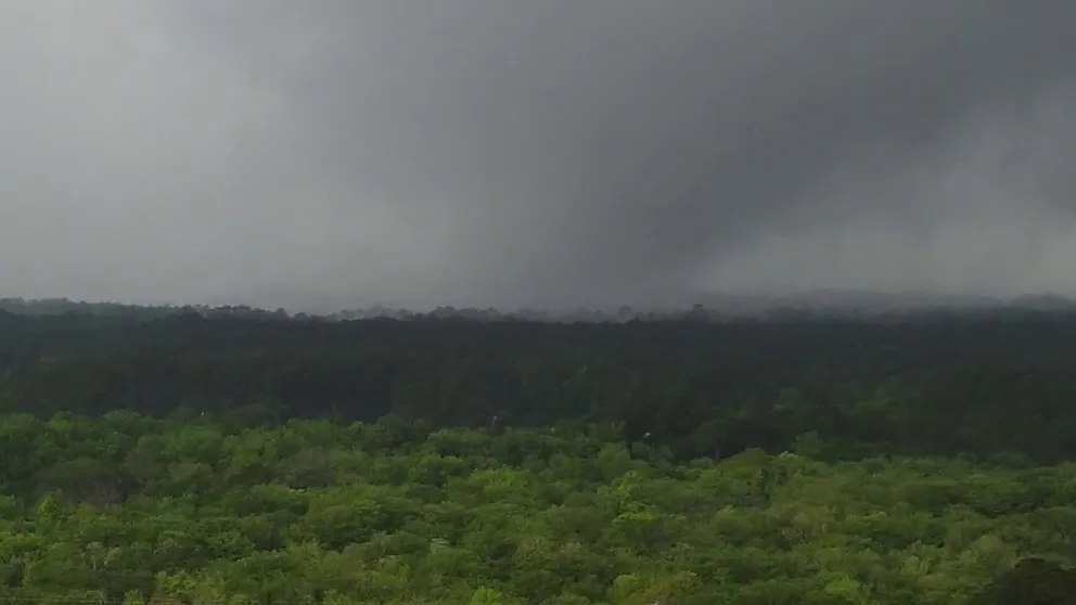
Watch: Video shows tornado near St. Augustine, Florida
A tornado caused exterior damage to buildings in northeast Florida on Thursday, officials said. The tornado hit the World Golf Village resort near St. Augustine.
Photos from St. Johns County Fire Department showed some roof damage to nearby homes, a mangled fence, and scattered toppled outdoor debris.
"Units on the scene are reporting no major structural damage," fire officials posted on Facebook. "Damage at this time appears to be all exterior."
![Tornado near St. Augustine, Florida]() Image 1 of 5
Image 1 of 5Reported tornado damage in St. John's County, Florida on April 10, 2024. (St. Johns County Fire & Rescue)
![Tornado near St. Augustine, Florida]() Image 2 of 5
Image 2 of 5Reported tornado damage in St. John's County, Florida on April 10, 2024. (St. Johns County Fire & Rescue)
![Tornado near St. Augustine, Florida]() Image 3 of 5
Image 3 of 5Reported tornado damage in St. John's County, Florida on April 10, 2024. (St. Johns County Fire & Rescue)
![Tornado near St. Augustine, Florida]() Image 4 of 5
Image 4 of 5Reported tornado damage in St. John's County, Florida on April 10, 2024. (St. Johns County Fire & Rescue)
![Tornado near St. Augustine, Florida]() Image 5 of 5
Image 5 of 5Reported tornado damage in St. John's County, Florida on April 10, 2024. (St. Johns County Fire & Rescue)


The St. Johns County Sheriff's Office said they found damage in the TrailMark area that stretched about 2 to 2.5 miles, though the tornado was later found to be on the ground for nearly 7 miles.
"A lot of damage as far as windows, fences, roofs, shingles – things like that," St. Johns County Sheriff Robert A. Hardwick said during a press conference Thursday afternoon.
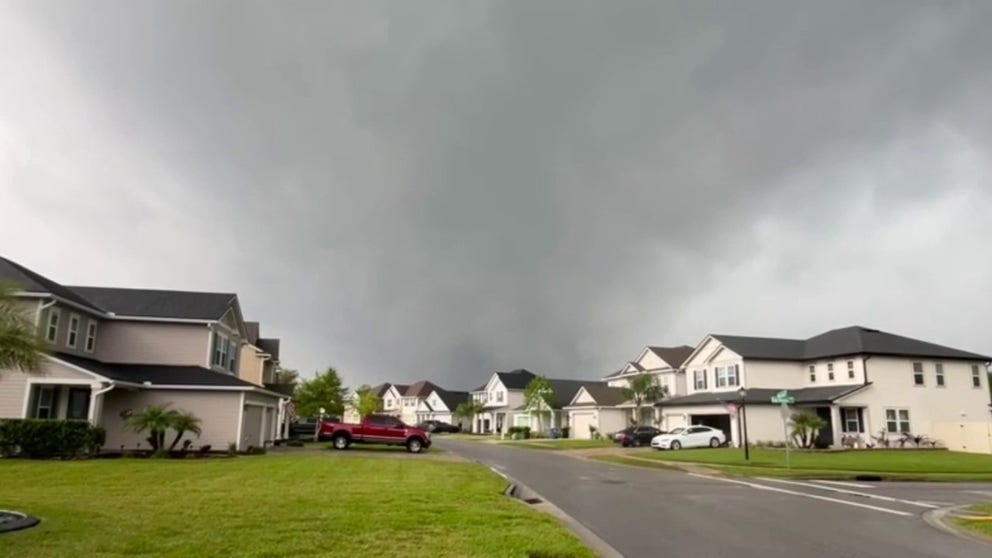
Caught on video: Tornado-producing supercell outside of nation's oldest city
A homeowner in St. Johns County, Florida, captured video of tornado-producing supercell outside of St. Augustine on Thursday.
County officials said they did not find any injuries upon arriving on the scene but later heard one person was taken to a local hospital on their own.
The National Weather Service had issued a "Particularly Dangerous Situation" Tornado Warning and noted the likely tornado was located over World Golf Village at 11:48 a.m. EDT Thursday. The "Particularly Dangerous Situation" wording from the NWS is issued for rare situations when intense tornadoes are likely already causing damage.
A storm survey team later estimated the damage consistent with 100 mph winds, giving the tornado an EF-1 rating on the Enhanced Fujita Scale.
More flooding woes in the Southeast
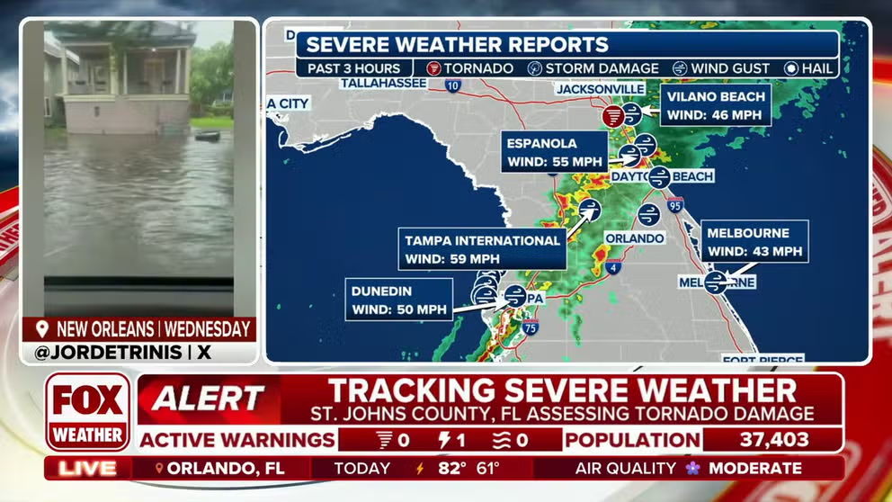
This comes following Thursday morning's heavy rain in the Southeast that prompted Flash Flood Warnings as roads flooded from Florida to South Carolina.
Authorities in Charleston, South Carolina, warned drivers to exercise caution as more than 50 local roads were shut down due to the increasing water levels. A Flash Flood Warning was issued in the area until noon EDT.
Car drives through floodwater in Charleston, South Carolina
A car was spotted driving through several inches of floodwater in Charleston, South Carolina, on Thursday morning.
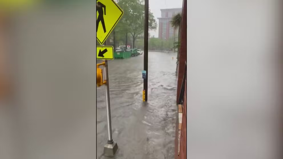
Flash flooding also swept across parts of Tallahassee, Florida, before sunrise as thunderstorms hit the Panhandle and Big Bend region. There were multiple reports of localized street flooding, scattered power outages and inoperable traffic signals.
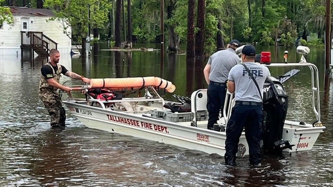
Flooding in Tallahassee, Florida on April 11, 2024.
(Tallahassee Fire Dept. )
Several inches of rain fell overnight and into the pre-dawn hours, triggering a Flash Flood Emergency that lasted until 6:30 a.m. EDT.
Footage from Riley Winch below shows streets in Tallahassee flooded, as authorities warned people to avoid roadways if possible.
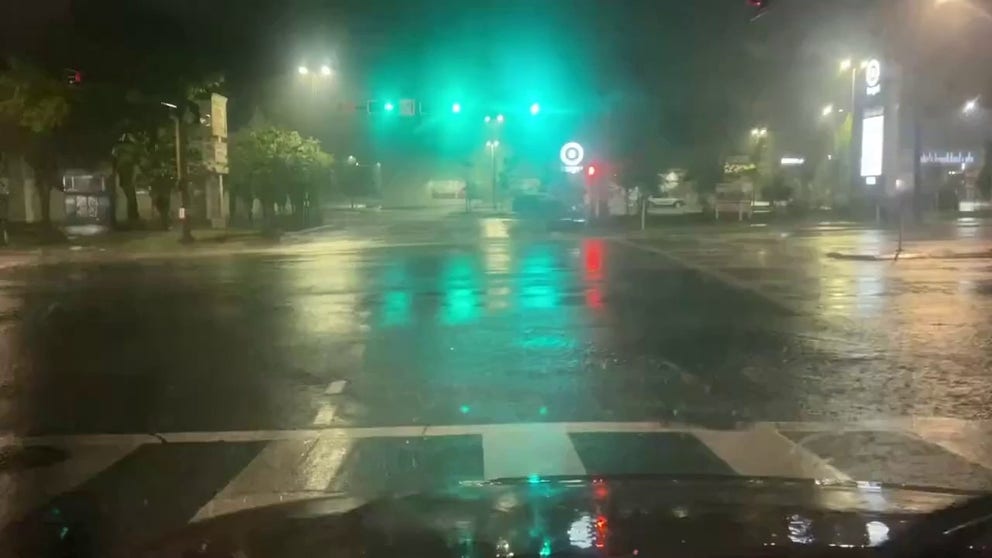
Flash flooding hits Tallahassee as thunderstorms batter Florida Panhandle
Flash flooding hit the city of Tallahassee in the early hours of Thursday, as thunderstorms hit the Florida Panhandle.
Due to the severe weather, a few schools and colleges in Florida either closed or delayed their operations.
The first major golf tournament of the year is expected to get off to a stormy start in Georgia. Due to the expected rainfall, the Masters has delayed gate openings on Thursday to give staff time to ensure parking lots are suitable for vehicles on the wet grounds.
Thursday's impacts in the Southeast follow a pair of Flash Flood Emergencies issued Wednesday in the New Orleans metro area and parts of East Texas when thunderstorms dropped as much as a foot of rain in some areas along the Gulf Coast.
A Flash Flood Emergency is the most severe flood alert the NWS can issue. It means life-threatening flooding and catastrophic damage are already occurring or expected to occur soon.
"If a Flash Flood Emergency is called for your town, that’s the worst of the worst when it comes to flash flooding," FOX Weather Meteorologist Britta Merwin said. "It’s a very rare warning that is only given when there is a significant risk to loss of property and loss of life."
The stormy weather is courtesy of the same system that produced dozens of reports of damage and significant flooding along the Gulf Coast on Wednesday. National Weather Service meteorologists said a tornado that struck Lake Charles, Louisiana, was an EF-2, and a Flash Flood Emergency was issued for the New Orleans metro.
A tornado also touched down in Chunchula, Alabama, damaging a home. The NWS confirmed that the tornado had a relatively short-lived EF-1 impact and max winds of around 100 mph.
Watch: Debris flies as tornado swirls close to homes in Chunchula, AL
Footage captured by Darian Fazlic from Chunchula Georgetown Road shows debris flying as the tornado swirls across a field.