On this day in 1870: The National Weather Service is founded
The NWS that issues Severe Thunderstorm Warnings, surveys disasters like tornados and forecasts weather for the big events of our lives was founded 153 years ago. FOX Weather looks at its history from humble beginnings and its key accomplishments and innovations that made it the weather authority it is today.
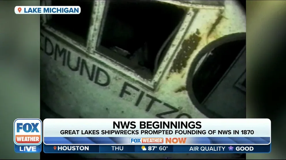
Great Lakes ship accidents was driver for NWS formation
FOX Weather's Winter Storm Specialist, Tom Niziol explains how deadly shipwrecks on the Great Lakes was the catalyst to forming the National Weather Service. He recalls some of the more preeminent accidents.
It is hard to imagine life today without modern weather forecasts and technology. We depend on the NWS for Thunderstorm Warnings in Missouri, Wind Chill advisories in Maine and atmospheric river forecasts in California.
Its tornado warnings keep Texans safe and snow forecasts allow cities to staff up plow drivers before a storm. That was not always the goal though or technically possible. FOX Weather explored the beginnings of the National Weather Service (NWS) and the innovations that shaped modern forecasting and public messaging.
Volunteer beginnings to ‘predict’ weather in 1865
What started out as a suggestion after the Civil War by Joseph Henry, Director of the Smithsonian Institute, grew into the NWS. Henry assembled about 600 volunteers and taught them to use instruments to measure temperature, wind, humidity, cloud cover and rain/snow.
At that time, observers were ‘predicting’ storms across telegraph lines in Great Britain. While in the Great Lakes, a scientist uses weather data collected three times a day to show that storms could be tracked from west to east.
GREAT LAKES CONDITIONS UNPREDICTABLE, COAST GUARD WARNS
Telegraph stations reported weather observations since the 1840s.
On February 9, 1870, President Ulysses S. Grant signed a bill into law requiring the Secretary of War to take weather observations at 44 military stations across the Great Lakes, Gulf and Atlantic Coasts and inland areas in the eastern half of the nation. The U.S. Signal Service oversaw the new organization that also distributed the information with the telegraph as an early form of forecasting.
First storm warning in 1870
The first "storm warning" on November 8, 1870, read, "High wind all day yesterday at Cheyenne and Omaha; a very high wind this morning at Omaha; barometer falling with high winds at Chicago and Milwaukee today; barometer falling and thermometer rising at Chicago, Detroit, Toledo, Cleveland, Buffalo and Rochester; high winds probable along the Lakes."
First weather map in 1871
The Signal Service published its first map on January 1, 1871, and gave it to newspapers. The map gave "deductions" not forecasts. Deductions then went on to be called "indications" as more data points were added.
HOW TO WATCH FOX WEATHER ON TV
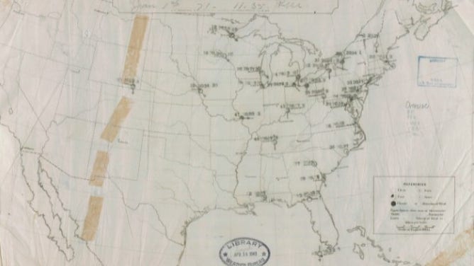
The first U.S. weather map produced on January 1, 1871.
A weather "predictor" devised four standard time zones across the U.S. to keep daily weather bulletins consistent. The railroads adopted it then the nation to what we now know as the national standard time zones.
In June 1871, Congress finally extended the Signal Service’s responsibility across all states. The service "predicted" weather for nine districts, 24 hours in advance. Ship weather reports were not included until 1873.
The first Hurricane Warning came in 1873.
The word ‘tornado’ was banned in 1884
The first severe storms forecaster makes "indications" of the possibility of "violent local storms" in 1884. The Signal Service chief banned the word "tornado" fearing mass panic of the public. The ban held until 1950.
The Department of Agriculture took over weather operations citing the importance of weather in 1891 and called the organization the Weather Bureau. Failure of the Service to issue a "Cold Wave Warning" for two deadly blizzards in 1888 prompted the transfer of responsibility.
In 1895 the Weather Bureau starts taking upper air measurements with kites. Balloons took the place of kites in 1909.
HOW A SUSPECTED CHINESE SPY BALLOON IS DIFFERENT THAN AMERICA'S CLASSIC WEATHER BALLOON
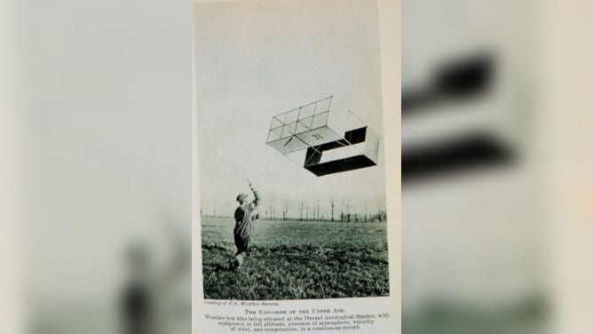
The Weather Bureau collected upper air data with weather kites. This one was launched in Drexel, Nebraska around 1915.
(NOAA Photo Library)
Hurricane Warning Network was established across the West Indies in 1898. It later grew into the National Hurricane Center in 1955.
In 1900, a Weather Bureau employee who experimented with radio, then called voice transmission over wireless telegraphy. Hew left the Bureau and laid the groundwork for AM radio.
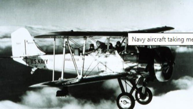
The Wright brothers consulted with the Weather Bureau on the best place for the first flight on December 17, 1903.
The first aviation forecasts were issued in 1926
The Weather Bureau started aviation forecasts for the military and air mail in 1918 and expanded to civilian forecasts in 1926.
HOW TO SET UP EVENTS IN YOUR PLAN TAB ON THE FOX WEATHER APP
AIRLINE HARNESSES ‘NEXT GENERATION OF FORECASTING’ TO CUT DOWN ON WEATHER DELAYS AND CANCELATIONS
In 1928 the teletype replaced the telegraph for distributing weather data.
The Department of Commerce takes over the Weather Bureau in 1940, primarily due to its role in aviation.
Weather data was banned in 1941
Weather forecasts and observations are censored after the attack on Pearl Harbor in 1941. The censorship continued through World War II.
PEARL HARBOR ATTACK LED TO US WEATHER DATA BAN
The Weather Bureau starts using weather radar in 1946. A radar network finally comes online in the 1950s.
The first Tornado Warning is issued on March 25, 1948, in Oklahoma.
The government established the Pacific Tsunami Warning Center after a tsunami swamped Hilo, Hawaii, in 1946.
Weather radio broadcasts its first warnings in 1965
The "ESSA (Environmental Science Services Administration) Weather Radio Network" broadcasts weather warnings after the 1965 Palm Sunday tornado outbreak. It is later named "NOAA Weather Radio" in 1970.
The first U.S. meteorological satellite was launched and deployed in April 1960. The unit only lasted for 78 days but proves useful.
WEATHER SATELLITES EXPLAINED: HOW NASA, NOAA MAKE FORECASTING POSSIBLE
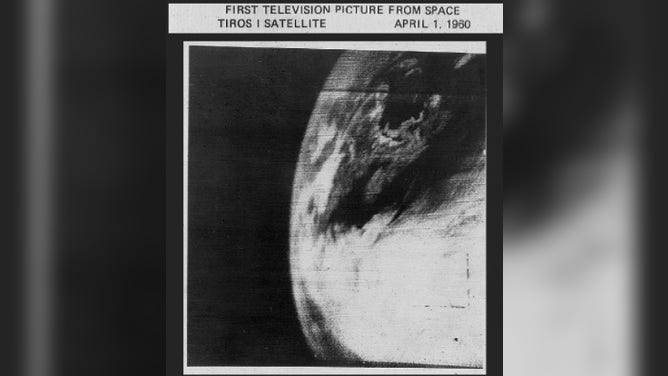
This is the first weather satellite image taken by TIROS-1.
The Weather Bureau is renamed The National Weather Service on October 1, 1970.
In 1982, the NWS issued the first Tornado Warning based on Doppler radar.
HOW TO USE THE 3D RADAR ON THE FOX WEATHER APP
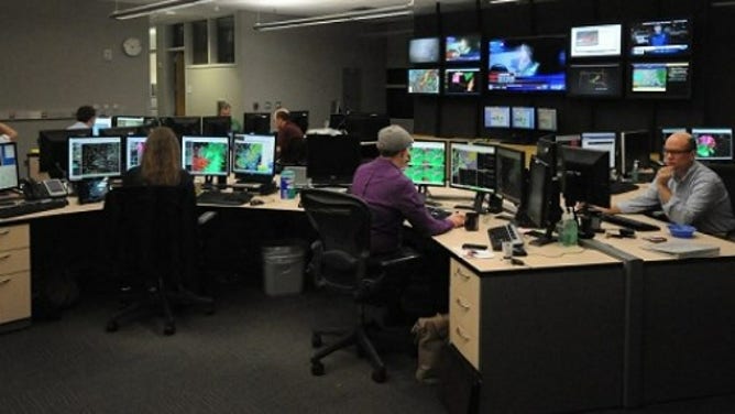
The National Weather Service forecast office in Norman, Oklahoma.
Happy birthday, NWS, and here's to many more!