Pearl Harbor attack led to multi-year ban on public weather data as US entered World War II
After the Dec. 7, 1941 attack on Pearl Harbor, the U.S. government heavily restricted the dissemination of public weather information. "The thought was the enemy would look for weather windows of opportunity to mount attacks."
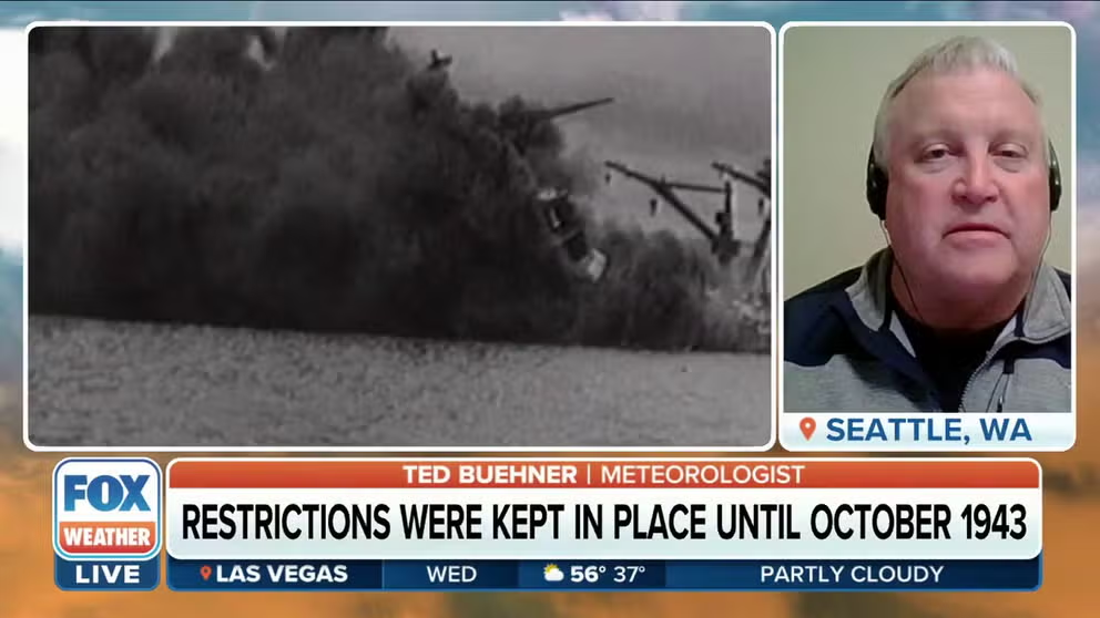
Meteorologist on US weather data ban after Pearl Harbor: There was fear enemy was among us
Meteorologist Ted Buehner says public weather information became restricted following Pearl Harbor in the belief data could be used by enemy spies to coordinate attacks on the West Coast.
These days, all the weather information you could ever want to process is available at the click of a button or flip of a channel.
But imagine a ban on any public weather information beyond 26 hours, and even then, only being told a range of possible temperatures, heavy rainfall and important warnings?
It happened 82 years ago, in the days after the Dec. 7, 1941, attack on Pearl Harbor and the Americans' entry into World War II.
That was long before satellite and radar technology would allow instant snapshots of global weather, and computer forecast models could simulate what comes next. Instead, learning about the weather relied on receiving current conditions from observers on the ground and an infant program of 35 stations launching weather balloons for measuring upper-air data.
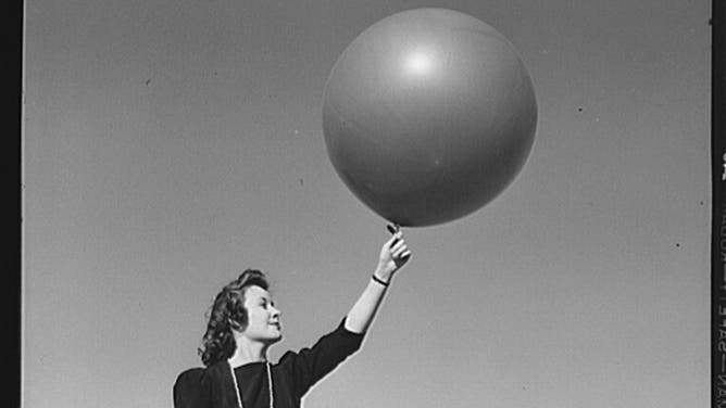
Washington, D.C. The U.S. Weather Bureau station at the National Airport. Pilot balloon being released to determine wind direction and velocity aloft.
(U.S. Library of Congress)
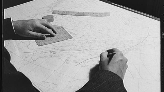
That information was then painstakingly plotted by hand to paint the current picture of the atmosphere.
Meteorologists used what was known about how fronts and weather systems formed to extrapolate the movement of weather, according to retired National Weather Service meteorologist Ted Buehner.
ACCURATE FORECASTS WOULD BE ALMOST IMPOSSIBLE WITHOUT WEATHER BALLOONS
"So, tools like the surface analyses and (weather balloon data) were key elements used in the forecast process," he told FOX Weather. "Analyses would provide trends in movement and intensity."
![]() Image 1 of 6
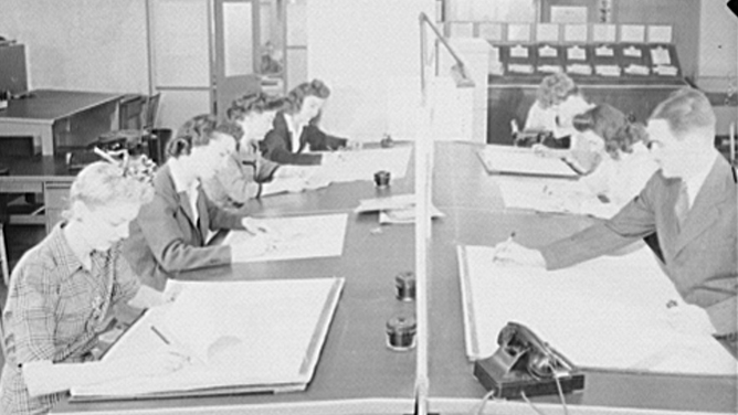
Image 1 of 6Washington, D.C. Preparing an advisory forecast at the U.S. Weather Bureau. Preparing an auxiliary weather map which reveals upper atmospheric conditions. (U.S. Library of Congress)
![]() Image 2 of 6
Image 2 of 6Washington, D.C. Preparing an advisory forecast at the U.S. Weather Bureau. Joe F. Fulks supervising the preparation of weather analyses. (Library of CongressU.S. Library of Congress)
![]() Image 3 of 6
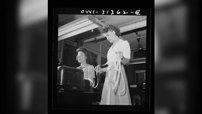
Image 3 of 6Washington, D.C. Preparing an advisory forecast at the U.S. Weather Bureau. Weather forecasts data are put on coding tape to transmission to various centers for dissemination and use in war activities. (U.S. Library of Congress)
![]() Image 4 of 6
Image 4 of 6Washington, D.C. The U.S. Weather Bureau station at the National Airport. Weather observations being analyzed by a district forecaster preparatory to issuing a weather forecast. (U.S. Library of Congress)
![]() Image 5 of 6
Image 5 of 6Washington, D.C. The U.S. Weather Bureau station at the National Airport. Pilot balloon being released to determine wind direction and velocity aloft. (U.S. Library of Congress)
![]() Image 6 of 6
Image 6 of 6Washington, D.C. The U.S. Weather Bureau station at the National Airport. Weather observation data from all sections of the country being placed on charts and maps preparatory to the issuing of of forecasts. (U.S. Library of Congress)


US fears weather data could fall into the wrong hands
But in the days after the Pearl Harbor attack, the U.S. Weather Bureau -- the predecessor to the modern-day National Weather Service -- announced it would immediately cease publication of nearly all weather observations and forecast data, lest it falls into the hands of our enemy.
In the first days after the attack, the publication of weather data west of the Cascades and Sierra Mountains along the West Coast was restricted by the U.S. Army, according to the published weather reports in the Seattle Daily Times. Then offshore weather reports and forecasts were curtailed on Dec. 13.
By a week following the attack, restrictions on public weather information would expand to cover the nation.
HOW TO WATCH FOX WEATHER ON TV
"Daily bulletins containing limited temperature and precipitation data will be issued on the specific authority of the chief of the Weather Bureau, F.W. Reichelderfer," according to an article published in the New York Times on Dec. 16, 1941. "They will contain no information of wind directions, positions of storm centers, air-mass fronts or 'other facts of actual or potential value to enemy interests.' "
The U.S. Weather Bureau station at the National Airport. Weather observation data from all sections of the country being placed on charts and maps preparatory to the issuing of forecasts.
(U.S. Library of Congress)
Any weather information broadcast on the radio would be limited to severe weather bulletins. The Weather Bureau's five-day forecasts would be discontinued, replaced with a 26-hour forecast primarily limited to temperature and precipitation expected, the article said.
Exceptions to the 26-hour and data limit rule would be made if severe weather threatened a town or region. Still, any storm warnings would be given "without reference to cloud formation, wind conditions or barometric pressure."
DEPARTMENT OF DEFENSE: WEATHER AWARENESS LEADS TO OPERATIONAL ADVANTAGES ON BATTLEFIELD
Such atmospheric details, if given over a wide area, would allow trained meteorologists to clue into locations of high and low pressure storm centers, which could give an advantage for any enemy military operation.
"There were thoughts that there were spies already in place that would share that data with the enemy," Buehner said. "The thought was the enemy would look for weather windows of opportunity to mount attacks."
‘Meteorologically, we are living in the year 1800.’
Newspapers used to publish a daily weather map and give current highs, lows, rainfall, barometer readings and current weather.
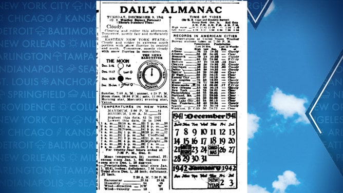
An inside page of the New York Daily News, Dec. 9, 1941. Detailed weather information such as wind direction and barometric pressure seen here would soon disappear from newspapers across the nation.
(Getty Images)
But after Dec. 16, the only information published was basic temperature data.
"We can no longer publish ranges of temperature and pressure over widely scattered communities, nor can we even hint whether or not it is raining in Chicago, Albany or New York," New York Times editors printed on Dec. 17, 1941, in the wake of the announced restrictions. "Meteorologically, we are living in the year 1800."
National weather charts would still be printed at the U.S. Weather Bureau but no longer published in newspapers, public squares, or railway stations. Instead, they would be mailed a week late to a restricted list "only when it is no longer useful for current forecasting purposes, " mainly for record-keeping or instruction. Each map contained a note at the bottom declaring it was being mailed one week late.
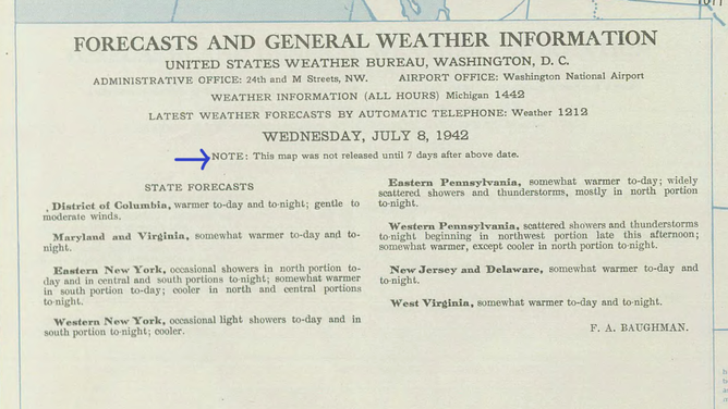
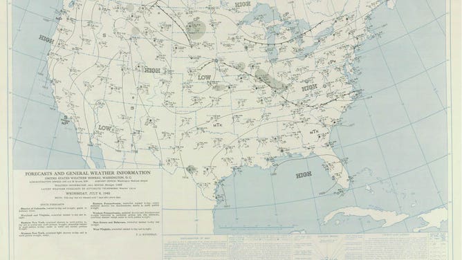
Screen capture of National Weather Map published by the National Weather Bureau on July 8, 1942.
(NOAA / National Weather Service)
Business forecasts curtailed too…
But it wasn't just the newspaper weather maps that changed. Coastal forecasts for boaters would only be given locally by red pennants or square flags flown at the shore denoting small craft advisories, gale warnings, or storm and hurricane warnings (the same system still used today). Still, neither direction of wind nor storm movement was given.
Storm-warning lights were also discontinued at night not to give away weather forecast information over large distances.
Agricultural forecasts were limited to temperature extremes and wind velocities; river and flood bulletins eliminated all references to rainfall less than 0.10 inches; weekend forecasts for ski resorts were halted and replaced with only current snow and ice conditions, the New York Times reported.
Fire weather information was confined to the local forest agencies.
Can't find the weather report? Do it yourself!
At least one forward-thinking business in Seattle realized weather information might be restricted in short order and bought an advertisement in the Seattle Daily Times three days after the attack touting weather instruments as "useful, valuable gifts" for the holiday season.
"Under war conditions, Government weather reports can not be given out while there is a danger of an air attack," the advertisement by Lowman & Hanford Company read. "Therefore, everyone must figure out his own weather."
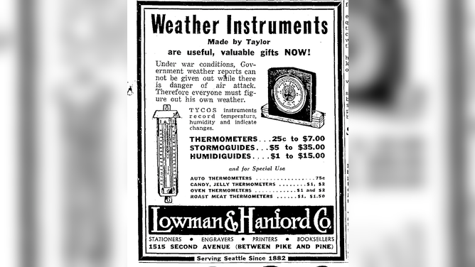
An advertisement published in the Seattle Daily Times on Dec. 10, 1941, by Lowman and Hanford Co. advertised weather instruments for figuring out your own weather during war conditions.
(Seattle Daily Times, 1941)
Confidential forecasts still issued as needed
But not everyone had to fend for themselves. For those whose weather data was critical to operations, such as city managers, transportation agencies, utilities, and heating companies, the Weather Bureau provided confidential expanded forecasts with various safeguards to keep the information from becoming public.
SALUTE YOUR SOCKS: WHY PROTECTING SOLDIER'S FEET FROM ALL ELEMENTS IS KEY
"All our facilities are now geared to serve the war program to the fullest possible extent," Reichelderfer told the New York Times, "and we are doubling that advantage to our own forces by withholding it completely from our enemy."
Screen capture of National Weather Map published by the National Weather Bureau on July 8, 1942.
(NOAA / National Weather Service)
Reichelderfer promised the bureau would reduce public inconveniences to a minimum and resume regular service "as soon as that can be done without detriment to the national defense."
It was a long wait…
That wait would be nearly two years. The weather information restrictions were in place until Oct. 31, 1943, when most were lifted, save for reporting wind direction and barometric pressure.
Officials determined that with the approaching winter, the weather data was crucial to boating navigation, aircraft operations and farmers that "under present conditions, the possible value of the information to the enemy is so slight as to justify the relaxation of the restrictions."
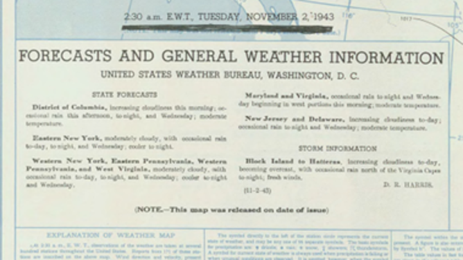
Screen capture of National Weather Map published by the National Weather Bureau on Nov. 2, 1943.
(NOAA / National Weather Service)
The bureau's weather map issued on Nov. 1, 1943, had scratched out the note that it was published seven days late, and the map on Nov. 2 had a new notation: "NOTE..- This map was released on date of issue."
Weather data had come back to the public eye.