Weather satellites explained: How NASA, NOAA make forecasting possible
Weather satellites are essential tools for meteorologists in accurate weather forecasting, providing high-quality, timely information about conditions around the globe. Satellites from the polar-orbiting JPSS and geostationary GOES series are some of the most important in predicting and preparing for severe weather events.
How satellites make forecasting the weather possible
Satellites are essential tools for meteorologists in accurate weather forecasting, providing high-quality, timely information about conditions around the globe.
For decades, NASA has been launching satellites into space with the goal of expanding our understanding of the Earth, the solar system and the universe beyond.
But what exactly are these orbiting spacecraft, and what do they do?
NASA’s satellites come in many different shapes and sizes, and are designed for a variety of purposes.
Some, like the Hubble Space Telescope, were built to observe distant galaxies and help us better understand the universe.
Our largest artificial satellite, the International Space Station, is an orbiting laboratory used for human spaceflight research and exploration.
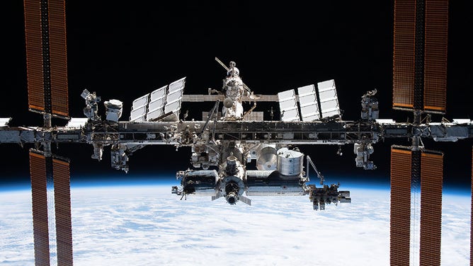
The International Space Station as seen from the SpaceX Crew Dragon Endeavour during its departure on Nov. 8, 2021.
(NASA)
However, NASA's satellites do more than just look outwards towards the cosmos.
They also help us to better see and understand our own planet, from forecasting the weather to monitoring Earth's changing climate.
Their fleet of observation satellites is constantly circling the globe, capturing photos and data that provide us with a wealth of knowledge on how the Earth's systems are changing and interconnected.
Forecasting the future
We live on an incredibly complex and ever-changing planet, making predicting the weather no easy task.
Satellites are essential tools for meteorologists in accurate weather forecasting, providing high-quality, timely information about conditions around the globe.
NASA has numerous weather satellites in operation, many of which are operated in partnership with the National Oceanic and Atmospheric Administration (NOAA).
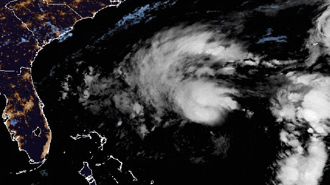
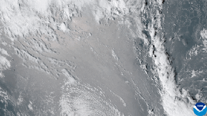
A satellite loop of Subtropical Storm Nicole on Tuesday, November 8, 2022 as seen from GOES East.
(NOAA / FOX Weather)
Each satellite in the fleet has its job in monitoring the various aspects of our atmosphere and oceans, from temperature and precipitation to cloud cover and ocean currents.
These millions of bits of satellite data infuse numerous aspects of your everyday life, including local weather forecasts, severe weather warnings, predictions about the global food supply, decisions about commercial flight paths and more.
Two main types of satellites are used for forecasting the weather: polar-orbiting and geostationary.
From pole to pole
Polar-orbiting satellites circle the Earth from pole to pole as it rotates beneath them, capturing a complete view of the globe twice a day from an altitude of 540 miles.
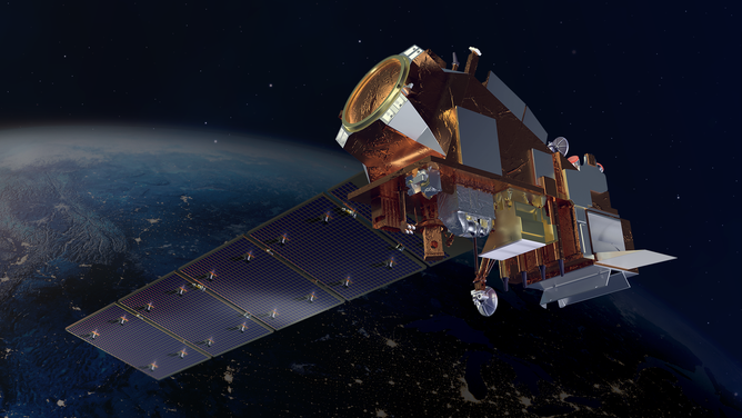
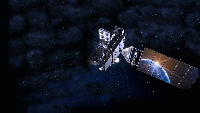
An artist’s rendition of the JPSS-2 polar-orbiting satellite in space.
(NOAA)
With as much as 85% of your local weather forecast data coming from polar-orbiting satellites, their global observations are critical to both short-term and long-term forecasting.
They also play a vital role in helping us to predict and prepare for severe weather events like hurricanes and blizzards.
Satellites in NOAA’s Joint Polar Satellite System (JPSS) are the backbone of this global observation system.
The JPSS constellation of satellites is responsible for gathering global measurements of atmospheric, terrestrial and oceanic conditions, including sea and land surface temperatures, vegetation, clouds, rainfall, snow and ice cover, fire locations and smoke plumes, atmospheric temperature, water vapor and ozone.

Overview of NOAA's Joint Polar Satellite System (JPSS)
NOAA’s Joint Polar Satellite System-2 (JPSS-2) mission will lift off from the Vandenberg Space Force Base in California on a United Launch Alliance (ULA) Atlas V rocket. Here's what it plans to do. (Video courtesy of NASA)
Staying stationary
While polar-orbiting satellites provide global coverage, the other primary type of weather satellite focuses on a specific region.
Geostationary satellites circle the globe at the same speed as the Earth’s rotation, allowing them to constantly monitor the same area of the Earth’s surface.
Orbiting about 23,000 miles above the equator, they appear stationary in the sky when viewed from the Earth’s surface.
Artist's rendering of NOAA's GOES-T, which will provide coverage of the western U.S., Alaska, Hawaii, the eastern and central Pacific Ocean to New Zealand. (NOAA)
(NOAA)
The Geostationary Operational Environmental Satellite (GOES) series is the nation’s most advanced fleet of geostationary weather satellites.
First launched in 1975, the data from GOES series has been used to create detailed images of weather systems and track the development and movement of storms.
NASA estimates the satellites have taken over 3 million images of Earth so far, providing stunning images of hurricanes and severe storms.
GeoColor imagery of the Hunga Tonga–Hunga Haʻapai eruption from NOAA’s GOES-17 satellite taken on January 15, 2022.
(NOAA)
NEWEST WEATHER SATELLITE BECOMES GOES-WEST
Sunny with a chance of meteor showers
While polar-orbiting and geostationary satellites are helping us forecast Earth’s weather, we are turning to deep space satellites when it comes to weather in space.
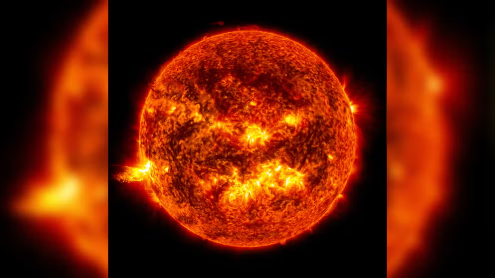
How scientists measure solar flares
NASA gives this short narrated video about solar flares, how they are classified, and their effect on Earth. (Video courtesy: NASA)
The Deep Space Climate Observatory, or DSCOVR, is NOAA’s first operational satellite in deep space, providing data that informs our space weather alerts and forecasts.
Located a million miles from Earth, it is also responsible for monitoring the amount of solar energy absorbed by Earth every day.