Newest weather satellite becomes GOES-West just in time to track bomb cyclone
NOAA's newest satellite, GOES-18, is now GOES-West, just in time for a bomb cyclone and Pineapple Express slamming into the West Coast.
NOAA satellite GOES-18 officially becomes GOES-West
NOAA's newest satellite in the GOES series entered service on Jan. 4, 2023 as GOES-West, beginning observations of the western U.S. and Pacific Ocean. (video: NOAA)
Weather forecasters have improved eyes in the sky as of Wednesday when NOAA's GOES-18 satellite officially took over monitoring the western U.S. and Pacific Ocean, becoming GOES-West.
GOES-18 is the third satellite in the upgraded series of spacecraft part of the NOAA and NASA's Geostationary Operational Environmental Satellites (GOES) program.
The GOES program began in 1975 when the first satellite, known as GOES-A launched from Cape Canaveral.
The most recent GOES satellite, GOES-18, launched in March 2022 and began sending back images in June. After about 10 months of commissioning, NOAA transitioned GOES-18 as the new operational GOES-West satellite on Wednesday.
IMPROVED SPACE WEATHER FORECASTS NEEDED TO AVOID DESTRUCTION OF SATELLITES
"In its new role, GOES-18 will serve as NOAA's primary geostationary satellite for detecting and monitoring Pacific hurricanes, atmospheric rivers, coastal fog, wildfires, volcanic eruptions, and other environmental phenomena that affect the western contiguous United States, Alaska, Hawaii, Mexico, and Central America," NOAA said in a news release.
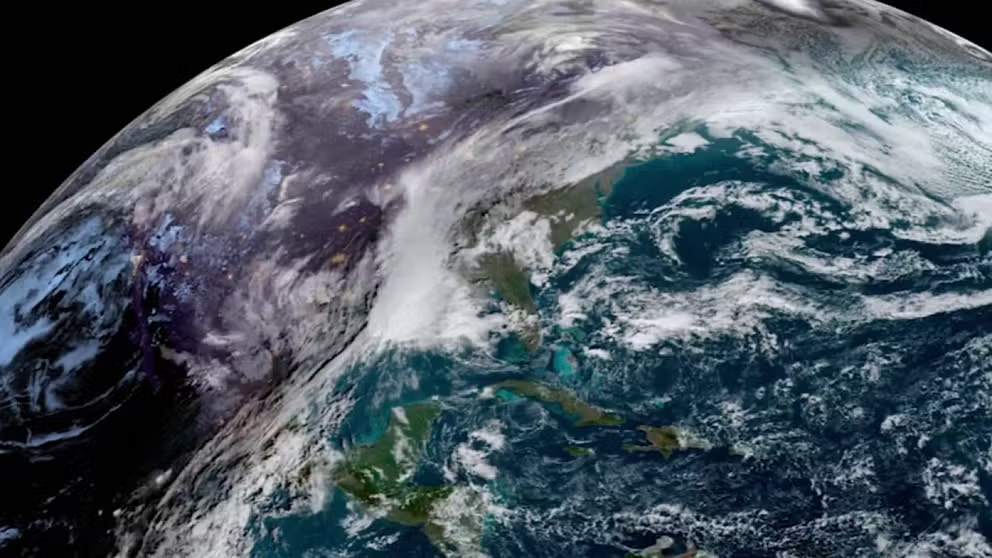
![A Jan. 4, 2023 view of the bomb cyclone storm moving over the West Coast as seen by NOAA's newest GOES West satellite.]() Image 1 of 5
Image 1 of 5A Jan. 4, 2023 view of the bomb cyclone storm moving over the West Coast as seen by NOAA's newest GOES West satellite. ( )
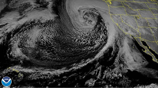
![]() Image 2 of 5
Image 2 of 5A bomb cyclone moves over the West Coast as seen by NOAA's GOES-18 satellite now known as GOES West. (Image: NOAA) ( )
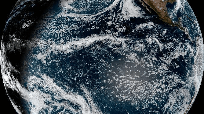
![]() Image 3 of 5
Image 3 of 5The NOAA GOES-18 satellite shows water vapor over the U.S. Pacific Coast on Jan. 4, 2023. (Image: NOAA) ( )
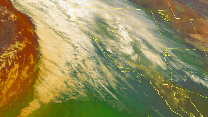
![NOAA satellite GOES West (GOES 18) observers the cooling cloud tops in RGB of the atmospheric river slamming into the West Coast on Jan. 4, 2023, the first day of the satellites new operational period.]() Image 4 of 5
Image 4 of 5NOAA satellite GOES West (GOES 18) observers the cooling cloud tops in RGB of the atmospheric river slamming into the West Coast on Jan. 4, 2023, the first day of the satellite's new operational period. (Image: NOAA) ( )
![A weather system known as an atmospheric river moves over the West Coast on Jan. 4, 2023 as seen by the GOES West satellite.]() Image 5 of 5
Image 5 of 5A weather system known as an atmospheric river moves over the West Coast on Jan. 4, 2023 as seen by the GOES West satellite. (Image: NOAA/RAMMB/CSU) ( )


Up until Wednesday, GOES-17 had been watching over the West Coast as GOES-West.
GOES-West orbits the Earth 22,236 miles above the equator over the Pacific Ocean using its suite of instruments to monitor the weather and climate on the West Coast. Another satellite, known as GOES-East, monitors weather on the East Coast and the Atlantic Ocean.
HELLO, SUN! PERIHELION 2023, EARTH'S CLOSEST APPROACH TO THE SUN HAPPENS WEDNESDAY
The older GOES-17 satellite will continue to orbit the Earth in a central "storage mode" mode between GOES-East and GOES-West, ready to serve as a backup for the constellation, according to NOAA.
The new GOES-West had a busy first day on the job as the double whammy of a bomb cyclone and Pineapple Express atmospheric river slammed into the Pacific Coast states.
The data and images from GOES-17 and GOES-18 have helped forecasters monitor the potentially life-threatening impact this west coast storm system could have.
The GOES-West instrument, known as the Advanced Baseline Imager, or ABI, was already imaging Earth every 10 minutes.
The ABI can photograph in 16 different colors or spectral bands to help show the different spectrum of features, including the atmosphere and water vapor.
Another satellite in the GOES series, GOES-U, is scheduled to launch in 2024.