JPSS-2 satellite launching Thursday will help forecast climate change, extreme weather
On Thursday, November 10, NOAA’s Joint Polar Satellite System-2 (JPSS-2) mission is expected to lift off from the Vandenberg Space Force Base in California on a United Launch Alliance (ULA) Atlas V rocket.

Overview of NOAA's Joint Polar Satellite System (JPSS)
NOAA’s Joint Polar Satellite System-2 (JPSS-2) mission will lift off from the Vandenberg Space Force Base in California on a United Launch Alliance (ULA) Atlas V rocket. Here's what it plans to do. (Video courtesy of NASA)
A new satellite made to help forecasters better predict extreme weather and monitor climate change will soon head to space.
At 1:25 a.m. on Thursday, November 10, NOAA will attempt to launch its Joint Polar Satellite System-2 (JPSS-2) from the Vandenberg Space Force Base in California on a United Launch Alliance (ULA) Atlas V rocket. The mission from Vandenberg will be the last for Atlas V as the pad will soon be modified to support the ULA's new Vulcan rocket.
JPSS-2 will be sent into a low-Earth orbit and will scan the globe from the North to the South Pole, crossing the equator 14 times a day.The satellite will capture data from 512 miles above Earth that inform weather forecasts, extreme weather events and climate change.
JPSS-2 is the third satellite in the Joint Polar Satellite System series and will be renamed NOAA-21 after reaching orbit.
![JPSS-2]() Image 1 of 9
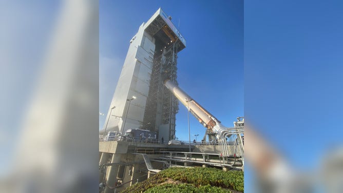
Image 1 of 9At Vandenberg Space Force Base in California, teams hoist the United Launch Alliance Atlas V rocket for the National Oceanic and Atmospheric Administration and NASA’s Joint Polar Satellite System-2 (JPSS-2) mission into a vertical position in preparation for a move into the Vertical Integration Facility (VIF) on Sept. 28, 2022. (USSF 30th Space Wing/Steve Gerlich)
![]() Image 2 of 9
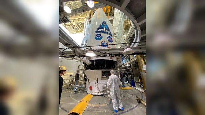
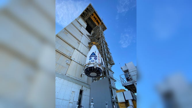
Image 2 of 9The JPSS-2 weather observatory for NOAA and NASA is mounted atop its ride to space, the United Launch Alliance (ULA) Atlas V rocket, in preparation for launch at Space Launch Complex-3 (SLC-3) at Vandenberg Space Force Base, California. Photo Credit: United Launch Alliance ( )
![]() Image 3 of 9
Image 3 of 9The JPSS-2 weather observatory for NOAA and NASA is mounted atop its ride to space, the United Launch Alliance (ULA) Atlas V rocket, in preparation for launch at Space Launch Complex-3 (SLC-3) at Vandenberg Space Force Base, California. Photo Credit: United Launch Alliance ( )
![]() Image 4 of 9
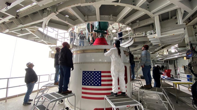
Image 4 of 9United Launch Alliance (ULA) hoists its Centaur upper stage atop the Atlas V rocket that will launch the JPSS-2 mission for NOAA and NASA. Photo credit: United Launch Alliance ( )
![]() Image 5 of 9
Image 5 of 9The JPSS-2 weather observatory for NOAA and NASA is mounted atop its ride to space, the United Launch Alliance (ULA) Atlas V rocket, in preparation for launch at Space Launch Complex-3 (SLC-3) at Vandenberg Space Force Base, California. Photo Credit: United Launch Alliance ( )
![]() Image 6 of 9
Image 6 of 9The JPSS-2 weather observatory for NOAA and NASA is mounted atop its ride to space, the United Launch Alliance (ULA) Atlas V rocket, in preparation for launch at Space Launch Complex-3 (SLC-3) at Vandenberg Space Force Base, California. Photo Credit: United Launch Alliance ( )
![]() Image 7 of 9
Image 7 of 9The JPSS-2 weather observatory for NOAA and NASA is mounted atop its ride to space, the United Launch Alliance (ULA) Atlas V rocket, in preparation for launch at Space Launch Complex-3 (SLC-3) at Vandenberg Space Force Base, California. Photo Credit: United Launch Alliance ( )
![]() Image 8 of 9
Image 8 of 9United Launch Alliance (ULA) hoists its Centaur upper stage atop the Atlas V rocket that will launch the JPSS-2 mission for NOAA and NASA. Photo credit: United Launch Alliance ( )
![]() Image 9 of 9
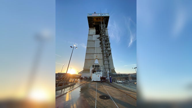
Image 9 of 9The United Launch Alliance (ULA) Atlas V first stage was raised vertically by the overhead MST crane and maneuvered it onto the Fixed Launch Platform (FLP) for the upcoming Atlas V JPSS-2 mission for NASA. Photo by United Launch Alliance ( )


Improving weather forecasts
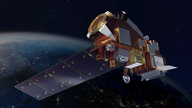
Artist’s rendition of the JPSS-2 satellite in space.
(Lamont W. Harvey)
JPSS-2 will continue the work of its predecessors, NOAA-20 (formerly JPSS-1) and the NOAA-NASA Suomi National Polar-orbiting Partnership (Suomi-NPP).
The JPSS-2 satellite will provide data for weather models used by meteorologists and weather apps. Measurements of temperatures, moisture and clouds will be taken to better improve forecasts.
The JPSS also collects information about particles in our air. These include smoke particles from wildfires, airborne dust during dust and sandstorms, urban and industrial pollution and ash from erupting volcanoes, NOAA said. The JPSS series of satellites can also measure ground-level ozone.
7 FACTS THAT EXPLAIN HOW AIR QUALITY IS MEASURED
Monitoring the effects of climate change
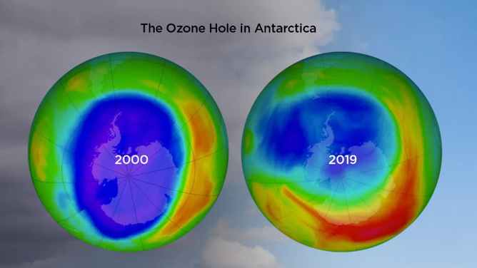
JPSS-2 will collect data on ozone concentrations that continues five decades of records.
(NASA/NOAA)
Once in orbit, the JPSS-2 satellite will help coastal resiliency as communities fight the impacts of the changing climate.
The satellite will take temperature measurements of Earth’s lower and upper atmospheres.
NASA says that by contributing to a long-term archive of these temperatures, they show how Earth’s atmosphere has changed over time.
In addition to temperatures, the satellite will also capture data on the ozone.
The measurements will help researchers and policymakers to create global climate models and monitor global ozone concentrations, scientists say.