Historic California drought, rare triple-dip La Nina triggered by Australian wildfires, study suggests
A study released Wednesday takes a look at the correlation between the worst wildfire in Australia's history during their summer in 2019/2020 and the rare, persistent La Nina event that brought drought to California and flooding to Washington.
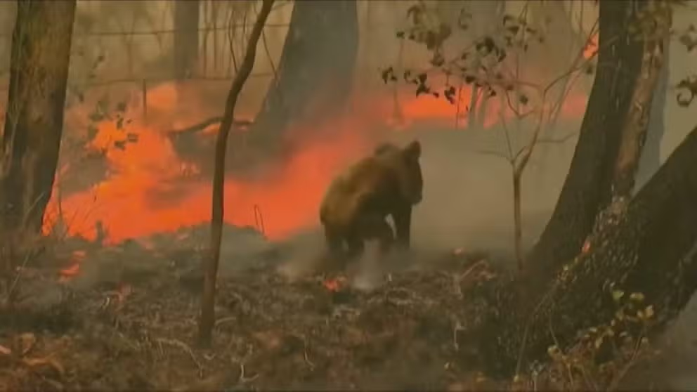
Historic wildfire blackens Australia in 2019/2020
FOX's Benjamin Hill gave a recap of the destruction that the worst wildfires in Australia's history wrought in 2019 and 2020. Over 46 million acres burned.
The massive wildfires across Australia during 2019 and 2020 were tragic on their own. But a new study published in the journal Science Advances suggests the fires could have triggered widespread areas of flood and drought worldwide for years after by triggering a rare, three-year strong La Niña event.
FOX News reporter Benjamin Hill called the summer of 2019/2020, "Australia’s black summer." He reported that 46 million acres, an area bigger than Washington state, burned.
EL NINO NEARLY SLAM DUNK TO IMPACT WORLD WEATHER LATER THIS YEAR
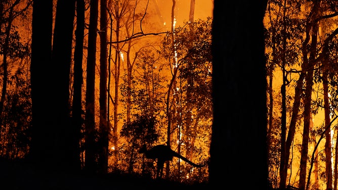
A kangaroo trying to escape the fire in November 2019.
(Brett Hemmings / Getty Images)
It killed 34 people and up to 3 billion animals, forcing some into extinction. Over 10,000 structures burned. And, the fire burned so hot, it melted the fire trucks battling the flames.
How smoke can change a planet's weather
The blazes released an untold amount of smoke and particles into the air. One computer model showed four times the amount of primary organic matter (particles) in the atmosphere, and prevailing winds spread it around the globe in just a month.
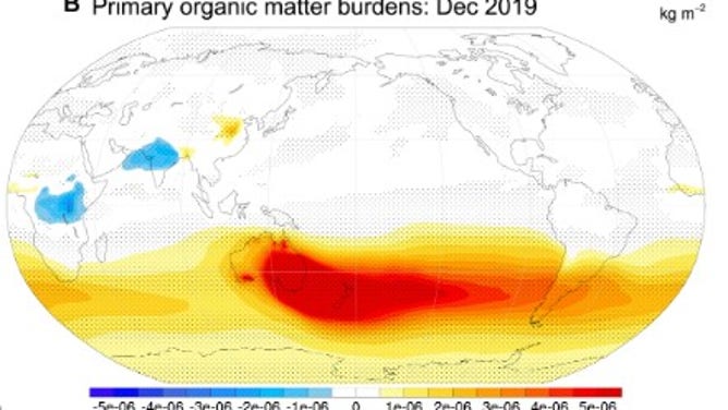
The red shows the massive volume of particulates from the wildfires suspended in the atmosphere.
(Fasullo et al. / FOX Weather)
The particles were a magnet for water vapor, creating clouds and blocking the sun’s rays.
"Clouds then became brighter and longer-lived, reflecting additional sunlight and cooling the ocean, particularly off the coast of South America where they are particularly able to influence La Niña," said John Fasullo, researcher with the National Center for Atmospheric Research and author of the study.
"The cooler ocean in that region then cooled the equatorial eastern Pacific Ocean via winds and currents, and the tropics were predisposed for a La Niña event," he continued.
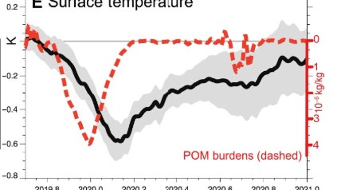
The bottom axis shows the year followed by the month. Take a look at the red which shows the amount of particulates in the atmosphere while the black shows sea surface temperatures. Temperatures drop right after the maximum readings for particulates.
(John Fasullo et al. / FOX Weather)
Persistent cooler eastern and central Pacific Ocean temperatures are what defines La Niña.
Fasullo and his fellow researchers ran simulations of the event using existing computer models and data from satellites and aircraft.
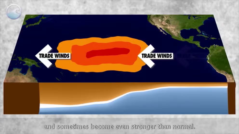
What is La Niña?
Easterly trade winds are usually strong, which create an upwelling of colder waters off of South America.
WHAT ARE EL NINO AND LA NINA CLIMATE PATTERNS?
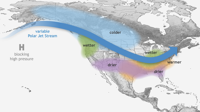
Typical La Niña Pattern
(NOAA's Climate.gov)
The northern jet is typically more amplified, meaning the southern tier of the country tends to be drier and warmer weather, and the northern half is usually colder and can see more precipitation than usual.
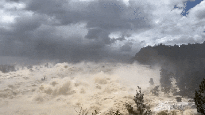
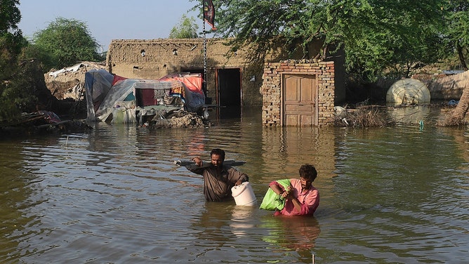
This was when California’s reservoirs dried up while Australia, Pakistan and the Pacific Northwest suffered through massive floods.
![Australia Dam Flooding]() Image 1 of 4
Image 1 of 4Water spills from Australia's Wyangala Dam (NSW RFS South West Slopes Zone via Storyful)
![Aerial photos show flooding in Sumas Prairie, British Columbia. (Image credit: City of Abbotsford)]() Image 2 of 4
Image 2 of 4Aerial photos show flooding in Sumas Prairie, British Columbia. (Image credit: City of Abbotsford) ( )
![Sumas, Washington flooding 11-15-2021]() Image 3 of 4
Image 3 of 4Flooded streets are seen in Sumas, Washington, on Nov. 15, 2021. (WSDOT)
![Flood affected people carry belongings out from their flooded home in Shikarpur, Sindh province, on August 31, 2022.]() Image 4 of 4
Image 4 of 4Flood affected people carry belongings out from their flooded home in Shikarpur, Sindh province, on August 31, 2022. (ASIF HASSAN/AFP)


Cooler waters and increased atmospheric winds tend to lead to a decrease in tropical activity in large parts of the Pacific, but the Atlantic usually is the opposite. Warm waters and less shear over the Atlantic basin during a La Niña event have caused some of the busiest hurricane seasons on record for the Gulf of Mexico, the Caribbean and the Atlantic.
"Unusual" La Niña event
The La Niña that started in 2020 was "poorly forecast" states the study, largely due to an absence of oceanic events that usually precede La Niña and a preceding major El Niño.
"The sequence of events … suggests that in some circumstances, important early influences on tropical Pacific SST (sea surface temperatures) can originate from the atmosphere and land surface rather than the equatorial ocean (where previous research suggested La Niña starts)," wrote the authors.
WORLDS OCEANS SET RECORD WARMTH PAVING WAY FOR ROBUST EL NINO
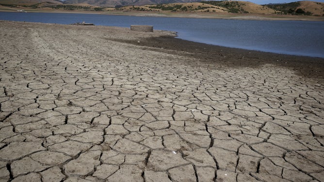
This cracked, dry reservoir bed in Northern California looks like most around the state in the third year of drought.
(Justin Sullivan/Getty Images / Getty Images)
And this La Niña stuck around for a very rare 3 years. Since 1950, NOAA has only recorded three other triple-dips; 1954-1956, 1973-1976 and 1998-2001.
Fasullo pointed to a similar La Niña event that also included Australia's fires.
"We suspect this has happened before," he said.
"(The triple-dip La Niña is) Quite rare and almost unheard of without a preceding El Niño," Fasullo continued. "We think there may be some similarities(of the 2020 to 2022) with the 1975-1976 La Niña, but even that was already underway when the fires in Australia occurred."
NOAA EMBARKS ON BUOY PROJECT THAT WILL ENHANCE EL NINO, LA NINA FORECASTS
The meaning of El Nino and La Nina
The status of whether the world is being impacted by an El Nino or a La Nina is determined by water temperatures in the central and eastern Pacific. (NOAA)
Fasullo only studied the first two years of this La Niña event and says despite the smokey atmosphere being short-lived, the impacts of fires can linger for years.
"The smoke was gone in a matter of months, but the reinforcing nature of a cooling eastern Pacific Ocean and the easterly winds there can stick around for much longer," Fasullo said. "We don’t address the third year of the La Niña event, but our results suggest that the chances of the first 2 years occurring due to the fires increased considerably, roughly doubled."
Can we forecast climate by looking at wildfires?
Fasullo said he and fellow researchers must extend their analysis past 2021 to determine how long the climate response to the wildfires lasted.
"And lastly, the questions of whether fires can be used to extend our predictive skill of climate and what role fires may have under climate change remain largely unanswered," he said about future work. "There is a lot to do."
In March, NOAA declared this past La Niña over.