NOAA embarks on buoy project that will enhance El Nino, La Nina forecasts
Scientists say the new buoys will help improve deep water observations, which are critical to determining the status of the El Niño Southern Oscillation or ENSO for short.
The meaning of El Nino and La Nina
The status of whether the world is being impacted by an El Nino or a La Nina is determined by water temperatures in the central and eastern Pacific. (NOAA)
Massive buoys located throughout the eastern and central tropical Pacific are in store for their first upgrade in nearly 30 years, which researchers believe could help with forecasting future El Niño or La Niña events.
Currently, some 55 buoys are moored between South America and Oceania, which are tasked with observing water temperature, wind, relative humidity and air temperature.
Observational data is routinely pumped into computer models that give researchers and climatologists a better sense of the state of the world’s climate patterns.
When water temperature anomalies in these critical parts of the eastern and central Pacific reach at least 0.5 degrees Celsius (0.9 degrees Fahrenheit) or warmer, an El Niño is determined to be active.
The event has a significant impact on global weather patterns, which can alter everything from air temperatures to tropical cyclone formation.
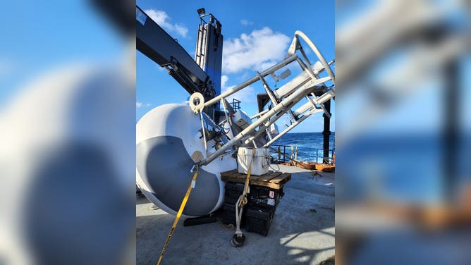
A new buoy on the deck of the M/V Bluefin before deployment in 2022.
(National Data Buoy Center. / NASA)
WHAT ARE EL NINO AND LA NINA CLIMATE PATTERNS?
Before the original set buoys became operational during the 1980s and early 1990s, NOAA admits significant events such as the strong El Niño of 1982-83 caught some weather experts off guard due to a lack of observations.
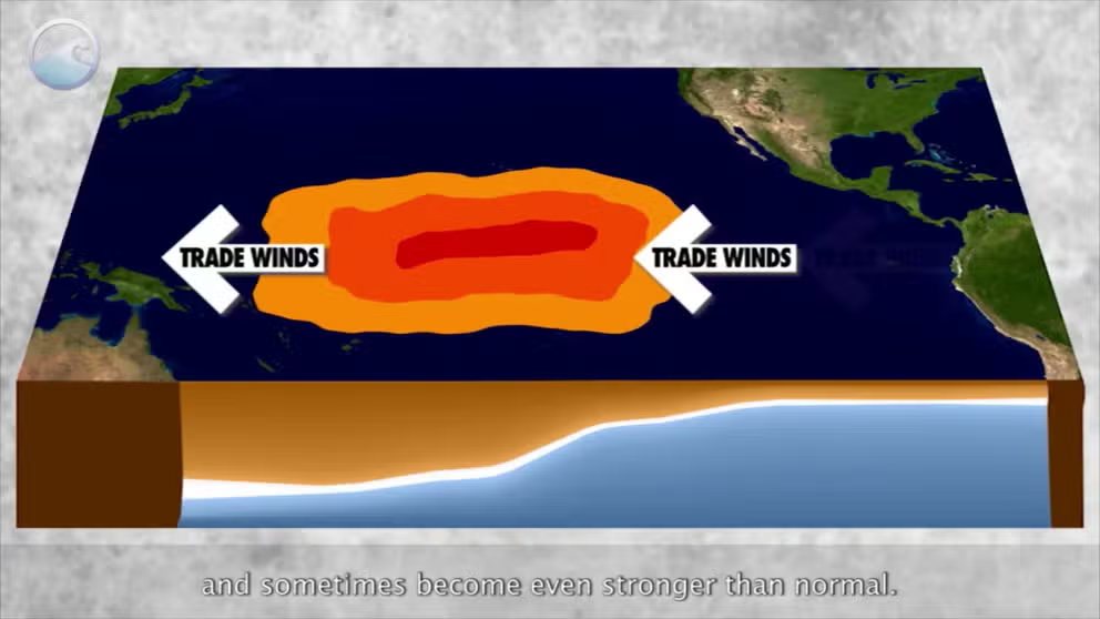
The current endeavors under the Tropical Atmosphere-Ocean project will adjust some buoy locations and add some sites along the Intertropical Convergence Zone, where trade winds converge.
NOAA said a critical aspect of the upgraded buoys will be to take increased measurements of the water column to better understand temperature mixing below the surface.
Sometimes water temperature anomalies are greater below the surface, leading to quick changes when enough mixing takes place by currents and winds.
EL NINO WATCH: PARTS OF WORLD STEADILY WARM TO NEAR CRITICAL THRESHOLD
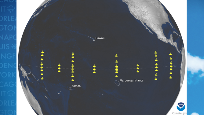
Map of important NOAA buoys in the Pacific
(NOAA)
The upgraded deployment is expected to be completed in 2027 and enhance temperature readings through at least the first 1,000 feet of underwater currents.
By the end of the project, the world will have likely been through an El Niño, which some climate models predict could be rather strong.
NOAA recently declared an "El Niño Watch" and pegged the chances of officially entering the climate pattern at more than 60% in the short term, with chances increasing to more than 80% during the fall.
Experts said an exit out of a rare triple dip La Niña could lead to extremes such as flooding, droughts and heat waves around the globe.
The last time the world was in an El Niño pattern was in 2018-19.
According to analysis completed by several agencies, the climate pattern is thought to have played a role in making 2019 the second-warmest year on record.
Global temperatures were 1.7 degrees Fahrenheit warmer than average, just shy of records produced during the 2015-16 super El Niño.
The strong El Niño helped temperatures soar to at least 1.8 degrees Fahrenheit above normal.
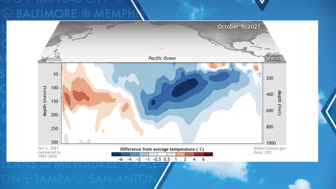
Water anomalies in Pacific during 2021.
(NOAA)