El Nino Watch: Parts of world steadily warm to near critical threshold
Warming sea surface temperatures in the central-east equatorial Pacific can lead to the formation of an El Niño climate pattern. The last El Niño occurred in 2018-2019, and according to NOAA outlooks, the world has a 62% chance of returning to the climate pattering during May-July 2023.
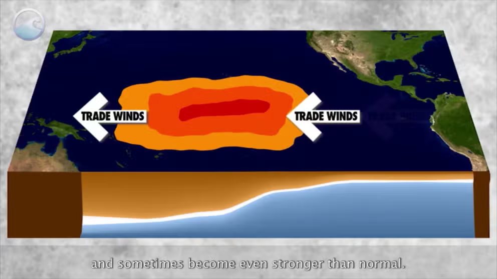
The meaning of El Nino and La Nina
The status of whether the world is being impacted by an El Nino or a La Nina is determined by water temperatures in the central and eastern Pacific. (NOAA)
Scientists have increased the chances that the central and eastern regions of the Pacific Ocean will reach a crucial threshold and have proclaimed the world as officially being in an El Niño Watch.
According to NOAA, the monitored regions of the Pacific are just below the 0.5 °C threshold which would indicate the world as officially being in an El Niño.
Due to the certainty through observations and computer models, forecasters say there is a 62% chance that an El Niño will develop during the late spring or early summer, and chances increase to more than 80% during the fall.
HERE’S WHAT AN EL NINO CLIMATE PATTERN IS
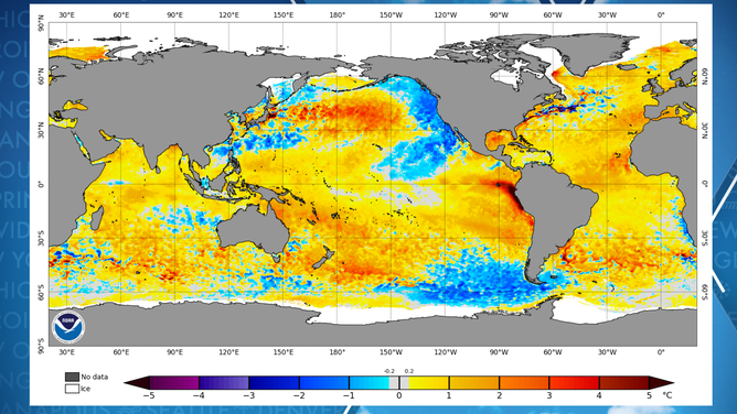
Water temperature anomalies around globe
(NOAA)
The world has been experiencing a rare triple dip La Niña, which means an exit out of and into a different pattern could result in weather extremes, such as flooding, droughts and heat waves.
Additionally, El Niño events have worldwide implications on tropical cyclone activity, which experts at Colorado State University are paying close attention to.
El Niños are known to suppress tropical cyclones in the Caribbean, Gulf of Mexico and the Atlantic Ocean, while the eastern Pacific tends to be more active than normal.
Due to the expected hostile conditions in the Atlantic basin, CSU forecasters expected the 2023 hurricane season could be slightly less busy than average.
"There’s a lot of uncertainty, but this year I think there’s even more, and that’s because you know we’ve been in this La Niña pattern for about three years, and that pattern is finally broken down," said Dr. Phil Klotzbach, lead author of the CSU outlook.
EXPERTS PREDICT SLIGHTLY BELOW-AVERAGE HURRICANE SEASON IN ATLANTIC DUE TO EL NINO INFLUENCES
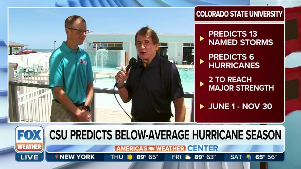
Potential development of El Nino could create a below-average hurricane season this year
FOX Weather Hurricane Specialist Bryan Norcross spoke with Research Scientist at Colorado State University Phil Klotzbach about the thought process into their latest 2023 hurricane outlook.
With the world’s largest and deepest ocean at warm levels, forecasters also expect global temperatures to reach extreme levels.
Since reliable technology started keeping track of world temperatures in the 1950s, the warmest year of any decade were periods dominated by an El Niño event, and the coldest were from La Niñas.
"During El Niño, unusually warm sea surface temperatures in the central/eastern tropical Pacific lead to increased evaporation and cooling of the ocean. At the same time, the increased cloudiness blocks more sunlight from entering the ocean. When water vapor condenses and forms clouds, heat is released into the atmosphere. So, during El Niño, there is less heating of the ocean and more heating of the atmosphere than normal," NOAA experts wrote in a 2022 ENSO blog.
Some long-range computer models depict the upcoming event as a ‘super El Niño,’ which could lead to record global heat and extremes that are rarely experienced.
Forecasters caution that some computer models may be over-forecasting predictions of an approaching strong El Niño, which is common during the spring and periods of volatility.
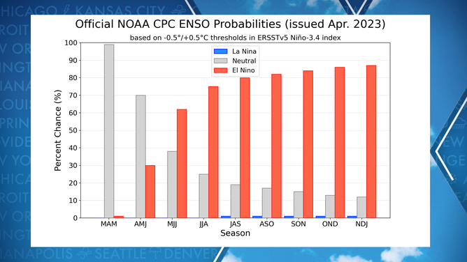
Chance of El Niño, La Niña and neutral conditions
(NOAA)