Major weekend storm set to deliver triple threat of severe storms, wind, heavy rain across eastern US
The FOX Forecast Center wants to emphasize that the storm system is still a few days away, and some changes may occur. However, all indications suggest this could be a significant storm that may cause travel disruptions and power outages for millions of Americans.
Major weekend storm bringing rain, snow and wind
Confidence is increasing that a developing storm system will deliver heavy snow, widespread rain and severe storms to the eastern half of the U.S. as we head into the weekend, the FFOX Forecast Center said.
Confidence is increasing that a developing storm system will deliver snow, widespread rain, severe storms and gusty winds to the eastern half of the country as we head into the weekend.
The FOX Forecast Center emphasizes that due to abnormally warm temperatures, the forecast will be rather complicated, and exact impacts will depend on one's location.
Most of the precipitation will fall in the liquid variety, but the combination of gusty winds and the expansive nature of the storm system will likely cause travel disruptions and power outages for millions of Americans.

(FOX Weather)
Because the system will be rapidly deepening through the weekend, blustery conditions are forecast to spread across the eastern part of the nation. Some forecast models indicate wind gusts of 50-70 mph could blast the East Coast, particularly the mid-Atlantic to New England on Sunday.
The expected windy conditions will likely trigger alerts and lead to plenty of downed trees and power outages.
The gusty winds will likely challenge even the best holiday decorations, and, if not secured properly, will likely become airborne.
CHRISTMAS LAWN DECORATIONS ARE SOMETIMES NO MATCH FOR MOTHERE NATURE
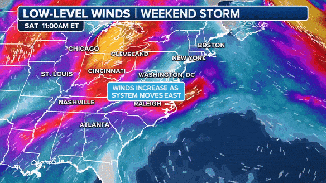
The FOX Forecast Center warns of very gusty weekend winds.
(FOX Weather)
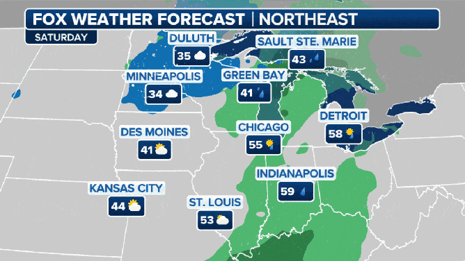
Snow expected along Great Lakes, interior Northeast
On the northern and backsides of the low-pressure system, enough cold air is expected to be in place that light snow could fall from the Great Lakes into the interior Northeast.
Usually, light accumulations range from a ground covering to about three inches.
Isolated higher amounts are expected to fall in the higher elevations in the Northeast and along the immediate shores of the Great Lakes.

(FOX Weather)
The best chance of frozen precipitation could come Sunday night into Monday morning as temperatures drop.
Forecast models show the chance of ice and even snow from Vermont and New Hampshire through the Appalachian Mountains in Tennessee and North Carolina.
Due to warm temperatures along the coast, any precipitation that falls along the I-95 corridor will be in the liquid variety.
For many counties impacted by the snowfall, amounts are expected to remain below the National Weather Service's revamped Winter Storm Warning criteria.
WINTER STORM WARNING CRITERIA FOR US REVAMPED BY NATIONAL WEATHER SERVICE
Computer models are not in agreement about where and when the rain snow changeover will be.
(FOX Weather)
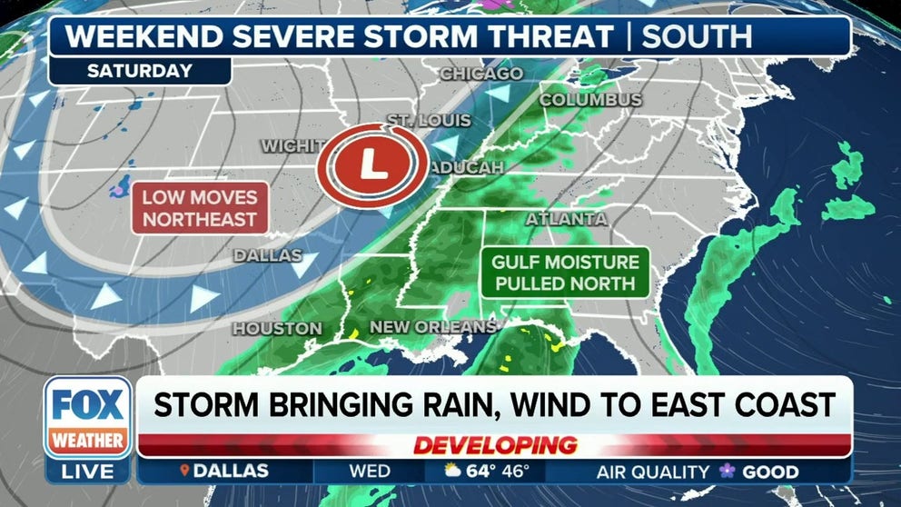
Severe weather threat in the South
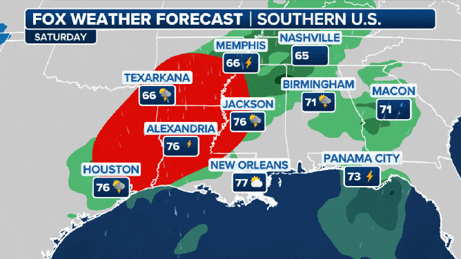
The FOX Forecast Center said it is also monitoring the potential for severe weather in the South with this storm system. A few strong to severe storms may pop up on Friday night in parts of the Ark-La-Tex region and near the Ozarks as moisture streams off the Gulf of Mexico.
NOAA’s Storm Prediction Center (SPC) has placed the region in a Level 1 out of 5 on its thunderstorm risk scale. This includes the cities of Tulsa and Broken Arrow in Oklahoma, Springfield in Missouri and Fort Smith and Fayetteville in Arkansas.

(FOX Weather)
By Saturday, a combination of increasing moisture and strong wind shear – the change in wind speed and direction with height – will result in a more substantial threat for severe thunderstorm development. Tornadoes, damaging winds and hail will all be possible from East Texas to Louisiana, Arkansas, western Mississippi and West Tennessee.
Southern soaking and severe over the weekend.
(FOX Weather)
The region is in a Level 2 out of 5 on the SPC's thunderstorm risk scale. This includes the cities of Shreveport and Alexandria in Louisiana, Little Rock in Arkansas, Jackson in Mississippi and Memphis in Tennessee.

(FOX Weather)
El Niño weather patterns are known to produce stormy weather across the Southeast, but so far, the last several storm systems have underperformed computer forecast model guidance.
The last severe weather outbreak to impact the Gulf Coast was on Nov. 20.