

Battered and bruised Bertha weakens as all storm watches and warnings are discontinued
Tropical Storm Bertha made an initial landfall in St. Bernard Parish, Louisiana, around 2:00 p.m. local time on Wednesday.
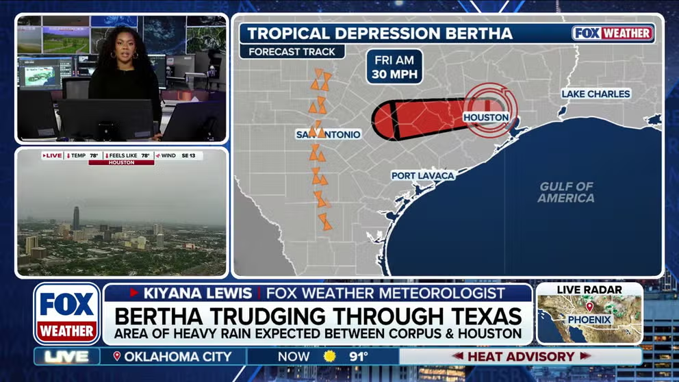
Bertha weakens to tropical depression as it moves across Texas
Bertha has officially weakened into a tropical depression after a brief trek across the Gulf Coast that included landfall in Louisiana before pushing inland into Texas. FOX Weather Meteorologist Kiyana Lewis breaks down how the storm weakened, where lingering impacts remain and what comes next for the second named storm of the 2026 Atlantic hurricane season.
NEW ORLEANS — Bertha has officially dissipated after moving inland across Texas, signaling the end of the system's brief tropical run as all coastal watches and warnings were lifted.
After re-forming over the northern Gulf, Bertha limped across Texas on Thursday, weakening to maximum sustained winds of 35 mph. The National Hurricane Center said the storm is expected to continue weakening and likely dissipate later tonight.
HURRICANE SEASON 2026: THESE ARE THE STORM NAMES YOU'LL SEE THIS SEASON
Bertha has gradually weakened as it lashed parts of the southwestern Louisiana and Upper Texas coasts with tropical-storm-force winds and coastal flooding.

(FOX Weather)
As of the NHC's 8 p.m. ET advisory, Bertha was about 40 miles west north-west of Houston, Texas, and is moving west at 14 mph.
Louisiana landfall
Tropical Storm Bertha made an initial landfall in St. Bernard Parish, Louisiana, around 2 p.m. local time on Wednesday.
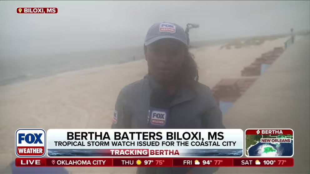
Tropical Storm Bertha batters the coast of Mississippi with intense wind gusts
BERTHA BATTERS COAST 🌀: FOX Weather Correspondent Brandy Campbell reports amid gusty winds in Biloxi, Mississippi, where the effects of Tropical Storm Bertha are battering the coast, threatening residents with severe flooding.
It's the first named storm to make landfall in Louisiana since Hurricane Francine struck in September 2024 and just the 10th tropical cyclone to make landfall in the state during the month of July since reliable records began in 1850.
FOX Weather Correspondent Brandy Campbell reported gusty winds along the beach in Biloxi, Mississippi, as Bertha's center tracked into southeastern Louisiana.
TRACK BERTHA: LIVE RADAR, FLOOD THREAT, WIND SPEED AND RADAR

Tropical Storm Bertha makes landfall in Louisiana as strong winds slam the coast of Alabama
Tropical Storm Bertha has officially made landfall in St. Bernard Parish, Louisiana, and is already bashing Alabama's coast. FOX Weather Senior Correspondent Robert Ray is live in Dauphin Island, Alabama with the latest.
FOX Weather Senior Correspondent Robert Ray experienced rough surf and 40 mph wind gusts on Dauphin Island, Alabama, early Wednesday.
HERE'S WHY BARRIER ISLANDS ARE IMPORTANT DURING HURRICANE SEASON
Bertha moved over the uninhabited Chandeleur Islands, a set of barrier islands that mark the easternmost point of Louisiana, on Wednesday morning.
All Tropical Storm Watches and Warnings discontinued
All Tropical Storm Watches and Warnings that were in effect along the Gulf Coast have since been discontinued, bringing Bertha's short-lived trek to an official end.
According to the FOX Forecast Center, winds gusted as high as 50 mph along the Texas Coast Thursday afternoon, but that has since decreased.
WHAT HURRICANE AND TROPICAL STORM WATCHES AND WARNINGS MEAN
While it is no longer a tropical storm, swells generated by Bertha will continue to impact the Louisiana and Texas coasts through Thursday night, creating dangerous surf and rip current conditions.

(FOX Weather)
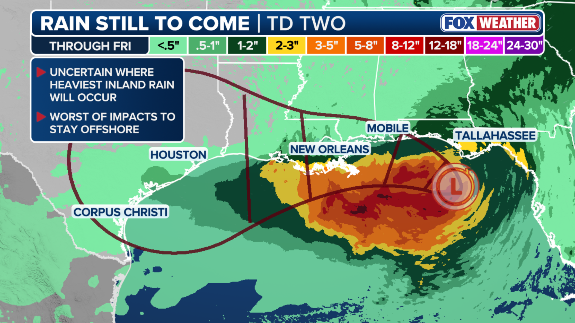
The FOX Forecast Center said Bertha reached peak intensity Tuesday as a moderate tropical storm, with the heaviest rain staying offshore.
Meanwhile, the FOX Forecast Center said there is a limited window for remaining rain.
HERE'S WHAT TO DO IF YOU ENCOUNTER A FLOODED ROAD
According to the National Hurricane Center, Bertha is expected to bring an additional 1 to 3 inches of rain, with isolated amounts up to 4 inches, through the night along the Texas Gulf Coast and South Texas, raising the threat of isolated flash flooding, especially in urban and low-lying areas.
(FOX Weather)
The storm dissipated quickly Thursday evening as it moved over land, with only a few remnant showers remaining Friday.
Bertha formed Monday in the northeastern Gulf, becoming the second named storm of the Atlantic hurricane season.