Days-long torrential rain brings flooding concerns to Gulf Coast, Southeast
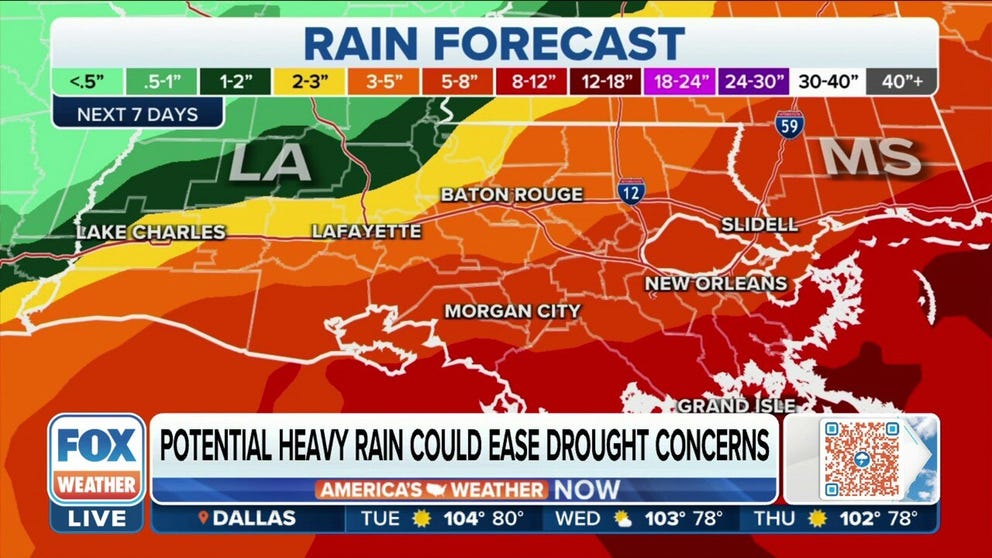
The heaviest rain is expected Monday and Tuesday along the Louisiana coast, stretching across the Gulf Coast and into Florida with generally 3 to 5 inches likely
Parts of Southeast could see significant rain amid Gulf tropical disturbance
FOX Weather multimedia journalist Robert Ray says New Orleans may pick up 12 inches of rain this week. Rainfall totals have potential to cause dangerous flash flooding.
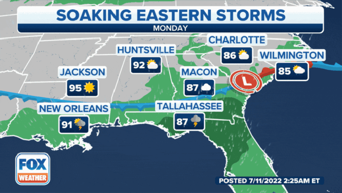
It's going to be a soggy start and finish to the workweek across much of the Southeast and Gulf Coast as the combination of a stalling cold front and plentiful tropical moisture will bring a days-long, potentially dangerous flood threat to the region.
7 FACTS YOU SHOULD KNOW ABOUT FLASH FLOODS
The heaviest rain is expected Monday and Tuesday along the Louisiana coast, stretching across the Gulf Coast and into Florida with generally 3 to 5 inches likely – though some spots could see even more, especially areas right along the shores.

(FOX Weather)
With a tropical moisture influence, periods of heavier rainfall could bring rainfall rates of 2 to 4 inches per hour or even higher, only increasing the flood threat.
EXPLAINING FLOOD ALERTS ISSUED BY NATIONAL WEATHER SERVICE
So far, the greatest threat for flash flooding on Monday is along southern Georgia and the far southeastern coast of South Carolina.

(FOX Weather)
While the Gulf Coast is expected to see the brunt of the rain, the heavy rain will spread farther north into the Carolinas too, with 2- to 3-inch rainfall totals common in the region. Rapid rises in creeks and streams and flash flooding are possible.
Meteorologists say in addition to the rainfall, there is a chance a few of the storms might become strong to severe, with damaging wind gusts being the main threat.
PLAN, PREPARE, PROTECT: HOW TO BEST COVER YOUR PROPERTY AGAINST FLOODS
While this rain will help with any drought conditions in the Southeast, too much could fall over a short period, increasing the flood threat.
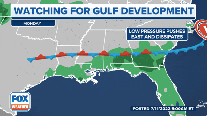
Storm could spur tropical development
This area of tropical moisture, in combination with an upper-level disturbance over Florida, could fuse together and form a tropical depression sometime later this week just off the Gulf Coast waters.
WHY WE'RE WATCHING THE NORTHERN GULF OF MEXICO FOR TROPICAL DEVELOPMENT LATER THIS WEEK
However, the National Hurricane Center is only currently giving this scenario a 30% chance of happening within the next five days.
(FOX Weather)
But regardless of whether there is any further tropical development, the focus for those in the region should remain on the threat of flooding, as that will be the main impact of anything that does develop.
HERE’S WHAT TO DO AFTER YOUR CAR IS FLOODED
The unsettled weather along the Gulf Coast will likely mean an increase in seas and rip currents along beaches.
Forecast models show a ridge of brief high pressure could work its way into the region by Wednesday to bring a relative lull in the rainfall, but a second front renews heavy rain chances toward the end of the week and into the weekend.
Four-day forecast for the Southeast.
(FOX Weather)
Be sure to download the FOX Weather app to track any storms in your area and receive potentially life-saving weather alerts issued by the National Weather Service. The free FOX Weather livestream is also available 24/7 on the website and app and on your favorite streaming platform. The FOX Weather Update podcast also provides weather information for the entire country.