

Over 30K still without power as remnants of Edouard bring more rain after prompting Flash Flood Emergencies
Government forecasters warned that Edouard's remnants will continue to produce heavy rain across parts of East Texas and North Texas through Thursday afternoon.
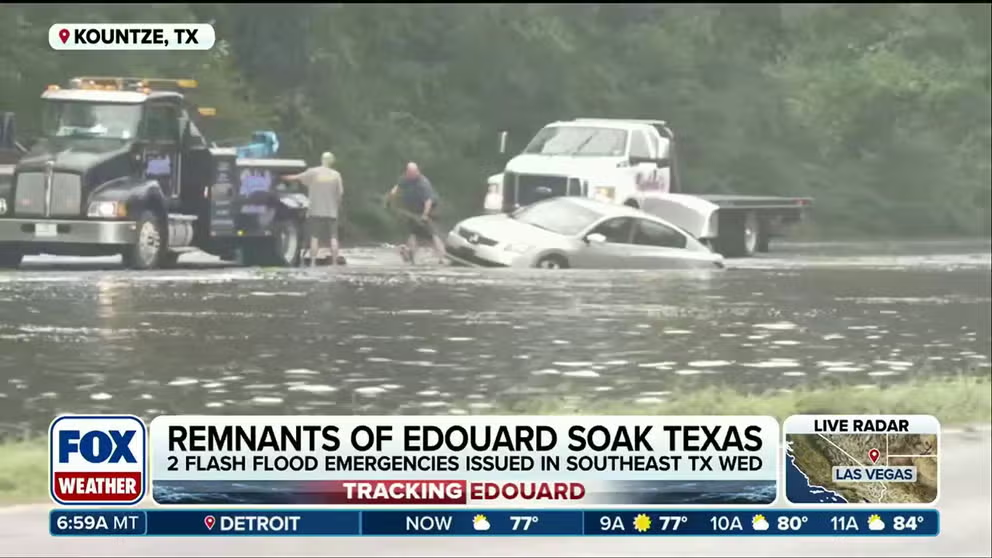
Edouard's remnants slam East Texas with heavy rain and flash flooding
The remnants of Edouard have moved into East Texas, bringing more heavy rain and flash flooding, while more than 30,000 customers are still without power in the storm's wake. Edouard's remnants will continue to produce heavy rain across parts of East Texas and North Texas through Thursday afternoon.
THE TAKEAWAY
- The remnants of Edouard are swamping Southeast Texas with heavy rain and flash flooding.
- Intense rain triggered a life-threatening Flash Flood Emergency across parts of Hardin and Tyler counties Wednesday morning.
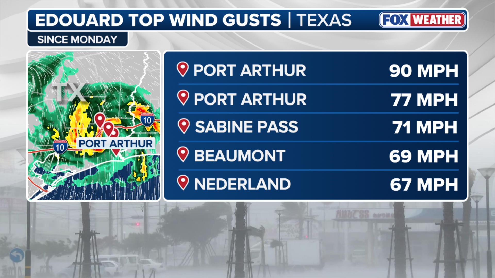
- A top wind gust of 90 mph was recorded in Port Arthur, with two other hurricane-force gusts measured in the area as Edouard made landfall Tuesday.
PORT ARTHUR, Texas — The remnants of Edouard have moved into East Texas, bringing more heavy rain and flash flooding, while more than 30,000 customers are still without power in the storm's wake.
A Flash Flood Emergency was issued for Hardin County, Texas, Wednesday night just to the southwest of Kountze.
LATEST FROM FOX WEATHER HURRICANE SPECIALIST BRYAN NORCROSS
![Heavy rain from Tropical Depression Edouard triggered Flash Flood Emergency in Kountze, Texas, on Sep. 2, 2026.]() Image 1 of 7
Image 1 of 7Heavy rain from Tropical Depression Edouard triggered Flash Flood Emergency in Kountze, Texas, on Sep. 2, 2026. (FOX Weather Senior Correspondent Brandy Campbell)
![Heavy rain from Tropical Depression Edouard triggered Flash Flood Emergency in Kountze, Texas, on Sep. 2, 2026.]() Image 2 of 7
Image 2 of 7Heavy rain from Tropical Depression Edouard triggered Flash Flood Emergency in Kountze, Texas, on Sep. 2, 2026. (FOX Weather Senior Correspondent Brandy Campbell)
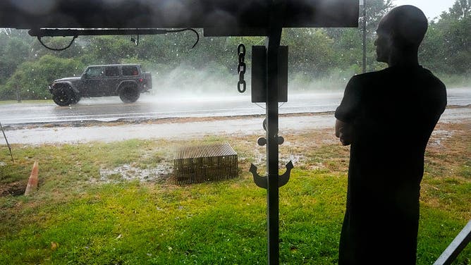
![Michael Espinoza stands under the awning of his shop, T&M Bait Shop, watching rain from Tropical Storm Edouard come down in High Island, Tuesday, Sept. 1, 2026.]() Image 3 of 7
Image 3 of 7Michael Espinoza stands under the awning of his shop, T&M Bait Shop, watching rain from Tropical Storm Edouard come down in High Island, Tuesday, Sept. 1, 2026. ((Photo by Brett Coomer/Houston Chronicle via Getty Images))
![BEAUMONT, TEXAS - SEPTEMBER 1: Tropical Storm Edouard passes over Beaumont on September 1, 2026 in Beaumont, Texas. Edouard, the fifth named storm of the Atlantic hurricane season, is expected to bring heavy rain along the upper Texas coast.]() Image 4 of 7
Image 4 of 7BEAUMONT, TEXAS - SEPTEMBER 1: Tropical Storm Edouard passes over Beaumont on September 1, 2026 in Beaumont, Texas. Edouard, the fifth named storm of the Atlantic hurricane season, is expected to bring heavy rain along the upper Texas coast. ((Photo by Antranik Tavitian/Getty Images))
![BEAUMONT, TEXAS - SEPTEMBER 1: A medical worker walks towards CHRISTUS Southeast Texas St.Elizabeth hospital during Tropical Storm Edouard on September 1, 2026 in Beaumont, Texas.]() Image 5 of 7
Image 5 of 7BEAUMONT, TEXAS - SEPTEMBER 1: A medical worker walks towards CHRISTUS Southeast Texas St.Elizabeth hospital during Tropical Storm Edouard on September 1, 2026 in Beaumont, Texas. ((Photo by Antranik Tavitian/Getty Images))
![Tropical Storm Edouard lashes Port Arthur, Texas]() Image 6 of 7
Image 6 of 7Tropical Storm Edouard lashes Port Arthur, Texas. (Britta Merwin)
![]() Image 7 of 7
Image 7 of 7Scenes from Port Arthur, Louisiana, as Tropical Storm Edouard's outer rain bands soaked the Gulf Coast on Tuesday. ( )
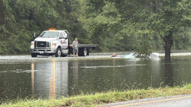
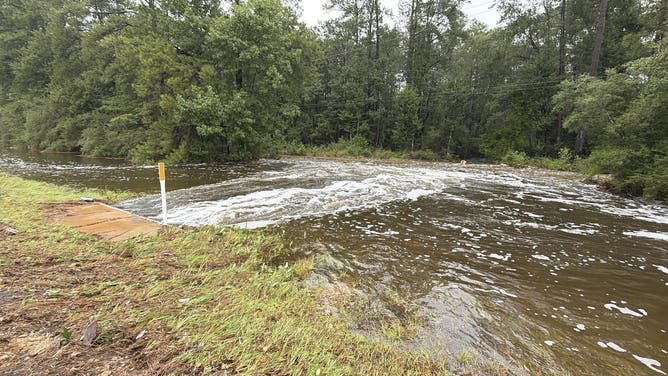
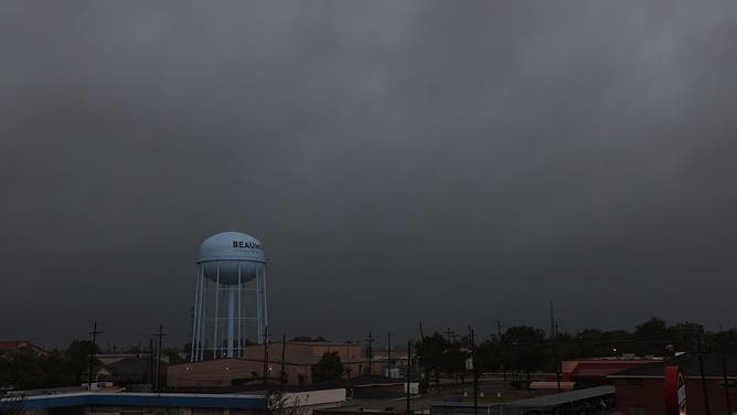
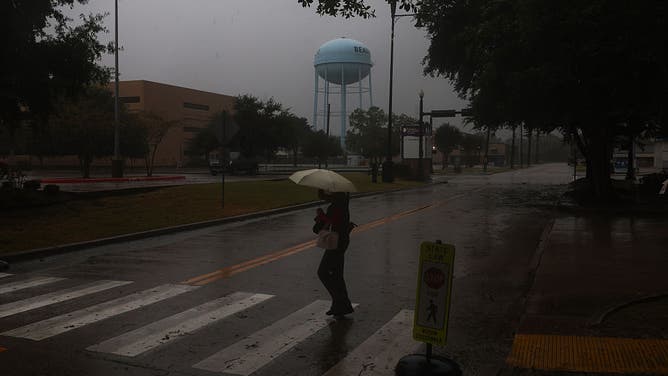

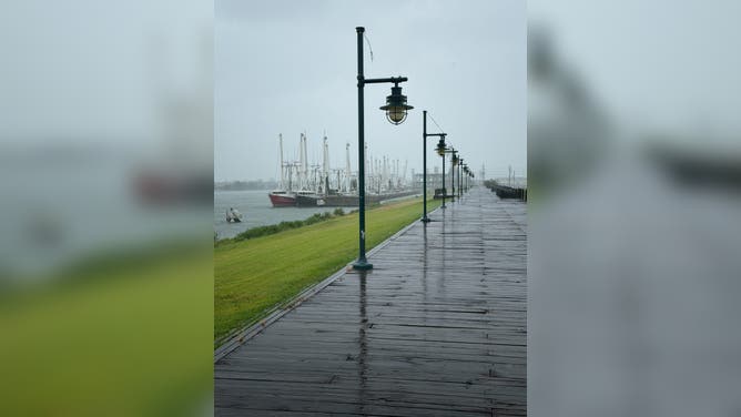
That followed a Flash Flood Emergency for life-threatening flooding issued early Wednesday morning for parts of Hardin and Tyler counties.
Nearby Polk County issued a disaster declaration following flooding overnight Wednesday. More than 2 feet of rain has fallen over the Little Pine Island Bayou within Polk County since Monday.
Kountze has recorded more than 13 inches of rain.
WHAT IS A FLASH FLOOD EMERGENCY?
FOX Weather Correspondent Brandy Campbell reported that water was nearly two feet deep over roads around Kountze Wednesday and several people had to be rescued from their vehicles.
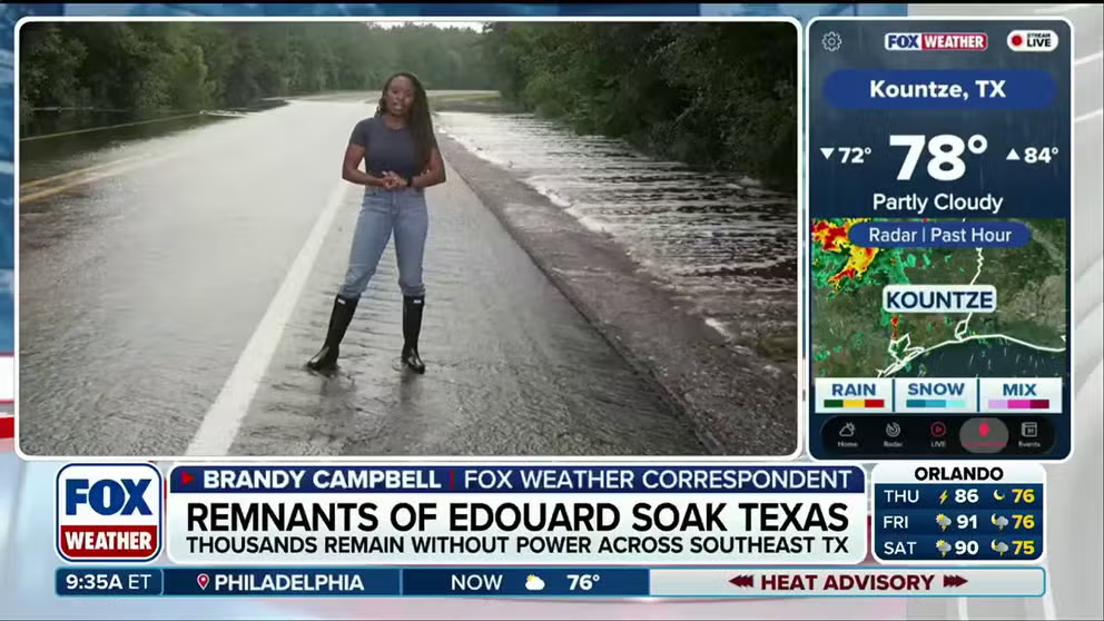
Latest from Kountze as remnants of Edouard soak East Texas
FOX Weather Correspondent Brandy Campbell is LIVE in Kountze, Texas, with the latest conditions after a Flood Emergency unfolded yesterday, leaving tens of thousands of people without power following Edouard's torrential rain. The storm’s remnants are still unleashing more downpours to parts of the Texas today. Latest on the ground:
Texas Gov. Gregg Abbott said on social media that 20 state agencies and more than 1,100 first responders were deployed to help mitigate impacts across the region.
Edouard made landfall as a tropical storm near Johnson Bayou, Louisiana, about 15 miles south-southeast of Port Arthur, Texas, at 2:20 p.m. local time on Tuesday, packing maximum sustained winds of 60 mph and a minimum central pressure of 996 mb, according to the National Hurricane Center (NHC).
(FOX Weather)
More than 70,000 customers were without power across the region at the height of the storm.
Edouard was downgraded to a tropical depression Tuesday night, and weakened to a remnant area of low pressure early Thursday.
However, government forecasters warned that Edouard's remnants will continue to produce heavy rain across parts of East Texas and North Texas through Thursday afternoon.
Campbell said floodwaters had receded around homes in Kountze on Thursday morning, but water was still running over roads as the nearby Village Creek continued to rise.

Watch: Intense winds from Tropical Storm Edouard SLAM Jefferson County, Texas
Tropical Storm Edouard destroyed part of a wall at the Sabine Pass Independent School and blasted the region with hurricane-force wind gusts as it roared ashore. Edouard caused widespread flooding and power outages well into Wednesday.
The Texas Game Wardens said they had to rescue 21 people from a Hardin County assisted living facility due to flooding Wednesday.
The Woodville Independent School District and several others nearby canceled school Wednesday morning.

Authorities conducted a water rescue in Texas amid heavy rain from Tropical Depression Edouard.
(Governor Greg Abbott's Office / FOX Weather)
Meanwhile, the Port Arthur Independent School District was closed Wednesday to assess damage to infrastructure.
City emergency management officials said they were investigating widespread reports of a gas odor across parts of the city as the storm came ashore.
🌀 TROPICAL STORM: The effects of Tropical Storm Edouard were in full display for coastal areas such as Sabine Pass, Texas, where ferocious wind gusts and violent waves crashed along the shore. pic.twitter.com/T6JEeMK2CZ
— FOX Weather (@foxweather) September 2, 2026
Both the city and Jefferson County issued disaster declarations ahead of the storm to help speed up anticipated cleanup.
Edouard tore down a wall at the nearby Sabine Pass Independent School as strong winds lashed the region.
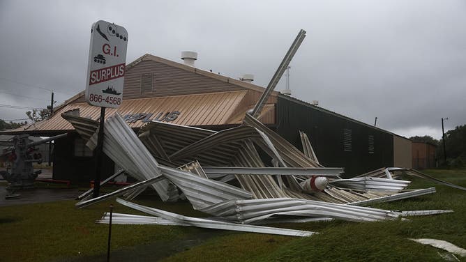
BEAUMONT, TEXAS - SEPTEMBER 1: A damaged G.I. Surplus store is seen during Tropical Storm Edouard on September 1, 2026 in Beaumont, Texas.
((Photo by Antranik Tavitian/Getty Images) / Getty Images)
The Jefferson County commissioner shared video of downed trees that had taken down power lines late Tuesday, and asked people to stay off the roads.
Beaumont announced that city facilities would not open until noon Wednesday while crews worked to clear debris.
The Medical Center of Southeast Texas also announced that widespread power outages caused temporary interruptions at some of its hospitals Wednesday.
Rain from Edouard's remnants will reach the Dallas metro area Thursday afternoon, which is mired in drought conditions.
Edouard marks the third landfall of the 2026 hurricane season
Tropical Storm Edouard strengthened before making landfall Tuesday afternoon.
"As it neared the coast, the inner core was able to form only a segment of an eye-wall on the southwest side of the storm," the FOX Forecast Center said.
WHAT’S THE DIFFERENCE BETWEEN A TROPICAL DEPRESSION, TROPICAL STORM AND HURRICANE?
"In this very small segment, tall thunderstorms formed over the center, allowing for winds to pick up from 40 mph to 60 mph."
(FOX Weather)
A top wind gust of 90 mph was recorded in Port Arthur, with two other hurricane-force gusts measured in the area Tuesday.
This is the third landfall of the 2026 Atlantic hurricane season, with the previous two tropical storms also coming ashore along the northwestern Gulf Coast: Arthur near Matagorda County, Texas, on June 17, and Bertha in St. Bernard Parish, Louisiana, on July 22.
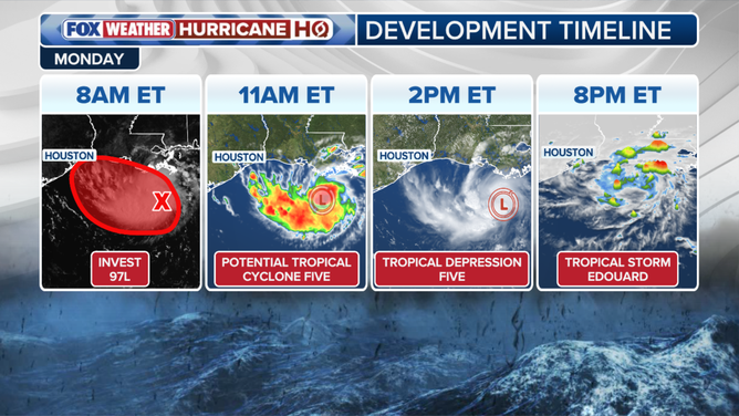
Tropical Storm Edouard development timeline
(FOX Weather / FOX Weather)
Edouard developed quickly from a cluster of thunderstorms in the northern Gulf Friday evening. The cluster was tagged as Invest 97L on Saturday afternoon.
WHAT IS AN INVEST DURING HURRICANE SEASON?
From there, Edouard strengthened from a Potential Tropical Cyclone to a full-blown tropical storm within the span of nine hours on Monday.