

Hawaii braces for potential direct strike from major Hurricane Lowell as Pacific is supercharged with activity
Part of Hawaii is now in the cone of monster Category 4 Hurricane Lowell. The National Hurricane Center is warning people in Hawaii that Lowell could still be a dangerous, major hurricane as it approaches the islands early next week.
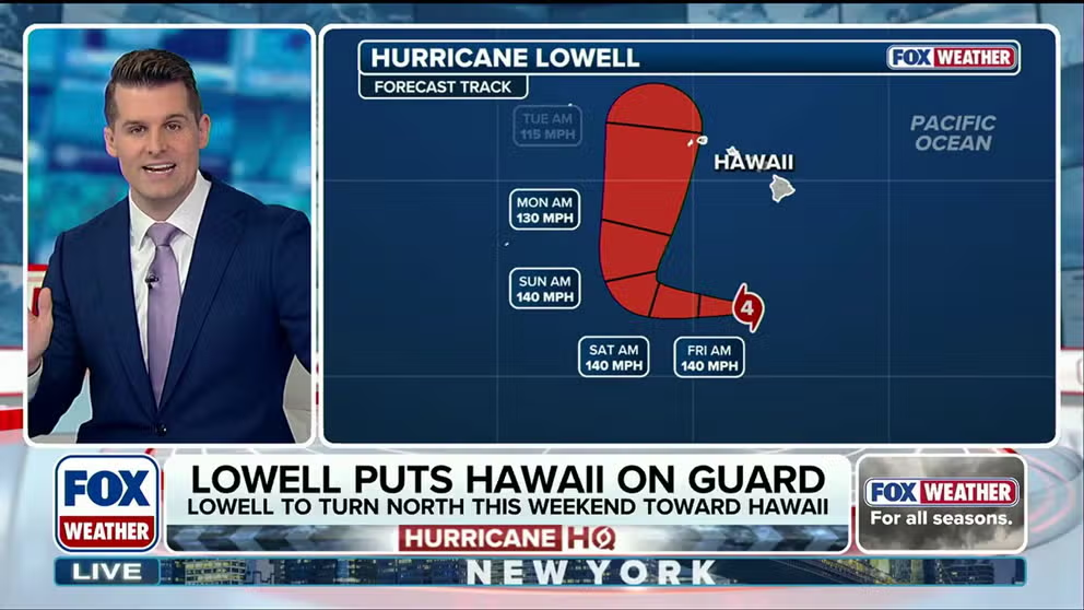
Hawaii braces for potential direct strike from major Hurricane Lowell
🌀HAWAII ON ALERT: Part of Hawaii is now in the cone of major Category 4 Hurricane Lowell. The National Hurricane Center is warning people in Hawaii that Lowell could still be a major hurricane as it makes its approach early next week. A direct landfall is still possible. Watch FOX Weather for the LATEST update:
THE TAKEAWAY
- Hurricane Lowell has the potential for a dangerous, direct strike on Hawaii early next week
- Hurricane Marie could fuel rare storms across the Southwestern U.S. into the holiday weekend.
- Hurricane Karina is expected to weaken into the weekend with no threat to Hawaii at this time as all eyes track Lowell.
Part of Hawaii is now in the cone of monster Category 4 Hurricane Lowell. The National Hurricane Center is warning people in Hawaii that Lowell could still be a dangerous, major hurricane as it approaches the westernmost islands early next week.
According to the FOX Forecast Center, a direct landfall is possible.
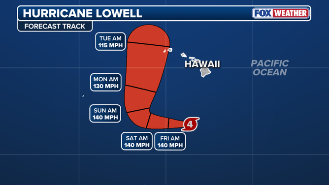
Tracking Hurricane Lowell
(FOX Weather)
Meanwhile, the rest of the basin is erupting with tropical activity as Category 4 Hurricane Karina and Category 1 Hurricane Marie churn in the Eastern Pacific. The surge comes amid a strengthening El Niño, with rising air and reduced wind shear creating prime conditions for storms to develop and intensify.
The warmer than average waters are then injecting extra fuel into the storms, leading to tropical systems such as major Hurricanes Karina and Lowell.
🌀 TRACKING THE TROPICS: Major Hurricane Lowell is barreling toward a potential direct strike on Hawaii. Meanwhile, Hurricanes Karina and Marie are also churning in the Pacific. Stick with FOX Weather as we continue to track these intensifying threats. pic.twitter.com/2hH3mDulCs
— FOX Weather (@foxweather) September 3, 2026
BREWING SUPER EL NIÑO EXPECTED TO BE STRONGEST ANYONE ALIVE ON THE PLANET HAS EVER EXPERIENCED
Hawaii is on alert for potential direct impacts from Lowell. Meanwhile, Karina is expected to weaken into the weekend.
Marie will influence weather across the Southwestern U.S. with its moisture through the holiday weekend.
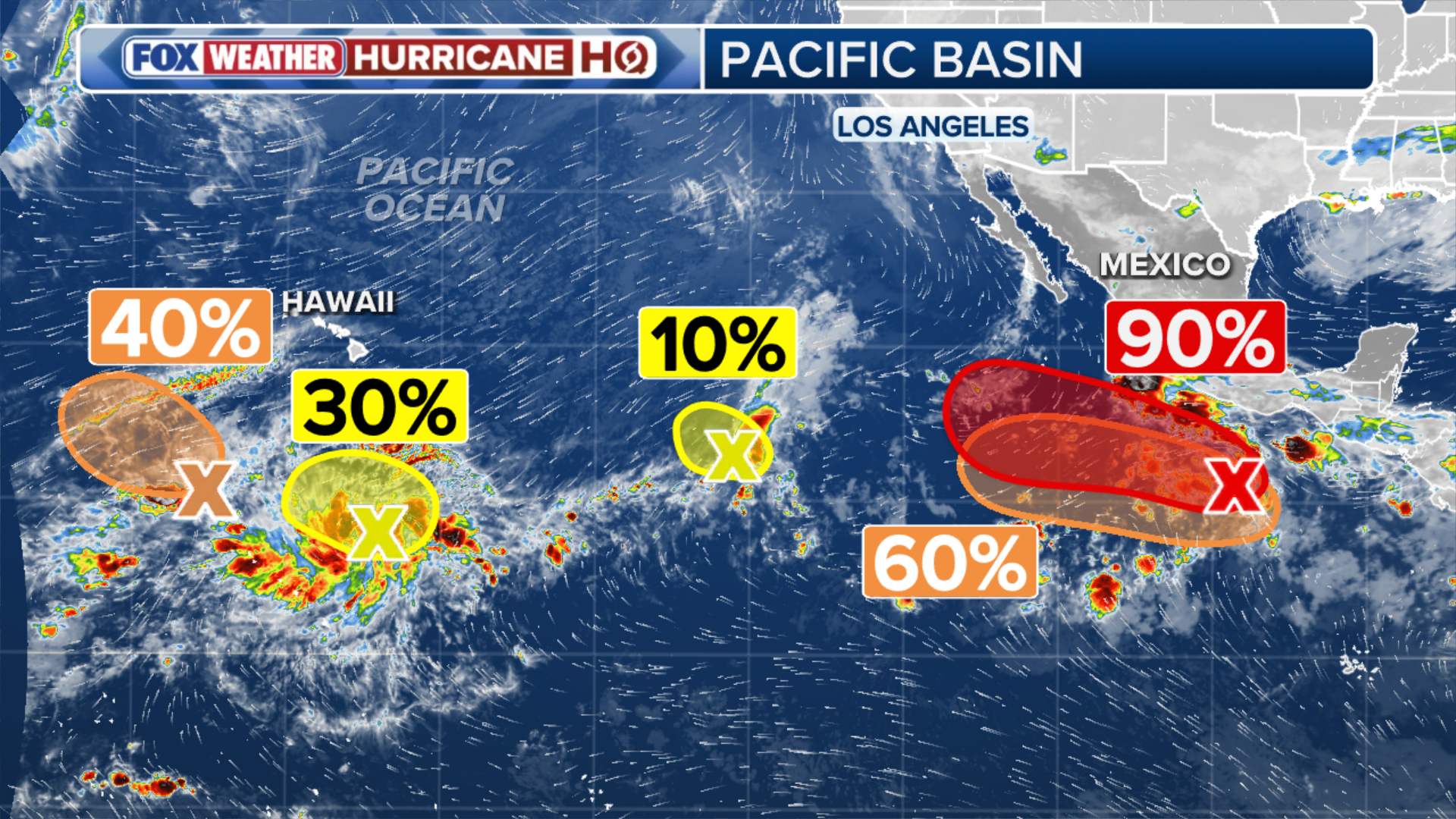
(FOX Weather)
Hawaii monitoring future of Lowell
Lowell is back to a very strong Category 4 hurricane after achieving Category 5 status for a short window on Wednesday — the first Cat 5 in the Central Pacific since Walaka in October 2018.
Now through Friday, Lowell should maintain a westward path, steered by high pressure to its north, while remaining at Category 4 strength or close to Category 5.
STRENGTHENING EL NIÑO COULD SHAKE UP FALL WEATHER ACROSS THE US. HERE’S WHAT TO EXPECT
According to the FOX Forecast Center, "This weekend is when things get interesting. An upper-level low will develop north of the Hawaiian Islands. This will erode the ridge, causing Lowell to slow down further and turn sharply northward."
While the majority of the models keep Lowell west of Hawaii, a direct landfall is possible.
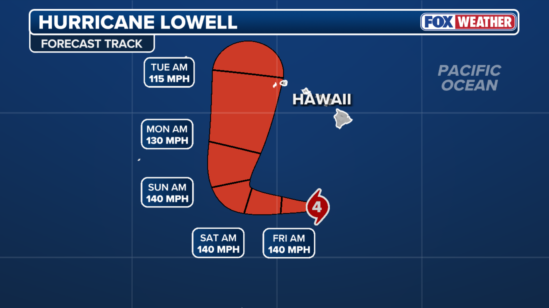
(FOX Weather)
There has been a notable trend in forecast guidance over the past 24 hours bringing the storm closer to the islands.
If this trend continues, significant impacts will be possible in Hawaii early next week. Even a storm passing west of the islands could bring huge waves and gusty winds to Kauaʻi.
Hurricane Lowell is now a Category 5 hurricane. While forecast to pass south of the Hawaiian Islands, now is the time to prepare.
— Oahu Emergency Mgmt. (@Oahu_DEM) September 2, 2026
Actions to take now:
• Prepare your home and supplies
• Review your family emergency plan
• Sign up for HNL Alert: https://t.co/T4c5F9a8EN pic.twitter.com/FfAxJPOtRr
But questions still remain until the forecast becomes more clear.
The National Hurricane Center said, "Interests in Hawaii should continue to closely monitor the progress of Lowell through this upcoming weekend. This is a good time for all residents to ensure they have their hurricane plan and supply kit in place."
WHAT’S THE DIFFERENCE BETWEEN A TROPICAL DEPRESSION, TROPICAL STORM AND HURRICANE?
Hurricane Karina expected to gradually weaken
Karina continues as a rare annular-type hurricane. Whereas typical hurricanes have sprawling rain bands, annular hurricanes look like a tire truck or donut.
"Only about 4% of hurricanes take on an annular structure. Annular hurricanes can better shield themselves from hostile conditions and typically maintain their strength longer than usual," the FOX Forecast Center noted.
That said, with Karina, annular or not, the eventual outcome is the same: the storm will die out north of Hawaii.

(FOX Weather)
Karina will track over marginally warm waters over the next few days with low wind shear. However, the system will be moving into a drier, more stable airmass by Thursday.
This should induce a gradual weakening trend during the next day or so and there is no threat to Hawaii at this time.
Hurricane Marie will affect weather across the Southwestern U.S.
Category 1 Hurricane Marie continues to spin off the southwestern coast of Mexican with peak winds of 80 mph.
It is now moving more west-northwest and will continue to do so over the next several days. Additional strengthening is forecast through Friday; however, weakening is expected into the weekend as the storm remains offshore.

(FOX Weather)
As Marie pulls northward through the end of the week, it will pump additional tropical moisture to the region, prompting a Level 2 out of 4 flash flood risk across southern Arizona on Friday, including Phoenix and Tucson.
Marie’s moisture is already amplifying the Southwest Monsoon across the Four Corners, where a Level 2 out of 4 flash flood risk is in place across southern Arizona Thursday and Friday.
By Saturday and Sunday, a Level 1 out of 4 risk expands westward into Southern California, including Los Angeles and Las Vegas. Rainfall totals remain low for now, with around a half-inch or less expected.
A new area to watch
Off the coast of southwestern Mexico, near where Tropical Storm Marie is moving, the NHC has highlighted a new area to watch.
The NHC warned that an area of low pressure could form over the weekend, with gradual development possible as early as next week as the system moves off the coast of Mexico.
The area has a 40% chance of development over the next seven days, and a near-zero chance to develop over the next two days, according to the NHC.