Development chances drop for Invest 95L with new disturbance in central Atlantic
The NHC has given Invest 95L a 10% chance of developing within the next two days and a 10% chance of development within a week. There is another area in the Central Atlantic the National Hurricane Center is tracking.
NHC tracking Invest 95L, new disturbance in Atlantic with low chance of development
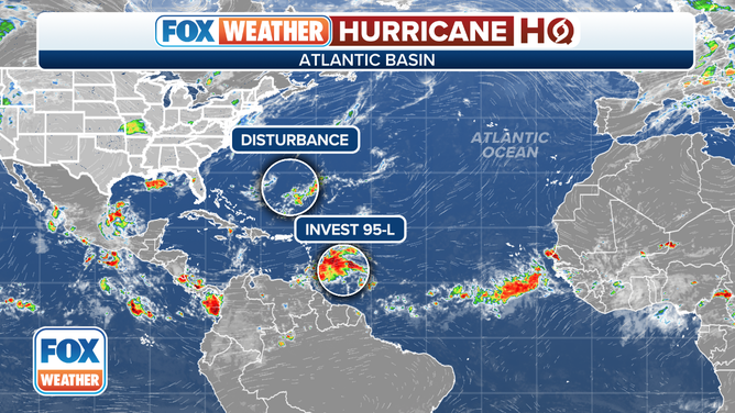
There are two disturbances in the Atlantic being watched by the National Hurricane Center for possible development. Invest 95L has dropped to a 20% chance of development as it continues to move toward the Caribbean.
Invest 95L continues to be monitored in the Atlantic, and now, the National Hurricane Center says they have a new area they are watching in the basin.
A tropical disturbance swirling in the Atlantic Ocean was designated Invest 95L by the National Hurricane Center on Friday, and over the weekend, chances for development dropped significantly.
Invest 95L is about halfway between the Caribbean's Lesser Antilles and the African coast. On Monday, the NHC has given it a 10% chance of developing within the next two days and a 10% chance of development within a week.
Depending on how the disturbance organizes, it could become a tropical depression or even Tropical Storm Emily.

(FOX Weather)
An "Invest" is simply a naming convention used by the National Hurricane Center to identify areas they are investigating for possible development into a tropical depression or tropical storm within the next seven days.
Once a system is dubbed an invest, a collection of specialized datasets and computer forecast model guidance can begin in that area of disturbed weather. These computer models simulate the system’s projected track possibilities and predict its future intensity.
This disturbance has peak winds of about 30 mph. The NHC said the system is currently drifting to the west at about 15 mph and is expected to continue to track due west toward the Lesser Antilles in the Caribbean.

(FOX Weather)
New area to watch in the Atlantic

(FOX Weather)
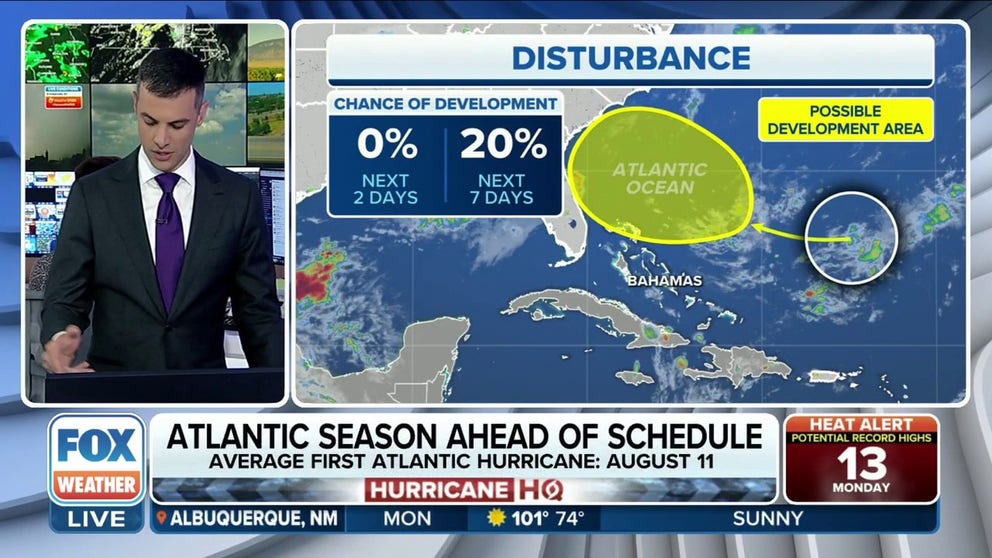
The NHC is now tracking another disturbance in the central Atlantic Ocean. A weak trough of low pressure located a few hundred miles south of Bermuda has a low chance for development. The NHC gives it a 20% chance over the next week.

The National Hurricane Center is tracking a disturbance and Invest 95L in the Atlantic.
(FOX Weather)
The unorganized area is worth watching as environmental conditions are expected to become marginally conducive for some development as it moves toward the southeastern U.S. into the weekend.
Meanwhile, Post-Tropical Cyclone Don continues trekking along after becoming the Atlantic season's first hurricane. Don is expected to fizzle out by Tuesday.
