Severe storm threat moves east after some damage reported in Chicago area
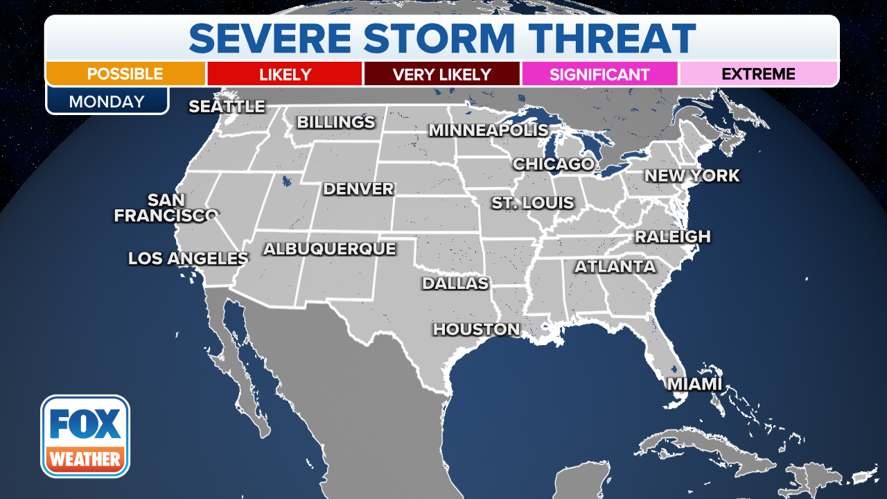
The highest risk of severe weather stretches northeast Missouri, east to northwest Ohio and north into central Michigan.
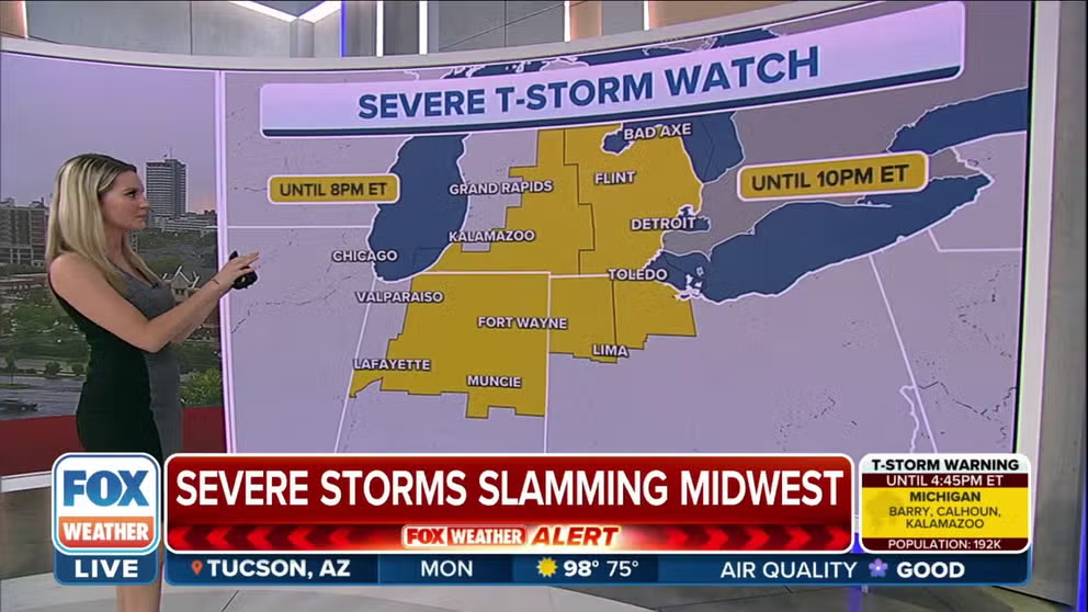
Severe Thunderstorm Watch extended until later Monday for parts of Midwest
11 million Americans are under a Severe Thunderstorm Watch in the Midwest. A watch will be place for parts of northwest Ohio and Lower Michigan until 10 p.m. ET.
CHICAGO – The threat of severe thunderstorms is marching east across the Great Lakes region after wind damage was reported in the Chicago area Monday afternoon.
Scattered storms fired up late Monday morning and have raced east across the region around 40-45 mph.
Severe Thunderstorm Watches were issued for areas throughout the Midwest and Ohio Valley.
HOW TO WATCH FOX WEATHER ON TV

(FOX Weather)
"The issue is going to be (Monday) afternoon and this evening -- that's when everything is lining up for the most impressive weather," said FOX Weather's Britta Merwin. "For Chicago, it's really the strong winds -- they could be in excess of 55 to 60 mph - that's strong enough to cause some damage. Take a look at your front porch and back patio and bring in a few things."
THE 5-POINT SEVERE THUNDERSTORM RISK CATEGORY SCALE EXPLAINED
Some storm damage was reported in the Chicago area Monday afternoon after the line of powerful storms moved east of the city. Pictures shared with FOX Weather showed large tree limbs ripped from trees and damage to the screen door of a home. Other images showed sheets of wind-driven rain.
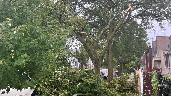
Trees are seen damage in Chicago, Illinois, after storms Aug. 29, 2022.
The highest risk of severe weather stretches northeast Missouri, east to northwest Ohio and north into central Michigan. Within that area, severe storms are very likely across northeast Indiana, far southern Michigan and northwest Ohio.
(FOX Weather)
Aside from frequent lightning, the primary threat will be damaging wind gusts of 60 and up to 75 mph – strong enough to knock down large tree limbs and fences.
WHEN THUNDER ROARS, EVEN TAKING OUT THE TRASH CAN TURN DEADLY
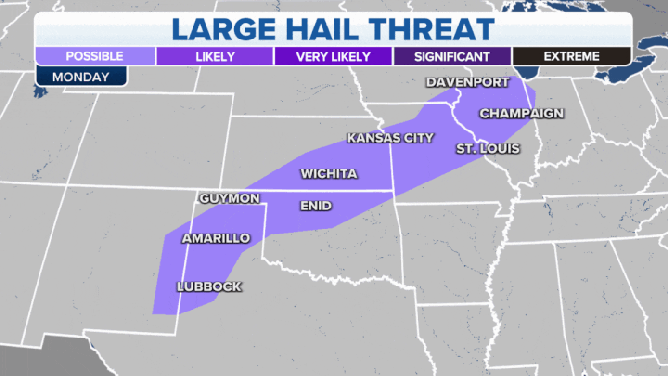
Large hail is possible, as well as heavy rains that could trigger isolated areas of flash flooding.
(FOX Weather)
Thunderstorms possible all along cold front
While the greater Chicago area is the focal point for severe weather, thunderstorms will develop along the frontal boundary and stretch southwest through St. Louis and the lower Missouri Valley into Kansas and Oklahoma.

(FOX Weather)
Once again, primary threats are damaging winds and areas of large hail.
Cold front pushes east for Tuesday
It will be the Ohio Valley's turn and eventually much of the East Coast who will get wet on Tuesday as this cold front continues to sweep east.

(FOX Weather)
The I-95 corridor can expect periods of rain, heavy at times, during the Tuesday evening commute.
LIGHTNING CHASER SHARES OUT TO CAPTURE NATURE'S FURY ON CAMERA
While the severe weather threat will diminish on Tuesday, there will still be a risk of isolated thunderstorms capable of localized flash flooding.