

Severe storms threaten millions across Midwest, Ohio Valley, Mid-Atlantic as 500K+ still without power
More than 500,000 people are without power, with the bulk of the outages being reported in Michigan.
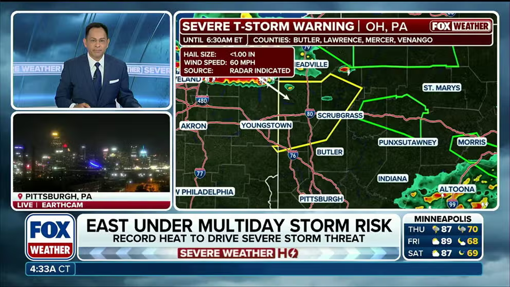
Severe storms threaten over 50M across Midwest, Ohio Valley, Mid-Atlantic
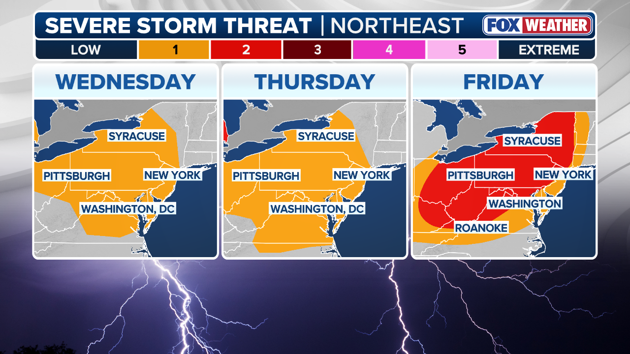
Severe weather is forecast to reignite Thursday over more than 50 million people across parts of the Great Lakes, Ohio Valley and Mid-Atlantic, part of a multiday threat that will last into the holiday weekend. The Milwaukee, Chicago, Cleveland, Pittsburgh, Baltimore and Washington, D.C. metro areas are all under a Level 2 out of 5 risk of severe thunderstorms Thursday, according to NOAA's Storm Prediction Center (SPC).
THE TAKEAWAY
- An active weather pattern continues in the Northeast and Mid-Atlantic, packing rounds of nasty storms each day this week.
- Over 500,000 homes are without power as severe storms move through.
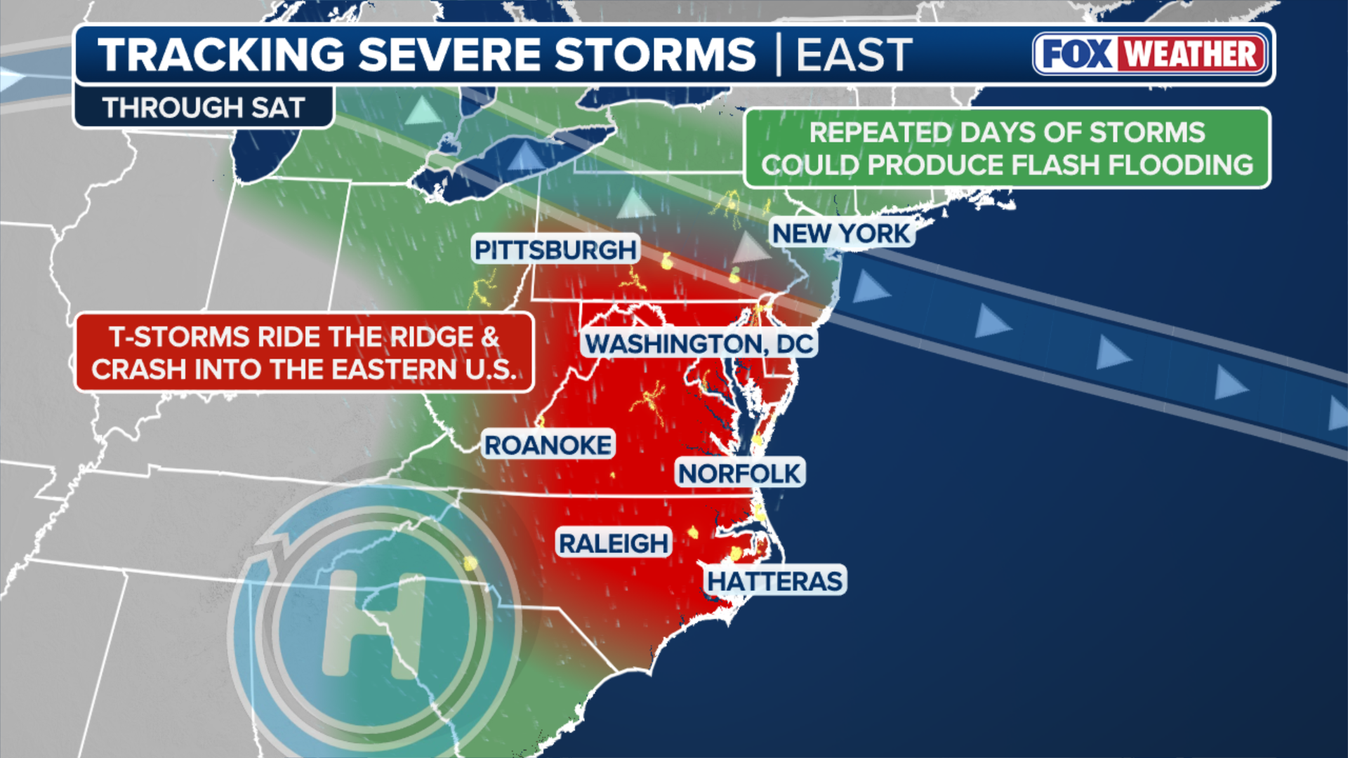
- Severe storms are expected to continue through Saturday.
Severe weather is ongoing for millions of people across parts of the Great Lakes, Ohio Valley and Mid-Atlantic, amid a multiday threat that will last into the holiday weekend.
The Milwaukee, Chicago, Detroit, Cleveland, Baltimore and Washington, D.C. metro areas were all under a Level 2 out of 5 risk of severe thunderstorms Thursday, according to NOAA's Storm Prediction Center (SPC).
SEE YOUR LABOR DAY WEEKEND FORECAST
A Level 3 out of 5 severe storm risk was also issued for damaging winds up to 75 mph across northeast Ohio and western Pennsylvania, including Cincinnati, OH and Pittsburgh, PA, on Thursday.
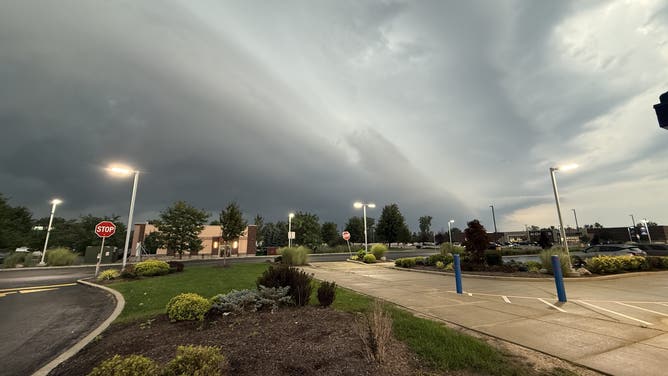
Shelf cloud looms over Lancaster, New York, ahead of strong thunderstorms on Sep. 2, 2026.
(Tara / FOX Weather)
More than 500,000 customers are without power after storms produced damaging wind gusts along a corridor from the thumb of Michigan across the eastern Great Lakes into Ohio, Pennsylvania and western New York and south across the Mid-Atlantic into North Carolina.
About 280,000 homes are without power in Michigan alone, with mounting outages being reported in Pennsylvania and Ohio, according to poweroutage.us.
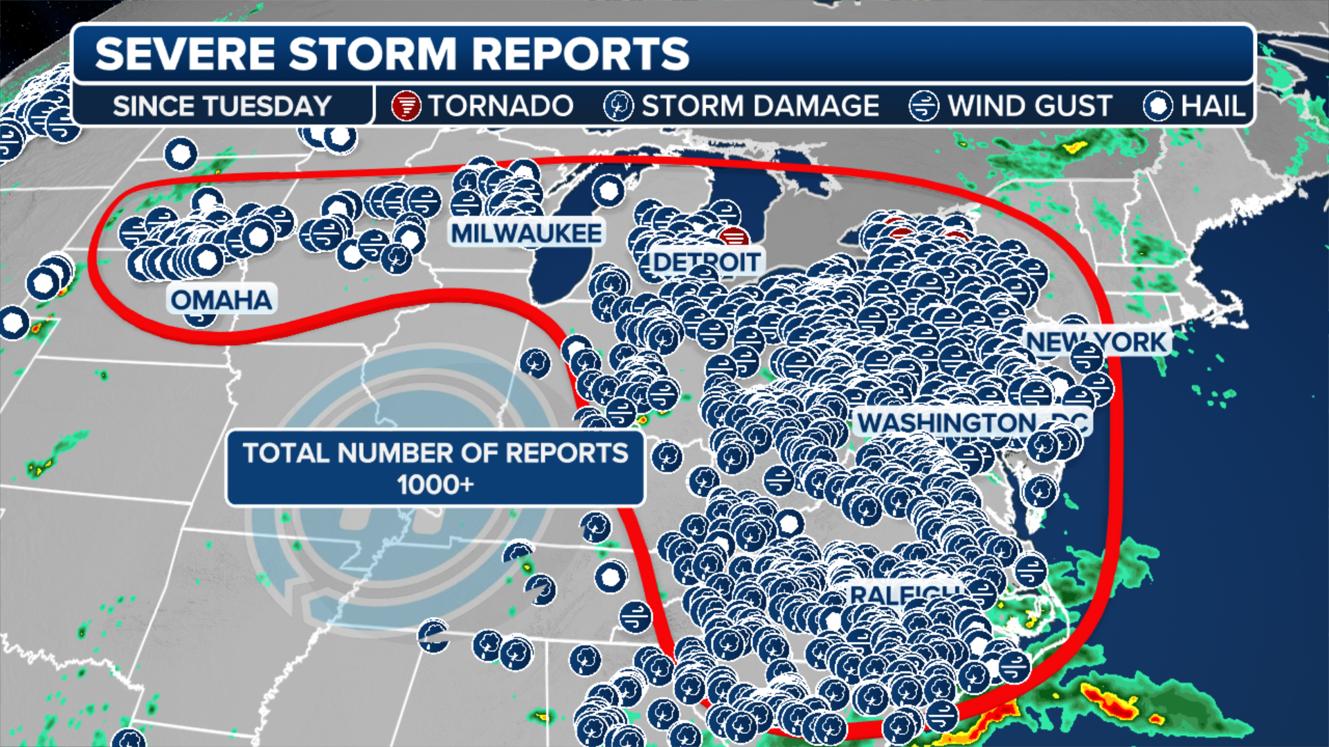 Storm Reports Since Tuesday.
(FOX Weather)
LABOR DAY WEEKEND OUTLOOK: NASTY STORMS THREATEN TO WREAK HAVOC ON OUTDOOR PLANS, HOLIDAY TRAFFIC
Storms are riding along the northern edge of a heat dome that's anchored over the Central Mississippi Valley, fueling a stormy pattern that began on Tuesday.
Numerous record high temperatures were possible ahead of afternoon thunderstorms.
(FOX Weather)
Showers and isolated thunderstorms were reported across New York City and Philadelphia on Thursday.
Week of severe storms
The multiday severe weather marathon erupted Tuesday, with numerous Severe Thunderstorm Warnings across Pennsylvania, New York and New Jersey as storms brought damaging winds and heavy rain.
By early Wednesday morning, more than tens of thousands of customers were without power across Pennsylvania, Delaware and New Jersey, with additional outages and damage possible as storms continue today, along with an ongoing risk of flash flooding.
Flash flooding occurred across eastern Pennsylvania, while wind gusts topped 55 mph and trees and power lines came down.
A confirmed tornado was reported near Somerset, New York, as a waterspout moved onshore northeast of Buffalo.
NOVICE CLIMBERS RESCUED AFTER AI-PLANNED MOUNT SHASTA ASCENT GOES SIDEWAYS
Numerous reports of tree damage, hail and strong winds came in from across the region.
(FOX Weather)
This is likely the first time areas like Philadelphia have been under a Level 2 out of 5 storm threat for three consecutive days in September since 2023.
The last occurrence in 2023 was the only other time, along with a stretch in 2008, where a span of severe weather days had occurred, making this a rather rare stretch for some, the FOX Forecast Center said.
ICONIC MUSIC FESTIVAL CANCELS 2027 EVENTS AFTER SEVERE STORMS LEAVE LASTING DAMAGE
Saturday
"All the ingredients from the previous two days will come back into play as we head into Labor Day Weekend," the FOX Forecast Center said.
(FOX Weather)
LABOR DAY WEEKEND OUTLOOK: NASTY STORMS THREATEN TO WREAK HAVOC ON OUTDOOR PLANS, HOLIDAY TRAFFIC
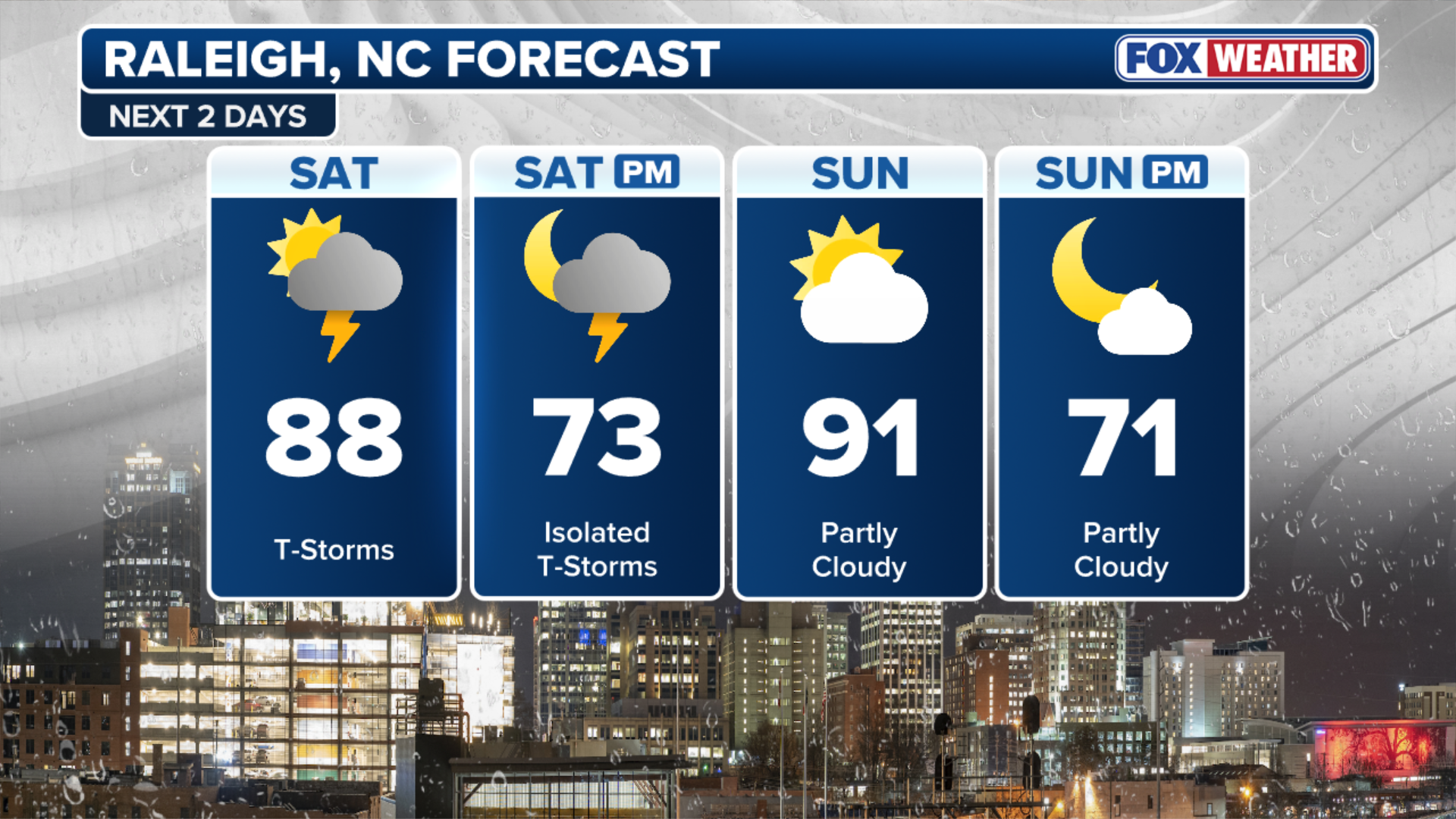
As this pattern begins to break down, storms will shift into the Carolinas into Saturday afternoon with, once again, a Level 2 out of 5 severe storm threat present for North and South Carolina.
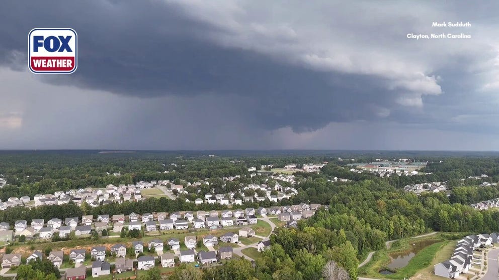
Massive shelf cloud looms over the sky outside Raleigh, North Carolina
A massive shelf cloud loomed over the skyline just outside Raleigh, North Carolina, as severe storms barreled into the area.
Sunday
By Sunday, the active weather pattern will finally begin to break down as severe storms shift into South Carolina and southeast Georgia.
A slow-moving cold front will push south along the East Coast, bringing storms to Charleston, South Carolina, Savannah, Georgia, and surrounding areas.
 Severe Storm Threat.
(FOX Weather)
A Level 2 out of 5 severe weather threat will be in place, with damaging wind gusts and powerful downbursts possible.