

Novice climbers rescued after AI-planned Mount Shasta ascent goes sideways
The U.S. Forest Service said the group used AI, Youtube and a popular smartphone application to plan the challenging climb, and wound up ill-prepared.
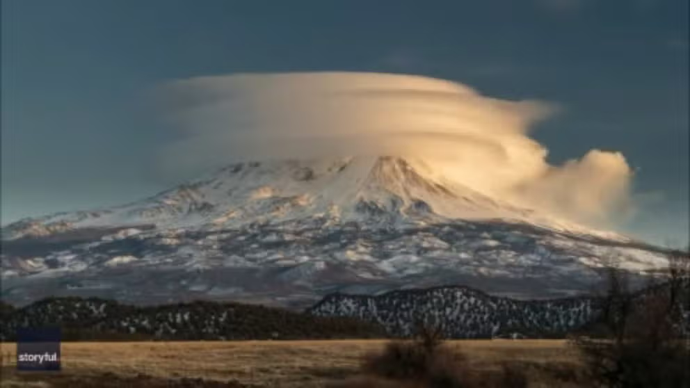
FILE: Stunning time-lapse video of lenticular cloud over Mt. Shasta
Those within sight of California's Mount Shasta last weekend were treated to quite a show as thin layers of clouds pancaked on top of each other to make, in essence, a floating cap. (Video courtesy: Robert Renick via Storyful)
THE TAKEAWAY
- Three novice climbers relied on AI to help plan their Mount Shasta ascent.
- The trio became stranded overnight after veering off route during the descent.
- A multiagency rescue effort brought all three climbers safely down the mountain.
SISKIYOU COUNTY, Calif. - Three novice climbers were rescued from Mount Shasta after relying too heavily on artificial intelligence to plan their attempt to summit the 14,000 stratovolcano in Northern California's Casade Mountain Range.
The trio encountered trouble not on the climb to Mount Shasta’s 14,179-foot summit, but during the descent, when poor preparation and reliance on artificial intelligence left them stranded overnight in a remote canyon without the proper supplies, according to the U.S. Forest Service.
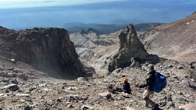
Three novice climbers became stranded overnight after relying on AI to plan their Mount Shasta ascent, veering off route and running low on supplies before rescuers guided them safely down.
(U.S. Forest Service - Shasta-Trinity National Forest.)
The U.S. Forest Service said the group used AI, YouTube and a popular smartphone application to plan the challenging climb, and wound up ill-prepared.
The group relied on artificial intelligence to determine what food to bring and how much food and water they would need for an eight-hour climb versus a 16-hour descent. When they veered far off course on the way down, the climbers found themselves in a dangerous situation in the dark, high in the Cascade Range.
CAN CONCERTS AND SPORTING EVENTS CAUSE EARTHQUAKES?
In hindsight, after all three survived the ill-prepared adventure, in their words, "We relied too much on AI rather than our own critical thinking."
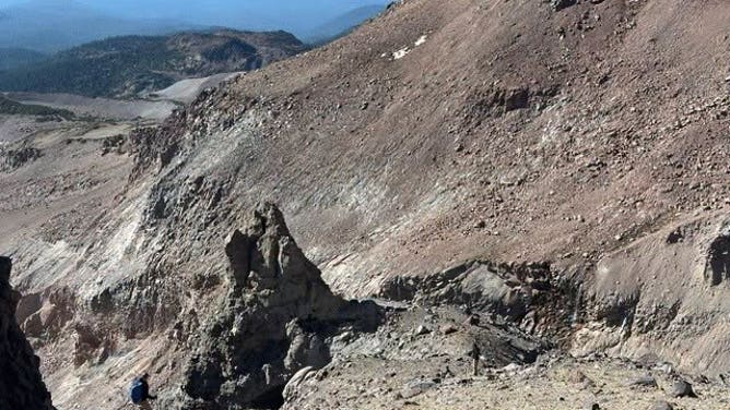
Officials recommend extra food, water, warm clothing, a headlamp and an emergency bivy. The group lacked adequate supplies when forced to spend the night at 11,000 feet.
(U.S. Forest Service - Shasta-Trinity National Forest.)
The journey
The journey began on Aug. 29, when the novice climbers set out from the Clear Creek Trailhead and reached the head springs around 8 p.m., where they established a base camp.
At roughly 3 a.m., the trio set out with enough food and water for an eight-hour climb. After making slow progress, they reached 11,000 feet around 1 p.m., debated whether to turn back and ultimately pressed on.
Two hours later, the party stopped to rest at Mushroom Rock, about 12,800 feet up, where two other climbing groups offered conflicting advice about whether to continue toward the summit.
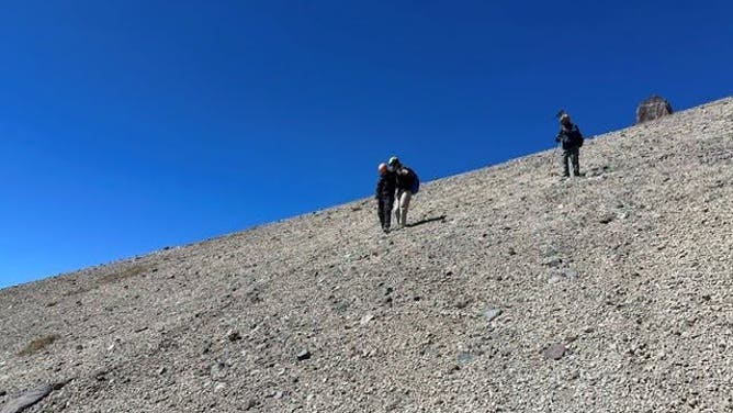
A multiagency rescue effort spanning most of Monday ultimately guided all three climbers safely out of Mud Creek Canyon and back to the Clear Creek Trailhead.
(U.S. Forest Service - Shasta-Trinity National Forest.)
"While resting, they spoke with two other climbing groups, one of which advised that they turn around and another that encouraged them to continue to the summit. The party reported not feeling great, but decided to proceed," a press release from the U.S. Forest Service said.
At 7 p.m., the trio reached the summit of Mount Shasta, a massive stratovolcano that rises 14,179 feet above Northern California’s Siskiyou County at the southern end of the Cascade Range.
TO STUDY CALIFORNIA’S LARGEST ACTIVE VOLCANO, SCIENTISTS FIRST HAVE TO CLIMB IT
Trouble struck on the descent when their navigation phone died and the climbers veered far off route, prompting them to call 911 just an hour after reaching the summit.
Forced to navigate primarily by sight as darkness fell, the trio found themselves in a dangerous situation high in the Cascades.
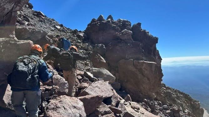
High winds and poor visibility can prevent helicopter operations, as demonstrated when two attempted hoists were abandoned during this rescue.
(U.S. Forest Service - Shasta-Trinity National Forest.)
One climber, who had kept their headlamp packed away to conserve its battery, lost their footing and injured their knee at roughly 11,500 feet before continuing the descent.
Around midnight, the trio stopped at roughly 11,000 feet and settled in for the night, inadequately prepared for the conditions inside remote Mud Creek Canyon — a remote deep glacial canyon on Mount Shasta.
MEET THREEHALVES: THE VIRAL ROBOT DESIGNED FOR EARTH'S MOST DANGEROUS ENVIRONMENTS
"The party was not prepared to spend an open night on the mountain, and lacked adequate food, water, warm layers or an emergency bivy," the press release said.
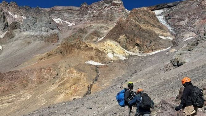
Because there is no marked trail to Mount Shasta’s summit, climbers must rely on their experience, judgment and current conditions to navigate, making a dead phone or failed charger especially dangerous.
(U.S. Forest Service - Shasta-Trinity National Forest.)
Their ill-prepared weekend climb turned into a weekday problem, triggering a multi-agency effort that ultimately brought all three climbers safely down the mountain.
The lesson
The following morning, after spending an ill-prepared night on the mountain, at 9:30 a.m., Forest Service climbing rangers reached the exhausted, hungry and thirsty party of three.
After multiple attempts by the California Highway Patrol to rescue the trio, the airlift was abandoned due to strong winds – and the group decided to descend on their own power with climbing rangers and reached their base camp at the Clear Creek springs around 3 p.m.
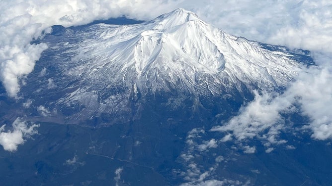
At 14,163-feet, Mount Shasta is the sixth tallest mountain in California, and the largest in the Cascade Range in the Golden State.
(Andy Calvert)
Members of Siskiyou Search and Rescue then helped guide the climbers from base camp to the Clear Creek Trailhead, where the lengthy rescue concluded around 6:30 p.m.
"It’s important to use reliable information sources for climbs like Mount Shasta, and to have backups to any electronic navigation you might use [paper maps of the route are a good choice]. It’s also important to have an established turnaround time and stick to that," the Forest Service said.
ALASKA’S SUICIDE BASIN SHOWS THE HIDDEN DANGER OF GLACIAL LAKE OUTBURST FLOODS
"Finally, on a mountain the size of Mount Shasta, it’s critical to have enough food and water for a long day or two, and to have adequate clothing and supplies in case you have to spend an unexpected night on the mountain," officials said.
For aspiring climbers hoping to conquer California’s largest active volcano, the Mount Shasta Avalanche Center offers essential guidance for planning a safer journey to the summit.