Polar Vortex to bring bone-chilling cold and first significant snow for Interstate 95 corridor this weekend
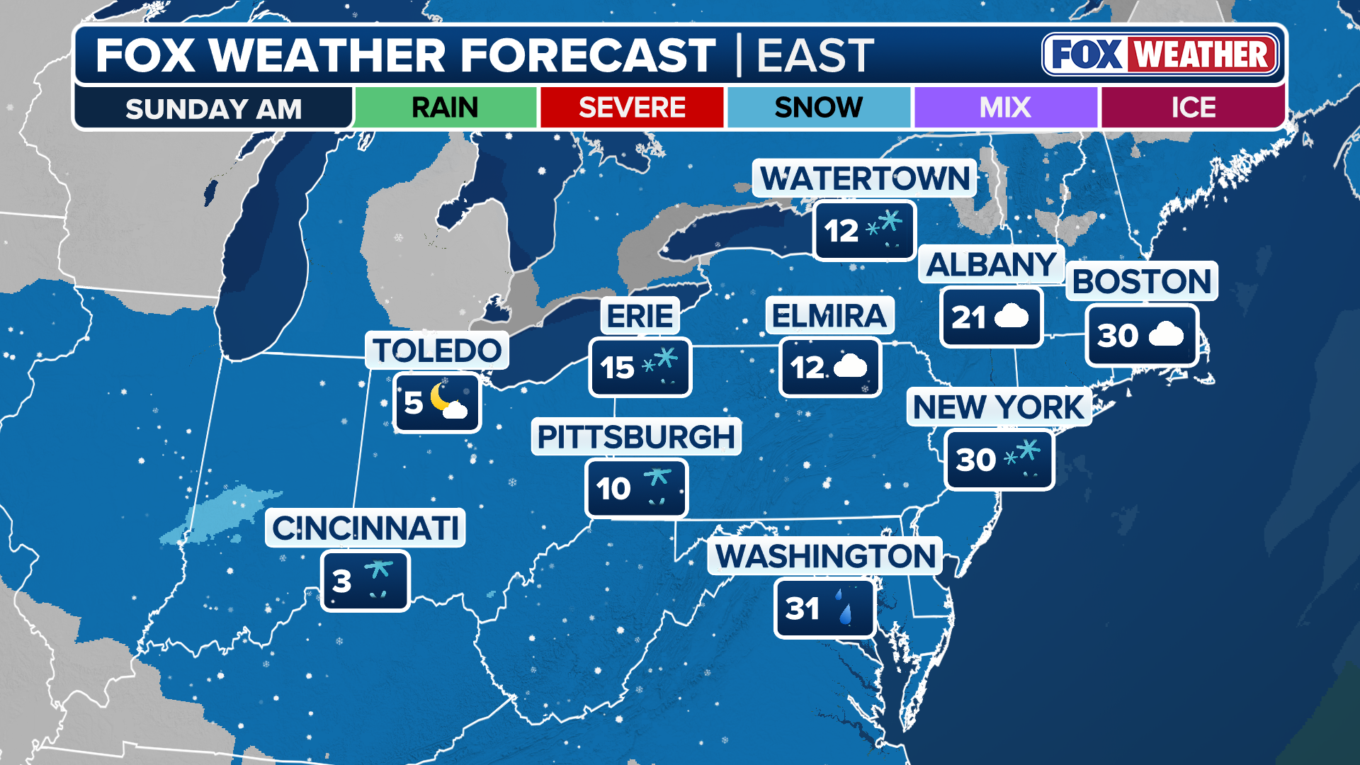
There is still uncertainty regarding where the heaviest snow will track on Sunday but regardless, this will be the first significant snow of the season for the Boston, New York and Philadelphia metro areas.

Polar Vortex expected to issue cold air and snow to parts of the Northeast
Parts of the Northeast - like New York, Philadelphia and Boston - could see their first significant snow of the season this weekend, thanks to a Polar Vortex issuing some cold air and winter weather to the I-95 corridor.
NEW YORK — Another round of bone-chilling air from the Polar Vortex is expected to invade the central and northeastern U.S. this weekend and help produce the first significant snow of the season for parts of the Interstate 95 corridor if this cold air meets up with moisture that is expected to race across the country.
Current computer forecast model guidance suggests that a fast-moving snowstorm will move into the Midwest Saturday and into the Mid-Atlantic and Northeast by Sunday. The speed of the system could limit the overall amount of snowfall along the I-95 corridor and there is still uncertainty regarding where the heaviest snow will track on Sunday.
![Snowy scenes throughout Chicago amid first round of clipper system]() Image 1 of 8
Image 1 of 8Snowy scenes throughout Chicago amid first round of clipper system (FOX Weather Correspondent Robert Ray)
![Snowy scenes throughout Chicago amid first round of clipper system]() Image 2 of 8
Image 2 of 8Snowy scenes throughout Chicago amid first round of clipper system (FOX Weather Correspondent Robert Ray)
![Snowy scenes throughout Chicago amid first round of clipper system]() Image 3 of 8
Image 3 of 8Snowy scenes throughout Chicago amid first round of clipper system (FOX Weather Correspondent Robert Ray)
![Snowy scenes throughout Chicago amid first round of clipper system]() Image 4 of 8
Image 4 of 8Snowy scenes throughout Chicago amid first round of clipper system (FOX Weather Correspondent Robert Ray)
![Snowy scenes throughout Chicago amid first round of clipper system]() Image 5 of 8
Image 5 of 8Snowy scenes throughout Chicago amid first round of clipper system (FOX Weather Correspondent Robert Ray)
![]() Image 6 of 8
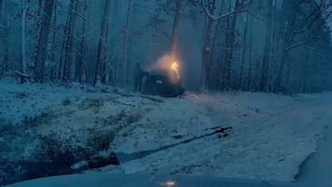
Image 6 of 8Virginia State Police trooper pulls man from burning Tesla in snowy conditions (Virginia State Police)
![]() Image 7 of 8
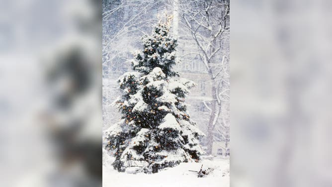
Image 7 of 8Christmas Tree in snow, Manhattan, New York. (Photo by: Joan Slatkin/UCG/Universal Images Group via Getty Images) (Joan Slatkin/UCG/Universal Images Group via Getty Images)
![Snow blankets Roanoke, Virginia on Friday, Dec. 5, 2025.]() Image 8 of 8
Image 8 of 8Snow blankets Roanoke, Virginia on Friday, Dec. 5, 2025. (Jeremy from Roanoke, VA)


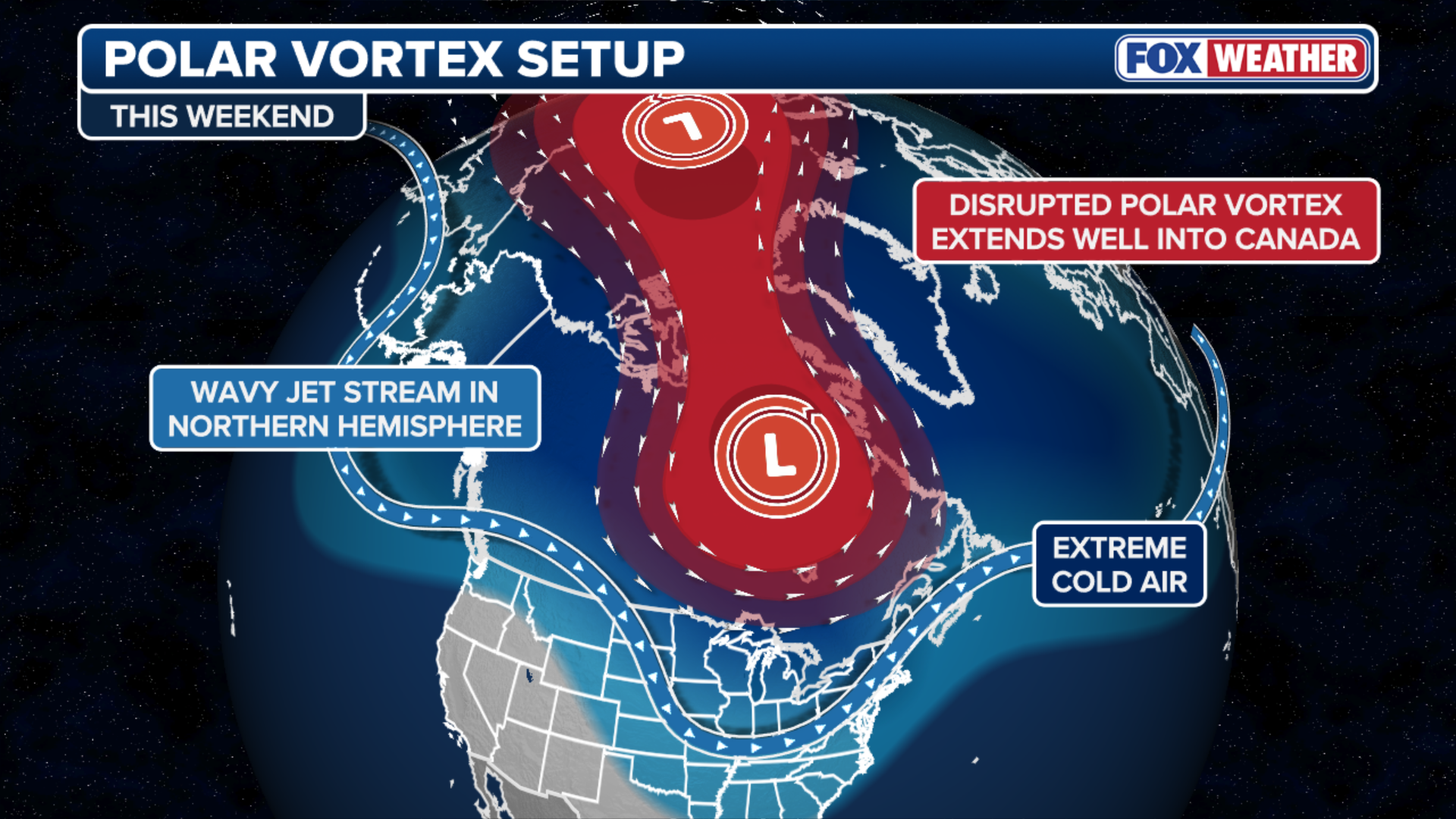
According to the FOX Forecast Center, the circulation of the Polar Vortex will weaken into the weekend, which will allow more cold air to spill into the Midwest and Northeast.
This comes after record low temperatures were already set on Tuesday in New England.
The Polar Vortex is a large, persistent area of low pressure and cold air near the poles and sits about 10-30 miles above Earth’s surface. A strong Polar Vortex keeps the coldest air contained over the arctic circles; a weaker Polar Vortex allows that frigid air to drop into the lowest level of the atmosphere and dips in the Pacific jet stream usher that cold air from Canada into the Lower 48.
(FOX Weather)
The cold arctic air will create prime snow-making conditions for the quick-moving storm system that is currently forecast to move east out of the Northwest.
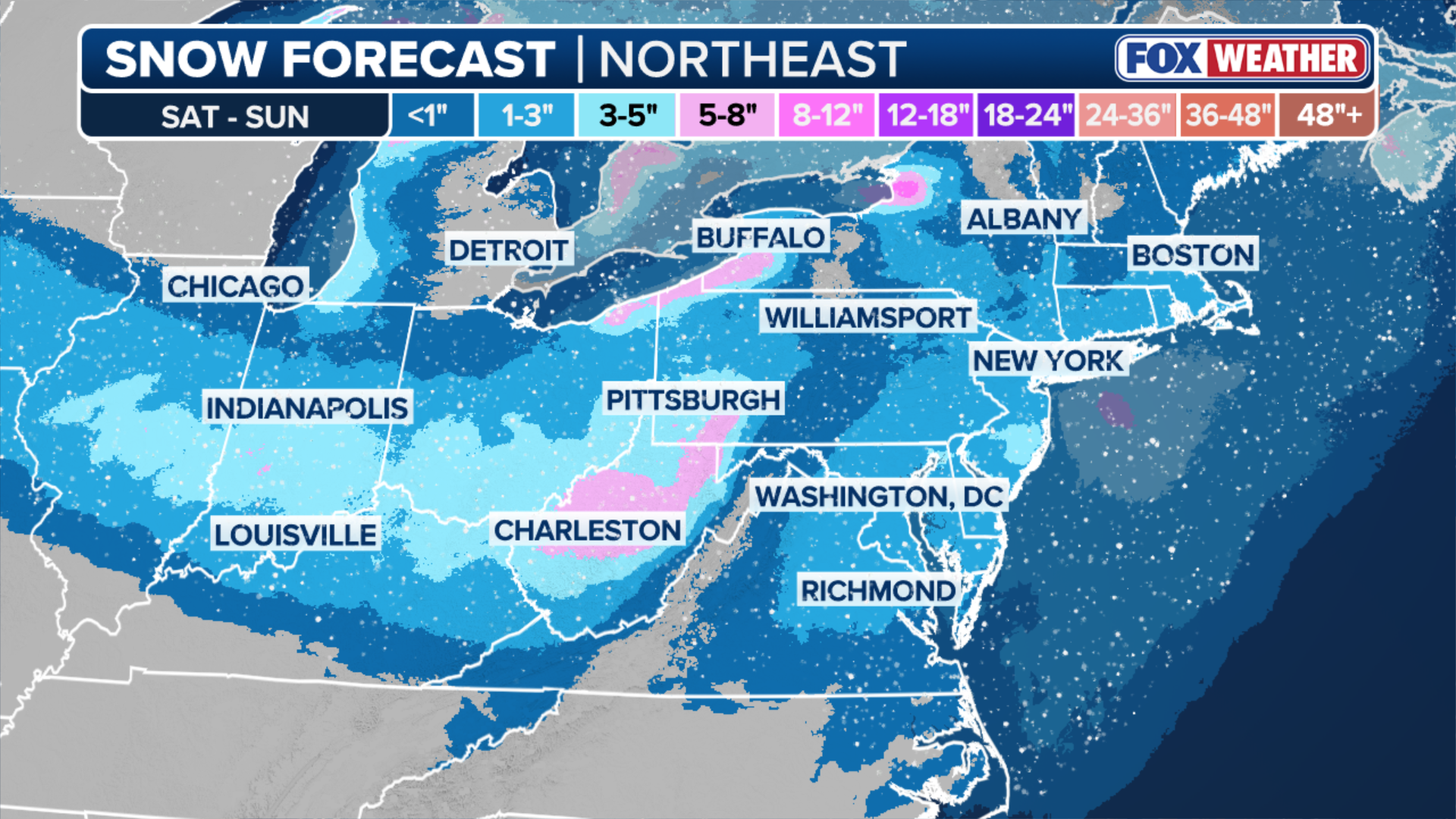
Computer forecast models have come into better agreement that snow will move into the Midwest and the Ohio Valley on Saturday. Indianapolis, Cincinnati and Columbus, Ohio are all expected to see snow yet again on Saturday night, after a previous round of snow on Thursday and Friday.
(FOX Weather)
Snow is expected to move into the Northeast overnight Saturday, with people along the Northeast coast waking up to snow Sunday before the system quickly exits the region as early as Sunday afternoon.
PARADE OF FAST-MOVING CLIPPERS THREATEN MIDWEST AND NORTHEAST WITH MORE SNOW, RAIN AND STRONG WINDS
According to the FOX Forecast Center, a widespread 1–3 inches of snow is expected from Indiana through Ohio and into Maryland, New Jersey, and potentially southern New England through Sunday. Localized pockets of 3–5 inches of snow are possible across central Indiana and Ohio.
(FOX Weather)
Computer forecast model uncertainty remains around the track of the expected snow on Sunday.
A more northerly track would increase snow totals for Boston and southern New England, while a more southerly track could keep the heavier snow confined to Philadelphia and southern New Jersey.
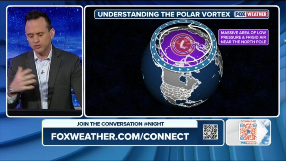
What is the Polar Vortex?
During a significant snowstorm or a freezing cold snap, you may hear the term "Polar Vortex" bandied about. FOX Weather Meteorologist Ari Sarsalari explains what exactly the Polar Vortex is, how it works and how it influences our weather.
Regardless, this will be the first significant snow of the season for the Boston, New York and Philadelphia metro areas.
Those with outdoor weekend plans in the region should stay updated as this forecast becomes further refined.
This latest storm bears out the long-range outlook from NOAA last month that forecast an active start to meteorological winter, due in part to the La Niña climate pattern.
Check back for updates on this developing story.