Oregon faces another stormy day Monday with slight risk of brief tornadoes
Atmospheric conditions remain marginally favorable Monday for creating some rotation as southerly winds at the surface mix with approaching westerly winds aloft, giving a low risk of a waterspouts or weak tornado along the Oregon coast or even into the Portland and Vancouver, Washington area Monday, according to the NWS in Portland.
Another stormy day on tap for the Pacific Northwest
Scattered showers and strong thunderstorms remain in the forecast for Monday in the Northwest, with a low risk of a brief tornado or waterspout west of the Cascades in Oregon.
PORTLAND, Ore. – A potent swirl of low pressure is working its way through the Pacific Northwest to kick off the work week, keeping what had been unsettled and even at times stormy weather over the weekend barreling into Monday.
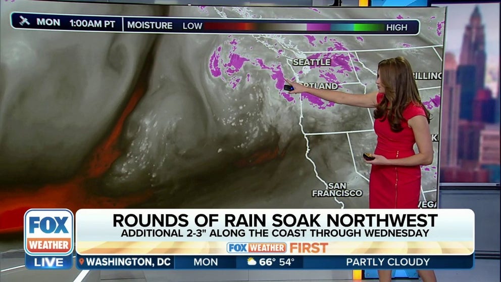
Frequent showers and even scattered thunderstorms dotted western Oregon Sunday with bursts of heavy rain and lightning.
"We have a little bit of a hot mess on our hands," says FOX Weather Meteorologist Britta Merwin. "Big spin of low pressure right offshore producing thunderstorms in the (Sunday) overnight hours, so many of might be tired at work and school Monday as you hear those rumbles of thunder."
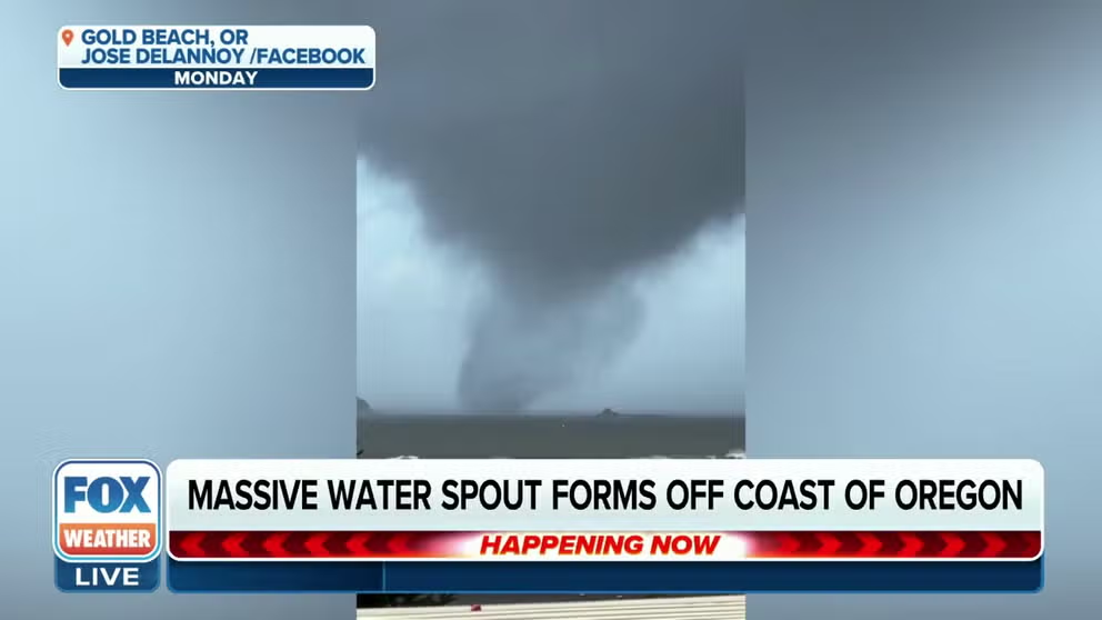
Waterspout sighted off Oregon coast
A large waterspout swirled just off the Oregon Coast near Gold Beach on Monday as rare severe weather swept through region.
Much of the Oregon coast and Interstate 5 corridor was even under a low risk threat of a weak tornado, though none were reported as of early Monday morning.
Still, it remains an active pattern into Monday as the main center of low pressure drifts inland into northern Oregon, with the risk of thunderstorms – some strong – through the day. The primary threats from any thunderstorms are small hail and heavy downpours, in addition to frequent lightning.

(FOX Weather)
However, atmospheric conditions remain marginally favorable Monday for creating some rotation as southerly winds at the surface mix with approaching westerly winds aloft, giving a low risk of a waterspout or weak tornado along the Oregon coast and the Portland and Vancouver, Washington area, according to the NWS in Portland.
HOW TO TELL THE DIFFERENCE BETWEEN A WATERSPOUT AND A TORNADO
"While this (forecast) may sound scary to some, please keep in mind the over 99% of the population will not see or experience a tornado even if one does develop somewhere," NWS Portland forecasters wrote in their Sunday morning weather discussion for their Sunday and Monday forecast. "That being said, people should at least ensure they have a way to receive NWS warnings just in case. It is also worth securing any loose outdoor objects that may easily blow away in the wind."
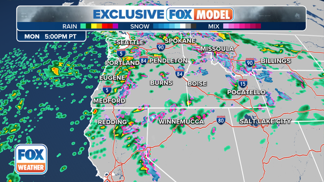
Northwest Forecast for Monday, Nov. 6, 2023.
(FOX Weather)
Oregon placed inside rare severe weather risk zone Sunday
The region had even caught the attention of the national severe storm forecasters at NOAA's Storm Prediction Center, garnering a rare-for-the-Northwest level 1 out of 5 risk of severe weather for Sunday.
THE 5-POINT SEVERE THUNDERSTORM RISK CATEGORY SCALE EXPLAINED
While Level 1 severe weather risks are fairly common across much of the nation during the year, they are rare in the coastal Pacific Northwest, where the cool, marine air inhibits severe weather.
The SPC did not have the Northwest inside any severe weather risk zone for Monday as of early morning.
"Severe weather is possible. We don’t have an official (SPC) outlook, but you can clearly see where the spin is, and this is going to be moving onshore throughout the day (Monday) so it can happen," Merwin said. "We can get waterspouts; we can get hail – it’s all possible with this setup."
A Wind Advisory also remains in effect for the Willamette Valley including the Portland area through Monday evening for potential southerly gusts to 45 mph.
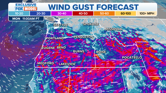
Northwest Wind Gust Forecast for Monday, Nov. 6, 2023.
(FOX Weather)
In addition, soaking rains will tally another 2-3 inches in along the coast through Tuesday night with up to an inch around Portland and Seattle.
Oregon only sees a few tornadoes anywhere in the state each year, and they are typically weak, rating an EF-0 or 1. The state has never had a deadly tornado, though six died in April 1972 when an EF-3 tornado struck just across the Columbia River in Vancouver.
HOW ARE TORNADOES RATED? THE ENHANCED FUJITA SCALE EXPLAINED
Calmer weather is in store for Tuesday and Wednesday as the storm moves out of the region. But being November and traditionally the stormiest month in coastal Northwest, more rain is on the way for later in the week and into the weekend.