What's the difference between a tornado, waterspout, landspout and dust devil?
They both spin from the clouds and swirl on the ground, but there's an important difference that gives each weather phenomenon its unique name.
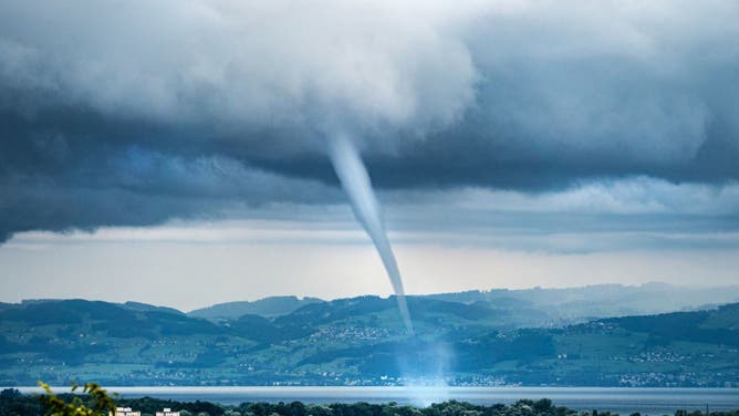
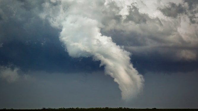
A waterspout sweeps across Lake Constance off Friedrichshafen, Germany.
(Dr. Christoph Sommergruber/picture alliance / Getty Images)
A vast majority of people could correctly identify a tornado if presented with a photo of one, but some funnels mimic tornadoes yet are formed by different processes.
Tornadoes are born from supercell thunderstorms containing descending currents of relatively cold, dense air, known as downdrafts. These downdrafts help a developing tornado maintain its rotation while also pushing it downward toward lower altitudes.
THIS IS A LIFE CYCLE OF A TORNADO
The rotation can eventually become so concentrated that a narrow column of violently rotating air develops, creating what's known as a funnel cloud. If the funnel cloud stretches far enough down that it reaches the ground, it becomes a tornado.
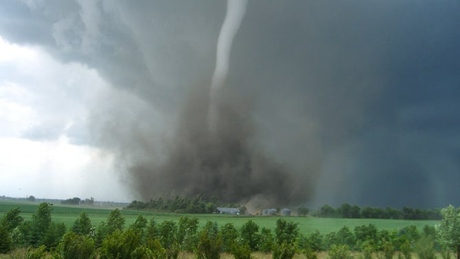
NOAA image of a tornado
Waterspouts: Tornadoes over water
If you've heard of warnings or boaters talking about waterspouts – simply put, a waterspout is just a tornado that is occurring over water. It becomes reclassified as a tornado if a waterspout comes ashore and begins to track across the land.
HOW TO WATCH FOX WEATHER ON TV
But there are two types of waterspouts -- one more dangerous than the other.
"Tornadic waterspouts" form from severe thunderstorms just like their tornado cousins. They can accompany strong winds, locally high seas, frequent lightning, and large hail, and are quite dangerous to mariners suddenly caught in their path.
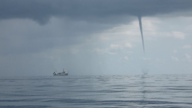
Waterspout swirls in the Gulf of Mexico near a NOAA ship in 2009.
(Melody Ovard / NOAA)
Then there are "fair weather" waterspouts, which form only over open water.
"They develop at the surface of the water and climb skyward associated with warm water temperatures, and high humidity in the lowest several thousand feet of the atmosphere," says Meteorologist Bruce B. Smith with the National Weather Service office in Gaylord, Michigan. "They are usually small, relatively brief, and less dangerous."
Waterspouts can be seen over any large bodies of water but are somewhat common sightings in Florida from late spring into early autumn. They can also be found quite frequently in the Great Lakes from August through October.
The National Weather Service recommends any boaters who spot a waterspout of either kind move at a 90-degree angle away from the waterspout's path.
What is a landspout?
If a funnel cloud that touches down over land is called a tornado and a waterspout is a tornado over water, then what is a "landspout"?
Funnel cloud that became landspouts form in Sully County, South Dakota
(Sully County Emergency Manager/Sheriff's deputy via National Weather Service, Aberdeen, S.D.)
Landspouts are a type of tornado that forms in a different way. Classic tornadoes form in supercell thunderstorms that contain their own rotating updraft.
Landspouts occur when you have colliding winds at the surface that will begin to make their own vortex, and then a developing thunderstorm passes overhead.
Updrafts from the passing thunderstorm will pull this rotating vortex skyward and make a tornado-like appearance.
Landspout tornado pictured on May 16, 2017 in Elk City, Oklahoma.
(Jason Weingart / Barcroft Images / Getty Images)
Landspouts tend to be pretty weak compared to traditional tornadoes but can still be strong enough to cause damage and warrant caution.
Gustnadoes: Not a tornado, but it sure looks like one…
Did you know that there are multiple types of tornadoes? Visit https://t.co/sOfDeUx2w0 for more info. #WeatherReady pic.twitter.com/bcukUlmZ2A
— NWS Owlie Skywarn (@NWSOwlieSkywarn) June 18, 2021
There are three other wind phenomenon that involves swirling columns of air but are not considered tornadoes.
"Gustnadoes" form at the head of a gust front and are just swirls of dust and/or debris from strong winds that race out ahead of a thunderstorm’s intense downdraft. They do not connect to cloud bases and do not have a traditional condensation funnel.
Dust devils: Another tornado lookalike
On the other hand, dust devils typically form in fair weather on sunny and hot days with light winds.
Intense heating along the ground causes a vast difference in temperature within a few hundred feet. The heated air, now quite buoyant, will shoot upward, with surface winds providing some spin.
Dust devils usually only last a few minutes and have low enough wind speeds to rarely cause damage.
Fire Whirls: Dust devils that get fired up
Perhaps the most apocalyptic version of a funnel beside a tornado would be fire whirls — which are similar to dust devils but driven by heat from a wildfire.
Here is a video of a fire whirl from the #TennantFire on June 29th. After a survey from the IMET, this was likely the rotation our radar was picking up on the 29th. Credit to the US Forest Service for taking this video. #CAwx #fire #fireseason pic.twitter.com/MMQLguZAZR
— NWS Medford (@NWSMedford) July 7, 2021
The rising air from the wildfire’s intense heat creates a column of hot air and flames that rise towards the sky, and like dust devils, winds along the surface can provide the spin.
Video from the #Chaparralfire burning in Riverside and San Diego counties shows the conditions that firefighters are facing in the 2021 fire season. Do your part to prevent wildfires. #California #CALFIRE #Wildfire #OneLessSpark #Prevent Video credit: Jeff Hall pic.twitter.com/ZDfYSV8y5L
— CAL FIRE (@CAL_FIRE) August 29, 2021
NOAA researchers say the most favorable condition for fire whirlwinds is over a fire near the top of a steep slope with strong winds over the ridge top.