New England braces for more rain and strong winds after weeks of soaking storms
After a relatively dry morning on Sunday, widespread showers will develop by the afternoon, fueled by an incoming disturbance and cold temperatures aloft.

Late spring showers and cool air linger across the Northeast
Late spring storms and cool air linger across the Northeast with additional showers potentially lasting through Monday. Showers could dump pea-sized hail in the region. FOX Weather Meteorologist Michael Estime has the latest forecast.
It has been a spring filled with rain, storms, cool temperatures and overall gloomy weather for the Northeast and New England, and unfortunately, the last weekend in May continues the trend with rain, gusty winds and cool temperatures.
There have been more rainy weekends than not this spring, with some cities in New England having seen double-digit precipitation totals since March 1.
Since the start of meteorological spring on March 1, Boston has recorded precipitation for 10 out of 13 weekends. This weekend marks the 11th.
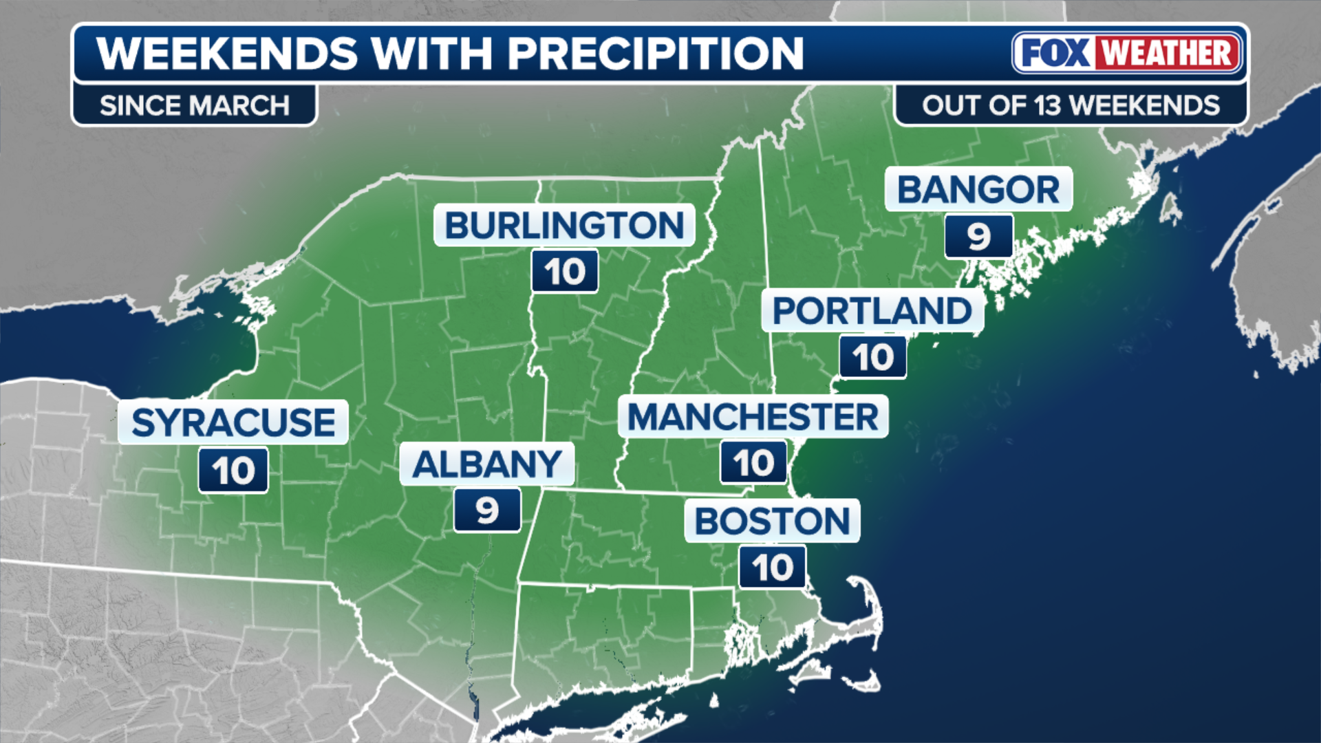
(FOX Weather)
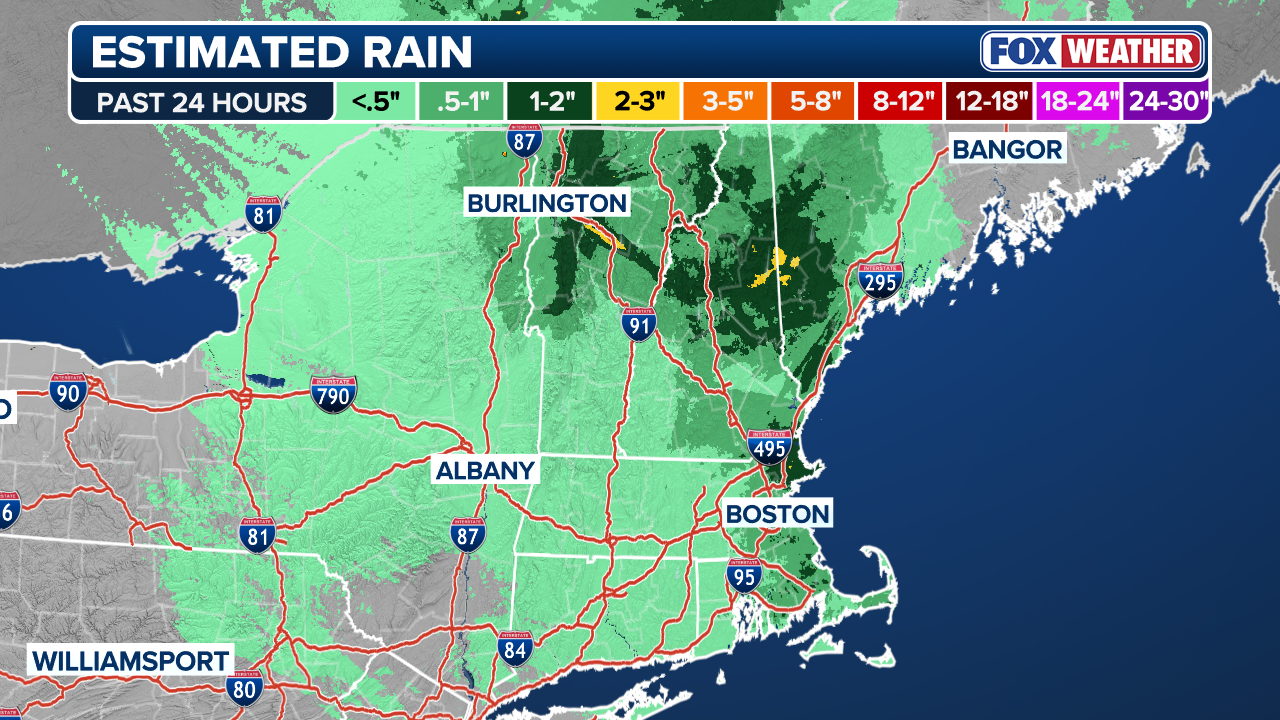
The FOX Forecast Center said this rainy pattern isn't letting up quite yet, with another widespread 1 to 2 inches of rain possible in parts of New England for the final weekend before the start of meteorological summer begins tomorrow.
JUNE SKYWATCHING GUIDE: FROM PLANET CONJUNCTIONS TO NEW MOONS, HERE IS WHAT TO LOOK UP FOR
An Omega block pattern allows for an area of low pressure to move into New England from southeastern Canada.

PORTLAND, ME - NOVEMBER 13: Pedestrians on Congress Street in the rain seen through a rain-coated bus stop window on Tuesday, November 13, 2018.
(Brianna Soukup/Portland Portland Press Herald / Getty Images)
On Saturday, Boston endured tropical storm-force winds with wind chills dipping into the upper 30s.
Power outages peaked at over 30,000 across New England, and a staggering half-foot of snow blanketed the highest peaks of Vermont and New Hampshire, including Mount Washington.
SEVERE STORMS REIGNITE ACROSS THE PLAINS WITH POTENTIAL FOR LARGE HAIL AND DAMAGING WINDS
The heaviest rain fell across Maine and into New Hampshire on Saturday.
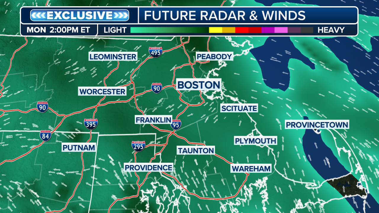
Another disturbance dropping out of Canada will cross New England on Sunday.
(FOX Weather)
After a relatively dry morning, widespread showers will develop by the afternoon, fueled by an incoming disturbance and cold temperatures aloft.
A few of the stronger storm cells could even contain lightning and small, pea-sized hail.
FLASH FLOOD THREAT CONTINUES ACROSS FLORIDA, SOUTHEAST AS TROPICAL DOWNPOURS BRING DROUGHT RELIEF
Gusty winds are expected to remain on Sunday. Wind gusts nearing 50 mph are likely across eastern New England as low pressure quickly moves offshore later Saturday evening.
(FOX Weather)
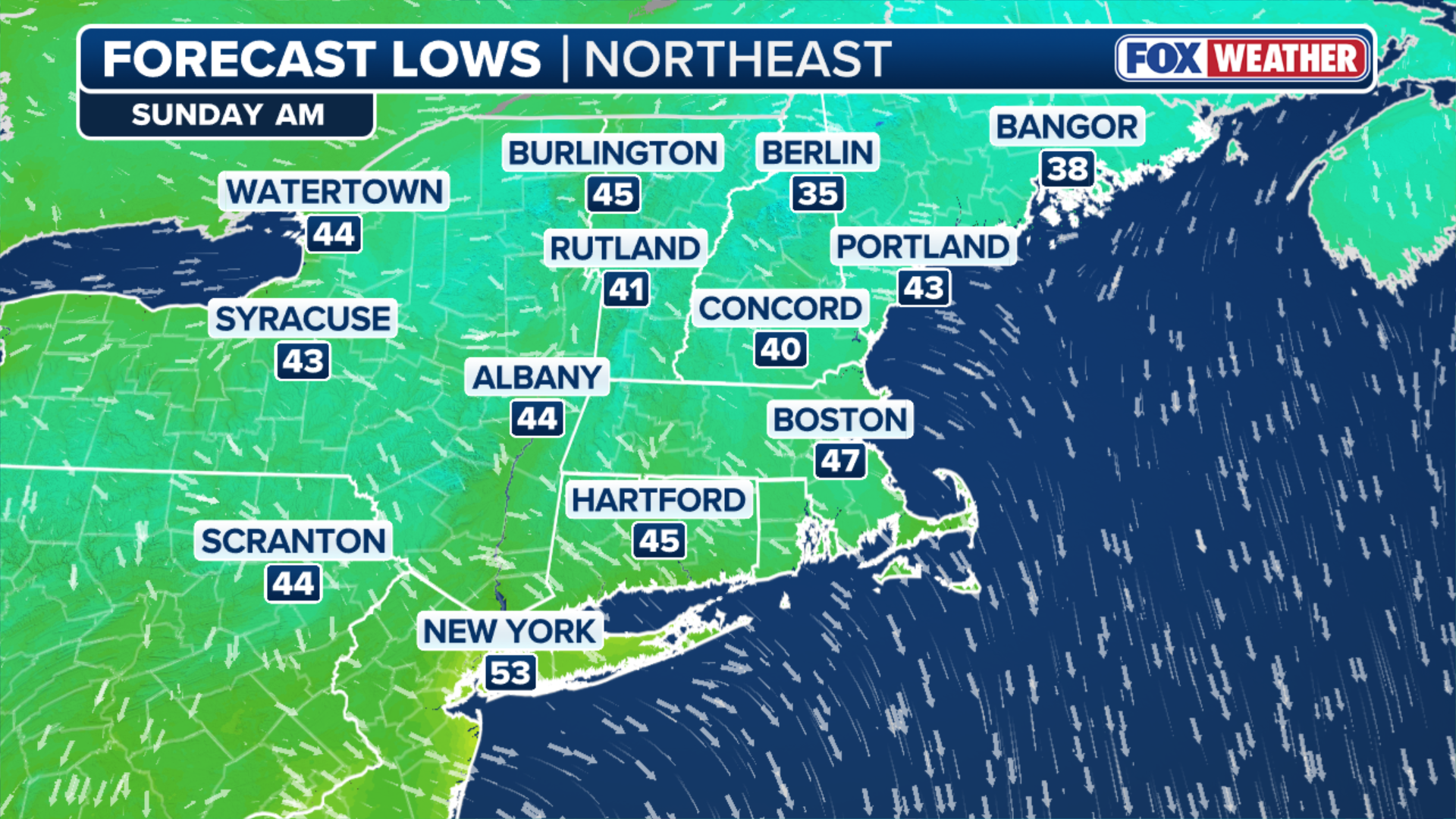
Morning low temperatures early Sunday could fall into the mid to lower 40s, with even temperatures in the mid-30s possible across the higher terrain of New Hampshire and Maine.
COULD SMELLY SARGASSUM BECOME THE NEXT FOOD PRODUCT?
Some precipitation will once again transition to snow on the highest peaks, threatening another winter-like coating for Mount Washington and the northern White Mountains.
(FOX Weather)
Looking farther ahead, this gloomy weekend pattern may finally begin to break down, the FOX Forecast Center said.
The Climate Prediction Center's eight to 14-day temperature and precipitation outlooks highlight above-average temperatures and below-average precipitation heading into the first week of June.