Vicious windstorm knocks out power to over 1 million Americans, unleashes travel chaos amid 100+mph gusts
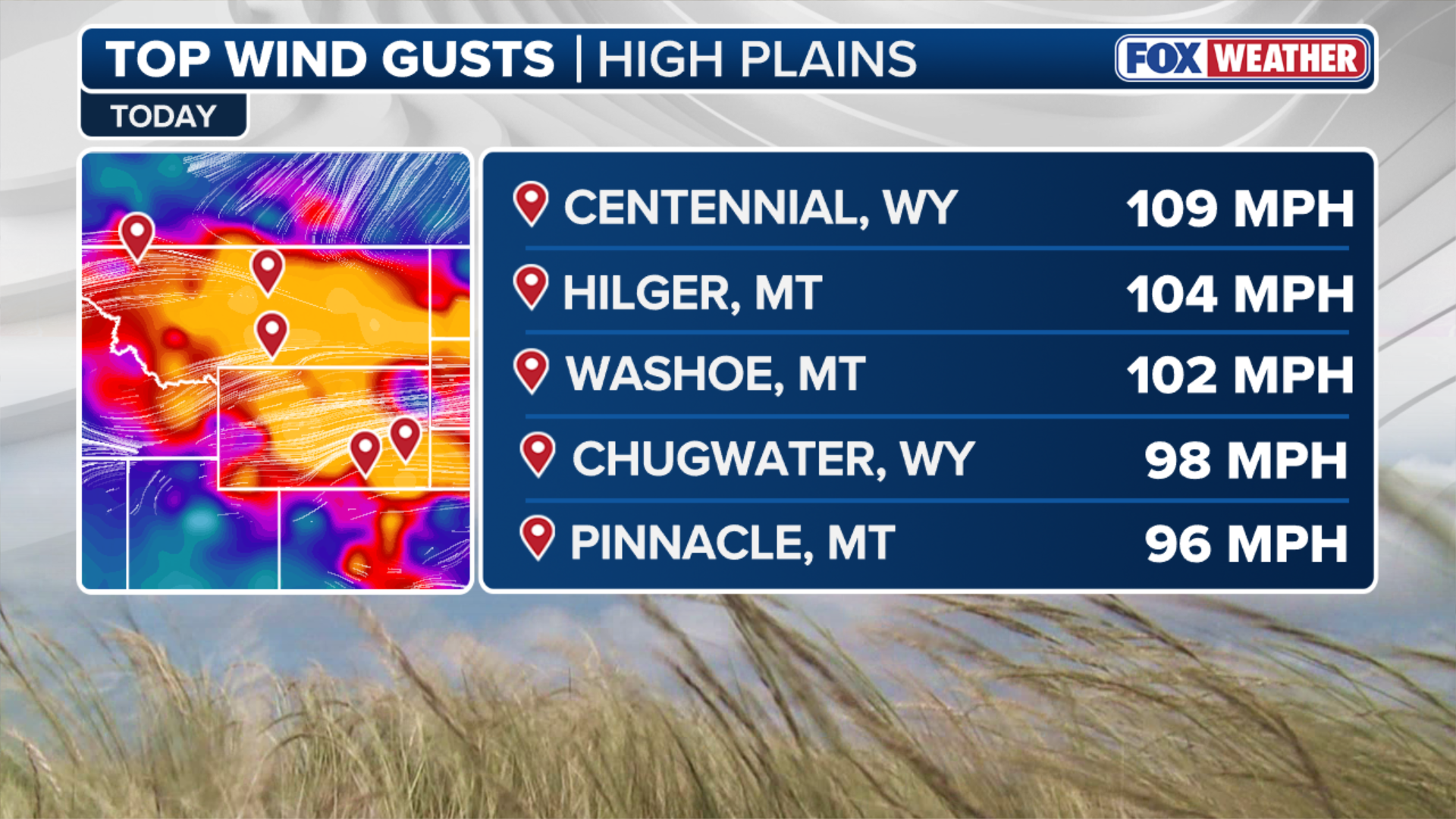
Even more intense wind gusts were recorded Thursday, where wind speeds topped triple-digits in parts of the Northern Plains Thursday. A 92 mph gust recorded in Cheyenne, Wyoming set a new daily record.
Powerful clipper triggers 1,000+ miles of wind alerts, more than 90K customers without power
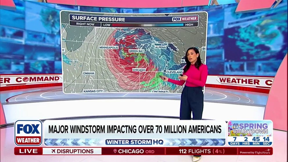
An intensifying clipper is moving across the Upper Midwest, the Great Lakes and the Ohio Valley, packing wind gusts that could exceed 75 mph for more than 70 million people. More than 90,000 customers were without power across the region early Friday and strong winds caused significant air travel delays. The strong wind will reach the interior Northeast and New England through the day Friday. Winds will briefly die down before ramping up again Saturday night when a second winter storm moves into the Midwest.
An intensifying clipper is moving across the Upper Midwest, the Great Lakes and the Ohio Valley Friday, packing wind gusts that could exceed 75 mph for more than 70 million people. At the storm's peak, over 1 million customers were without power in Minnesota, Wisconsin, Illinois and Michigan on Friday.
Strong gusts caused significant air travel delays originating in major Midwest hubs. More than 230 flights were delayed into or out of Chicago O'Hare International Airport by mid-morning.
WHAT YOU SHOULD KNOW ABOUT HIGH WIND WARNINGS

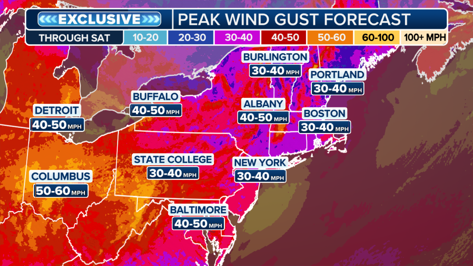
(FOX Weather)
Chicago, Minneapolis, Milwaukee are all under High Wind Warnings through much of Friday afternoon, as the strongest winds howl into the Ohio Valley and interior Northeast.
Even more intense wind gusts were recorded Thursday, where wind speeds topped triple-digits in parts of the Northern Plains Thursday. A 92 mph gust recorded in Cheyenne, Wyoming set a new daily record.

Wind shreds salt shed in Livingston, Wyoming Thursday.
(Wyoming Department of Transportation/Facebook / FOX Weather)
Winds reached 109 mph in Centennial, Wyoming and 104 mph in Hilger, Montana.
The intense winds shredded a salt shed in Arlington, Wyoming Thursday and topped trucks on Interstate 70 and another highway in Jefferson County, Colorado.
WATCH: COLORADO HIGHWAYS CLOSE AFTER EXTREME WINDS BLOW DUST AND TOPPLE SEMI TRUCKS
(FOX Weather)
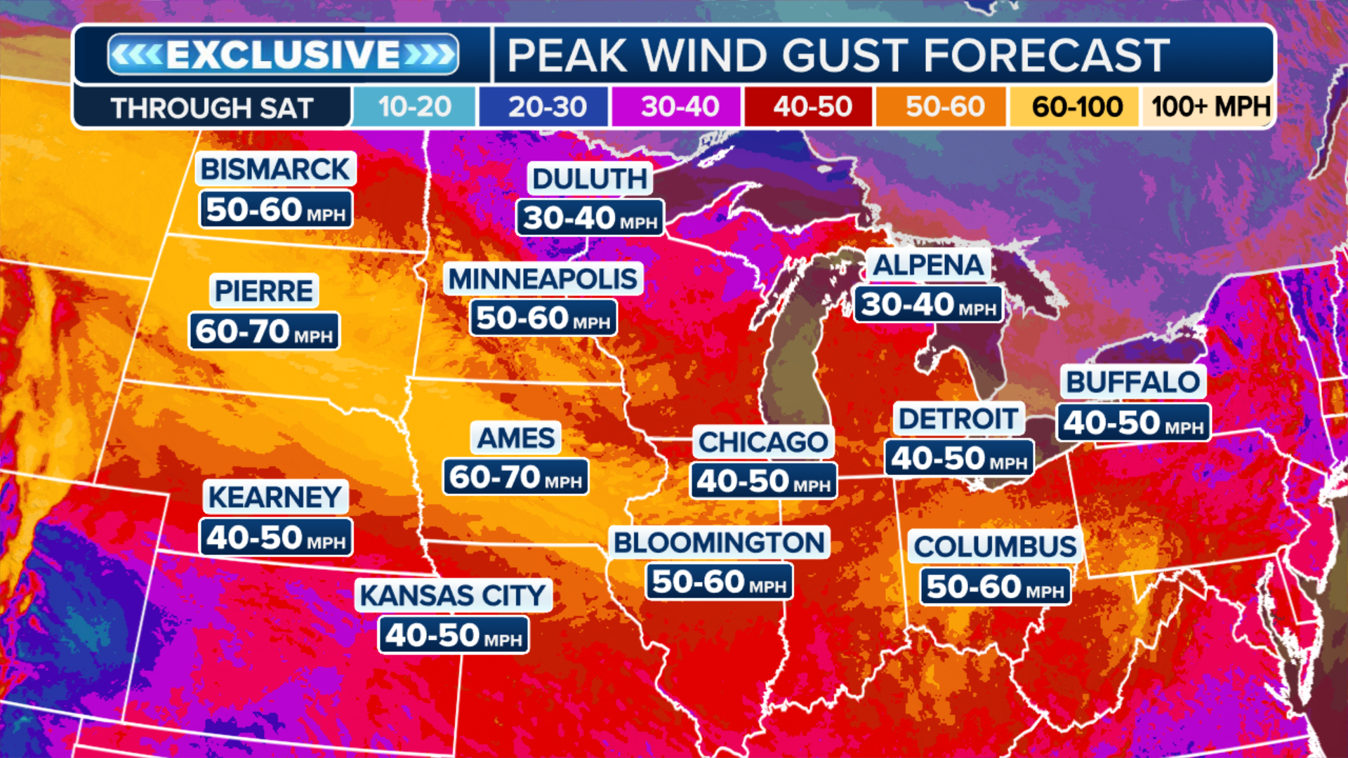
The vicious winds are a result of rapidly intensifying low pressure at the center of the clipper. This steep pressure drop causes air to rush in behind the system as it races eastward.
RECORD-BREAKING 252 MPH WIND READING VERIFIED FROM HISTORIC HURRICANE MELISSA
The storm is the first of two systems to sweep across the North over the coming days, according to the FOX Forecast Center.
(FOX Weather)
According to the FOX Forecast Center, the wind field broadened on Friday, bringing 50 to 60 mph gusts to cities like Louisville, Columbus and Pittsburgh.
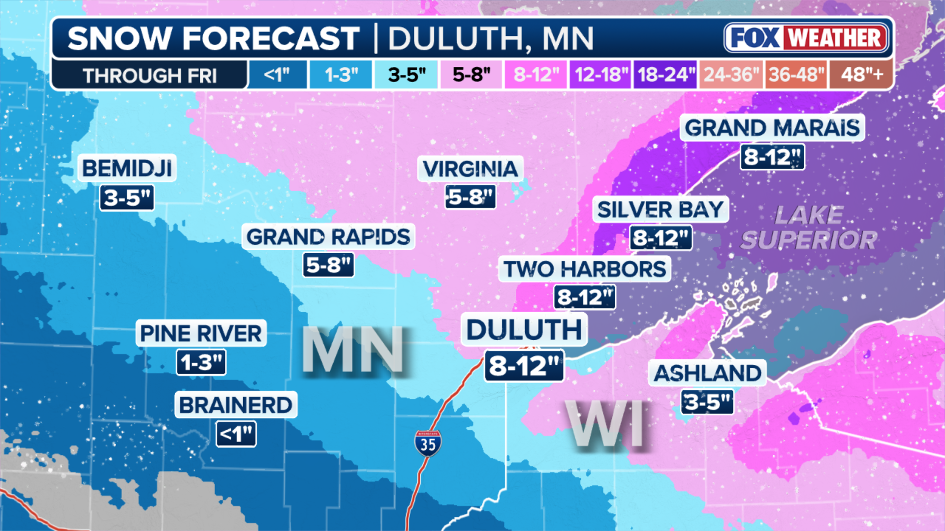
The snow associated with the clipper will stay mostly north of Interstate 94, where the combination of wind and snow will likely lead to brief, but intense periods of whiteout driving conditions.
(FOX Weather)
Snow totals could reach 5 to 8 inches primarily north of Interstate 94. The heaviest snow will be confined to the Great Lakes, where over a foot of snow is possible.
WHAT YOU SHOULD KNOW ABOUT BLOWING, DRIFTING SNOW
(FOX Weather)
Windy conditions will remain across the eastern third of the country through the start of the weekend.
Winds will briefly die down before ramping up again Saturday night when the second winter storm moves into the Midwest.