Winter storm slams millions across Northern Plains, Upper Midwest as blizzard conditions snarl travel
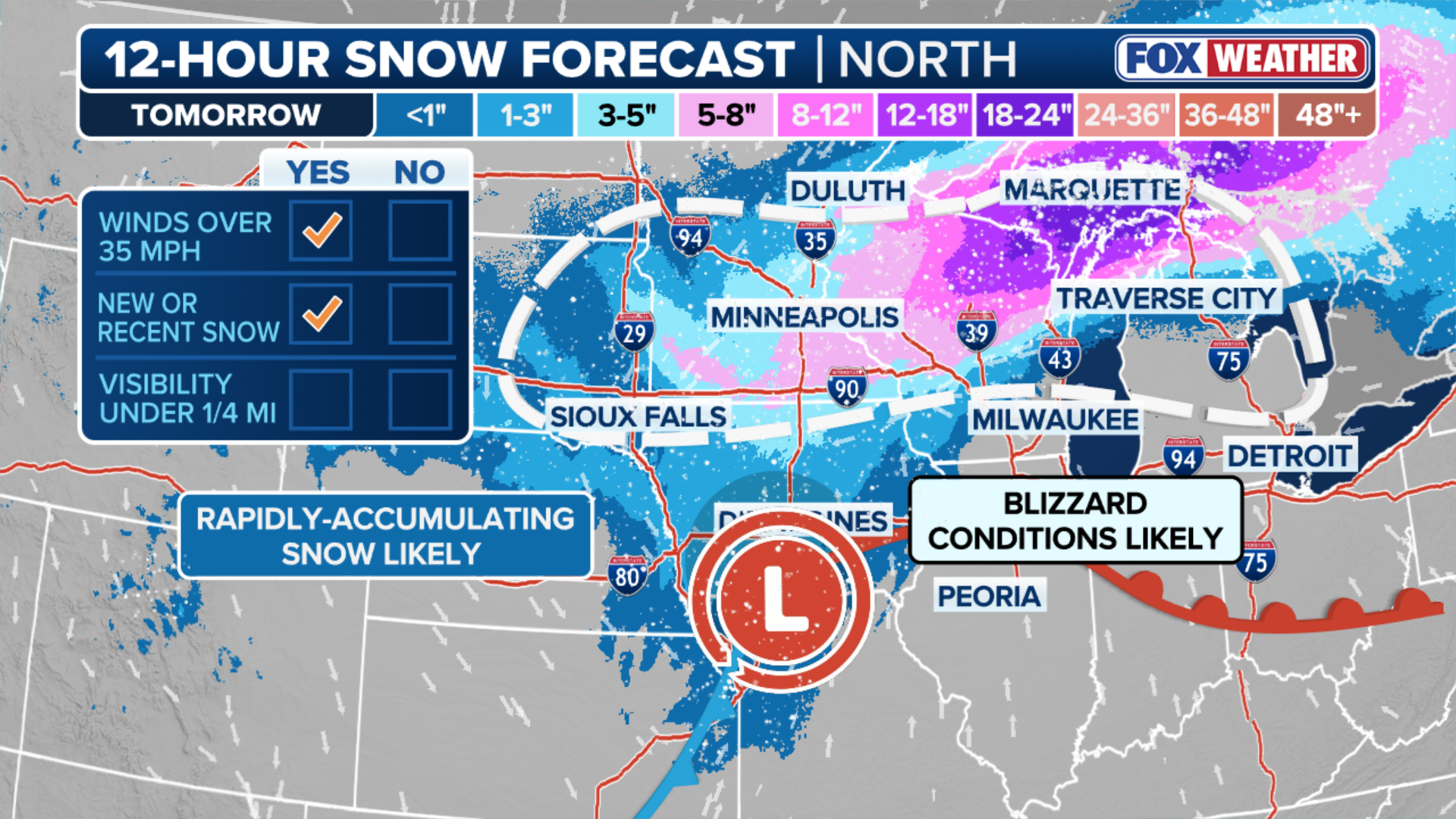
All told, more than two feet of snow could fall across parts of Wisconsin and Michigan through Monday, with more than a foot possible for other parts of the Upper Midwest as well as the Northern Plains and New England.
Winter storm slams millions across Plains, Midwest as blizzard conditions snarl travel
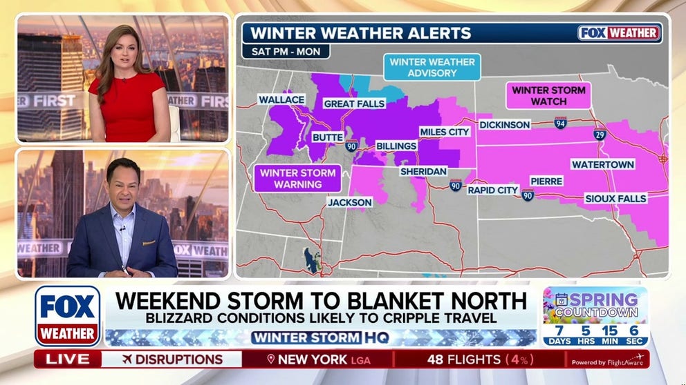
A potent clipper out of the northwest is dropping snow and packing wind gusts of 60-70 mph across Minnesota, Illinois and Iowa Friday, where High Wind Warnings are in effect. Blizzard conditions were reported in Grand Forks, North Dakota early Friday. This winter system will move into the Great Lakes through the day. 5-8 inches of snow accumulation is expected mainly north of the Interstate 94 corridor. Behind this storm, a second system will also begin to traverse the Midwest and Great Lakes on Saturday, blasting those regions with even more snow and blizzard conditions through Monday.
A potent clipper out of the northwest is blasting millions across the Upper Midwest with snow and powerful wind gusts, creating dangerous road conditions and contributing to thousands of air travel delays across the country.
Behind this storm, a second system will also begin to traverse the Midwest and Great Lakes on Saturday — packing an even more intense punch of snow and blizzard conditions through Monday.
MAJOR STORM TO BRING TRIPLE-DIGIT WIND GUSTS TO MILLIONS OF AMERICANS ACROSS 2,000+ MILES
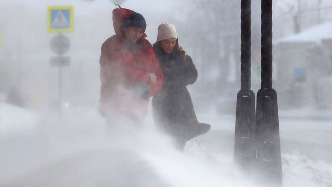
People walk in a street during a snowstorm.
(Nail Fattakhov\TASS via Getty Images / FOX Weather)
This comes immediately following an early March warmup that shattered hundreds of temperature records across most of the country.
First storm: Friday
Friday's clipper is an extension of the atmospheric river that is currently impacting the Pacific Northwest. The storm is expected to deliver wind gusts between 60–70 mph across Minnesota, Illinois and Iowa, which have been placed under High Wind Warnings through Friday.
AT LEAST 1 DEAD, MORE THAN 87,000 WITHOUT POWER AS ATMOSPHERIC RIVER BLASTS NORTHWEST
Blizzard conditions were reported in Grand Forks, North Dakota and Duluth, Minnesota early Friday.

(FOX Weather)
This winter system will move into the Great Lakes through the day. Between 5 and 8 inches of snow accumulation is expected mainly north of the Interstate 94 corridor, where periods of whiteout driving conditions are expected.
HURRICANE SEASON 2026: THESE ARE THE STORM NAMES YOU'LL SEE THIS SEASON
Blizzard Warnings are in effect for the lakeshore regions of Lake Superior in Minnesota.
Lighter snow is expected to reach the interior Northeast and New England later Friday and Wind Alerts have been issued for parts of western New York.
Thousands of flights were delayed early Friday with more disruptions mounting at Minneapolis and Chicago airports.

(FOX Weather)
Second storm: Saturday night through Monday
A second storm is expected to form Saturday and begin to track into the Midwest and Great Lakes Saturday night.
According to the FOX Forecast Center, with high pressure remaining anchored over Canada, much colder air will be ushered in behind this strengthening area of low pressure. This colder air will allow precipitation across the Midwest to fall as snow and will likely expand into the Great Lakes region by Sunday.
HOW HIGH PRESSURE AND LOW PRESSURE DRIVE THE WEATHER
(FOX Weather)
As the low moves east into the Great Lakes, heavy snow is likely to break out across the Upper Midwest and northern Great Lakes.
Limited visibility is likely due to blowing moderate to heavy snow, which could lead to blizzard conditions across Minnesota, Wisconsin and northern Michigan. This includes cities such as Minneapolis, Marquette, MI and Green Bay, WI.
All told, more than 2 feet of snow could fall across parts of Wisconsin and Michigan through Monday, with more than a foot possible for other parts of the Upper Midwest as well as the Northern Plains and New England.
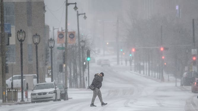
People commute in downtown Milwaukee as Wisconsin braces for a winter storm that in the coming days could bring blizzard conditions, causing possible power outages, and make holiday travel conditions dangerous.
(Alex Wroblewski for The Washington Post via Getty Images / Getty Images)
Northern portions of New York and New England could see some snow as well, starting late Sunday into early Monday.
A blast of arctic air will move in after the second storm, impacting the Upper Midwest all the way down into the Tennessee Valley, preventing snow from melting for several days.