Winter Storm Warning issued in Hawaii as Kona Low drenches state with brewing flood threat, snow
A strengthening Kona low will cause periods of heavy rain and thunderstorms across the islands of Hawaii while significant snow and ice are expected at higher elevations on the Big Island.
Kona Low to soak Hawaii, triggers statewide flood watch
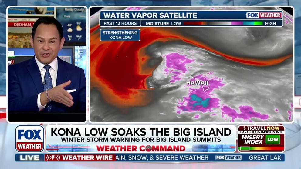
An area of low pressure is just northwest of Hawaii, bringing rounds of heavy rain across the state. A Flood Watch remains in effect through Monday afternoon. The greatest risk for heavy, prolonged rain continues across southeast to south-facing mountain slopes of the Big Island and Maui County. A Winter Storm Warning is in effect for the Big Island summits through early Tuesday morning.
HONOLULU – Active winter weather is strengthening across Hawaii as a powerful, cold low-pressure system develops through early Tuesday, bringing heavy rain, thunderstorms, and winter conditions.
The low-pressure system, known as a Kona low, is currently located just to the northwest of Hawaii and is drifting south while an active associated rainband drapes across the islands.
The National Weather Service (NWS) warned Monday that rapid runoff from the rain could cause significant urban flooding as well as landslides.

(FOX Weather)
Within the next few days, a persistent southeasterly flow will continue to push deep tropical moisture across the mountain slopes of the Big Island and Maui County, creating a risk for heavy, prolonged rain across the area.
The FOX Forecast Center says thunderstorms remain possible as the cloud band associated with the Kona low moves across the state.
YEAR IN REVIEW: THE MOST DRAMATIC VOLCANIC ERUPTIONS IN 2025
1 to 2 inches of rain are expected through midweek, with pockets of up to 8 inches possible on some of the southern and eastern slopes of the Big Island and Maui, as the system interacts with Hawaii's tall mountains.
A Flood Watch will remain in effect for most of the state through Monday afternoon.
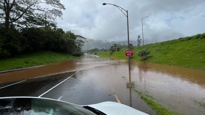
Flash flooding on Oahu during heavy rain on May 13, 2024.
(Hawaii Department of Transportation / FOX Weather)
In addition to heavy rain, a Winter Storm Warning is in effect through early Tuesday morning for the summits of the Big Island.
The falling temperatures at the summits, combined with the tropical moisture, will create ideal conditions for accumulating snow and ice. This type of precipitation will cause significant icing on the summits' roadways.
The FOX Forecast Center predicts up to six inches of snow is likely.

(FOX Weather)
In addition to the snow and ice, high wind conditions are expected at the summits, with wind gusts of 50–60 mph and occasional gusts up to 75 mph possible at lower elevations.
All these factors combined will greatly reduce visibility, with near-zero visibility possible at times.

FILE -Drone video captures flooding in Hawaii
FILE - Drone video from the county of Maui shows extensive flooding in the aftermath of a powerful storm that struck the island chain on Thursday.
By midweek, the Kona low will weaken as it drifts west of the state, but a weak, mild disturbance is expected to move in later in the week, bringing more precipitation.