Tropical Atlantic becoming more active with 3 other systems as deadly Hurricane Fiona intensifies
Gaston and Hermine are the next two names on this year's naming list for Atlantic tropical storms and hurricanes.
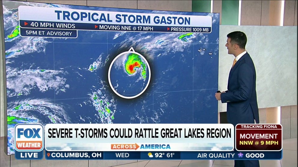
Tropical Storm Gaston forms in central Atlantic
Tropical Storm Gaston forms in the central Atlantic with maximum sustained winds of 40 mph.
While the focus has been on Hurricane Fiona as the strengthening Category 3 hurricane batters the Turks and Caicos Islands after bringing torrential rain and high winds to Puerto Rico and the Dominican Republic, there are three other systems in the Atlantic that the FOX Forecast Center is keeping an eye on.
HOW TO WATCH FOX WEATHER ON TV

(FOX Weather)
Tropical Storm Gaston formed Tuesday afternoon southwest of the Azores, an archipelago in the eastern Atlantic Ocean.
The FOX Forecast Center expects it to move northward through Tuesday night, then turn toward the northeast on Wednesday and eventually the east later this week.
WHAT'S THE DIFFERENCE BETWEEN A TROPICAL DEPRESSION VS. TROPICAL STORM VS. HURRICANE?

(FOX Weather)
The FOX Forecast Center is also keeping a close eye on a tropical disturbance in the central tropical Atlantic that’s expected to organize as it eyes the Caribbean Sea.
This tropical disturbance has been dubbed Invest 98L by the NHC.
An invest is simply a naming convention used by the NHC to identify an area of weather that it is investigating for possible development into a tropical depression or tropical storm within the next five days.
This disturbance could possibly strengthen into Tropical Storm Hermine in the next several days.

(FOX Weather)
A tropical cyclone receives a name when it organizes into a tropical storm with maximum sustained winds of at least 39 mph.
There is a fourth area near Africa that the NHC has given a low chance of development during the next five days.