Experts provide first glimpse of potentially another busy Atlantic hurricane season
The experts at Colorado State University will release its first outlook for the 2022 hurricane season on April 7
The Atlantic hurricane season could be headed for a record seventh back-to-back season with above-average activity if an outlook released by European forecasters verifies.
The European Centre for Medium-Range Weather Forecasts' long-range outlook, which runs through the peak of the tropical weather season, shows cyclone energy in the basin could be around 120 percent of normal.
While the center does not break down how many cyclones they expect to form, the expected Accumulated Cyclone Energy can give forecasters clues on how busy the season could be.
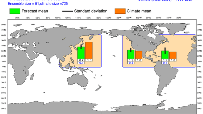
Above-average tropical cyclone energy is expected in the Pacific and Atlantic.
(ECMWF)
ACE is a metric that quantifies how much energy a tropical cyclone uses during its lifetime.
The more prolonged and intense a tropical cyclone is, the higher the ACE value that will accumulate.
The ACE produced during the 2021 season was 142, or around 151 percent of the long-term mean, from the years 1951 through 2020.
7 THINGS WE'LL REMEMBER ABOUT THE 2021 ATLANTIC HURRICANE SEASON
This year's outlook of 120 percent of the average value does not take into account potential activity in either October or November, which could sway how active a season could be.
The world will get its first glance at the expected amount of tropical storms and hurricanes when Colorado State University releases its annual outlook on April 7, which will be followed by the National Oceanic and Atmospheric Administration's prediction in May.
HOW TO WATCH FOX WEATHER ON TV
Indications of an active season
Several ingredients that forecasters look to for increased tropical cyclone activity are in place now and, if they remain for the next several months, could lead to an active hurricane season in the Atlantic basin.
Forecasters believe La Niña or neutral atmospheric patterns should be in place for most of the season.
During these events, wind shear tends to be lower across the basin, allowing cyclones to form without putting up a hindrance.
Additionally, water temperatures across vast parts of the Atlantic, Gulf of Mexico and Caribbean are warmer than average.
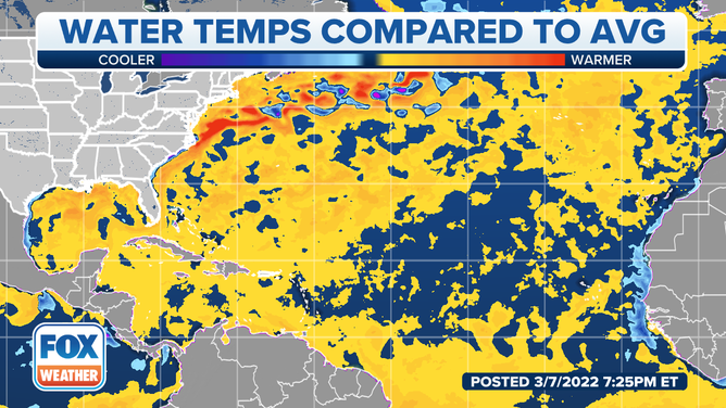
Most of the Atlantic, Gulf of Mexico and Caribbean Sea currently have water temperatures above average.
(FOX Weather)
Water temperatures have great variability, but trends have alluded to oceans continuing their warm streak into the cyclone season.
SAILDRONE'S JOURNEY INTO CATEGORY 4 HURRICANE UNCOVERS CLUE INTO RAPIDLY INTENSIFYING STORMS
Forecasters with CSU and NOAA take these and several other measures into account before they release their tropical cyclone outlooks.
The Atlantic basin hurricane season will kick off on June 1 and end on November 30.
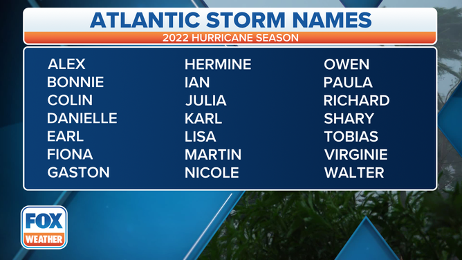
The list of tropical cyclone names for the 2022 hurricane season.
(FOX Weather)