

Damaging winds, large hail and tornadoes threaten the Plains as a heat dome fuels unsettled weather
Powerful, ridge-riding storms are expected to track along the northern edge of a large heat dome currently impacting the Southwest.
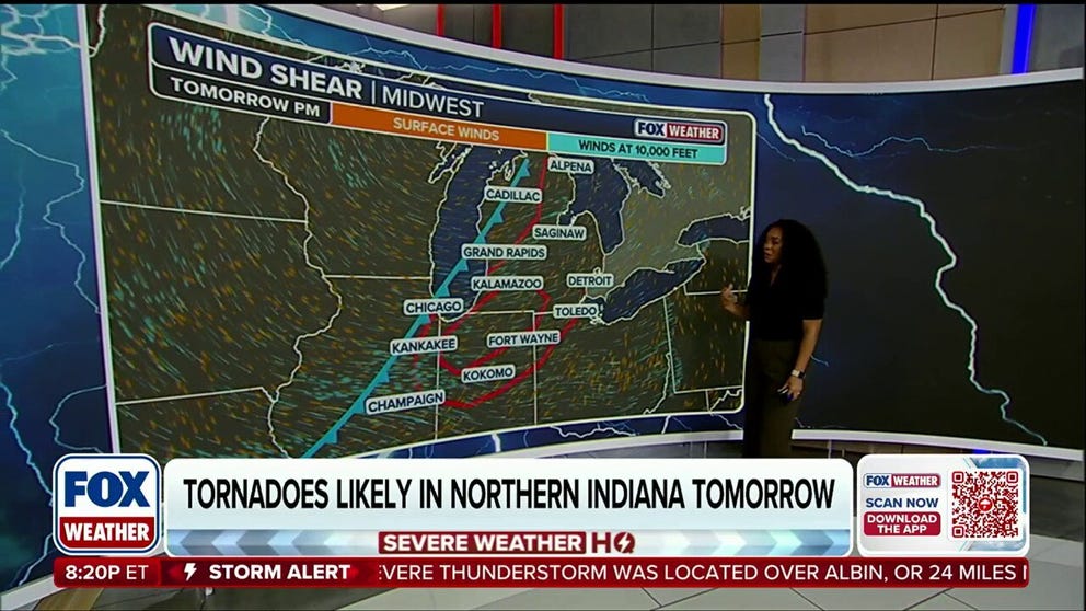
Tornadoes, hail and damaging winds threaten the Great Lakes
Severe storms are expected to ramp up across parts of the Midwest and Great Lakes as a cold front sweeps eastward from the Mid-Mississippi Valley. Daytime heating and wind shear could fuel damaging winds, large hail and a few tornadoes from Chicago to Detroit, with the highest tornado threat centered over northern Indiana.
THE TAKEAWAY
- Severe weather and heavy rain are expected to develop across the Plains this week.
- NOAA's Storm Prediction Center issued a Level 2 out of 5 severe storm threat.
- By midweek, storms will shift south into the central Plains and Rockies.
After days of relentless heat, severe weather and heavy rain are expected to develop across the Plains, bringing the threat of damaging winds, large hail and flooding.
EXTREME HEAT SAFETY: RECOGNIZING SIGNS OF HEAT ILLNESS AND HOW TO TREAT IT
This comes as powerful, ridge-riding storms track along the northern edge of a large heat dome currently impacting the Southwest.
 The severe weather on Tuesday.
(FOX Weather)
The threat began Monday as tennis-ball-size hail and wind gusts up to 77 mph impacted North Dakota.
Severe weather was also reported in South Dakota, Nebraska, Wyoming, Idaho and Utah.
'BOLT FROM THE BLUE': HOW DANGEROUS LIGHTNING CAN STRIKE MILES AWAY FROM THUNDERSTORMS
On Tuesday, the storms shifted to the Northern Plains, where afternoon thunderstorms developed from the Dakotas through Nebraska and into parts of the Rockies.
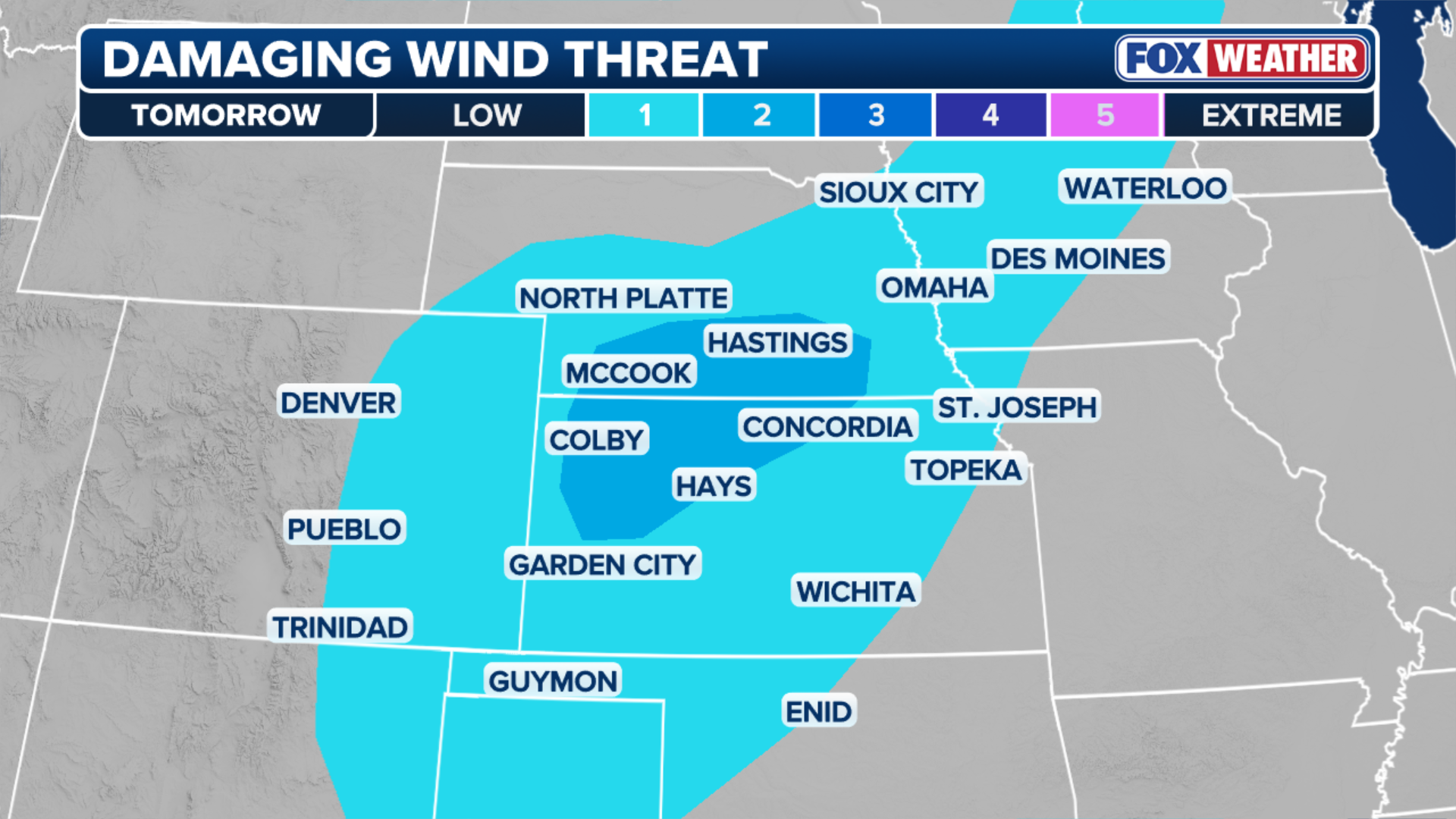 The damaging wind threat.
(FOX Weather)
The east-southeast winds carried moisture that hit the mountains of Colorado and Nebraska, prompting the thunderstorm development.
The organized storms produced damaging wind gusts that reached 75 to 90 mph and large hail. This prompted the NOAA Storm Prediction Center to issue a Level 2 out of 5 severe storm threat for Kansas, Nebraska and Oklahoma and the Texas Panhandle.
SLOW-MOVING SUMMER STORMS SOAK THE SOUTHEAST, DRIVING FLOOD THREAT ACROSS A DOZEN STATES
According to the FOX Forecast Center, these thunderstorms quickly grew and merged as rain-cooled air which triggered the development of new storms.
 The severe weather outlook for Wednesday.
(FOX Weather)
By Tuesday night, some of these storms brought swaths of damaging winds to the region.
Father north, thunderstorms developed across the Upper Mississippi Valley ahead of a cold that swept in from Canada.
WHAT IS A HEAT DOME AND HOW CAN IT AFFECT YOU DURING THE SUMMER MONTHS?
The strong wind shear caused severe wind gusts and hail across northern Minnesota and Wisconsin.
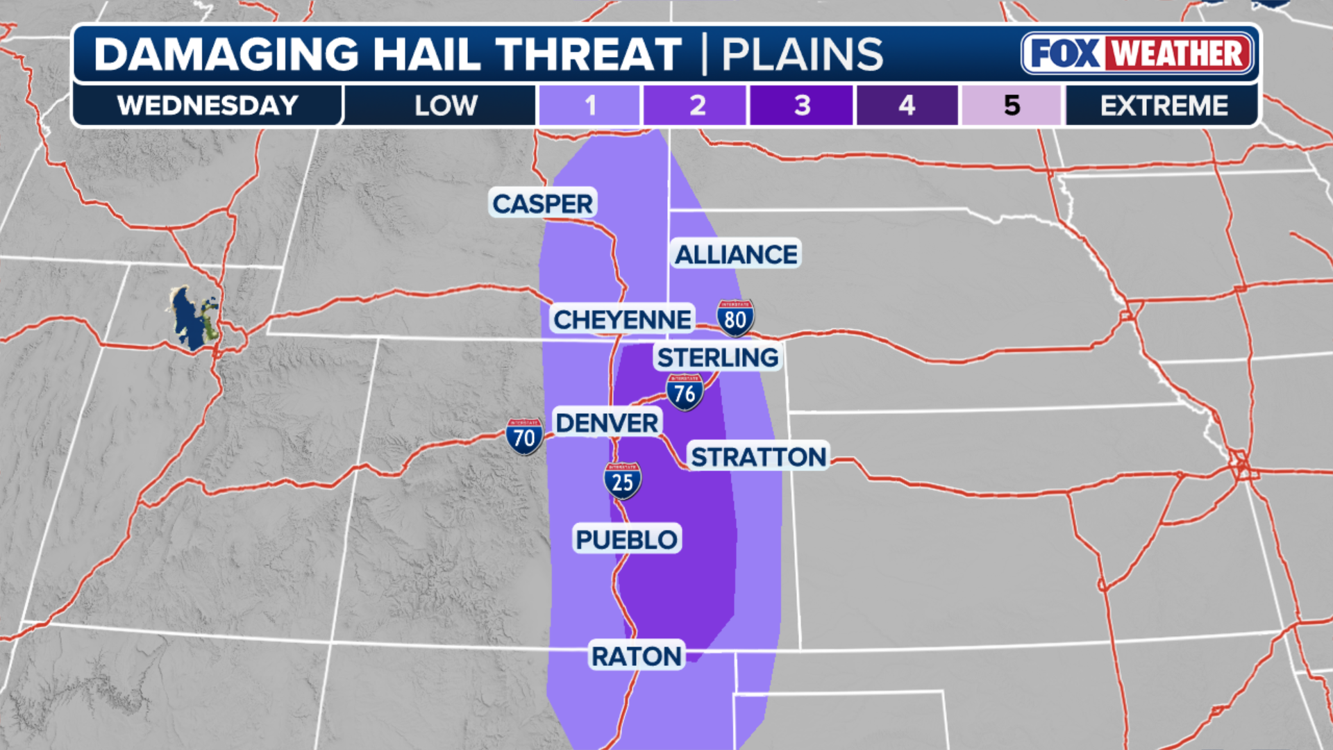 The hail threat for Wednesday.
(FOX Weather)
By Wednesday, severe storms are expected to ramp up across parts of the Midwest, especially in areas closer to Lake Michigan and Huron County, MI.
The FOX Forecast Center said intense daytime heating and wind shear could fuel a few tornadoes from Chicago to Detroit, with the highest threat centered over northern Indiana, including Lake County.
LIGHTNING STRIKE KILLS MOTHER AND 2-YEAR-OLD DAUGHTER IN BROWARD COUNTY, FLORIDA
Overall, the threat for severe weather and heavy rain remains relatively low, but persistent, with daily chances for storms continuing across the central Plains throughout the week.
Stay with FOX Weather for the latest.