

Slow-moving summer storms to soak the Southeast through the week, driving flood threat across a dozen states
These repeated downpours are not only bringing a flash flood threat to the region, but also the increased chance for severe storms.
Severe storms, flooding rain to fuel unsettled stretch across the Sout
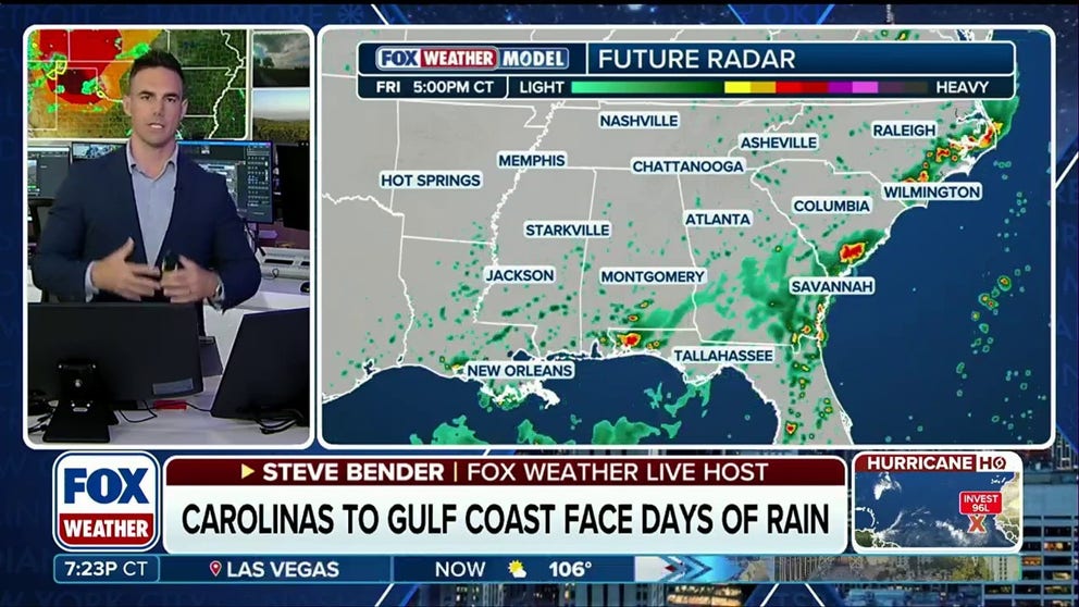
A prolonged stretch of unsettled weather is taking hold across the South, bringing a one-two punch of severe storms and flooding rain. The threat begins Wednesday, when thunderstorms could turn severe across parts of the region, before repeated rounds of tropical moisture and a slowing cold front shift the focus to flash flooding through the weekend. FOX Weather Meteorologist Steve Bender analyzes the forecast.
THE TAKEAWAY
- The Southeast is seeing rounds of storms all week.
- A prolonged stretch of nasty weather has settled across the southern U.S.
- A Level 1 out of 4 flash flood threat is in place through Thursday.
Residents across the Mid-South and Southeast are facing a soggy week as repeated rounds of heavy rain and thunderstorms threaten little relief between downpours.
The active weather pattern is taking hold across the South, beginning with a heightened severe storm threat Wednesday before transitioning to a daily flood threat heading into the weekend.
FIRST TASTE OF FALL ON THE WAY AS COOLER AIR TARGETS THE EASTERN US
Forecasters are monitoring a prolonged stretch of nasty weather that has settled across the southern U.S., bringing repeated rounds of heavy rain and thunderstorms through the end of the week.
These repeated downpours are not only bringing a flash flood threat to the region, but also the increased chance for severe storms.

(FOX Weather)
The strongest storms may produce damaging wind gusts and isolated flash flooding, especially across portions of the Lower Mississippi Valley, the Gulf Coast and parts of the Southeast.
Storms began on Monday across the Southeast, with heavy daytime showers and thunderstorms lingering on Tuesday, stretching from portions of the Florida Panhandle to coastal South Carolina.
RELENTLESS DOWNPOURS, WATERSPOUTS TARGET THE EAST AS SEVERE STORMS COOL OFF PARTS OF THE GULF COAST
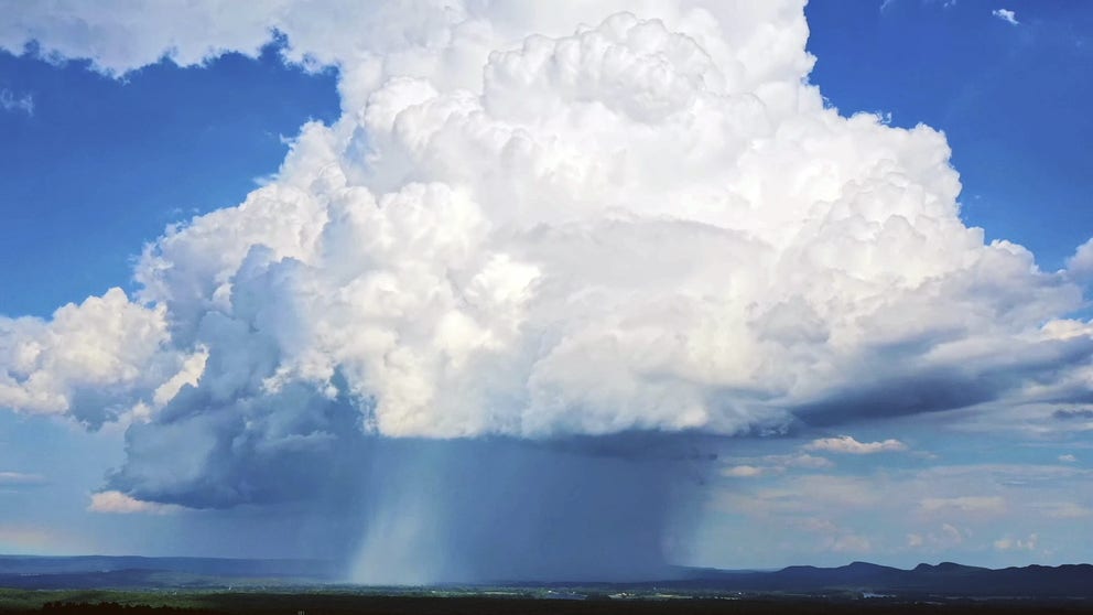
What is a microburst?
Like an atmospheric water balloon, a microburst is an incredible downdraft that spills forth from the belly of thunderstorms.
The FOX Forecast Center said an area of leftover spin from Tuesday's storms will be near northeast Oklahoma Wednesday morning, with a very warm, humid, and unstable air mass already in place.
(FOX Weather)
Scattered thunderstorms are expected to develop by early to mid-afternoon as temperatures rise, and could consolidate into a complex capable of producing pockets of damaging winds across Arkansas, western Tennessee and Mississippi, where a Level 2 out of 5 threat for severe weather was added, according to the FOX Forecast Center.
Storms increase flood risk
Once Wednesday’s severe weather threat passes and a slower Thursday follows, the focus will shift from damaging winds to a growing flood threat.
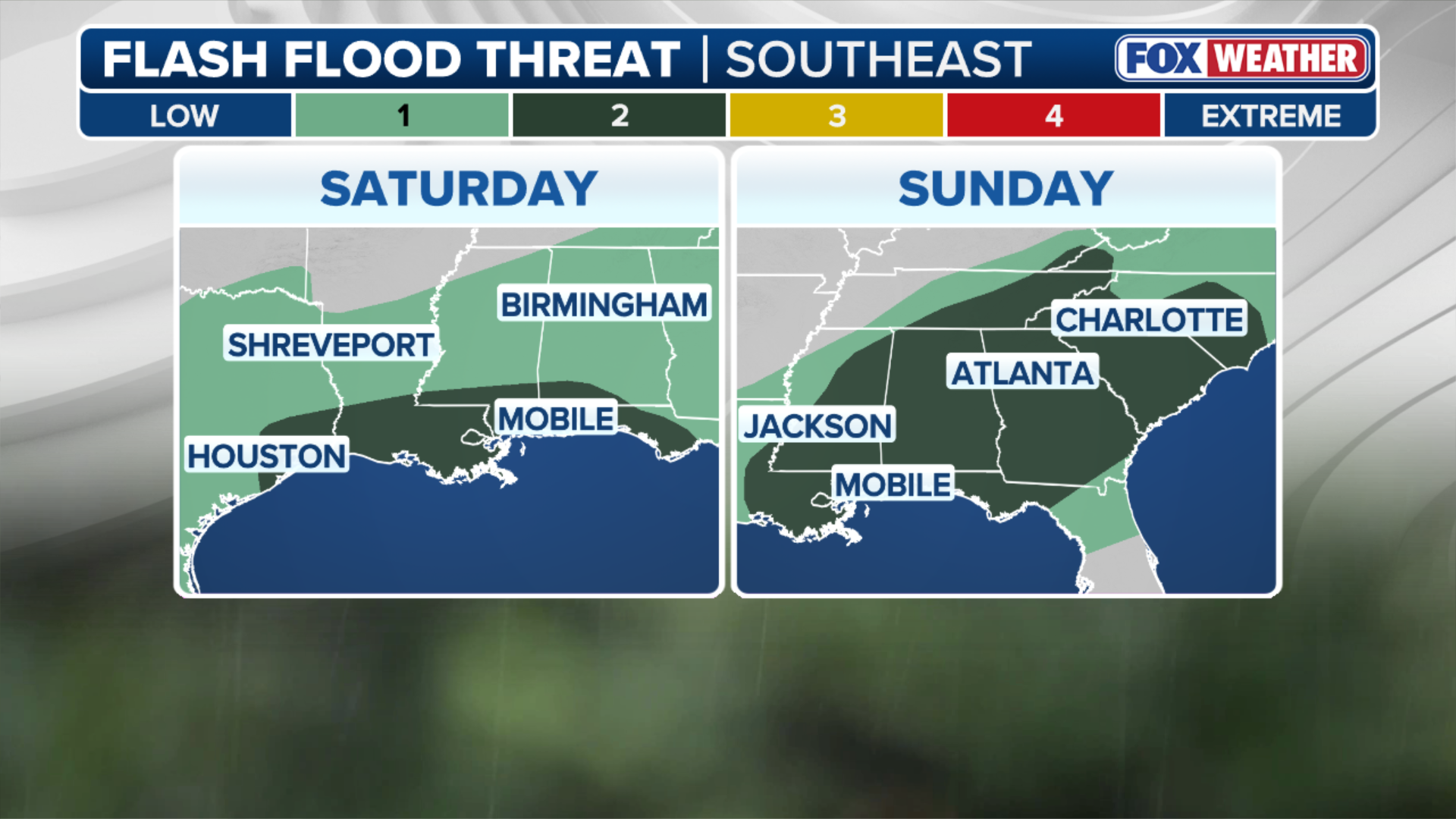
With a leftover stationary front firing up repeated rounds of heavy rain and thunderstorms, flash flooding will become a concern, prompting a Level 1 out of 4 flash flood threat through Thursday.
Storms could impact cities including Birmingham, Alabama; Jackson, Mississippi; Memphis, Tennessee; and possibly even Atlanta, according to the FOX Forecast Center.

(FOX Weather)
After Thursday, the cold front responsible for severe weather in the Northeast will be pushed south by a strengthening area of high pressure.
As the boundary slows across the Southeast beginning Friday, it will bring a low-end Level 1 out of 4 flash flood threat through Sunday from the Carolinas and Georgia to the Florida Panhandle and Gulf Coast.
WHAT HAPPENS WHEN A HURRICANE COLLIDES WITH HAWAII’S MASSIVE VOLCANOES?
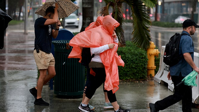
Pedestrians try to stay dry as rain inundates the area on November 15, 2023 in Miami Beach, Florida.
(Joe Raedle)
By the end of the week, much of the Southeast could pick up 1 to 3 inches of rain.
While no single day is expected to be a washout, repeated rounds of showers and thunderstorms could put a damper on outdoor plans for millions this weekend.
Stick with FOX Weather throughout the week as we continue to monitor the next developing storm.