California getting biggest soaking since rains from rare Tropical Storm Hilary
The storm that already dropped record snow on Anchorage, will park itself off the California coast and bring the coast unsettled weather through the workweek.
California: First widespread rain since Tropical Storm Hilary
FOX Weather is tracking a storm just off the California coast. It is sprinkling the Golden State with rounds of rain, the most since the summer's Tropical Storm Hilary. Find out how much rain and when the stubborn system will finally depart. Will it dampen the weekend?
The monster storm that triggered a snow emergency in Anchorage, Alaska last week is soaking the California coast with several days of rain, the most since Tropical Storm Hilary.
The storm originated in the Gulf of Alaska, where it dumped over five feet of snow in less than a day on Thompson Pass.
ALASKA'S LARGEST CITY DECLARES ‘SNOW EMERGENCY’ AFTER RECORD SNOWFALL PILES UP ON BACK-TO-BACK DAYS

Two dogs are seen bounding through the snow in Anchorage. Nov. 10, 2023.
(@Climatologist49 / WEATHER TRAKER /TMX / FOX Weather)
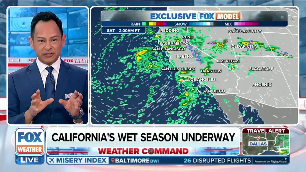
"Low pressure is spinning off the coast and will hang there for the next couple of days. It will take until the weekend for the low to finally make its way onshore," explained the FOX Forecast Center. "While this slow, offshore movement will limit widespread, heavy rain, it will draw out the period of time that rain will be in the forecast. For cities across Northern California, they may see rain each day through the weekend."
San Francisco, Sacramento and Redding could see three or more straight days of rain. This will be the first time since May for those cities.
"The stubbornness of this low is not going to budge much. We wait and wait and wait for this low to eventually move onshore," said Meteorologist Stephen Morgan." Really what we're going to see here, a couple of rounds (of rain)."
Santa Rosa, California, north of San Francisco, declared an end to Fire Season with the early week rain and promise of more. This was an area devastated by wildfires in 2017 and 2020.
WHAT IS AN ATMOSPHERIC RIVER? EARTH'S LARGEST FRESHWATER RIVERS ARE IN THE SKY
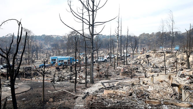
File: Utility crews work on Vintage Circle in the heart of in the Fountaingrove neighborhood, destroyed by the Tubbs Fire, in Santa Rosa on Tuesday Oct. 17, 2017.
(Paul Chinn/The San Francisco Chronicle / Getty Images)
Timing of the West Coast storm
Wednesday and Thursday
The low meanders off the coast of Northern California and cuts itself off from the jet stream, which would move it across the country. California gets the next slug of widespread rain Wednesday afternoon and evening, just in time to snarl rush hour for both Northern and Southern California.
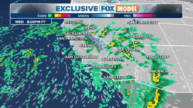
Stubborn storm hanging off the coast until late Sunday.
(FOX Weather)
Friday and Saturday
The low continues to bounce off the coast, penned in by a high to the west. This could set the coast up for many days of rain.
"So the next round comes in Wednesday night," Morgan said. "We'll see that's mostly a warm system not producing a bunch of Sierra snow. Then there's another one come Friday. This one could be stronger. But be patient. It's going to take its time."
The low will eventually push east toward the end of the workweek.
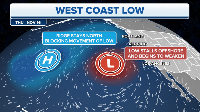
"It really takes the rest of this week for that low to start to move in," Morgan said.
Saturday, the low finally weakens and pushes on shore. This is the last significant rainfall. By the end of teh week some areas could see almost 2 inces of rain and up to 3 inches at the highest peaks of the coastal range.
WHERE WEATHER COULD CAUSE PROBLEMS FOR THANKSGIVING THIS YEAR
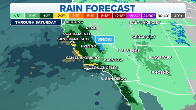
Days of rain add up.
(FOX Weather)
The Sierra Nevada mountain range is poised to make out well with early-season snow as well.
"This will also be the first opportunity for meaningful snow in the Sierra. At this point, we're looking at snow levels staying high up in the mountains, so this won't have much impact on people living there," explained the FOX Forecast Center. "And because of the system's track, it looks like snow totals will be on the lower side, less than a foot on the peaks, and maybe an inch or two down at levels where people actually live."
RIDICULOUS PHOTOS SHOW AFTERMATH OF 12 FEET OF SNOW IN CALIFORNIA'S SIERRA NEVADA
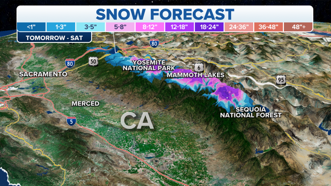
Sierra snow.
(FOX Weather)
San Francisco, usually happy to see rain, is a bit blue as they welcome tens of thousands of visitors for the international Asia Pacific Economic Cooperation summit this week.