Bryan Norcross: Hurricanes Otis and Tammy both surprisingly and suddenly intensify
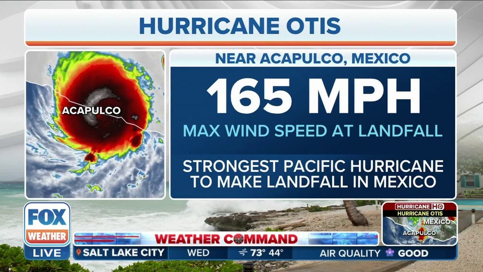
Otis is the strongest Pacific storm in the record book ever to hit Mexico. And no hurricane remotely as strong as this has made landfall in the Acapulco area. The only storm on a similar track to impact that part of Mexico was in 1951, and that was a Category 1.
'This is shocking': FOX Weather hurricane specialist Bryan Norcross breaks down Hurricane Otis' explosive intensification
FOX Weather hurricane specialist Bryan Norcross spoke with FOX Weather meteorologist Amy Freeze on Wednesday morning to break down what went wrong with the official forecast with Hurricane Otis ahead of its historic landfall near Acapulco, Mexico, on Wednesday, October 25, 2023.
Updated at 9:30 a.m. EDT on Wednesday
Hurricane Otis came ashore over the Acapulco metropolitan area on the southern coast of Mexico overnight as an incredible Category 5 hurricane. Yesterday morning, the forecast landfall intensity was 85 mph Category 1.
In addition, reminiscent of Hurricane Ian, but on a much shorter time scale, yesterday's cone was aimed north of the city, but the storm hugged the right side, putting the strongest part of the hurricane into Acapulco.
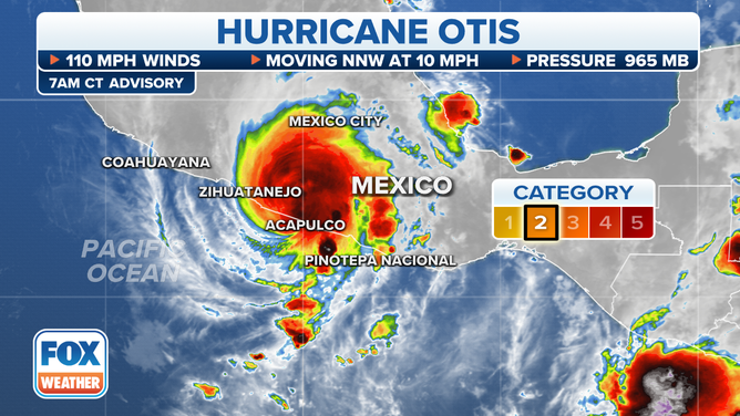
The latest details about Hurricane Otis.
(FOX Weather)
Otis is the strongest Pacific storm in the record book ever to hit Mexico. And no hurricane remotely as strong as this has made landfall in the Acapulco area. The only storm on a similar track to impact that part of Mexico was in 1951, and that was a Category 1.
This was not a case where some computer forecasts showed a powerful storm, and others said it would be weak, so forecasters took the middle ground. Not one fancy, modern computer model showed the off-the-charts rapid intensification.
It's not clear yet what went so incredibly wrong. A component, no doubt, was Otis's size. Small storms can spin up quickly if the environment is conducive. Because their diameter is small, it's easier to get the air spinning. But they are also more susceptible to external disruption. In this case, there was clearly a pocket of pristine atmosphere that happened to line up with the hurricane in those last hours before landfall overnight.
Also, there was a dip in the jet stream over Baja California just to the north. The interaction between hurricanes and nearby jet stream dips has been a subject of discussion and research for years. If the jet stream gets too close to the storm, it pulls the system apart with hostile upper winds. If it's close but not too close, it can pull air out of the top of the hurricane in a very efficient way, which causes the storm to intensify if all the other environmental conditions are ideal.
The nearby jet stream dip no doubt contributed to Hurricane Otis' explosive intensification, but research will be required to understand all the factors and how the computer forecasts missed it so badly.
In the meantime, the situation in Acapulco is undoubtedly terrible today. Our thoughts are with the people there.
Otis will quickly weaken over the rugged Mexican mountains, but flash flooding and strong winds will persist for at least another day.
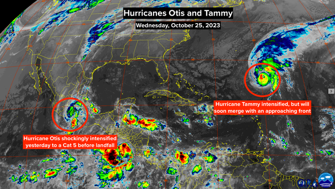
A satellite image of hurricane's Tammy and Otis on Wednesday, Oct. 25, 2023.
(NOAA)
In the Atlantic, Hurricane Tammy suddenly and unexpectedly intensified, though nowhere near as dramatically as Otis. Tammy only jumped to Category 2 strength. In this case, it's pretty clear that a large jet stream dip to the west of Tammy created a patch of atmosphere that was conducive for intensification – broadly similar to the Otis scenario.
A cold front related to the large jet stream dip is approaching Tammy and is forecast to merge with the storm, creating a very strong wintertime-like low-pressure system with attached fronts. Over the next few days, the new system is forecast to slowly weaken, but it could still affect Bermuda over the weekend with gusty winds – though likely of tropical-storm strength.
People in Bermuda should stay informed. There is poor agreement among the various computer forecasts, in this case, on the track of ex-Tammy. The storm is likely to meander around the Atlantic in the general vicinity of Bermuda, and predicting the exact twists and turns is a fool's errand.
Otherwise, we'll keep an eye on the Caribbean. Pressures are forecast to be low there over the next week. Sometimes a system develops through a mechanism like we saw last year. November's Hurricane Nicole was the result. For now, it's just an area to watch.