Why is the right side of a hurricane more dangerous?
Hurricanes are dangerous to hundreds of miles in every direction. Storm 101 explains why winds and storm surge are more intense on the right side of the storm.
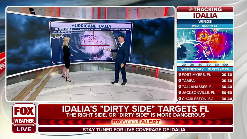
The right side of the hurricane is the most dangerous
FOX Weather explains why the right side or the dirty side of a hurricane is the most dangerous -- stronger winds, deeper storm surge and higher wave heights.
Have you ever wondered why meteorologists say that the eastern side of hurricanes are the most dangerous? Or call it the "dirty side" of the storm?
Usually, the right-front quadrant of a storm in the Northern Hemisphere carries higher winds, waves and storm surge, according to the University Corporation for Atmospheric Research.
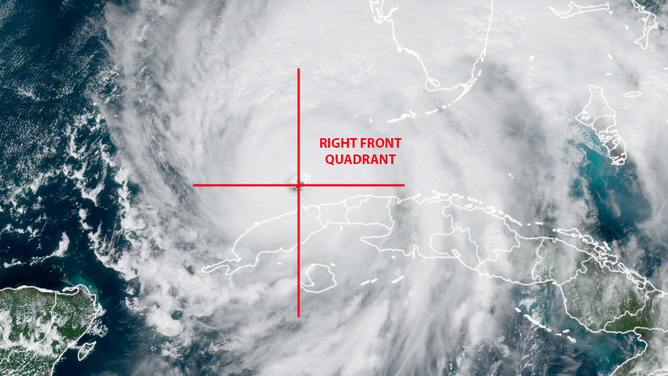
If you look at a satellite image of Hurricane Franklin in the Atlantic Ocean. The right front quadrant, from essentially 1 o'clock to 3 o'clock on our imaginary clock, will have the strongest winds and worst storm surge. The U.S. won't have to worry about the diary side of Hurricane Franklin because it continues to move northeast in the Atlantic Ocean.

Hurricane Franklin as seen by NOAA's GOES-16 satellite. (Image: NOAA/CIRA)
(NOAA)
HERE ARE THE BUZZWORDS YOU'LL BE HEARING DURING HURRICANE SEASON
Another image below from Hurricane Nicole in 2022 shows the right side of the storm.
(GOES-16 image courtesy NOAA/CIRA/RAAM-B)
Every low pressure or cyclone circulates internally in a counter-clockwise direction in the Northern Hemisphere, including hurricanes, nor'easters and most tornadoes.
How the right-front quadrant generates faster wind speed
Steering currents, driven by atmospheric airflow in the upper levels, add to the strength of the maximum sustained winds in that quadrant. For example, if a hurricane's steering currents were moving at 30 mph and the sustained winds of the hurricane were 80 to 100 mph, the combination generates a wind speed of 130 to 150 mph at 3 o'clock on the clock face.
On the left side of the hurricane (9 o'clock on our imaginary clock face), the maximum sustained winds flow against the steering currents. So, in the example above, the steering current of 30 mph would reduce the 100 mph hurricane wind speed to 70 mph, according to UCAR. The National Hurricane Center takes this into account when issuing official wind estimates.
Storm surge is greatest on the eastern side of a hurricane too
The faster winds on that energized "right side" of the hurricane create higher waves, slightly higher wind gusts and the storm surge. The National Hurricane Center wrote that storm surge triggered by the low pressure of the storm (the atmosphere pressing less on the surface of the water) is minimal – about 5% – compared to the amount of water forced onshore by the hurricane-force wind.
WHY FLORIDA'S GULF COAST IS SUSCEPTIBLE TO A HURRICANE'S STORM SURGE
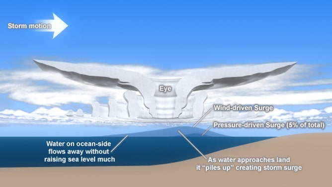
The storm motion is left to right with the circulation of the storm being counter-clockwise. Look at the water piling up at the right front quadrant of the cross-section of the hurricane.
(The Comet Project and NOAA)
When a storm surge triggered by being in the right quadrant of the storm aligns with a waterway like a bay or river, the effects can be even more dangerous.
But being on the other side of the storm can have opposite effects. In 2017, Hurricane Irma made landfall at Marco Island, Florida, putting Tampa Bay on the left side of the storm.
The 115 mph winds out of the northeast were offshore and actually forced water out of Tampa Bay. The video shows exposed sea walls and birds walking on what, just hours before, was underwater by feet:
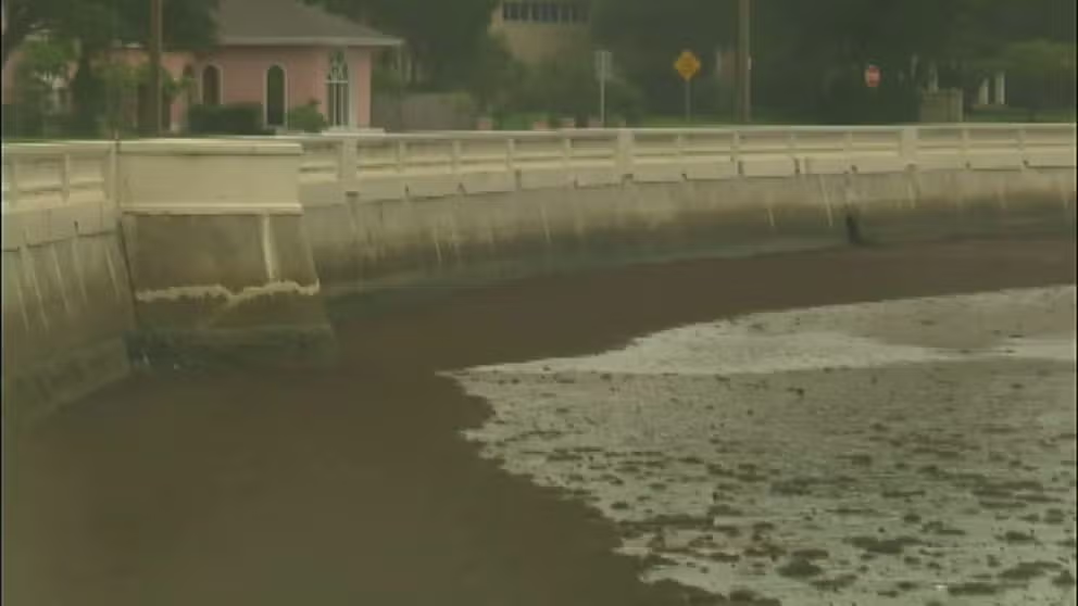
Water receded from Tampa Bay due to Irma
Tampa Bay was on the left side of Hurricane Irma in 2017 when it made landfall near Marco Island. The offshore winds blew the waters of Tampa Bay out to the Gulf of Mexico while areas to the right of Erma were flooded by storm surge.
Tornadoes
The majority of tornadoes embedded in thunderstorms in the hurricane's rain bands and eyewall form in the front right quadrant as well, according to the National Weather Service. Twisters spawned by a tropical system are generally weak and short-lived but can still do damage.
THIS IS THE LIFECYCLE OF A TORNADO
The NWS looked at tornadoes formed by tropical systems in central South Carolina and eastern Georgia from 1950 to 2013. Their research showed that most of the tornadoes were from tropical storms and hurricanes that made landfall in the Gulf of Mexico and traveled north-northeast.