

Keeping an eye on the Atlantic as tropics show signs of waking up at the end of August
If a tropical storm does develop out of this potential disturbance, it will get the name Dolly.
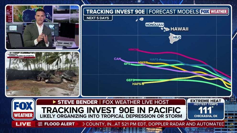
Tracking Invest 90E as it targets the Hawaiian Islands
FOX Weather Meteorologist Steve Bender breaks down the renewed threat for the Hawaiian Islands as Invest 90E could develop into a tropical storm this weekend.
THE TAKEAWAY
- The tropics are showing signs of waking up in the Atlantic.
- Computer models show that an area of low pressure will spin up offshore and quickly turn into a tropical storm or a depression.
- Aug. 20 begins the period of most activity in the Atlantic.
The Atlantic is not expected to see any tropical development in the next week, as per the National Hurricane Center, but long-range forecast models are indicating that the period of inactivity may not last much longer.
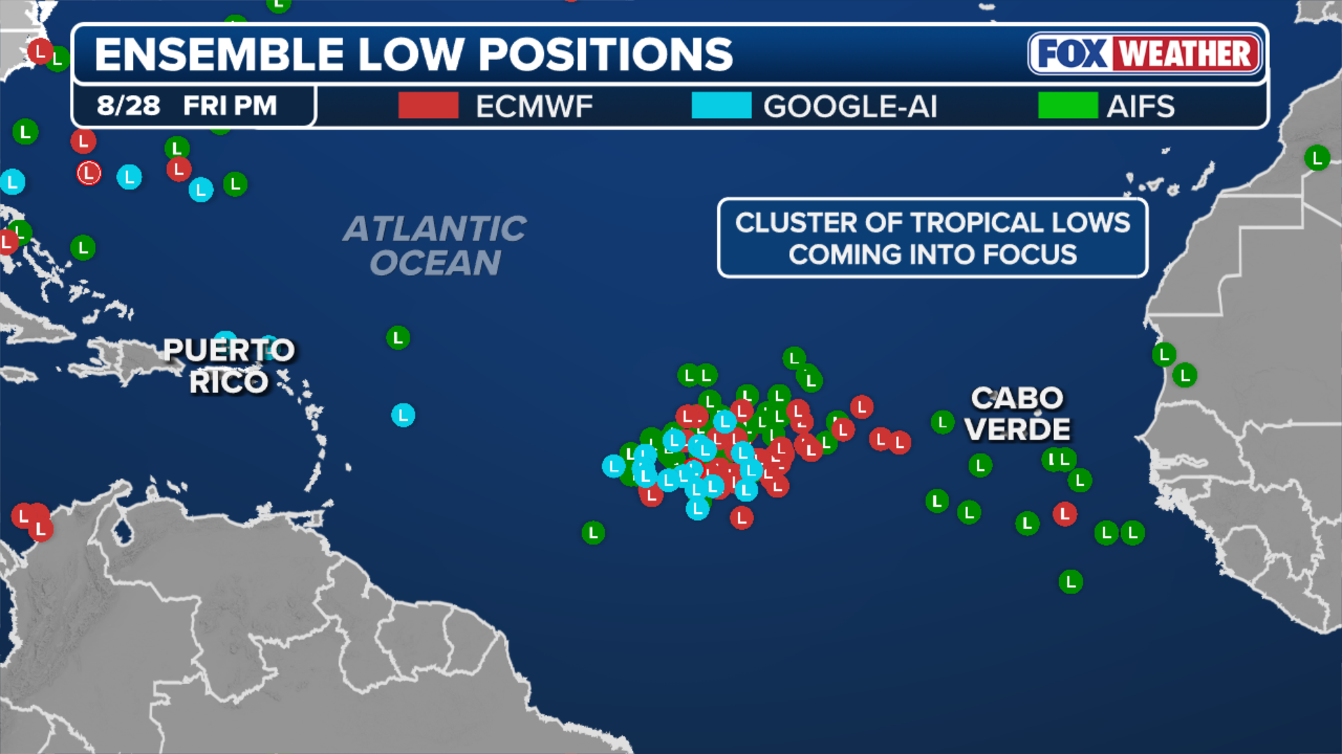
According to the FOX Forecast Center, computer forecast models are showing that an area of low pressure will spin up offshore Africa by Sunday and quickly turn into a tropical depression or tropical storm next week.
BRYAN NORCROSS: REMEMBERING 34 YEARS AGO TODAY AND KEEPING AN EYE ON HAWAII AGAIN
(FOX Weather)
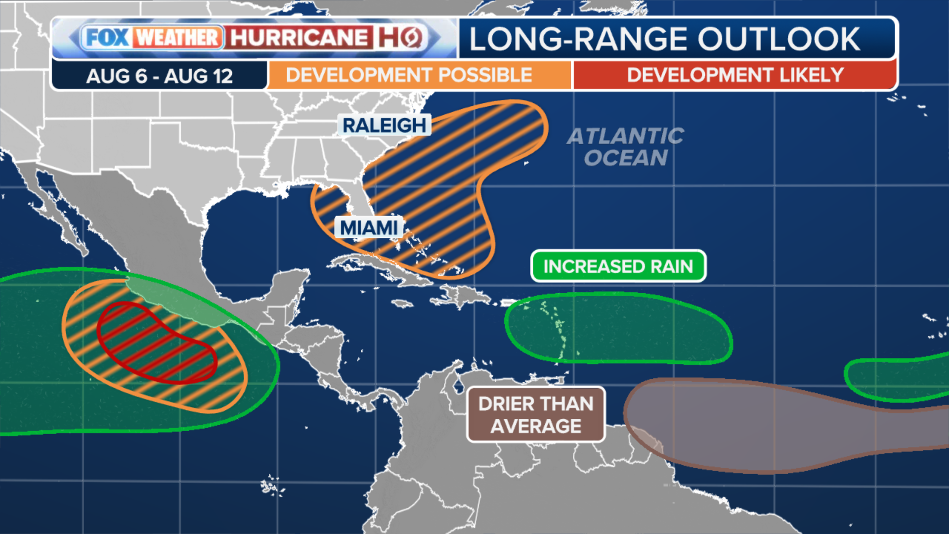
The current two and three-week tropical hazards outlooks by the Climate Prediction Center show that the Main Development Region of the Atlantic, between Africa and the Caribbean, has a low chance of tropical development into early September.
This isn't unusual, the FOX Forecast Center said, as Aug. 20 begins the period of most activity in the Atlantic.
BREWING SUPER EL NIÑO EXPECTED TO BE STRONGEST ANYONE ALIVE ON THE PLANET HAS EVER EXPERIENCED
What's different about this possible disturbance is how hearty it appears on these computer forecast models. The majority of the models, both AI and traditional, agree that there will be an area of spin in the far eastern Atlantic.
(FOX Weather)
If a tropical storm does develop out of this potential disturbance, it will get the name Dolly.
The one negative factor for tropical development is the brewing Super El Niño, which has already killed several other Atlantic disturbances this season.
NEW TROPICAL THREAT EMERGES FOR HAWAII AS INVEST 90E HAS HIGH CHANCE OF BECOMING A TROPICAL STORM
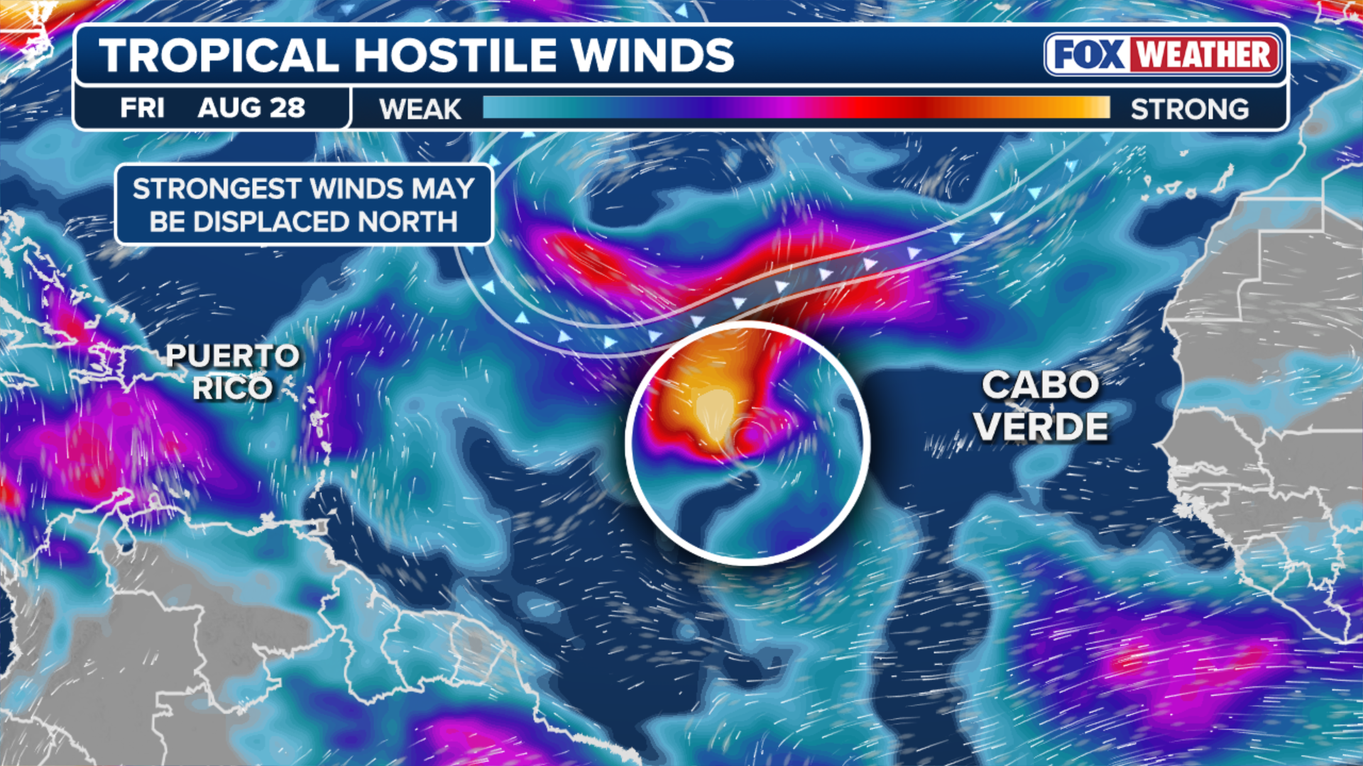
A long stretch of hostile upper-level winds still extends out of the Caribbean across the basin, acting as a protective wall.
(FOX Weather)
The FOX Forecast Center said what might change next week is that this next tropical disturbance could try to curve north, into an area less influenced by the belt of strong, hostile winds.
As for where this wave could end up? If it takes the aforementioned path, it will recurve safely away from land.
Stay tuned to FOX Weather as we continue to model the forecasts.