Why Atlantic hurricane season is off to slow start while Eastern Pacific buzzes with tropical activity
According to the FOX Forecast Center, the lack of storms in the Atlantic so far has been caused by three unfavorable atmospheric conditions over the basin, including the current water temperatures, wind shear and Saharan dust.
Hurricane season has gotten off to a fast start to begin the new season
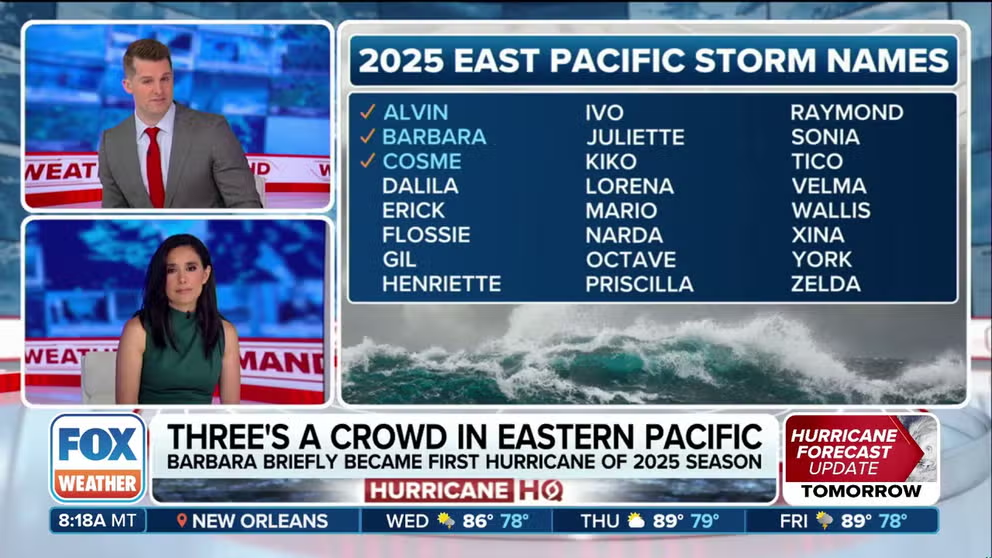
East Pacific has seen three named storms, while the Atlantic has yet to see its first named storm of the season.
The Eastern Pacific hurricane season has gotten off to a fast start, with three named storms already forming since the beginning of the season on May 15. Meanwhile, since the start of the Atlantic hurricane season on June 1, the basin has remained void of any tropical activity.
"This is the overall pattern you would expect for the month of June, where you watch (tropical) waves, but nothing is going to come to fruition," FOX Weather Meteorologist Stephen Morgan said.
On average, the Eastern Pacific Basin sees its first named storm on June 10, its second by June 24 and its third by July 6. Alvin, Barbara and Cosme all formed in less than two weeks, marking a fast start for the ocean basin.
Saharan dust usually does not reach far enough east to affect the Eastern Pacific; the dust is lifted north toward the U.S. before it can interfere with Eastern Pacific storms.
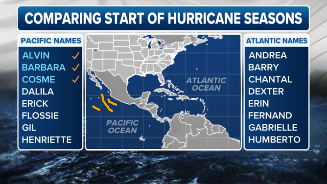
Comparing the start of the Eastern Pacific and Atlantic hurricane seasons as of June 10, 2025.
(FOX Weather)
According to the FOX Forecast Center, the lack of storms in the Atlantic so far has been caused by three unfavorable atmospheric conditions over the basin, including the current water temperatures, wind shear and Saharan dust.
The Saharan dust, which is known for suppressing tropical activity in the basin, limits the ability of tropical showers to develop and grow. Meanwhile, persistent wind shear prevents tropical disturbances and waves from organizing.
BARBARA WEAKENING IN EASTERN PACIFIC AFTER BECOMING FIRST HURRICANE OF 2025 SEASON
"Hurricanes, tropical cyclones, do not thrive in an environment that is a high-shear one. Any sort of development that you would think could be possible here with these little waves, the shear will choke them off," Morgan explained.
While water temperatures are warm enough to support development, they are not as favorable as they have been in recent years and are part of the reason for the lack of formation in the Atlantic.
There is currently a high chance of another tropical cyclone developing in the Eastern Pacific over the next seven days, while the slow start in the Atlantic shows no signs of increased activity and is perfectly normal for this time of year, according to the FOX Forecast Center.