

See it: Wisconsin tornado rated EF-3 after leaving trail of destruction through Menasha, Appleton
Despite the widespread nature of the destruction, no injuries or deaths have been reported.

Tornado leaves trail of destruction across cities in Wisconsin's Fox Valley
A tornado left a trail of destruction after tearing through Wisconsin's Fox Valley, about 35 miles south of Green Bay, on Monday afternoon. The twister tore directly through the cities of Menasha and Appleton, destroying homes and knocking down trees and power lines. FOX News Multimedia Reporter Peter Cuddihy has the latest conditions from Menasha.
APPLETON, Wis. — The tornado that tore through Wisconsin's Fox Valley, about 35 miles south of Green Bay, on Monday afternoon has been preliminarily rated as an EF-3 by the National Weather Service (NWS) after leaving a trail of destruction. The twister cut directly through the cities of Menasha and Appleton, destroying homes and knocking down trees and power lines.
Several local states of emergency have been declared and many of the communities directly impacted remained without power early Tuesday.
![MENASHA, WISCONSIN - JULY 27: A flag flies in front of a home damaged by a tornado that ripped through town on July 27, 2026 in Menasha, Wisconsin.]() Image 1 of 9
Image 1 of 9MENASHA, WISCONSIN - JULY 27: A flag flies in front of a home damaged by a tornado that ripped through town on July 27, 2026 in Menasha, Wisconsin. ((Photo by Scott Olson/Getty Images))
![MENASHA, WISCONSIN - JULY 27: An aerial view shows damage after a tornado ripped through town on July 27, 2026 in Menasha, Wisconsin.]() Image 2 of 9
Image 2 of 9MENASHA, WISCONSIN - JULY 27: An aerial view shows damage after a tornado ripped through town on July 27, 2026 in Menasha, Wisconsin. ((Photo by Scott Olson/Getty Images))
![MENASHA, WISCONSIN - JULY 27: Workers shut off gas lines as residents begin recovery after a tornado ripped through town on July 27, 2026 in Menasha, Wisconsin.]() Image 3 of 9
Image 3 of 9MENASHA, WISCONSIN - JULY 27: Workers shut off gas lines as residents begin recovery after a tornado ripped through town on July 27, 2026 in Menasha, Wisconsin. ((Photo by Scott Olson/Getty Images))
![]() Image 4 of 9
Image 4 of 9MENASHA, WISCONSIN - JULY 27: A power pole lays in front of a home damaged by a tornado that ripped through town on July 27, 2026 in Menasha, Wisconsin. ( (Photo by Scott Olson/Getty Images))
![]() Image 5 of 9
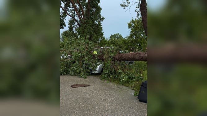
Image 5 of 9Officials reported several downed power lines, trees and tree limbs across the area. (CODY BUECHEL/FACEBOOK.COM)
![]() Image 6 of 9
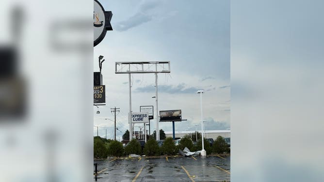
Image 6 of 9A confirmed destructive tornado ripped through Appleton, Wisconsin. (CODY BUECHEL/FACEBOOK.COM)
![]() Image 7 of 9
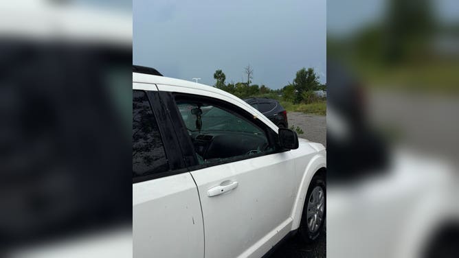
Image 7 of 9The storm destroyed numerous cars in the area. (CODY BUECHEL/FACEBOOK.COM)
![]() Image 8 of 9
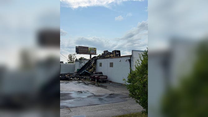
Image 8 of 9A destructive tornado damaged buildings as it tore through the region. (CODY BUECHEL/FACEBOOK.COM)
![]() Image 9 of 9
Image 9 of 9The destructive tornado stripped structures of their exteriors. (CODY BUECHEL/FACEBOOK.COM)



Local public works crews are beginning to remove extensive damage and debris with damage assessment still underway in some places.
WHAT IS A 'TORNADO EMERGENCY'?
Despite the widespread nature of the destruction, no injuries or deaths have been reported.

MENASHA, WISCONSIN - JULY 27: Residents survey damage after a tornado ripped through town on July 27, 2026 in Menasha, Wisconsin.
((Photo by Scott Olson/Getty Images))
FOX News Multimedia Reporter Peter Cuddihy showed a heavily damaged Menasha neighborhood early Tuesday, where homes were destroyed and trees and power lines were downed.
Video of the twister's aftermath showed cars flipped completely upside down.
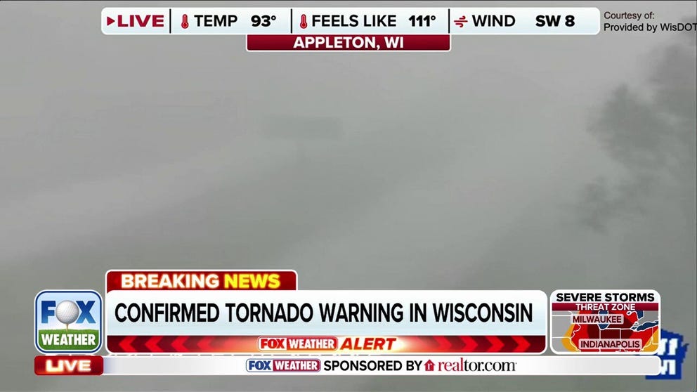
Watch: Large, dangerous tornado rips through Wisconsin area as severe storms ramp up
Watch as a large and dangerous confirmed tornado rips through the Appleton, Wisconsin, area with reports of large hail. Stick with FOX Weather for the latest updates as severe storms move through the region:
The twister spawned around 12 p.m. local time as severe storms exploded across parts of the Upper Midwest. Wisconsin Department of Transportation cameras showed intense winds around Appleton and Menasha.
According to the FOX Forecast Center, the tornado formed just north of Appleton, before it quickly dropped south where it peaked in intensity in the Menasha area.
"The tornado then continued on south across Lake Winnebago where it lifted over the lake," the FOX Forecast Center said.

Appleton-Menasha tornado survey.
(FOX Weather / FOX Weather)
As the tornado tracked across the region, the National Weather Service issued a Particularly Dangerous Situation (PDS) warning for the region, indicating an imminent threat to life and property.
Preliminary tornado survey results from the NWS Tuesday estimated peak wind speeds of 140 mph, with the twister on the ground for at least 12 miles. At its maximum width, the tornado was about 15 football fields wide.
The area was under a Level 3 out of 5 risk of severe thunderstorms, according to NOAA's Storm Prediction Center (SPC). Despite the elevated severe weather threat, the SPC forecast called for only a low (2%) tornado risk.
"The lack of higher tornado probabilities was no doubt due in part to uncertainty in even the short-range models in how the day would evolve," the FOX Forecast Center said.
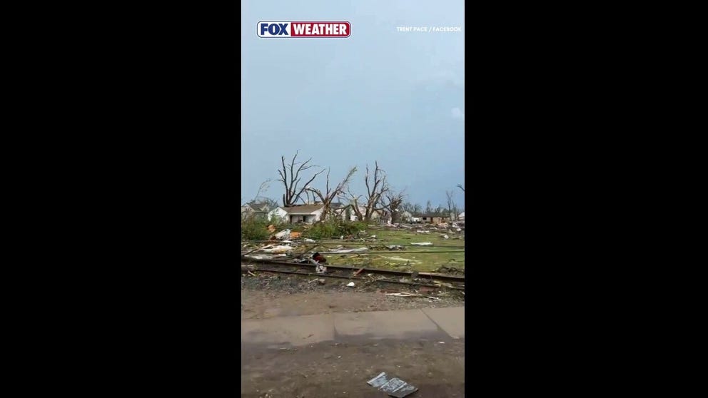
Destructive tornado rips through Wisconsin
The city of Menasha, Wisconsin, sustained extensive damage after a tornado moved through the area. Officials reported damaged structures, downed trees and debris scattered across the community.
A Boil Water Advisory is still in effect across parts of Menasha and Fox Crossing.
The Village of Fox Crossing said several water plants suffered damage and were knocked offline. The village is currently asking the public to conserve water.
DEVASTATING DAMAGE REPORTED ACROSS MULTIPLE STATES AFTER TORNADO OUTBREAK HAMMERS THE MIDWEST
A curfew was issued for parts of Menasha and Fox Crossing from 10 p.m. Monday night to 5 a.m. Tuesday morning due to the widespread damage.

MENASHA, WISCONSIN - JULY 27: Residents survey damage after a tornado ripped through town on July 27, 2026 in Menasha, Wisconsin.
((Photo by Scott Olson/Getty Images) / Getty Images)
The Appleton Police Department said in the immediate aftermath many roads throughout the city were impassable, with numerous traffic signals out, causing significant traffic delays.
Menasha police urged people to avoid traveling into the city as traffic congestion, downed trees, power lines, debris, and blocked roadways prevented emergency responders and utility crews from reaching affected areas.
Photos obtained by FOX Weather show extensive damage to vehicles and structures, including missing sections of roofs and debris scattered throughout the area.
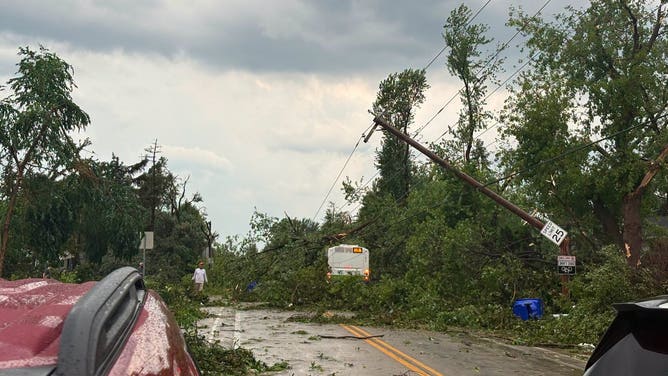
Trees fall on city bus during confirmed tornado in Appleton, Wisconsin, on July 27, 2026.
(Appleton Police Department / FOX Weather)
Following the storm, Congressman Tony Wied and State Representative Lee Snodgrass, offered support for impacted residents.
Gov. Tony Evers said he has been briefed on the situation and is monitoring the ongoing response across the affected communities.
This is the strongest July tornado to hit Wisconsin since the destructive 1996 F-5 Oakfield tornado.
Severe storms also produced a 4.5 inch hailstone in Gresham, Wisconsin, Monday.
Tornado damage was also reported in Glen Ellyn, Lansing and Markham, Illinois.
The severe weather threat is charging east Tuesday, while the Upper Midwest will likely remain storm free until at least Friday.
Stay with FOX Weather for the latest updates.