What made these surreal clouds that signaled arrival of damaging derecho and 80-mph winds?
In Thursday's case, the shelf cloud was signaling the arrival of a derecho that would go on to bring 80-100-mph wind gusts amid torrential rains and frequent lightning. Over 500,000 people lost power.
Timelapse of shelf cloud moving through central Illinois
The first video was shot in the town of Charleston, while the second video was shot in nearby Mattoon. June 29, 2023.
MATTOON, Ill. – Just in time for July Fourth, a cloud formation that looked like something out the movie Independence Day filled the skies of central Illinois on Thursday in the moments before a derecho blasted the region with ferocious winds.
The formation, known as a "shelf cloud" typically notes the front edge of an approaching line of strong thunderstorms.
In Thursday's case, the shelf cloud was signaling the arrival of a derecho that would go on to bring 80-100-mph wind gusts amid torrential rains and frequent lightning to the mid-Mississippi and Ohio valleys. Over 500,000 people lost power.
Shelf clouds are not tornadoes, but they can be indicative of intense thunderstorms with damaging winds.
![Shelf Cloud over Illinois]() Image 1 of 8
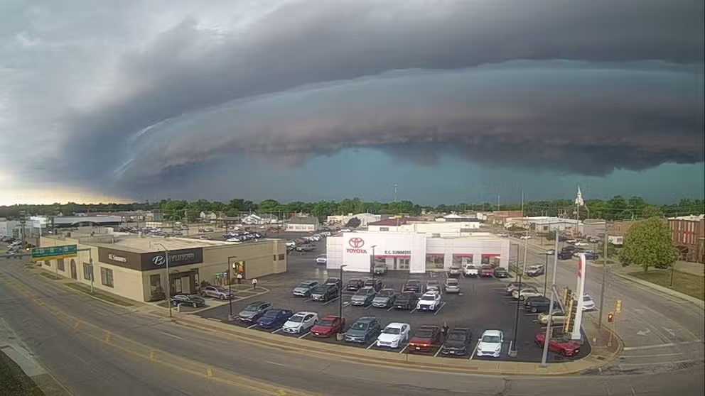
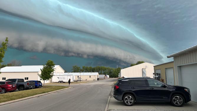
Image 1 of 8A shelf cloud looms over Mattoon, Illinois on June 29, 2023. (Mike Dresch)
![Shelf Cloud over Illinois]() Image 2 of 8
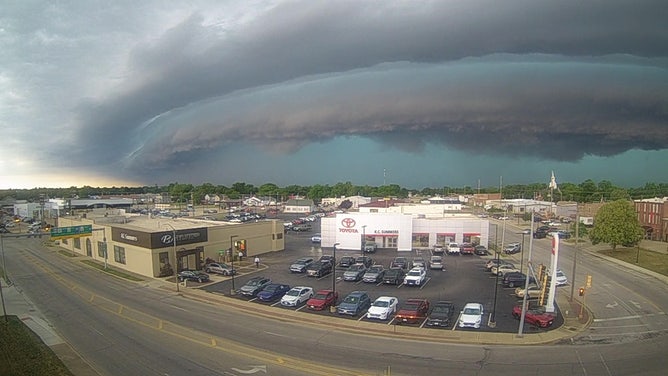
Image 2 of 8Shelf cloud looms over Mattoon, Illinois on June 29, 2023. ( )
![Shelf Cloud over Illinois]() Image 3 of 8
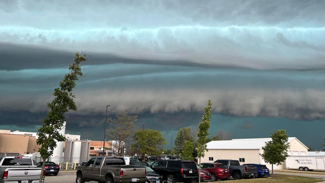
Image 3 of 8Shelf cloud looms over Charleston, Illinois on June 29, 2023. ( )
![Shelf Cloud over Illinois]() Image 4 of 8
Image 4 of 8A shelf cloud looms over Mattoon, Illinois on June 29, 2023. (Mike Dresch)
![Shelf Cloud over Illinois]() Image 5 of 8
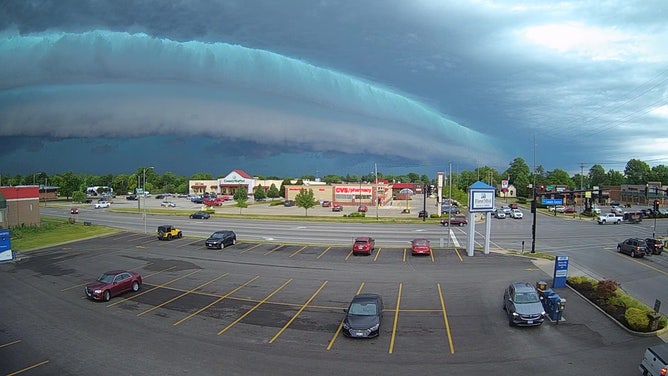
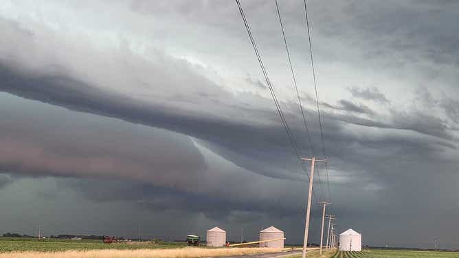
Image 5 of 8Shelf cloud looms over central Illinois on June 29, 2023. (KJ Sank / Americas Weather Watchers)
![Shelf Cloud over Illinois]() Image 6 of 8
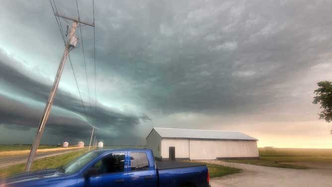
Image 6 of 8Shelf cloud looms over central Illinois on June 29, 2023. (KJ Sank / Americas Weather Watchers)
![Shelf Cloud over Illinois]() Image 7 of 8
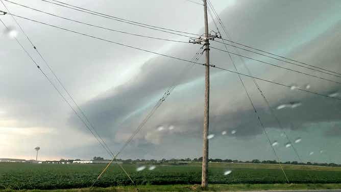
Image 7 of 8Shelf cloud looms over central Illinois on June 29, 2023. (KJ Sank / Americas Weather Watchers)
![Shelf Cloud over Illinois]() Image 8 of 8
Image 8 of 8Shelf cloud looms over central Illinois on June 29, 2023. (KJ Sank / Americas Weather Watchers)

As rain-cooled air rushes downward out of the thunderstorms – known as a downdraft – warm air is lifted upward out ahead of the storms to replace that cooler air.
When that warm air rises, it condenses and forms the shelf cloud that we all rush outside to snap a photo of for social media.
LIGHTNING SAFETY: WHEN THUNDER ROARS, EVEN TAKING OUT THE TRASH CAN TURN DEADLY
Just don't stay outside too long because that rain and wind come in fast.
A similar meteorological setup was in place in nearly the same area on Saturday afternoon and evening, meaning shelf clouds may be spotted again. You can always share your "shelfies" with us anytime, anywhere, in our America's Weather Watchers community on Facebook, email them to weather@fox.com or add the hashtag #FOXWeather to your post on your favorite social media platform.