Drone photos show path of possible tornado in Illinois
On Thursday, a line of severe thunderstorms produced large hail, damaging wind gusts and even possible tornadoes across the Midwest.
Derecho rips across Midwest leaving behind extensive damage
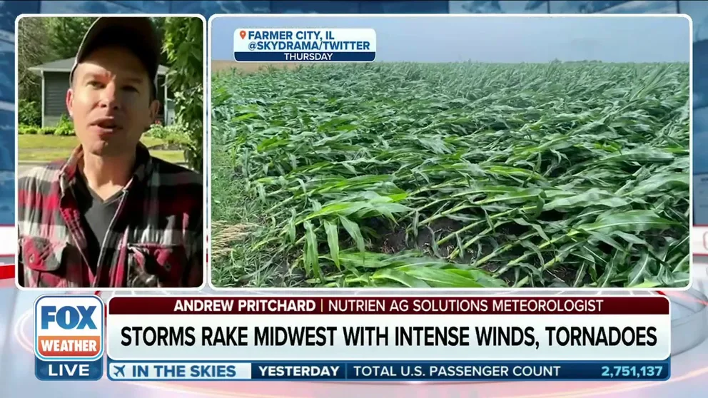
Andrew Pritchard, Senior Meteorologist for Nutrien Ag Solutions, joined FOX Weather to discuss the derecho that ripped across the Midwest, leaving behind extensive damage on Thursday.
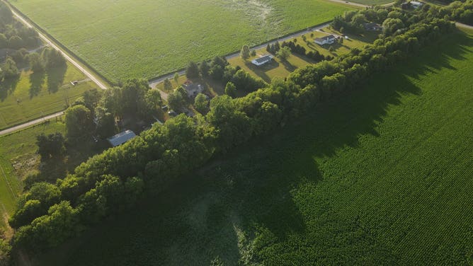
CHATHAM, Ill. – Flattened stalks of corn trace the path of what may have been a tornado near the central Illinois town of Chatham.
On Thursday, a line of severe thunderstorms in Illinois and throughout the Midwest produced large hail, wind gusts up to 100 mph and possible tornadoes.
Drone photos captured images of a possible tornado track through a cornfield in Chatham.
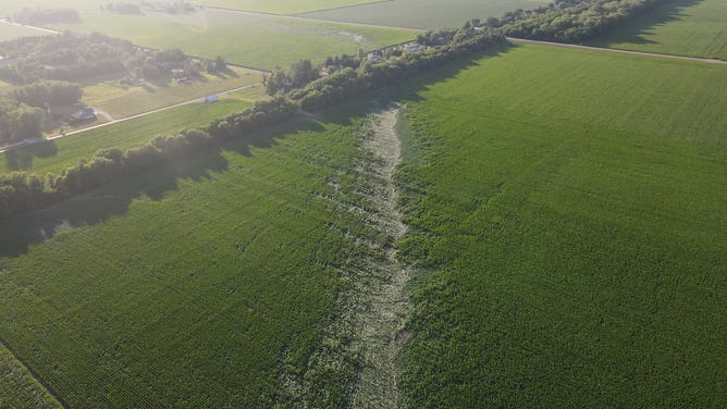
Path of apparent tornado near Chatham, Illinois on June 20, 2023.
(Kyle Golden / FOX Weather)
In the images, a line of flattened corn stalks could be seen, signaling where the possible tornado might have tracked.
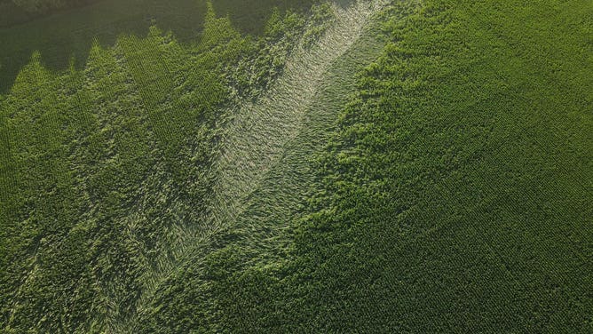
Path of apparent tornado near Chatham, Illinois on June 20, 2023.
(Kyle Golden / FOX Weather)
According to photographer Kyle Golden, the path takes a shape turn southeast.
At the top of the photo, note how the path takes a sharp turn.
(Kyle Golden / FOX Weather)
A photo shot up close shows how much the corn stalks were flattened along the path.
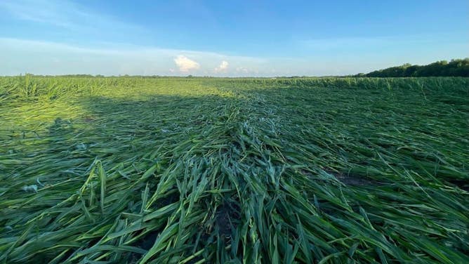
Path of apparent tornado near Chatham, Illinois on June 20, 2023.
(Kyle Golden / FOX Weather)
Throughout central Illinois, powerful wind from the thunderstorms caused extensive damage, such as flipped-over semi-trucks and uprooted trees, during a phenomenon known as a derecho.