Safe inside: Storm preps need to be done by these times in Boston, New York and Philadelphia
The storm arrives in Philadelphia and New York City on Friday evening, then in Boston overnight
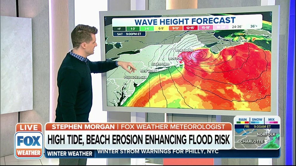
Weekend nor'easter could cause blizzard conditions with 70 mph wind gusts
This weekend's nor'easter could cause blizzard conditions with 70 mph wind gusts.
A major nor'easter will impact millions of Americans along the Interstate 95 corridor beginning Friday evening, bringing threats of heavy snow, 70-mph winds and coastal flooding through Saturday.
Friday is the last day to prepare in cities such as Boston, New York and Philadelphia before the winter storm arrives and prevents many people from safely leaving their homes.
Here's when you need to be prepared to hunker down in each of these major cities as the storm develops off the East Coast.
THOSE IN PATH OF NOR'EASTER BRACE FOR HEAVY SNOW, HIGH WINDS AS STORM LOOMS
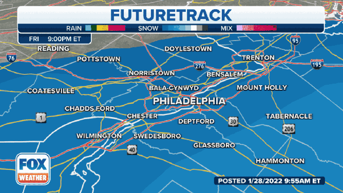
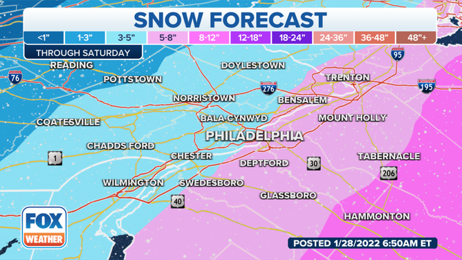
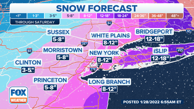
Philadelphia: 5 p.m. Friday
(FOX Weather)
Some light snow or flurries are possible in the Philadelphia metro area during the day on Friday, but the steadier snow is predicted to arrive between 5 and 8 p.m. Friday.
The snow could turn heavy at times overnight, and it will be accompanied by wind gusts to 35 mph. All unnecessary travel should be avoided once the snow begins.
Snow should lighten up on Saturday morning before tapering off between 11 a.m. and 2 p.m.
Storm totals will range from 3 to 6 inches in Philadelphia, with higher amounts expected to the east in New Jersey and lower amounts in the city's northern and western suburbs.
(FOX Weather)
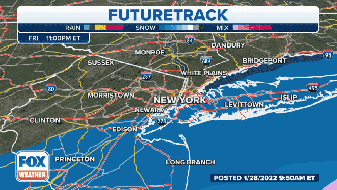
New York City: 7 p.m. Friday
(FOX Weather)
Similar to Philly, some light snow or flurries are possible around the New York City tri-state area during the day on Friday, but the steadier snow is predicted to arrive between 7 and 10 p.m. Friday.
The snow could be heavy at times overnight and into Saturday, and it will be accompanied by wind gusts to 45 mph. The National Weather Service said near-blizzard conditions are even possible for a period on Saturday, which would result in very low visibility and extremely dangerous driving conditions.
Snow should decrease in intensity by Saturday afternoon before ending between 1 and 4 p.m.
New York City is predicted to receive 8 to 12 inches of snow, with higher amounts over Long Island and lower amounts west of the city.
(FOX Weather)
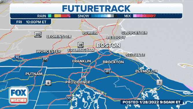
Boston: 10 p.m. Friday
(FOX Weather)
Boston residents will have the longest amount of time to prepare for the incoming nor'easter, as snow should hold off until between 10 p.m. Friday and 1 a.m. Saturday.
The snow will turn heavy at times Saturday morning through the afternoon, potentially falling at the rate of 2 to 4 inches per hour for a period of time. Blizzard conditions are expected to materialize as winds gust to between 50 and 70 mph. Travel should be avoided at all costs on Saturday.
‘THEY JUST PUKED EVERYWHERE’: A LESSON ABOUT SNOW AND PARKING SPACES IN BOSTON
Snow will start to lighten up Saturday evening before tapering off between 9 p.m. and midnight.
It's not out of the question that 2 feet or more could pile up in the Boston area.

(FOX Weather)
Make sure to follow FOX Weather on social media for more videos, photos and coverage of the nor'easter. Don't forget to tag us in your weather photos or use #FOXWeather.
- FOX Weather on Facebook: facebook.com/FOXWeather
- FOX Weather on Twitter: twitter.com/FOXWeather
- FOX Weather on Instagram: instagram.com/FOXWeather
- FOX Weather on TikTok: tiktok.com/@officialfoxweather
- FOX Weather on YouTube: youtube.com/foxweather